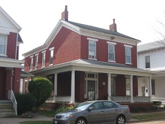
Listed on the National Register of Historic Places in
1983. A historic map-sheet match is not published yet. The record needs a coordinate-quality review before it can be joined to a sheet boundary.
From the record
“Iron and Coal. - Upon these deposits, in their abundance and their superior quality, we might rest our claims to your action, had we no other, as the facility they give for the manufacture of iron over anywhere else in the country, insure us heavy exports by means of our routes to the seaboards, bringing back imports to a like extent. Within an average of less than thirty miles of Portsmouth, and mainly dependent upon it for trade, are fiftyseven furnaces, each manufacturing 2,500 tons annually - an aggregate of 142,500 tons of the best pig iron, known as the Hanging Rock, of which the iron and steel was made, which, in the late war, covered our Mississippi gun- boats, and protected them from Forts Henry and Douelson's Confederate balls.”
An Accurate and Concise Sketch of Portsmouth, Ohio (1876). Machine-read text.
one of 36 National Register listings in Scioto County · listed in 1983 · category: Building.
National Register reference number.83002056- the number the National Park Service assigned this property when it was listed, and the key its nomination file is catalogued under at the National Archives.
Portsmouth is situated on the Ohio river, 116 miles above Cincinnati, at the mouth of the Scioto river, which flows from the centre of this great State through valleys unequalled in fertility, and of such extent as to add largely to our National exports. It is also the southern terminus of the Ohio Canal, thus affording a direct water communication between the South and West, and North and East; also of the Hocking Valley Railroad, long since constructed, and the Scioto Valley Road, now being completed from Columbus to this city. It will also necessarily form an important point in the extension of the Chesapeake and Ohio Railroad, now completed from Norfolk, Virginia, to Huntington, West Virginia, on the Ohio river, forty-five miles above this city, in its connection with the Northwest, and its point of divergence to strike the Southern Pacific Railroad. It is also probable that, either by public or private means, the James River and Kanawha Canal will be completed at no distant day,, and Portsmouth will then be the central point of three great water lines to the sea, and, as we shall proceed to show, naturally and artificially, the best entrepot of the trade, of a large and rich district of country, as it now is.
While, as we have said, Portsmouth is one hundred and sixteen miles nearer than Cincinnati to the Atlantic seaports, the navigation of the river from New Orleans to the former is as good as to the latter, in all stages of water, while there is no important point above to which it is not obstructed by low water, or ice. None, in fact, approaching it in business or population, nearer than Wheeling, two hundred and seventy miles above,
Regional context, not property-specific
evidence. The
federal wildfire occurrence database
lists 131 fires within 5 miles of Hurth Hotel between
1997 and 2020, burning about 4,791 acres in total. None started naturally. 24 were recorded as arson.
Distance is straight-line from the map coordinates, so a fire counted
here may appear on a neighbouring settlement's page as well.
Reported cause
Fires
Debris and open burning
60
Missing data/not specified/undetermined
37
Arson/incendiarism
24
Recreation and ceremony
7
Equipment and vehicle use
2
Smoking
1
The most recent of
them, most recent first, with the day each was reported and the service
that recorded it.
Regional context, not property-specific
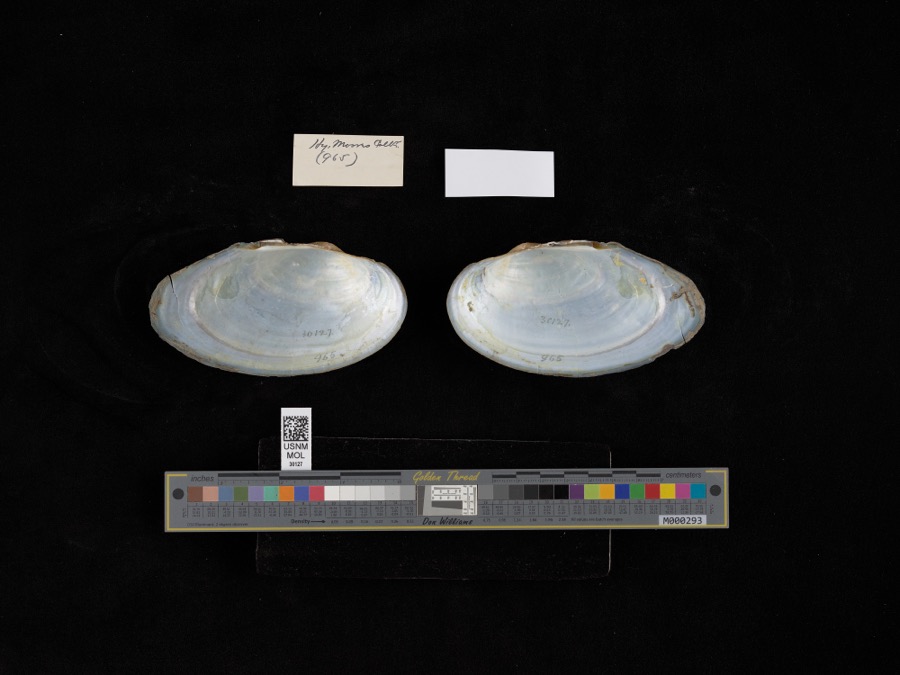
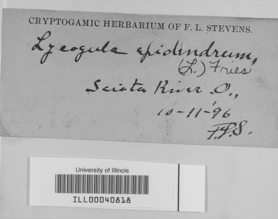
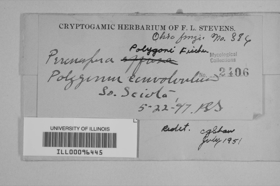
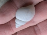
evidence. Museums hold 1,311 specimens
collected within 10 miles of Hurth Hotel between 1884 and
1975: 1,194 Animalia, 69 Plantae, 41 Fungi, 4 Protozoa, 2 Unrecorded, 1 Chromista. 12 distinct Species records are shown.
Collected by ?, Ahles, H.E., Anson A. Hinkley and others. Each is a
physical object with a catalogue
number, and each entry opens the museum's record. This is what was
collected and kept, not a survey of what lives here - nothing can be
concluded from a species being absent.
Regional context, not property-specific
evidence. The federal mineral resources record lists
4 workings within 5 miles of Hurth Hotel: 2 producers, 1 plant, 1 prospect.
3 still produce. What was taken out: Clay, Iron, Stone, Crushed/Broken. Distance is straight-line from the
map coordinates, so a quarry counted here may appear on a neighbouring
settlement's page as well.
Regional context, not property-specific
evidence. The National Weather Service names
Portsmouth, the town this property stands in, in 98 storm reports between 1995 and 2024: 44 thunderstorm wind, 27 hail, 14 flash flood, 12 flood.
No death or injury is recorded in these reports. Each account below is quoted exactly as the forecast office
filed it, from the NOAA Storm Events Database, and each date
opens the federal record of that event.
Numerous roads across the county were flooded and closed. Vehicles in Portsmouth were stranded in high water, and portions of Clay and Vernon Townships were also significantly affected by the flooding. A retaining wall collapsed next to a home in Rosemount.
1 paper published in this town,
digitised by the Library of Congress and free to read: 0 issues,
0 pages. Every page is searchable, so a name or a street can be
looked for directly in what the town printed about itself at the time.
No historic map-sheet match is published
for this property yet. That does not mean no map exists. This record needs
a coordinate-quality review before it can be joined to a sheet boundary.
Browse the county's mapped places while that work is
pending.
From the nomination file
1,826 words on record
When this property was proposed for the
National Register, someone wrote the case for it: what the building is,
and why it matters. That document is a federal record in the public domain.
It is quoted below word for word, never summarised. The text was read off the scanned case file by machine, so the
occasional stray character is the recogniser's and the 1970s
typewriter's.
Description of the property
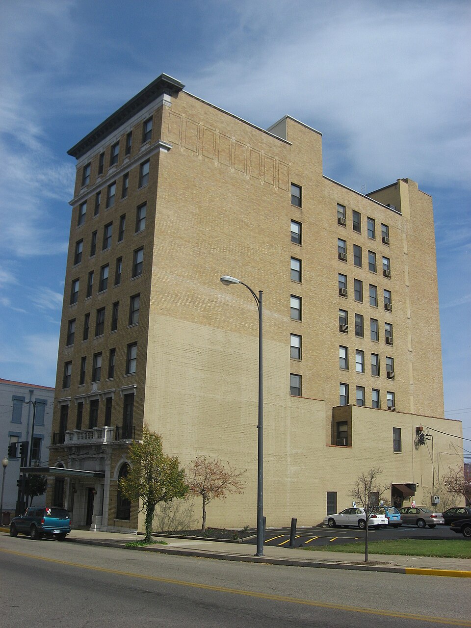
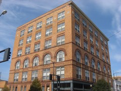
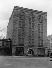
rusticated by advancing courses of brick.It is arcaded with stone arched windows that flemish bond wire brushed brick with wide mortar joints and cast stone detailing. swags in relief.The interfenistration has decorative brick patterns in panels. sliding windows have replaced the original multiple light casements. doors are approached by marble steps and have a Renissance arabesque decorated The crowning eighth story rests on a strong dentiled architraval molding.The cornice with Renaissance arabesque frieze and a large lunette with decorative The piano nobile has tall windows with cornice hood resting on ancones.The base The three bay main entrance on Third Street thrusts upward into the piano nobile of each is abalconette with iron balustrade and stone porch resting on cantilevers.
The original French doors have been replaced by sliding metal windows with panels. the cornice of the center bay of the piano nobile is a shield and garland decoration. are punched with soldier course brick 1intels and stone lug sills.Wood sash has Chillicothe Street and the long main facade facing north on Third Street. - good - molded panel. The bracketed stone balconette of the piano nobile crowns the doorway. above the windows are in stone.
The windows each have a stone lintel with In the piano nobile basket weave brick pilasters support stone capitals, a stone deteriorated unexposed fair have decorated keystones and basket weave brick breast panels.The arched transoms The Hotel Hurth isa rectangular three part Renaissance Revival composition in tan paneling and molding.In the wall above the lunette isa decorated stone flagpole The Hurth Hotel Building is near the Ohio River at the south end of the main commercial Areas of Significance-Check and justify below - archeology-historic -.. agriculture - sculpture X architecture . social/ _music .
(in one paragraph) in which "Rivertown" merchants built a new and architecturally distinctive commercial Bridge (c 1926) crossing the Ohio River marked the completion of the new city center. Portsmouth originated as a port town on the Ohio River at the mouth of the Scioto center was again enhanced by the completion of the Scioto and Hocking Valley Railroad shoe and heavy machinery manufacturing had become the towns primary economic influences. The center of commerce drifted from the canal oriented Bonnyfiddle District (on The National Register) to railroad oriented Chillicothe Street after the Civil War. Chillicothe Street was partially developed in low late Victorian buildings but shifted commercial core along Chillicothe Street is National Register quality architecture.
Hotel Hurth has been found eligibte by the Keeper of the National Register in construction of anewer hotel nearby which absorbed most of the demand for high quality through it conversion to senior citizens low-income housing. 1800-1899 1500-1599 1700-1799 1400-1499 1600-1699 communications economics application. humanitarian conservation Builder/Architect engineering education invention military industry science Specific dates prehistoric law literature 8. Significance environmental review.It is the subject of a Historic Preservation Certification hay-day Hotel Hurth was considered the community social center.The now aging -art - archeology-prehistoric - philosophy contribution to early twentieth century Portsmouth.
This was an era of high prosperity to taller Renaissance influenced building near the completion of the era. In its Hotel Hurth remained a viable hotel in Portsmouth as late as the 1970s when it began to deteriorate into a hotel of a lesser quality. This transition was partially due to the hotel accomadations.
Quoted from the National Register nomination
for reference 83002056, 11 pages, held by the National Archives in Record
Group 79. See the
catalogue record.
Listed places nearby
6 within 8 miles
Other National Register properties close
enough to walk or drive between, ordered by distance from this one. Both
positions come from the same geocoding pass that matched these properties
to their map sheets.
Listing record. National Park Service National Register of Historic Places, listed-properties dataset, current to 2026-05-22.
Map join. Address geocoded through the United States Census geocoder, then tested against the published boundary of every sheet in the USGS Historical Topographic Map Collection.
How this page is made. Listing fields come from federal records; map-sheet coverage is a labelled coordinate-to-boundary calculation, not a source-field claim.
Wildfire. Short, Karen C. 2022. Spatial wildfire occurrence data for the United States, 1992-2020 [FPA_FOD_20221014]. 6th Edition. Fort Collins, CO: Forest Service Research Data Archive. https://doi.org/10.2737/RDS-2013-0009.6 Collected with United States Government funding and usable without additional permissions or fees.
Specimens. Global Biodiversity Information Facility (GBIF), https://www.gbif.org/. Only records licensed CC0 or CC BY are used. Records licensed CC BY-NC are excluded because this site carries advertising. Images are checked individually and any whose licence is non-commercial, no-derivatives or unreadable is refused.
Mines and quarries. USGS Mineral Resources Data System (MRDS) https://mrdata.usgs.gov/mrds/ A work of the United States government, no copyright under 17 U.S.C. 105.
Storms. NOAA National Centers for Environmental Information, Storm Events Database https://www.ncei.noaa.gov/stormevents/ A work of the United States government, no copyright under 17 U.S.C. 105. Narratives are quoted verbatim from the National Weather Service report and are not edited or summarised.
 Block
Block