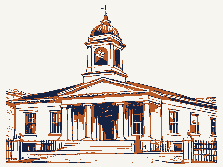
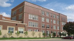
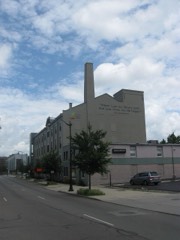
Independent Order of Oddfellows, Dayton Lodge No. 273
Listed on the National Register of Historic Places in
1984. A historic map-sheet match is not published yet. The record needs a coordinate-quality review before it can be joined to a sheet boundary.
From the record
“The Dayton merchants kept a miscellaneous stock of articles, selling dry goods, groceries, medicines, stationery; almanacs, which were In great demand, books, queensware, glass, hardware, iron, uails, and castings. When cash payments could not be obtained, wheat, rye, corn-fed pork, corn, or other merchantable produce, "suitable for the Orleans market,' was taken in payment, if delivered in time for the spring trip south by flatboat.”
History of Dayton, Ohio. With Portraits and Biographical Sketches of Some of Its Pioneer and Prominent Citizens (1889). Machine-read text.
one of 117 National Register listings in Montgomery County · listed in 1984 · category: Building · one of 4 National Historic Landmarks in Montgomery County.
National Register reference number.84000109- the number the National Park Service assigned this property when it was listed, and the key its nomination file is catalogued under at the National Archives.
What happened here
An account from the chapter on Dayton city, The inset identifies its exact
source book and publication year.
A Typical Frontier Vavern - Daytou Contained Nine Dwellings in 1799- - Several Roads Opened--Monument Avenue Cleared--Main Street a Narrow Wagon Road - Settlements Few and Far Between - Hardships of Pioneer Life--Tidian War Apprehended - Block House Built - Schooi Opened in the Block House- - First Distillery Started - Cooper's Saw Mill - Corn Cracker - Hogs Introduced - Feed on Mast - Attacked by Wild Animals--First Flat Boat Launched-Sheep Introduced - Cost of Groceries at Cinciunati - Little Money jin Circulation - Business Conducted by Barter - Value of Diffsrent Kinds of Skins--Cut Money - McDougal's Store - Trade with the Indians - First Child Boro in Dayton - Taxation in 1800 - First Wedding - Census in 1801 - First Miuister - - Methodists - Presbyterians--Log Meeting House - First Grave Yard - - Jobn W.
During the winter of 1796-97, Dayton Township and other township, were formed, making eleven in all in the county, viz., Cincinnati, Columbi; Miami, Anderson. Iron Ridge, South Bend, Colerain, Springfield, Fairfiel Deerfield and Dayton. Fairfield Township included the territory east of tl Big Miami, now in Butler County. Deerfield Township included the territoi west of the Little Miami, now in Warren County, and that part of Montgon irj County between the Miami Rivers south of the north line of the fifth range )f" townships. Dayton Township was bounded as follows: Beginning at a point >n the east bank of the Big Miami, where it was intersected by the north line )f the fifth range of townships; thence up that river in all its meanderings to he Indian boundary-lino, at a point where said river crossed the said Indian boundary -line, in Section 18, Township 2, in the fom-teenth range of townships, between the Miamis; thence along said line to Ludlow's line, and down that ine to the southeast corner of Section 5, Township 6, in the eighth range of townships between the Miamis, where was a branch of the Little Miami River; hence down the river to the north line of the fifth range of townships; thence (vest with said line to the place of beginning. The township thus described infiuded within its limits territory that now forms portions of the counties of Montgomery, Greene, Miami, Clark, Champaign, Logan and Shelby. All of Wayne, Mad River and Van Buren, with parts of Washington, Dayton and Miimi Townships, of Montgomery County, as at present formed, were in Dayton Township.
The Commissioners of Hamilton County, on the 10th of June, 1797, at a neeting held at the Mansion House, of Seth Cutter's, in Cincinnati, appointed Assessors and Collectors for the several townships. James Brady was made Issessor, and John Kitchell, Collector, of Dayton Township. John Kitchell, 'ailing to qualify, Calvin Morrill, was, on the 25th of August, appointed in his lead, and Cyrus Osborn was appointed Constable of Dayton Township. Constables made returns of persons and property to the Assessors, who made the iists and assessments, that were placed in the hands of the Township Collectors for collection. The Commissioners and Assessors jointly controlled the disbursenents, making regular reports to the County Court. The reports of assessments ind collections for Dayton Township for this year, were lost in transit, between Dayton and Cincinnati ; the Clerk was ordered to forward duplicates, and Collector Morrill was directed to make return by the 15th of January, 1798. There vere sixteen delinquents in the township, and the Collector made final return, fight of them non est, seven satisfied and one lost. After the lists were returned each year, the Commissioners and Assessors met as a Court of Appeals, to hear appeals against assessments. The following orders show the amount of fees paid to these first officers.
Regional context, not property-specific
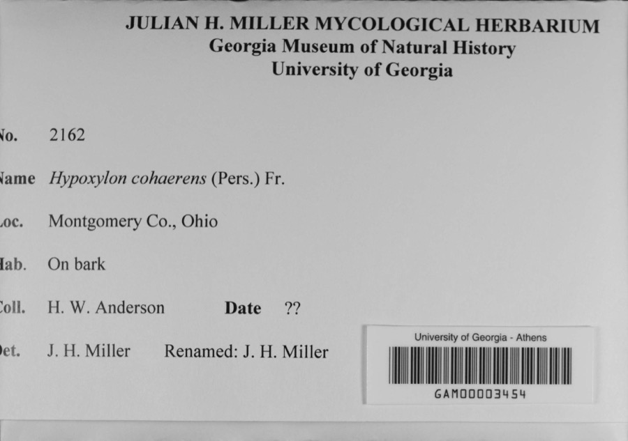
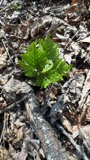
evidence. Museums hold 1,010 specimens
collected within 10 miles of Independent Order of Oddfellows, Dayton Lodge No. 273 between 1835 and
1975: 849 Animalia, 90 Plantae, 59 Fungi, 4 Protozoa, 4 Unrecorded, 4 Chromista. 12 distinct Species records are shown.
Collected by A JOHN, A JOHN AND W E DUELLMAN, A. E. Foeerste and others. Each is a
physical object with a catalogue
number, and each entry opens the museum's record. This is what was
collected and kept, not a survey of what lives here - nothing can be
concluded from a species being absent.
Regional context, not property-specific
evidence. The federal mineral resources record lists
15 workings within 5 miles of Independent Order of Oddfellows, Dayton Lodge No. 273: 10 past producers, 5 producers.
5 still produce. What was taken out: Sand and Gravel, Construction. Distance is straight-line from the
map coordinates, so a quarry counted here may appear on a neighbouring
settlement's page as well.
Regional context, not property-specific
evidence. The National Weather Service names
Dayton, the town this property stands in, in 74 storm reports between 1994 and 2026: 41 thunderstorm wind, 15 hail, 8 flash flood, 7 flood.
The reports record 1 injury. Each account below is quoted exactly as the forecast office
filed it, from the NOAA Storm Events Database, and each date
opens the federal record of that event.
A University of Dayton student, Sean Ferguson, 23 of Pittsburgh, was struck by lightning as he ran across university parking lot C. The student was hospitalized with serious burns and a broken jaw.
Thunderstorms winds measured by spotters as high as 72 mph downed numerous trees, many of which fell on cars and blew on to and into homes. A construction trailer was severely damaged and some businesses received damage.
A roof was blown off of a residence in East Dayton as well as several utility poles that were snapped in half. Numerous trees were down in the vicinity of Glenrock Road and East Fifth Street. Several trees landed on parked automobiles and garages.
Large limbs were reported broken. A large tree was uprooted. Numerous large tree limbs were down in the road. These occurrences were due to damaging thunderstorm winds.
A car was stranded on Keowee Street under State Route 4 due to high water. Three feet of water was also reported on Webster Street at the underpass of State Route 4.
Numerous roads were flooded throughout the Dayton metropolitan area. A man had to be rescued when he drove his car into a flooded retention pond near the Dayton Mall.
8 papers published in this town,
digitised by the Library of Congress and free to read: 0 issues,
0 pages. Every page is searchable, so a name or a street can be
looked for directly in what the town printed about itself at the time.
No historic map-sheet match is published
for this property yet. That does not mean no map exists. This record needs
a coordinate-quality review before it can be joined to a sheet boundary.
Browse the county's mapped places while that work is
pending.
From the nomination file
3,947 words on record
When this property was proposed for the
National Register, someone wrote the case for it: what the building is,
and why it matters. That document is a federal record in the public domain.
It is quoted below word for word, never summarised. The text was read off the scanned case file by machine, so the
occasional stray character is the recogniser's and the 1970s
typewriter's.
Description of the property
eight feet long and a depth of sixty-six feet, churches, it is the largest building in the district, being a full story higher than the No. 1,2,3, and 4). The pressed brick faced structure has a very strong architectural character on the West section of the facade above the water table is composed of a pressed buff brick matching 1 and 5). The main temple facade is composed of red pressed brick above the basement level. A symme- trical design is highlighted with decorative insertions of limestone and multi-colored with the same common brick used in the rear and side walls. the bays adds to this effect, as well as providing an impression of size and strength to Condition unexposed Exterior: fair 7.
Description It reflects the surrounding community by incorporating and modifying many of the materials Check one metal cornice once again reflects the limestone foundation in size and color.The cornice and styles used in nearby residences and religious structures.With the exception of the dart molding.Separated by brickwork is a molding fasces topping and a row of dentil the building. with an intricate pattern of brick voissqirsand corbelled brick.The same detail of segmented cornice and the parapet is finished off by using split tile of dark vitreous ceramic. are composed of the sandstone cymatium, pressed brick, and sheetmetal forming a cyma reversa designated historic district of single family homes of mid to late 19th Century architecture.
the native limestone iswater table ofmassive sandstone blocks cut in a rustic pattern.The accent on horizontal lines at this level.(Reference black and white photographs No. (Reference black and white photographs No.3 and 6).
(in one paragraph) _education entrance and delineation of floors by string courses. home for the lodge. _invention Odd Fellows movement through Daughters of Rebekah sister lodges which admitted men as non- The time that this lodge was built was the most flourishing period of the I.o.o.F.movement. The occupations of the officers and committeemen of Dayton Lodge No.273 in 19ll reflect the -prehistoric -politics/government of the community itserved.The building sits on a quiet street of mostly small vernacular the lodge, community planning architecture 19th Century residential structures. It is located near Fifth Street and serves, not only organizations in the United States. Begun in Great Britain, the movement was imported to the sixth lodge in the area, was instituted April 30, 1855.
Membership grew steadily in which to meet. By 1908 Lodge No, 273 had a membership of 368 brothers, making it the hard-working, moderate income neighborhood in which the lodge was located. In the working Builder/Architect Peters, Herman and Brown as a focal point from Laßelle Street, but also from the main thoroughfare which houses the United States in 1802 when a lodge was founded in Baltimore. The order's seal solemnly and regalia which brought people together under the "Triple Links" of Love, Truth, and through the latter half of the 19th century, and the lodge rented several different halls barrier to membership.
Jewish, Catholic, and many Protestant faiths were represented in 1911 1600-1699 archeology-prehistoric medicare and low-cost life insurance.The lodge served as the center for vital community in Odd Fellows Homes established across the United States.Women also participated in the 9.
Quoted from the National Register nomination
for reference 84000109, 33 pages, held by the National Archives in Record
Group 79. See the
catalogue record.
Listed places nearby
6 within 8 miles
Other National Register properties close
enough to walk or drive between, ordered by distance from this one. Both
positions come from the same geocoding pass that matched these properties
to their map sheets.
Listing record. National Park Service National Register of Historic Places, listed-properties dataset, current to 2026-05-22.
Map join. Address geocoded through the United States Census geocoder, then tested against the published boundary of every sheet in the USGS Historical Topographic Map Collection.
How this page is made. Listing fields come from federal records; map-sheet coverage is a labelled coordinate-to-boundary calculation, not a source-field claim.
Specimens. Global Biodiversity Information Facility (GBIF), https://www.gbif.org/. Only records licensed CC0 or CC BY are used. Records licensed CC BY-NC are excluded because this site carries advertising. Images are checked individually and any whose licence is non-commercial, no-derivatives or unreadable is refused.
Mines and quarries. USGS Mineral Resources Data System (MRDS) https://mrdata.usgs.gov/mrds/ A work of the United States government, no copyright under 17 U.S.C. 105.
Storms. NOAA National Centers for Environmental Information, Storm Events Database https://www.ncei.noaa.gov/stormevents/ A work of the United States government, no copyright under 17 U.S.C. 105. Narratives are quoted verbatim from the National Weather Service report and are not edited or summarised.
 Block
Block