Listed on the National Register of Historic Places in
1984. A historic map-sheet match is not published yet. The record needs a coordinate-quality review before it can be joined to a sheet boundary.
From the record
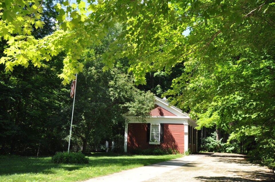
“The Morewood School is a historic one-room schoolhouse at 30 South Mountain Road in Pittsfield, Berkshire County, Massachusetts. Built in 1843, it was converted to a vacation cottage in the 1980s after serving for 130 years as a schoolhouse.”
Wikipedia article Morewood School, CC BY-SA 4.0.
one of 94 National Register listings in Berkshire County · listed in 1984 · category: Building · one of 1 National Historic Landmarks in Berkshire County.
National Register reference number.84002084- the number the National Park Service assigned this property when it was listed, and the key its nomination file is catalogued under at the National Archives.
The names inscribed on the monument are those of citizens of Pittsfield who died in the war, either from wounds, or, before their discharge, from disease contracted in the war ; not including citizens of other places, who served on her quota. They are as follows :
It was determined to place it at the west end of the park, in or near which, a large portion of the Pittsfield soldiers volunteered, and which possessed many other associations of patriotic interest; and the park, however beautiful, being not considered in a proper condition for the reception of the contemplated work, the town placed in the hands of the committee before-named, a further sum of seven thousand dollars, for the purpose of making some longdesired improvements. The nature of these improvements was left to the discretion of the committee, by whom the following changes were made : The oval plot which constitutes the park, was surrounded by a handsome and substantial coping of granite, outside of which a broad gravel walk, with granite curbing, was built. The surface of the plot was graded, and a considerable number of trees, which had become so thick as to impede each other's growth, were felled. The Old Elm had fallen in 1861. In addition to this, the grade of Park place was reduced so as to make it more uniform with that of Bank row.
Regional context, not property-specific
evidence. The
federal wildfire occurrence database
lists 117 fires within 5 miles of Morewood School between
2002 and 2020, burning about 86 acres in total. 2 started naturally. 2 were recorded as arson.
Distance is straight-line from the map coordinates, so a fire counted
here may appear on a neighbouring settlement's page as well.
Reported cause
Fires
Debris and open burning
60
Recreation and ceremony
22
Smoking
8
Railroad operations and maintenance
6
Equipment and vehicle use
5
Missing data/not specified/undetermined
5
Misuse of fire by a minor
4
Natural
2
Arson/incendiarism
2
Power generation/transmission/distribution
1
Other causes
1
Fireworks
1
The most recent of
them, most recent first, with the day each was reported and the service
that recorded it.
Regional context, not property-specific
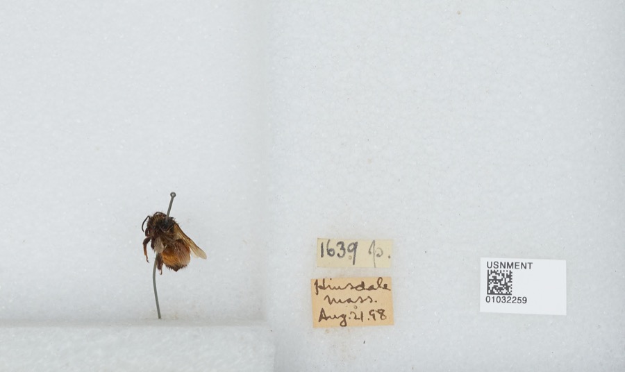
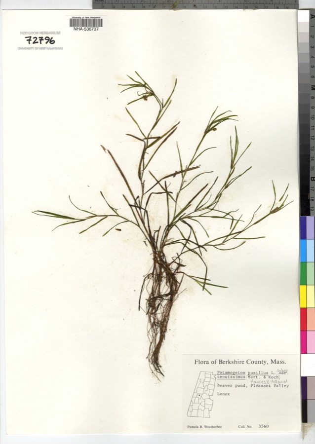
evidence. Museums hold 966 specimens
collected within 10 miles of Morewood School between 1833 and
1975: 472 Plantae, 293 Animalia, 197 Fungi, 4 Unrecorded. 12 distinct Species records are shown.
Collected by A W Evans, A. Brown, A. H. Mead and others. Each is a
physical object with a catalogue
number, and each entry opens the museum's record. This is what was
collected and kept, not a survey of what lives here - nothing can be
concluded from a species being absent.
Regional context, not property-specific
evidence. The federal mineral resources record lists
11 workings within 5 miles of Morewood School: 8 past producers, 2 producers, 1 occurrence.
2 still produce. What was taken out: Iron, Sand and Gravel, Construction. Distance is straight-line from the
map coordinates, so a quarry counted here may appear on a neighbouring
settlement's page as well.
Regional context, not property-specific
evidence. The National Weather Service names
Pittsfield, the town this property stands in, in 98 storm reports between 1994 and 2025: 64 thunderstorm wind, 17 hail, 13 flash flood, 3 flood.
The reports record 1 injury. Each account below is quoted exactly as the forecast office
filed it, from the NOAA Storm Events Database, and each date
opens the federal record of that event.
Survey team observed several structures with shingle damage to roofs. Many limbs and several trees were knocked down. Upon observation these trees were determined to be shallow rooted. Roofs dislodged from clubhouse and dugout of Waconah Park baseball stadium. Eyewitnesses with various vantage points reported observing rotating debris consistent with a tornado. Additional reports indicate a portion of the fencing at Waconah Park was also knocked down, and bleachers along the left field were pushed backward. In addition, trees and wires were downed on Tyler Street and Woodlawn Avenue, and two moored motor boats at Burbank Park were flipped over and partially submerged. There was also a report of a tree falling on a house on Charles Street. Top winds estimated at 70 mph.
A line of thunderstorms, that developed over eastern New York, moved into southern Berkshire county shortly after noon on May 25. This line of storms continued to produce strong gusty winds that brought numerous large trees and power lines down throughout the city of Pittsfield.
A cold front moving east into Berkshire County triggered widely scattered severe thunderstorms. The storms brought down large limbs and power lines in the town of Pittsfield.
No historic map-sheet match is published
for this property yet. That does not mean no map exists. This record needs
a coordinate-quality review before it can be joined to a sheet boundary.
Browse the county's mapped places while that work is
pending.
From the nomination file
2,478 words on record
When this property was proposed for the
National Register, someone wrote the case for it: what the building is,
and why it matters. That document is a federal record in the public domain.
It is quoted below word for word, never summarised. The text was read off the scanned case file by machine, so the
occasional stray character is the recogniser's and the 1970s
typewriter's.
Description of the property
The Morewood School, or Pittsfield District School #9 is located on the east bank of Wampenum Brook, in the south central part of Pittsfield. It is the fourth building on the north side of S. Mountain Road, west from the intersection with South Street (Route 7). The building is located at the rear 1/3 of the lot, allowing the remainder to be used as a schoolyard. Since1973 the yard has been used as a neighborhood playground. Constructed ca. 1841 in the Greek Revival style, the Morewood School is a relatively ela- borate example of a one room, district schoolhouse of the period. The wood frame, rectan- gular plan (24'6" X 32'6") structure rises one story from a dry laid fieldstone foundation to a gable roof, now clad with asphalt.
A brick chimney to service the school's wood stove rises in the north end of the main roof; a galvanized iron ventilator with conical cap is centered on the ridge of the roof - Elevations are sheathed with original narrow clapboards and articulated by paneled corner pilasters, a full dentilated entablature and raking cornices in the gable ends. Windows with narrow surrounds contain 6/6 sash. The south gable end elevation which faces the street, contains a single window centered in the wall and directly beneath the cornice. The north elevation is identical with the exception of an original one story attached shed built for wood storage and privies and which now contains the heating plant and a small teacher's office. (converted ca. 1860).
The east and west elevations are identical with paired sash at their southern ends and recessed entries, one for boys and one for girls, at their northern ends.
(in one paragraph) Builder/Architect Unknown The Morewood School retains integrity of location, design, setting, materials, and workmanship, as well as important associations with the 19th century development of Pittsfield, Mass- achusetts. Built ca. 1843, it is the city's oldest remaining schoolhouse and until its recent sale it was the oldest civic building still in public hands in the city. Additionally, it is an unusually well detailed and preserved example of a one room mid-19th century schoolhouse. Thus, the Morewood School meets criteria A and C of the National Register of Historic Places. Al though sixteen other one.room schoolhouses exist in the county,, this is one of the few which continues to be unaltered .
Accordingto a record book kept by Jesse Oliver Howard, who attended the school in 1865, he was told that an earlier schoolhouse located at about 550 South Street burned in June, 1841 when during noon hours several boys built a fire in the yard. The blazeispread to the school and to a shed, barns, and a house owned by Oliver Luce, Jesse Howard's The partly burned schoolhouse was purchased by Mr. Luce. In return, he graded the inhabitants of School District #9 "part of a lot on the west bank of the ditch that conducts the water from the pond to said Luce's Saw Mill." He also gave the the right of trespass on the west side of the property to a spring of water on the west bank of the brook for the benefit of the school. Though the deed is dated August 18, 1853, to the best of Mr.
Howard's'recollection, the one room schoolhouse was built in 1843. City school records are unable to confirm this, but the style, design. and construction support the earlier construction date.
Quoted from the National Register nomination
for reference 84002084, 10 pages, held by the National Archives in Record
Group 79. See the
catalogue record.
Listed places nearby
6 within 8 miles
Other National Register properties close
enough to walk or drive between, ordered by distance from this one. Both
positions come from the same geocoding pass that matched these properties
to their map sheets.
Listing record. National Park Service National Register of Historic Places, listed-properties dataset, current to 2026-05-22.
Map join. Address geocoded through the United States Census geocoder, then tested against the published boundary of every sheet in the USGS Historical Topographic Map Collection.
How this page is made. Listing fields come from federal records; map-sheet coverage is a labelled coordinate-to-boundary calculation, not a source-field claim.
Wildfire. Short, Karen C. 2022. Spatial wildfire occurrence data for the United States, 1992-2020 [FPA_FOD_20221014]. 6th Edition. Fort Collins, CO: Forest Service Research Data Archive. https://doi.org/10.2737/RDS-2013-0009.6 Collected with United States Government funding and usable without additional permissions or fees.
Specimens. Global Biodiversity Information Facility (GBIF), https://www.gbif.org/. Only records licensed CC0 or CC BY are used. Records licensed CC BY-NC are excluded because this site carries advertising. Images are checked individually and any whose licence is non-commercial, no-derivatives or unreadable is refused.
Mines and quarries. USGS Mineral Resources Data System (MRDS) https://mrdata.usgs.gov/mrds/ A work of the United States government, no copyright under 17 U.S.C. 105.
Storms. NOAA National Centers for Environmental Information, Storm Events Database https://www.ncei.noaa.gov/stormevents/ A work of the United States government, no copyright under 17 U.S.C. 105. Narratives are quoted verbatim from the National Weather Service report and are not edited or summarised.
 Block
Block