BlockBefore
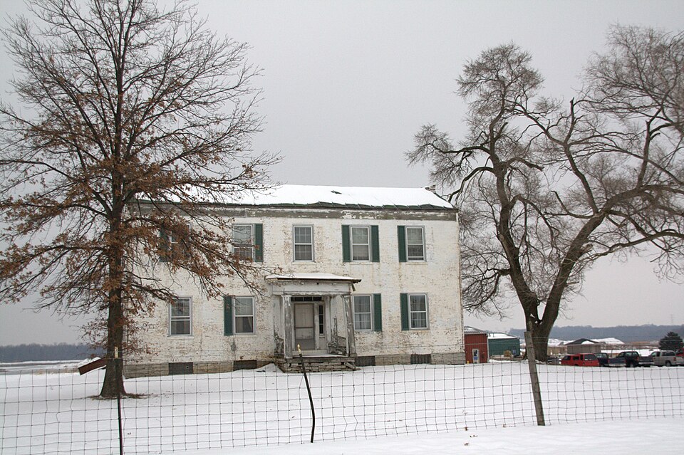
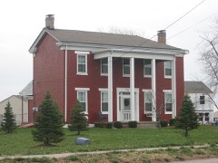
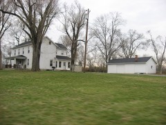
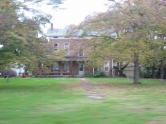
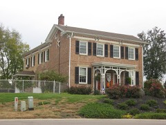
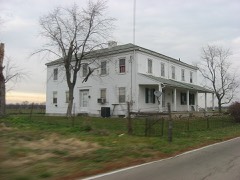
Photograph of John Augspurger Farm No. 1
Photograph by Photo by Greg Hume ( Greg5030 ), CC BY-SA 3.0. Via Wikimedia Commons.

Augspurger, John, Farm No. 1

Listed on the National Register of Historic Places in 1984. A historic map-sheet match is not published yet. The record needs a coordinate-quality review before it can be joined to a sheet boundary.

From the record

“John Augspurger Farm No. 1 is a registered historic building near Trenton, Ohio, listed in the National Register on 1984-08-03.”

Wikipedia article John Augspurger Farm No. 1, CC BY-SA 4.0.

one of 63 National Register listings in Butler County · listed in 1984 · category: Building · one of 3 National Historic Landmarks in Butler County.

Sources: the Wikipedia article · the case file at the National Archives · the National Register database, National Park Service

The listing

  • What is counted as historic. The nomination lists 3 buildingss as contributing to the listing.
  • Address. 2731 Woodsdale Rd., Trenton, 45067
  • When was it listed? 1984-08-03
  • Category. building
  • Also known as. Augspurger Amish/Mennonite Settlement TR
  • Township. Madison township
  • National Register reference number. 84002901 - the number the National Park Service assigned this property when it was listed, and the key its nomination file is catalogued under at the National Archives.

The ground it stands on

11,332 words

The chapter on Madison Township in A History and Biographical Cyclopædia of Butler County, Ohio : with Illustrations and Sketches of Its Representative Men and Pioneers, published 1882 names Trenton. This is what it says, exactly as the scans read.

Mapison Townsuip was originally a portion of Lemon. It lies on the north border of the county, and is divided from Lemon by the Miami River, which flows from north-east to south-west, and separates the two townships in such a way that the lower part of Madison is very narrow. Nearly the whole distance north of Trenton the hills border on the river; but below the bottom spreads out, and forms a wide alluvial plain. At Middletown the river divides in two parts, the old and the new, the latter increasing in volume year by year, and the former lessening. The bridge across the river here is precarious, and liable to be washed away by the flood at any time. A couple of miles west of the river the hills rise to a great height, and afford beautiful views.

Passage source: A History and Biographical Cyclopædia of Butler County, Ohio : with Illustrations and Sketches of Its Representative Men and Pioneers, published 1882.

Settlement was begun about 1802, when the lands were offered for sale; but there were a few squatters there before. The first compact settlement was at what is now known as Trenton. This is the most considerable village in the township. Other places are known here as Miltonville,: Poasttown, Madison City, and Woodsdale. Astoria is a local name applied to a neighborhood in the west center, where there was formerly a post-office. Elk Creek is the principal stream beside the Miami; but all the brooks and creeks are liable to sudden overflows, and then become torrents of no mean magnitude. The Cincinnati, Hamilton and Dayton Railroad passes through the length of the township near the river bank, and is of great value to the inhabitants.

Passage source: A History and Biographical Cyclopædia of Butler County, Ohio : with Illustrations and Sketches of Its Representative Men and Pioneers, published 1882.

Machine-read from a century-old scan, so expect the errors a machine makes: misspelled names, dropped words, stray characters.

Read the whole chapter on Madison Township - 11,332 words on its settlement, mills, schools and churches.

Specimens collected near this property

12 of 440 shown

Regional context, not property-specific evidence. Museums hold 440 specimens collected within 10 miles of Augspurger, John, Farm No. 1 between 1835 and 1974: 385 Animalia, 34 Plantae, 20 Fungi, 1 Unrecorded. 12 distinct Species records are shown. Collected by ?, A. C. Billups, A.R. Gaufin, H.H. Ross and others. Each is a physical object with a catalogue number, and each entry opens the museum's record. This is what was collected and kept, not a survey of what lives here - nothing can be concluded from a species being absent.

Image SpeciesYear Collected by Where, as recorded
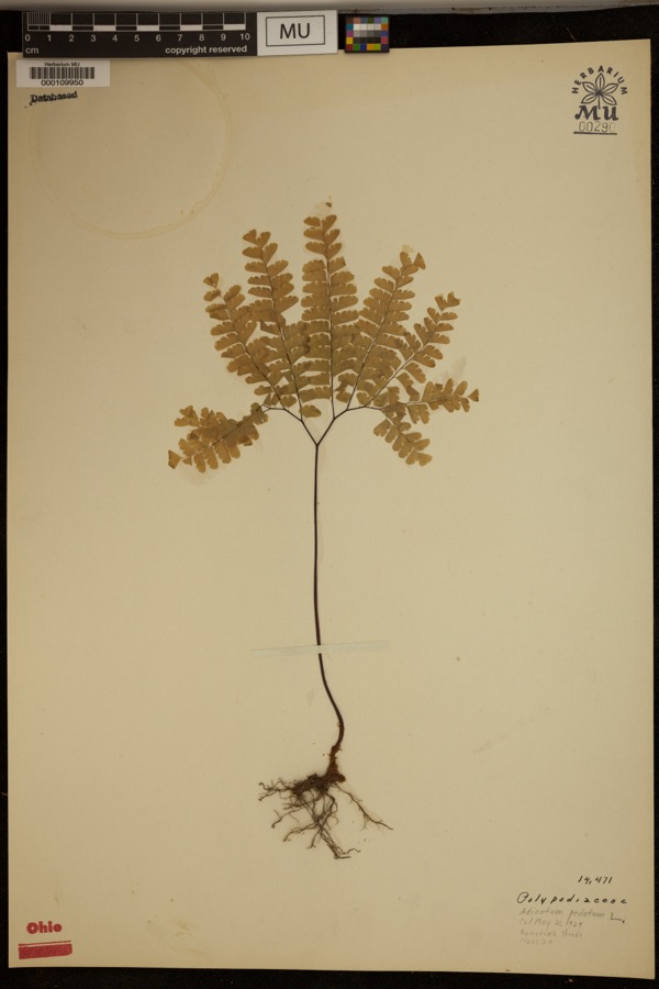
Specimen of Adiantum pedatum L.Adiantum pedatum L.1929?Hueston Woods.
A photograph of the species Carex careyana, not of this specimenCarex careyana Torr. ex Dewey1835Collector unknownIn ditione "Miami" civitatis Ohio.
Carex convoluta Mack.1835Collector unspecified"Miami"
A photograph of the species Carex gracillima, not of this specimenCarex gracillima Schwein.1835B. FrankIn ditione "Miami" civitatis Ohio.
A photograph of the species Calidris melanotos, not of this specimenCalidris melanotos (Vieillot, 1819)1879W. DouglassJones Station
A photograph of the species Coluber constrictor, not of this specimenColuber constrictor Linnaeus, 17581879not recordedHughes
A photograph of the species Diadophis punctatus, not of this specimenDiadophis punctatus arnyi Kennicott, 18591879not recordedHughes
A photograph of the species Lampropeltis triangulum, not of this specimenLampropeltis triangulum (Lacépède, 1789)1879not recordedHughes
A photograph of the species Mimus polyglottos, not of this specimenMimus polyglottos (Linnaeus, 1758)1879Porter collection, J.B.LOCNM: Jones
A photograph of the species Spiza americana, not of this specimenSpiza americana (J.F.Gmelin, 1789)1879Porter, J.B.
A photograph of the species Storeria dekayi, not of this specimenStoreria dekayi (Holbrook, 1839)1879not recordedHughes
A photograph of the species Storeria occipitomaculata, not of this specimenStoreria occipitomaculata Storer, 18391879not recordedHughes

All 440 specimens within 10 miles, at the Global Biodiversity Information Facility.

Mines and quarries near this property

6 within 5 miles

Regional context, not property-specific evidence. The federal mineral resources record lists 6 workings within 5 miles of Augspurger, John, Farm No. 1: 3 producers, 3 past producers. 3 still produce. What was taken out: Sand and Gravel, Construction. Distance is straight-line from the map coordinates, so a quarry counted here may appear on a neighbouring settlement's page as well.

Where SiteCommodity StatusRecorded
Fairfield PitSand and Gravel, ConstructionPast Producer
Hamilton Plant #710Sand and Gravel, ConstructionProducer
Mecco Inc.Sand and Gravel, ConstructionProducer
Mecco, Incorporated PltSand and Gravel, ConstructionPast ProducerSedimentary
Middletown PitSand and Gravel, ConstructionPast ProducerSedimentary
Middletown PitSand and Gravel, ConstructionProducer

Every working recorded in Butler County

Storms near this property

21 since 1995

Regional context, not property-specific evidence. The National Weather Service names Trenton, the town this property stands in, in 21 storm reports between 1995 and 2025: 14 thunderstorm wind, 5 hail, 1 flash flood, 1 flood. No death or injury is recorded in these reports. Each account below is quoted exactly as the forecast office filed it, from the NOAA Storm Events Database, and each date opens the federal record of that event.

WhenEvent Place namedHarm What the report says
September 2000Thunderstorm WindTrenton$50,000Numerous trees downed and some damage occurred to buildings.
May 2011Thunderstorm WindTrenton$32,000Seven homes were damaged due to thunderstorm winds. In addition, one vehicle was overturned and two trees were snapped due to the winds.
June 2012Thunderstorm WindTrenton$30,000Numerous large trees were down and siding damage occurred to several homes due to thunderstorm winds.
March 2025Thunderstorm WindTrenton$3,000Roof shingles were lifted from portable shelters.
March 2001Thunderstorm WindTrenton$3,000Trees downed in eastern part of county.
July 1999Thunderstorm WindTrenton$3,000Several trees downed.
April 2025Thunderstorm WindTrenton$1,000A tree was downed near the intersection of Dover Court and Governors Avenue.
June 2020Thunderstorm WindTrenton$1,000A tree was reported knocked down.
June 2020Thunderstorm WindTrenton$1,000A tree fell into power lines on North 1st Street.
July 2015Thunderstorm WindTrenton$1,000Several one foot diameter trees were downed near the intersection of Quail Drive and Aviary Place.
June 2008HailTrenton$1,000no account filed
August 2016Thunderstorm WindTrenton$500One ten inch diameter tree was knocked down.
June 2022Thunderstorm WindTrenton$250Several large branches were downed.
July 2020Thunderstorm WindTrenton$250Several 5-6 inch diameter tree limbs were downed.
June 2020FloodTrenton-Storm drains backed up due to heavy rain, causing localized flooding on numerous streets.
July 2001Flash FloodTrenton-Thunderstorms produced heavy rain which caused a road to be closed.
April 2010HailTrenton-no account filed
October 2010Thunderstorm WindTrenton-no account filed
May 1998HailTrenton-no account filed
June 1995HailTrenton-no account filed

Every storm recorded in Butler County

Map coverage status

No historic map-sheet match is published for this property yet. That does not mean no map exists. This record needs a coordinate-quality review before it can be joined to a sheet boundary. Browse the county's mapped places while that work is pending.

From the nomination file

977 words on record

When this property was proposed for the National Register, someone wrote the case for it: what the building is, and why it matters. That document is a federal record in the public domain. It is reproduced in full on its own page, word for word and never summarised. The text was read off the scanned case file by machine, so the occasional stray character is the recogniser's and the 1970s typewriter's.

The whole case file for this property - 977 words, 10 pages, reproduced complete.

Quoted from the National Register nomination for reference 84002901, 10 pages, held by the National Archives in Record Group 79. See the catalogue record.

Listed places nearby

6 within 8 miles

Other National Register properties close enough to walk or drive between, ordered by distance from this one. Both positions come from the same geocoding pass that matched these properties to their map sheets.

Photograph PropertyDistance Listed
Ehresman, Christian, Farm0.4 miles1984
Augspurger, John, Farm No. 20.5 miles1984
Iutzi, Christian, Farm1.3 miles1984
Kennel, John, Jr., Farm1.4 miles1984
Schrock, Peter, Jr., Farm1.4 miles1984
Kennel, John Sr., Farm1.9 miles1984

Sources for this property

National Archives recordThe nomination case file for reference 84002901 in Record Group 79.
Wikipedia articleCommunity-written account of this property, licensed CC BY-SA.
Butler CountyAll 63 listed properties in this county.

Provenance

  • Listing record. National Park Service National Register of Historic Places, listed-properties dataset, current to 2026-05-22.
  • Map join. Address geocoded through the United States Census geocoder, then tested against the published boundary of every sheet in the USGS Historical Topographic Map Collection.
  • How this page is made. Listing fields come from federal records; map-sheet coverage is a labelled coordinate-to-boundary calculation, not a source-field claim.
  • Specimens. Global Biodiversity Information Facility (GBIF), https://www.gbif.org/. Only records licensed CC0 or CC BY are used. Records licensed CC BY-NC are excluded because this site carries advertising. Images are checked individually and any whose licence is non-commercial, no-derivatives or unreadable is refused.
  • Mines and quarries. USGS Mineral Resources Data System (MRDS) https://mrdata.usgs.gov/mrds/ A work of the United States government, no copyright under 17 U.S.C. 105.
  • Storms. NOAA National Centers for Environmental Information, Storm Events Database https://www.ncei.noaa.gov/stormevents/ A work of the United States government, no copyright under 17 U.S.C. 105. Narratives are quoted verbatim from the National Weather Service report and are not edited or summarised.