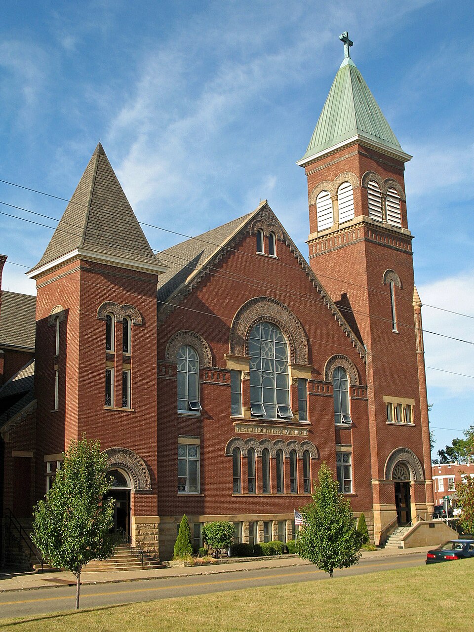
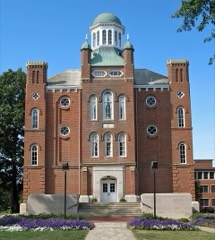
First Methodist Episcopal Church of Alliance, Ohio
Listed on the National Register of Historic Places in
1985. A historic map-sheet match is not published yet. The record needs a coordinate-quality review before it can be joined to a sheet boundary.
From the record
“First Methodist Episcopal Church of Alliance, Ohio is a historic church at 470 E.”
Wikipedia article First Methodist Episcopal Church (Alliance, Ohio), CC BY-SA 4.0.
one of 81 National Register listings in Stark County · listed in 1985 · category: Building.
National Register reference number.85000945- the number the National Park Service assigned this property when it was listed, and the key its nomination file is catalogued under at the National Archives.
Specimens collected near this property
12 of 76 shown
Regional context, not property-specific
evidence. Museums hold 76 specimens
collected within 10 miles of First Methodist Episcopal Church of Alliance, Ohio between 1890 and
1975: 72 Animalia, 2 Fungi, 2 Plantae. 12 distinct Species records are shown.
Collected by Armbruster, D. C. (Daniel C.), Bryan, J. M., Collector(s): William D. Stull and others. Each is a
physical object with a catalogue
number, and each entry opens the museum's record. This is what was
collected and kept, not a survey of what lives here - nothing can be
concluded from a species being absent.
Regional context, not property-specific
evidence. The federal mineral resources record lists
3 workings within 5 miles of First Methodist Episcopal Church of Alliance, Ohio: 2 past producers, 1 producer.
1 still produces. What was taken out: Clay, Sand and Gravel, Construction, Coal. Distance is straight-line from the
map coordinates, so a quarry counted here may appear on a neighbouring
settlement's page as well.
Regional context, not property-specific
evidence. The National Weather Service names
Alliance, the town this property stands in, in 38 storm reports between 1995 and 2021: 22 thunderstorm wind, 13 hail, 2 flash flood, 1 lightning.
No death or injury is recorded in these reports. Each account below is quoted exactly as the forecast office
filed it, from the NOAA Storm Events Database, and each date
opens the federal record of that event.
Thunderstorm winds caused considerable damage in Alliance and adjacent Washington Township. Dozens of trees were downed in these areas. A house just south of Alliance was heavily damaged by a fallen tree. Several barns in Washington Township lost portions of roof and a couple mobile homes were also damaged.
Thunderstorm winds downed many trees south of Alliance. A large pole building sustained considerable damage and a home nearby was damaged by a fallen tree. Scattered power outages were reported in the area.
No historic map-sheet match is published
for this property yet. That does not mean no map exists. This record needs
a coordinate-quality review before it can be joined to a sheet boundary.
Browse the county's mapped places while that work is
pending.
From the nomination file
6,364 words on record
When this property was proposed for the
National Register, someone wrote the case for it: what the building is,
and why it matters. That document is a federal record in the public domain.
It is quoted below word for word, never summarised. The text was read off the scanned case file by machine, so the
occasional stray character is the recogniser's and the 1970s
typewriter's.
Description of the property
tall tower marking its SE corner and smaller towers at the SW and SE corners. rises to the roof, with a basement underneath. Other areas of the church The church is a florid example of the Romanesque Revival style, the lower level built up of seven or eight courses of large sandstone blocks, above the sandstone courses provide light to the basement. Stonework is used in other architectural detalls.
The south-east tower of the church, its highest, provides a catalogue of rounded arch above supported on each side by a plain cornice which continues Incorporating several decorative devices such as dentilation on the inner sharing a heavy stone lintel are divided by engaged columns, above which panel of patterned brickwork with panels of contrasting brick set in the courses of red brick above a string course of contrasting brick which runs brick, it rises to more than half the height of the tower, with "false" On the Broadway Avenue facade, between the two towers, six tall round-headed dentral panel. Here, the sides of the great arch rest on two imposts of is plain red brick almost to the peak, where two small round-headed windows roof line by contrasting brick-work.
Condition unexposed excellent fair 7. Description cross which revolves. are located.The red brick ends in a stepped gable, filled in to the sloping contain three stories. - moveddate X_original site _ruins _ unaltered Christ United Methodist Church is basically square in configuration with a Its interior consists primarily of a massive, corner-oriented sanctuary which original rounded steps of the south east tower) leads to an entranceway, the itself, like all the arches of the church, is made of a rather unique light brick of slightly variable hue, which gives each arch a soft, pol ychrome area, and "billeting" on the outer.
(in one paragraph) architecturally because it is the largest, most fully-developed, and most the geographical vicinity, largely in original and well-kept condition. It is example in Alliance of the Romanesque Revival style, the church embodles doors, especially the series of first floor arcaded windows, brick corbelling, The Hillgreen, Lane Pipe Organ Company was founded in Alliance in 1898. The Installation outside of their studio.
Portions of the original instrument 1895 1700-1799 1500-1599 1600-1699 economics Stonework 1400-1499 transportation communications X_1800-1899 engineering literature education conservation commerce humanitarian Period archeology-prehistoric invention Builder/Architect agriculture theater science prehistoric Specific dates law exploration/settlement sculpture 1900- landscape architecture appointments, and superior stained glass work. decorative brick bonding and tall corner tower. The First Methodist Episcopal Church is a major representation of the turn-of-the-century building phase in Alliance churches. An outstanding value is shown especially in exterior workmanship, interior woodcarving and 8.
Significance Xarchitecture Methodist Church) constructed in 1895,is significant to Alliance history _archeology-historic Criterion C stylistic characteristics through its use of round arches over windows and industry sides are Sunday School rooms which could be a part of or closed off from the the late 19th century by Lewis Miller to provide efficiency of space and military .communityplanning social/ remain and.they latter expanded the organ..The same company added an echo ornamented example of the Romanesque Revival style and "Akron Plan! church in apex of the triangular-shaped sanctuary, radlating from the back and to the operable. Hillgreen, Lane Pipe Organ Company went out of business in 1972.
art minimal movement during church services.The plan locates the pulpit at the The First Methodist Episcopal Church of Alliance (now known as Christ United the last of the later I9th century downtown Alliance churches.High artistic The First Methodist Episcopal Church is also significant as an early.example 9.
Quoted from the National Register nomination
for reference 85000945, 36 pages, held by the National Archives in Record
Group 79. See the
catalogue record.
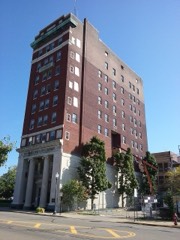
Listed places nearby
6 within 8 miles
Other National Register properties close
enough to walk or drive between, ordered by distance from this one. Both
positions come from the same geocoding pass that matched these properties
to their map sheets.
Listing record. National Park Service National Register of Historic Places, listed-properties dataset, current to 2026-05-22.
Map join. Address geocoded through the United States Census geocoder, then tested against the published boundary of every sheet in the USGS Historical Topographic Map Collection.
How this page is made. Listing fields come from federal records; map-sheet coverage is a labelled coordinate-to-boundary calculation, not a source-field claim.
Specimens. Global Biodiversity Information Facility (GBIF), https://www.gbif.org/. Only records licensed CC0 or CC BY are used. Records licensed CC BY-NC are excluded because this site carries advertising. Images are checked individually and any whose licence is non-commercial, no-derivatives or unreadable is refused.
Mines and quarries. USGS Mineral Resources Data System (MRDS) https://mrdata.usgs.gov/mrds/ A work of the United States government, no copyright under 17 U.S.C. 105.
Storms. NOAA National Centers for Environmental Information, Storm Events Database https://www.ncei.noaa.gov/stormevents/ A work of the United States government, no copyright under 17 U.S.C. 105. Narratives are quoted verbatim from the National Weather Service report and are not edited or summarised.
 Block
Block