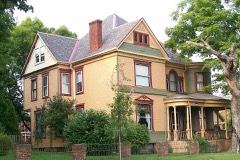
Listed on the National Register of Historic Places in
1985. A historic map-sheet match is not published yet. The record needs a coordinate-quality review before it can be joined to a sheet boundary.
From the record
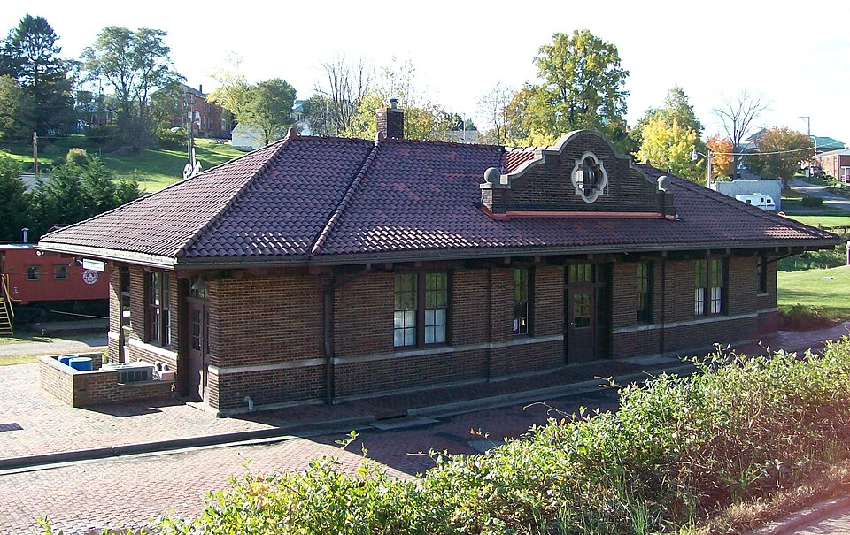
“Barnesville station is a historic train station in Barnesville, Ohio. It is located at 300 East Church Street, between Mulberry and Railroad Streets.”
Wikipedia article Barnesville station (Ohio), CC BY-SA 4.0.
one of 15 National Register listings in Belmont County · listed in 1985 · category: Building.
National Register reference number.85001694- the number the National Park Service assigned this property when it was listed, and the key its nomination file is catalogued under at the National Archives.
In 1804 Henry Grier located west of Barnesville, near the line, and John Kennon, father of Judge William Kennon, Sr., camped upon a tract adjoining Alexander Campbell's, who had settled on the land just over the line in Guernsey County.
In 1806 Joseph Middleton erected the first horse mill for grinding grain. Prior to that time the corn was ground on hand mills or cracked on hominy blocks. A year later Cam. Thomas built the first water mill, three and one-half miles south of Barnesville, and in connection with this grist mill a sawmill was
Regional context, not property-specific
evidence. The
federal wildfire occurrence database
lists 4 fires within 5 miles of Barnesville Baltimore and Ohio Railroad Depot between
2014 and 2016, burning about 1 acres in total. None started naturally. None was recorded as arson.
Distance is straight-line from the map coordinates, so a fire counted
here may appear on a neighbouring settlement's page as well.
Reported cause
Fires
Debris and open burning
4
The most recent of
them, most recent first, with the day each was reported and the service
that recorded it.
Regional context, not property-specific
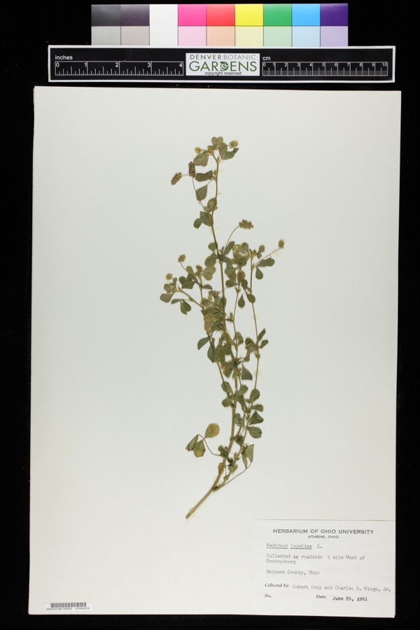
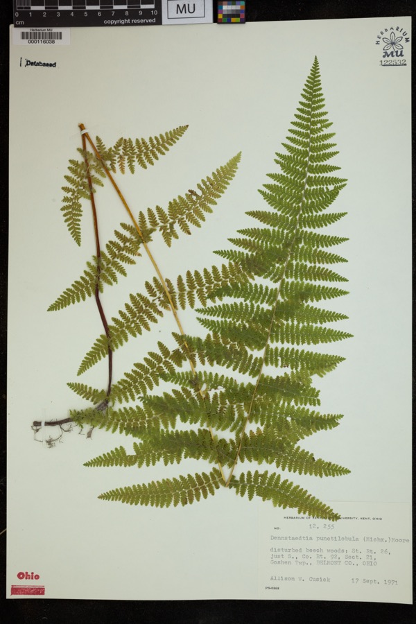
evidence. Museums hold 163 specimens
collected within 10 miles of Barnesville Baltimore and Ohio Railroad Depot between 1884 and
1975: 125 Animalia, 26 Plantae, 10 Fungi, 2 Unrecorded. 12 distinct Species records are shown.
Collected by A. Goff, Buker, W.E., Buker, W.E.; Henry, L.K. and others. Each is a
physical object with a catalogue
number, and each entry opens the museum's record. This is what was
collected and kept, not a survey of what lives here - nothing can be
concluded from a species being absent.
Regional context, not property-specific
evidence. The National Weather Service names
Barnesville, the town this property stands in, in 31 storm reports between 1994 and 2023: 16 thunderstorm wind, 11 hail, 2 flash flood, 2 flood.
No death or injury is recorded in these reports. Each account below is quoted exactly as the forecast office
filed it, from the NOAA Storm Events Database, and each date
opens the federal record of that event.
Large trees down in Bethesda. About the same time, high winds ripped a roof off two businesses, on North Chestnut St in Barnesville, causing them to collapse. The collapse ripped down several power lines.
A few basements were flooded in Barnesville. Five miles south-southeast of Barnesville, Little Captina Creek went out of its banks and water flooded Route 800S.
No historic map-sheet match is published
for this property yet. That does not mean no map exists. This record needs
a coordinate-quality review before it can be joined to a sheet boundary.
Browse the county's mapped places while that work is
pending.
From the nomination file
1,921 words on record
When this property was proposed for the
National Register, someone wrote the case for it: what the building is,
and why it matters. That document is a federal record in the public domain.
It is quoted below word for word, never summarised. The text was read off the scanned case file by machine, so the
occasional stray character is the recogniser's and the 1970s
typewriter's.
Description of the property
Check one The Barnesville Depot is located in the northeastern quadrant of the city quatrefoil opening positioned in the center of each side wall. brick laid in flemish bond and has a stone water table about 4' above grade. Doors in the center of each wall enter a single large waiting room with Xoriginal site The depot is a single-story rectangular brick structure measuring 77' x 26 and projects about 5' over the wall where it is supported by distinctive The last 8' of each side elevation is stepped back slightly so that the . deteriorated District, NR, 7/14/84). In fact the railroad line passed beneath the main street though a stone tunnel now in the process of being enclosed by concrete built in 1916-17 by local contractor W. H. Patterson and Son.
It is a buff topography the depot is about 30' lower in elevation than the commercial design are brick Mission-shaped dormers with stone coping, ball finials and offices with bathrooms on one end wall.A third double door in the east end 8.
Statement of significance
(in one paragraph) the Baltimore and Ohio Railroad Company desire to provide a uniform public The railroad was built through Barnesville in the mid-1850s, but passenger separate passenger facility warranted in the village, although a local general floor plan, sweeping-tile roof configuration, stone water table and The Barnesville depot however, was distinguished by its shaped dormer whose 0 (1910-1941). His concern for the corporate image of the B & 0 and the Idea and it was from this vantage point that immigrant, new resident, and 1700-1799 commerce communications 1400-1499 1500-1599 1800-1899 conservation humanitarian literature invention archeology-historic characteristics.
engineering education industry Period theater science music prehistoric law social/ sculpture military communities where traffic warranted. -economics service but build on local community pride through distinctive structural The Barnesville Railroad Depot is significant under criteria A and C.After Barnesville and the surrounding satellite communities as a "front door" from that the company should view itself as a public servant led directly toa -agriculture Cambridge,Mt.Vernon and Barnesville depots all built between 1907 and 1917.
demolition of the freight station in 1962 no other railroad related structure of western Belmont County left on the trains from this point to serve in three The Barnesville depot was built during Daniel Willard's presidency of the B& ...archeology-prehistoric built by the B&O in the first decades of the 20th century.Specifically the ...religion - philosophy Identify their location and helped to create the impression that the village was getting "special" treatment by the rail company. all B & 0 lines in the early years of the 20th century, in fact between 1907 visiting relative, viewed Barnesville for the first time.
Quoted from the National Register nomination
for reference 85001694, 18 pages, held by the National Archives in Record
Group 79. See the
catalogue record.
Listed places nearby
1 within 8 miles
Other National Register properties close
enough to walk or drive between, ordered by distance from this one. Both
positions come from the same geocoding pass that matched these properties
to their map sheets.
Listing record. National Park Service National Register of Historic Places, listed-properties dataset, current to 2026-05-22.
Map join. Address geocoded through the United States Census geocoder, then tested against the published boundary of every sheet in the USGS Historical Topographic Map Collection.
How this page is made. Listing fields come from federal records; map-sheet coverage is a labelled coordinate-to-boundary calculation, not a source-field claim.
Wildfire. Short, Karen C. 2022. Spatial wildfire occurrence data for the United States, 1992-2020 [FPA_FOD_20221014]. 6th Edition. Fort Collins, CO: Forest Service Research Data Archive. https://doi.org/10.2737/RDS-2013-0009.6 Collected with United States Government funding and usable without additional permissions or fees.
Specimens. Global Biodiversity Information Facility (GBIF), https://www.gbif.org/. Only records licensed CC0 or CC BY are used. Records licensed CC BY-NC are excluded because this site carries advertising. Images are checked individually and any whose licence is non-commercial, no-derivatives or unreadable is refused.
Storms. NOAA National Centers for Environmental Information, Storm Events Database https://www.ncei.noaa.gov/stormevents/ A work of the United States government, no copyright under 17 U.S.C. 105. Narratives are quoted verbatim from the National Weather Service report and are not edited or summarised.
 Block
Block