Listed on the National Register of Historic Places in
1982. A historic map-sheet match is not published yet. The record needs a coordinate-quality review before it can be joined to a sheet boundary.
From the record
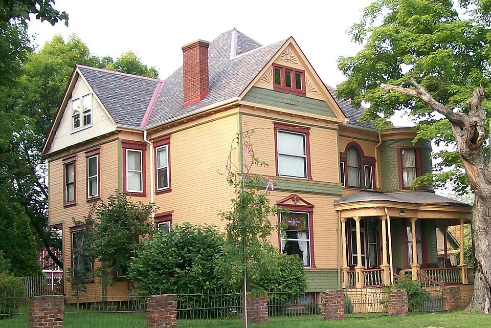
“Lindley Schooley House and Office is a Queen Anne style house in Belmont, Ohio. The house on Main Street was built around 1895 for Dr.”
Wikipedia article Dr. Lindley Schooley House and Office, CC BY-SA 4.0.
one of 15 National Register listings in Belmont County · listed in 1982 · category: Building.
Architectural style. Queen Anne style architecture in the United States
National Register reference number.82003545- the number the National Park Service assigned this property when it was listed, and the key its nomination file is catalogued under at the National Archives.
Belmont or Wrightstown was laid out by Jose])h Wright in 1808. The name Wrightstown ought to have been perpetuated in honor of the enterprising' and intelligent Irish gentleman who first settled there. Mr. Wright was the first school teacher and taught in the old. round-log school house for years. He was
Belmont is to be supplied with natural gas. A company is now laying mains. Some time ago a well was put down a little way north of town. A considerable flow of gas was found at a depth of about 900 feet. The well was closed up and nothing done with it until a few months ago, when parties purchased the farm on which the well is located and began arrangements to carry the gas into town. Other wells will be put down and the supply will, it is thought, be equal to the demand. '
Regional context, not property-specific
evidence. The
federal wildfire occurrence database
lists 9 fires within 5 miles of Schooley, Dr. Lindley, House and Office between
2002 and 2017, burning about 55 acres in total. None started naturally. None was recorded as arson.
Distance is straight-line from the map coordinates, so a fire counted
here may appear on a neighbouring settlement's page as well.
Reported cause
Fires
Debris and open burning
5
Missing data/not specified/undetermined
2
Other causes
1
Equipment and vehicle use
1
The most recent of
them, most recent first, with the day each was reported and the service
that recorded it.
Regional context, not property-specific
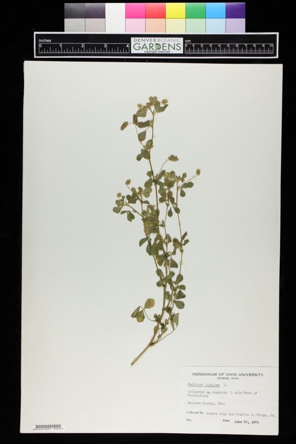
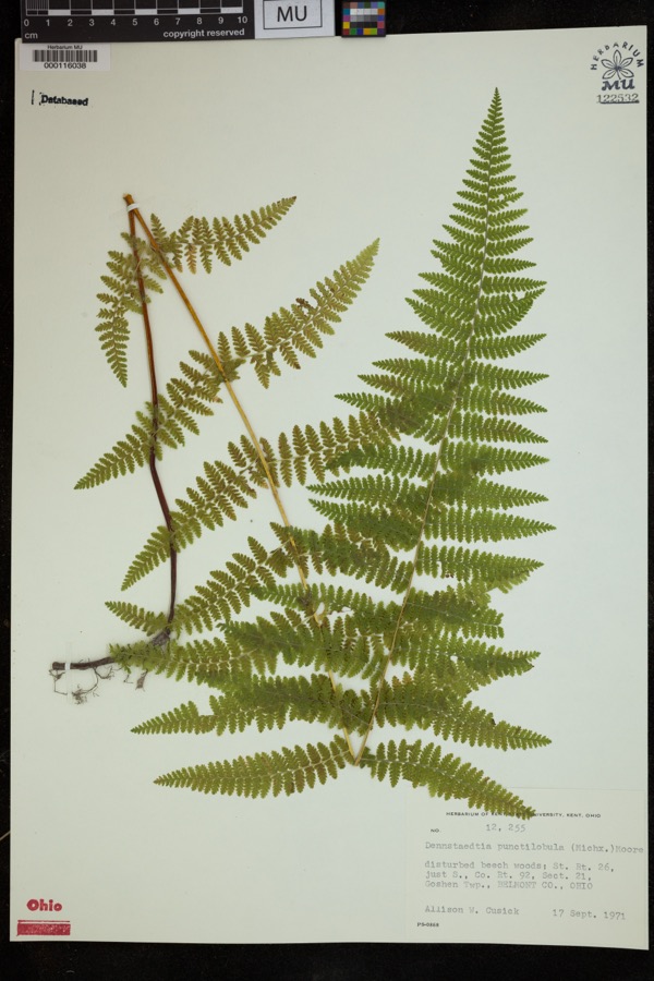
evidence. Museums hold 229 specimens
collected within 10 miles of Schooley, Dr. Lindley, House and Office between 1877 and
1975: 188 Animalia, 30 Plantae, 10 Fungi, 1 Unrecorded. 12 distinct Species records are shown.
Collected by A. Goff, Buker, W.E., Buker, W.E.; Henry, L.K. and others. Each is a
physical object with a catalogue
number, and each entry opens the museum's record. This is what was
collected and kept, not a survey of what lives here - nothing can be
concluded from a species being absent.
Regional context, not property-specific
evidence. The National Weather Service names
Belmont, the town this property stands in, in 15 storm reports between 1995 and 2025: 9 thunderstorm wind, 3 hail, 2 flash flood, 1 flood.
No death or injury is recorded in these reports. Each account below is quoted exactly as the forecast office
filed it, from the NOAA Storm Events Database, and each date
opens the federal record of that event.
At 935 PM EDT, water began spilling over Epworth Park Dam. People trapping in camper in Bethesda. By 1020 PM EDT, secondary creeks emptying into McMahon Creek were flooding, starting 1 mile southeast of Belmont. Water covering SR 149 near Barkcamp State Park in Goshen Twp. McMahon Creek was bankful on SR 149 in Warnock after 2.75 inches of rain.
No historic map-sheet match is published
for this property yet. That does not mean no map exists. This record needs
a coordinate-quality review before it can be joined to a sheet boundary.
Browse the county's mapped places while that work is
pending.
Named in the fire insurance atlases
Sanborn surveyors printed an index of the
town's establishments at the front of each atlas. This property is named in
one, read straight off the scanned sheet.
When this property was proposed for the
National Register, someone wrote the case for it: what the building is,
and why it matters. That document is a federal record in the public domain.
It is quoted below word for word, never summarised. The text was read off the scanned case file by machine, so the
occasional stray character is the recogniser's and the 1970s
typewriter's.
Description of the property
barn with board-and-batten siding.Directly east of the barn is a coal house. Check one The interior of the Schooley House is as impressive as is its exterior.It rises in two turns from the entrance foyer. is completely finished in golden oak and has a very impressive array of contribute greatly to the character of the attached map)Lindley was in the horizon during the heyday of Queen Anne design.All windows are foundation with a full basement. Typical of the Queen Anne style, its silhouette with a conical slate roof and intact finial. A handsome open porch, raised c. 4 feet of wood, 1s varied in the application of imbricated shingles on the tower, in at Lanesville, Ohio, a 1yth century decorative tile center. The dining room plotted lots.
A series of related outbuildings, of wood frame construction, all structures and the main house is a highly ornamental well house with classical styling and imbricated shingle roof. Northwest of the house is a very small - good such as one of the front windows which is capped with a broken pedimental hood double-hung, is found on the stairlanding, on the east elevation. On the west date fair above grade, extends across much of the facade and around the tower, terminating is irregular, and is comprised of rectangular blocks and rounded corners. Perhaps its most distinctive feature is the round tower located at the southeast corner, flat-arched,one-over-one lights.Some have more elaborate trim than others, Areas of SignificanceCheck and justify below - prehistoric .
archeology-historic _ conservation . law - science - agriculture - sculpture .education _ social/ .art - music X 1800-1899 _ commerce -philosophy .communications - politics/government .transportation .other (specify) c. 1895 Statement of
Statement of significance
(in one paragraph) The D. Lindley Schooley House is nominated as the house of one of Belmont's most prominent citizens, and as an extremely well-preserved example of the tendency toward architectural eclecticism during the last decade of the Architecturally, the property represents a complex of buildings central to the history of the village, and, indeed, representative of many small towns with the of its ante-bellun Greek Revival and earlier residences, but most of these are of its clearly delineated high-style detailing, is one of the village's finest. 1700-1799 economics 1600-1699 1400-1499 military engineering theater Period industry invention literature Builder/Architect exploration/settlement humanitarian 1900- Specific dates 8.
Significance The house was built for Dr.Schooley (1824-1908),who was born in the village 1500-1599 - archeology-prehistoric - - community planning nineteenth century. of Belmont and practiced nearly all of his life there. He graduated from Starling Medical College in Columbus, Ohio, and began the practice of medicine in 1846. In 1851, he settled in his home town, where he remained until his death. In 1902, at the age of 78, he was elected president of the First National Bank of Belmont, a position which he held until his death at 84. .architecture Thompson, Richard, Interview, 20 June 1980. Acreage of nominated property ca.
2 acres Bethesda, Ohio 1: 24000 Quadrangle name UMT References Verbal boundary description and justification Lots 51, 52, 55, 56, and 59 of the Village of Belmont List all states and counties for properties overlapping state or county boundaries - State David L.
Quoted from the National Register nomination
for reference 82003545, 18 pages, held by the National Archives in Record
Group 79. See the
catalogue record.
Listed places nearby
3 within 8 miles
Other National Register properties close
enough to walk or drive between, ordered by distance from this one. Both
positions come from the same geocoding pass that matched these properties
to their map sheets.
Listing record. National Park Service National Register of Historic Places, listed-properties dataset, current to 2026-05-22.
Map join. Address geocoded through the United States Census geocoder, then tested against the published boundary of every sheet in the USGS Historical Topographic Map Collection.
How this page is made. Listing fields come from federal records; map-sheet coverage is a labelled coordinate-to-boundary calculation, not a source-field claim.
Wildfire. Short, Karen C. 2022. Spatial wildfire occurrence data for the United States, 1992-2020 [FPA_FOD_20221014]. 6th Edition. Fort Collins, CO: Forest Service Research Data Archive. https://doi.org/10.2737/RDS-2013-0009.6 Collected with United States Government funding and usable without additional permissions or fees.
Specimens. Global Biodiversity Information Facility (GBIF), https://www.gbif.org/. Only records licensed CC0 or CC BY are used. Records licensed CC BY-NC are excluded because this site carries advertising. Images are checked individually and any whose licence is non-commercial, no-derivatives or unreadable is refused.
Storms. NOAA National Centers for Environmental Information, Storm Events Database https://www.ncei.noaa.gov/stormevents/ A work of the United States government, no copyright under 17 U.S.C. 105. Narratives are quoted verbatim from the National Weather Service report and are not edited or summarised.
 Block
Block