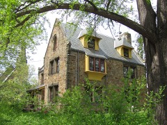
Listed on the National Register of Historic Places in
1985. A historic map-sheet match is not published yet. The record needs a coordinate-quality review before it can be joined to a sheet boundary.
From the record
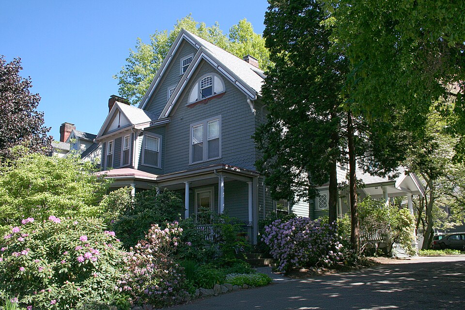
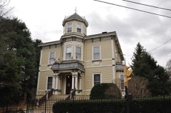
“The William Murphy House is a historic house located in Brookline, Massachusetts.”
Wikipedia article William Murphy House, CC BY-SA 4.0.
one of 249 National Register listings in Norfolk County · listed in 1985 · category: Building · one of 2 National Historic Landmarks in Norfolk County.
Architectural style. Queen Anne style architecture in the United States
National Register reference number.85003303- the number the National Park Service assigned this property when it was listed, and the key its nomination file is catalogued under at the National Archives.
THERE are only six cities and no individual towns in the Commonwealth of Massachusetts with a larger tax list than the town of Brookline. The town of Milton is the only one approaching it in the value of its taxable property, ami the relative value on the tax lists of the two towns is as $65,- 000,000 is to $20,000,000. Watertown, Westll(.l,l Detlham, Manchester, Framingham, Plymouth, Falmouth, Weymouth, N'atick, Attleboro, Marblehead and Amesbury, all delightful colonial towns, each brin- to the Commonwealth a tax income of less than one tenth the amounl contributed by Brookline.
When the town of Brookline was bom mi November 13, 1705, Massachusetts bad over sixty towns in her family ranging in age from one to eighty-five years. The same form of town government inaugurated at the birth of each has been preserved by Brookline and carried nut in the town meetings of cad, year. The officers taking part in the celebration of the two hundredth anniversary of Brookline's birth, November 13, [005, were elected to office and performed the same functions as did i1m.sc chosen in 1705 to stand sponsors t<> the infant town. The voting list df the town lias increased to 1,300 and the limits of the town include the villages of Cottage population at the time of the celebration of its -w,, hundredth birthday numbered over 23,000. Brookline is unique, as a Massachusetts town, its limits, the only exception being electric motors and philosophical instruments. Its wealth and importance is due mainly to its natural and acquired beauty, and its healthfulness a- a residential town. The private fortunes of its inhabitants furnish the means for its multiplying wealth of attractions as a place of suburban residence, and unlike most Massachusetts towns, no rich corporations are sheltered within its borders.
Regional context, not property-specific
evidence. The
federal wildfire occurrence database
lists 21 fires within 5 miles of Murphy, William, House between
2015 and 2020, burning about 20 acres in total. None started naturally. 2 were recorded as arson.
Distance is straight-line from the map coordinates, so a fire counted
here may appear on a neighbouring settlement's page as well.
Reported cause
Fires
Missing data/not specified/undetermined
8
Recreation and ceremony
7
Smoking
3
Arson/incendiarism
2
Equipment and vehicle use
1
The most recent of
them, most recent first, with the day each was reported and the service
that recorded it.
Regional context, not property-specific
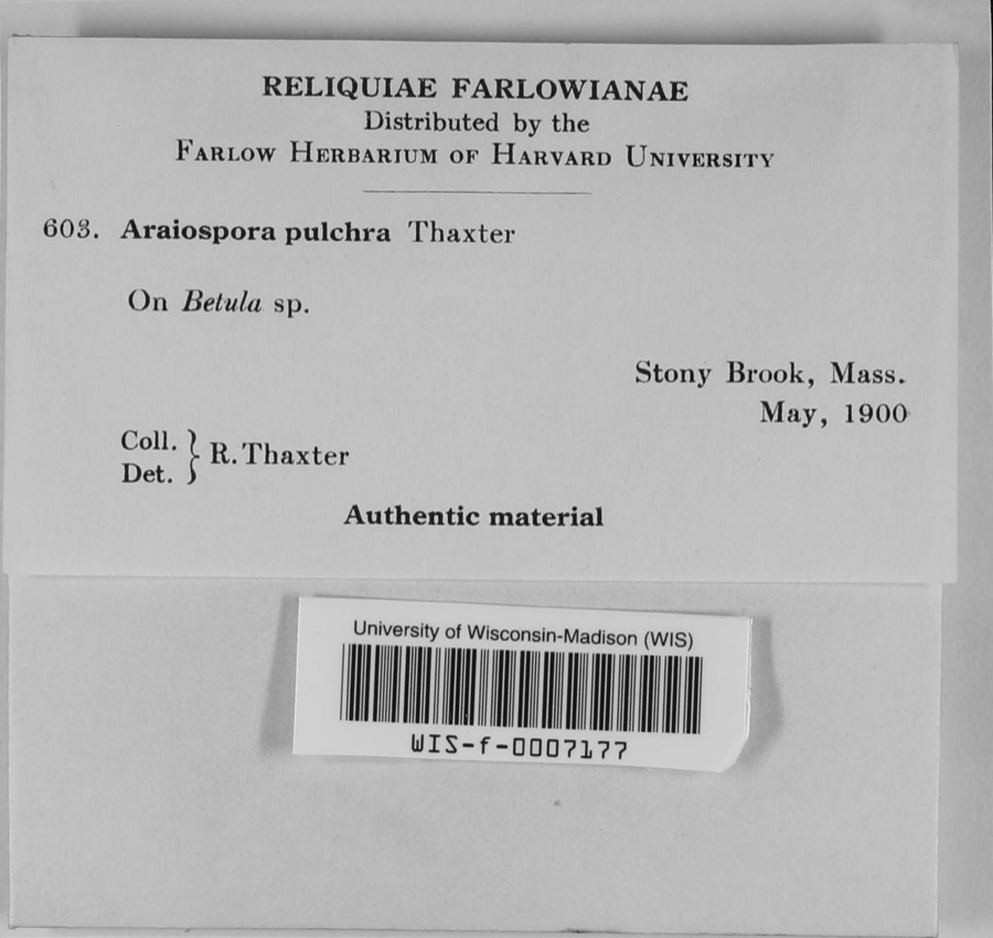
evidence. Museums hold 12,566 specimens
collected within 10 miles of Murphy, William, House between 1810 and
1975: 5,165 Plantae, 3,815 Fungi, 3,119 Animalia, 193 Protozoa, 177 Chromista, 64 Unrecorded, 33 Bacteria. 12 distinct Species records are shown.
Collected by (MARSDEN, H W), ?, ? ex Herb. W.G. Farlow and others. Each is a
physical object with a catalogue
number, and each entry opens the museum's record. This is what was
collected and kept, not a survey of what lives here - nothing can be
concluded from a species being absent.
Regional context, not property-specific
evidence. The federal mineral resources record lists
8 workings within 5 miles of Murphy, William, House: 7 plants, 1 past producer.
7 still produce. What was taken out: Iron, Lead, Tantalum, Niobium (Columbium). Distance is straight-line from the
map coordinates, so a quarry counted here may appear on a neighbouring
settlement's page as well.
Regional context, not property-specific
evidence. The National Weather Service names
Brookline, the town this property stands in, in 19 storm reports between 1995 and 2022: 13 thunderstorm wind, 3 flash flood, 2 flood, 1 hail.
No death or injury is recorded in these reports. Each account below is quoted exactly as the forecast office
filed it, from the NOAA Storm Events Database, and each date
opens the federal record of that event.
Several trees and wires on Cottage Street and Dean Road were downed by thunderstorm winds. In addition, an amateur radio operator reported a 58 mph wind gust.
In Brookline, at 1259 PM EST (159 PM EDT), a tree was down onto a building on Perry Street. At 101 PM EST (201 PM EDT), a tree was down on the 200 block of Walnut Street.
Portions of Route 9 (Boylston Street) were flooded with up to three feet of water. Newton and South Streets and Clark Road were impassable due to flooding.
No historic map-sheet match is published
for this property yet. That does not mean no map exists. This record needs
a coordinate-quality review before it can be joined to a sheet boundary.
Browse the county's mapped places while that work is
pending.
Listed places nearby
6 within 8 miles
Other National Register properties close
enough to walk or drive between, ordered by distance from this one. Both
positions come from the same geocoding pass that matched these properties
to their map sheets.
Listing record. National Park Service National Register of Historic Places, listed-properties dataset, current to 2026-05-22.
Map join. Address geocoded through the United States Census geocoder, then tested against the published boundary of every sheet in the USGS Historical Topographic Map Collection.
How this page is made. Listing fields come from federal records; map-sheet coverage is a labelled coordinate-to-boundary calculation, not a source-field claim.
Wildfire. Short, Karen C. 2022. Spatial wildfire occurrence data for the United States, 1992-2020 [FPA_FOD_20221014]. 6th Edition. Fort Collins, CO: Forest Service Research Data Archive. https://doi.org/10.2737/RDS-2013-0009.6 Collected with United States Government funding and usable without additional permissions or fees.
Specimens. Global Biodiversity Information Facility (GBIF), https://www.gbif.org/. Only records licensed CC0 or CC BY are used. Records licensed CC BY-NC are excluded because this site carries advertising. Images are checked individually and any whose licence is non-commercial, no-derivatives or unreadable is refused.
Mines and quarries. USGS Mineral Resources Data System (MRDS) https://mrdata.usgs.gov/mrds/ A work of the United States government, no copyright under 17 U.S.C. 105.
Storms. NOAA National Centers for Environmental Information, Storm Events Database https://www.ncei.noaa.gov/stormevents/ A work of the United States government, no copyright under 17 U.S.C. 105. Narratives are quoted verbatim from the National Weather Service report and are not edited or summarised.
 Block
Block