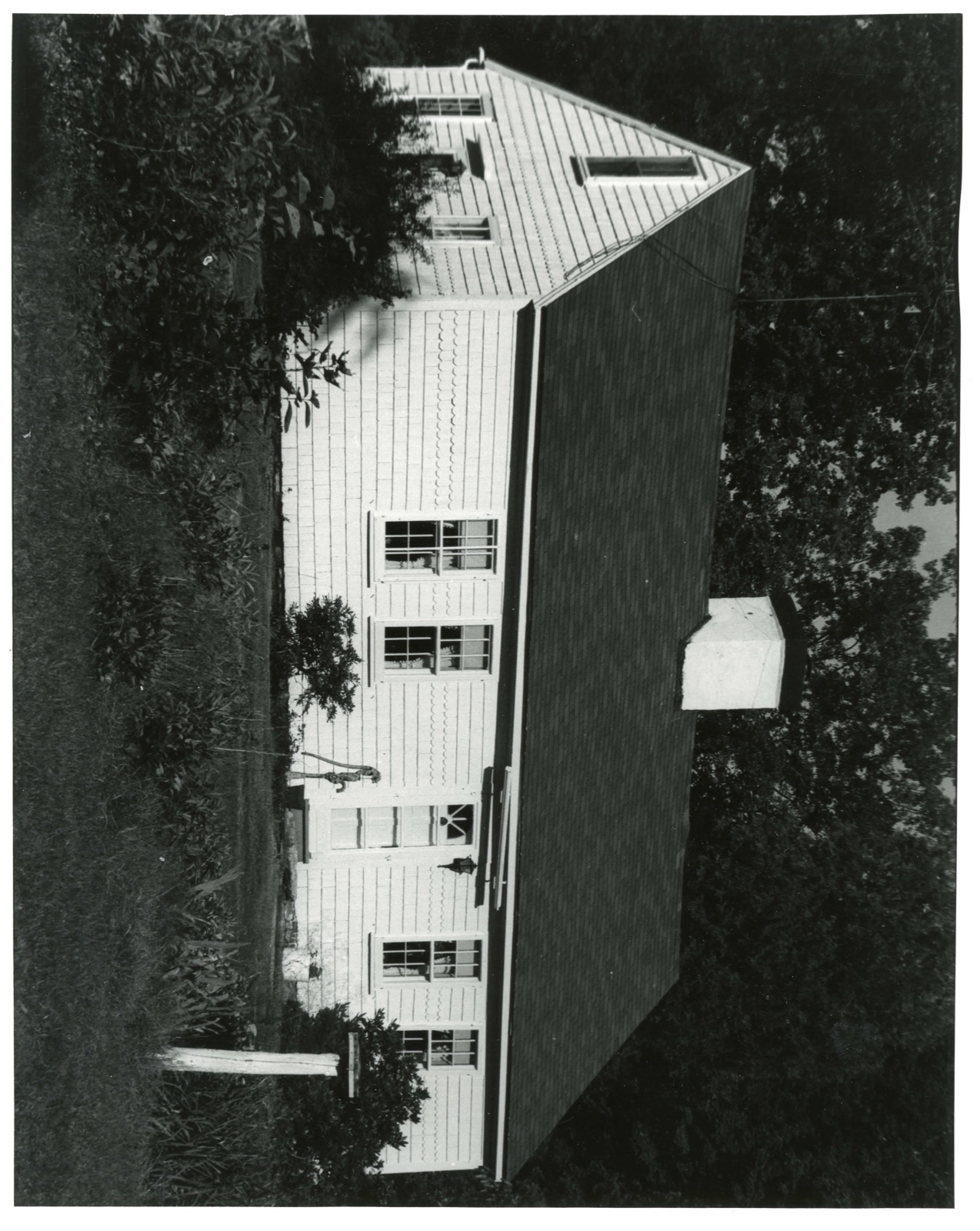
Photographs from the nomination case file, National Park Service records.
Stone, Joseph, House
Listed on the National Register of Historic Places in
1986. A historic map-sheet match is not published yet. The record needs a coordinate-quality review before it can be joined to a sheet boundary.
From the record
one of 500 National Register listings in Worcester County · listed in 1986 · category: Building · one of 1 National Historic Landmarks in Worcester County.
National Register reference number.86000028- the number the National Park Service assigned this property when it was listed, and the key its nomination file is catalogued under at the National Archives.
Fires near this property
88 since 2015
Regional context, not property-specific
evidence. The
federal wildfire occurrence database
lists 88 fires within 5 miles of Stone, Joseph, House between
2015 and 2020, burning about 67 acres in total. None started naturally. 5 were recorded as arson.
Distance is straight-line from the map coordinates, so a fire counted
here may appear on a neighbouring settlement's page as well.
Reported cause
Fires
Debris and open burning
26
Recreation and ceremony
21
Missing data/not specified/undetermined
12
Smoking
11
Railroad operations and maintenance
7
Arson/incendiarism
5
Equipment and vehicle use
3
Power generation/transmission/distribution
2
Misuse of fire by a minor
1
The most recent of
them, most recent first, with the day each was reported and the service
that recorded it.
Regional context, not property-specific
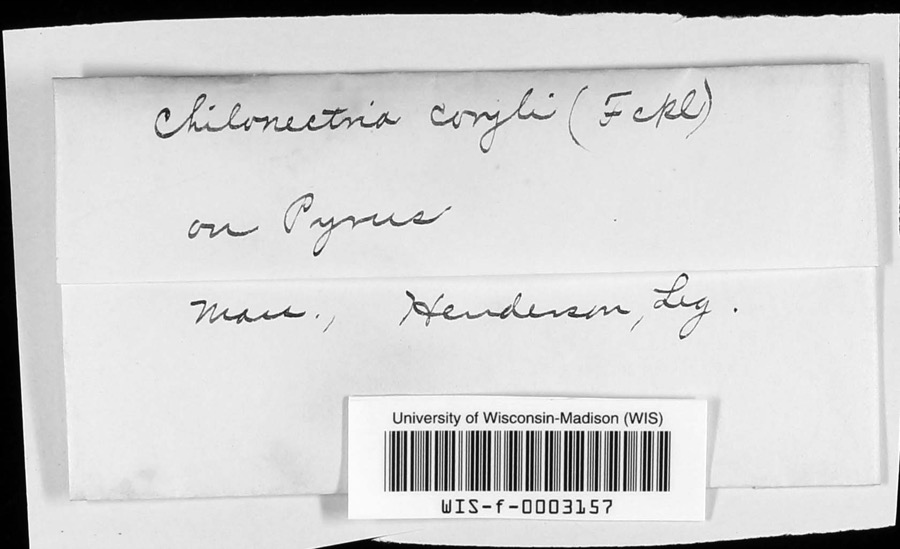
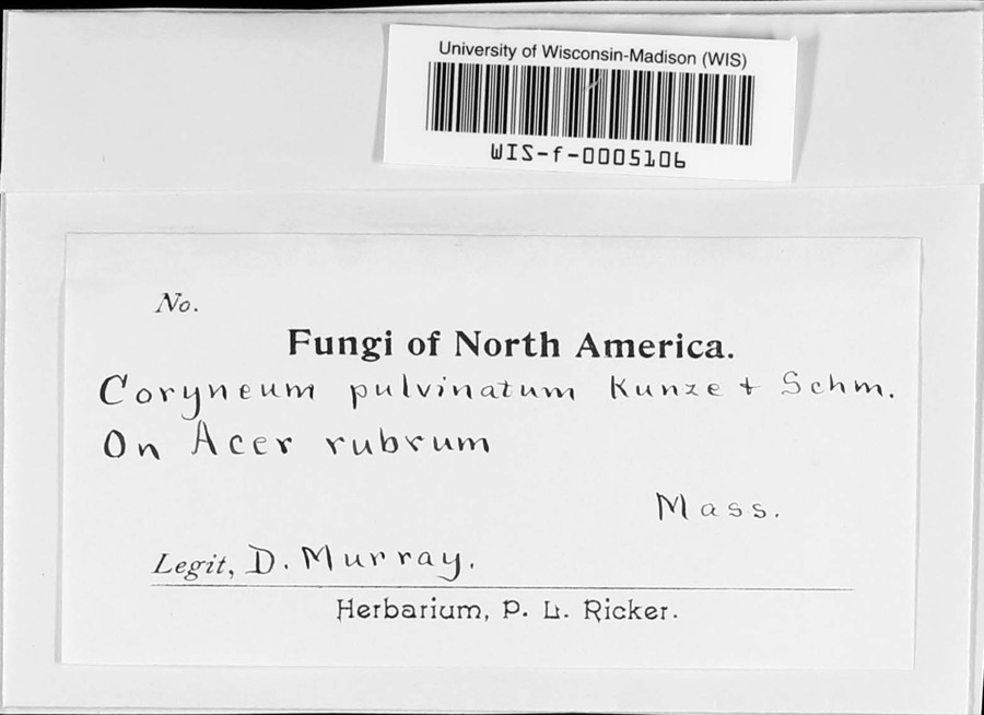
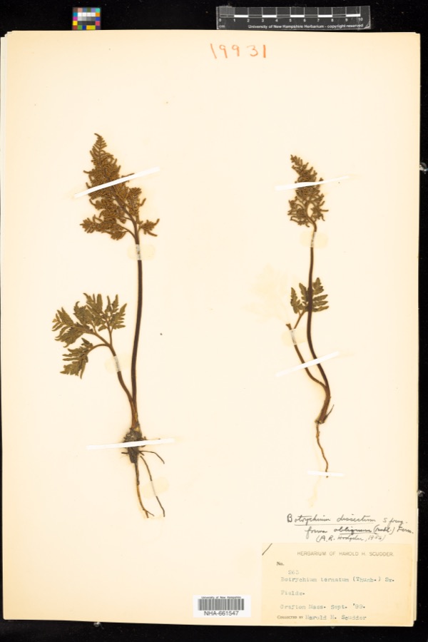
evidence. Museums hold 1,676 specimens
collected within 10 miles of Stone, Joseph, House between 1839 and
1974: 928 Plantae, 461 Animalia, 261 Fungi, 16 Unrecorded, 6 Protozoa, 4 Chromista. 12 distinct Species records are shown.
Collected by A E WOODHEAD, A. A. Eaton, A. B. Seymour and others. Each is a
physical object with a catalogue
number, and each entry opens the museum's record. This is what was
collected and kept, not a survey of what lives here - nothing can be
concluded from a species being absent.
Regional context, not property-specific
evidence. The federal mineral resources record lists
18 workings within 5 miles of Stone, Joseph, House: 13 past producers, 3 producers, 2 plants.
5 still produce. What was taken out: Sand and Gravel, Construction, Iron, Titanium, Metal. Distance is straight-line from the
map coordinates, so a quarry counted here may appear on a neighbouring
settlement's page as well.
Regional context, not property-specific
evidence. The National Weather Service names
Auburn, the town this property stands in, in 15 storm reports between 1995 and 2021: 7 hail, 5 thunderstorm wind, 2 flash flood, 1 lightning.
No death or injury is recorded in these reports. Each account below is quoted exactly as the forecast office
filed it, from the NOAA Storm Events Database, and each date
opens the federal record of that event.
At 3:10 PM EST, a downpour over Auburn flooded the intersection of U.S. Route 20 and Southbridge Street. A water depth of 18 inches was reported on Route 20.
No historic map-sheet match is published
for this property yet. That does not mean no map exists. This record needs
a coordinate-quality review before it can be joined to a sheet boundary.
Browse the county's mapped places while that work is
pending.
From the nomination file
3,736 words on record
When this property was proposed for the
National Register, someone wrote the case for it: what the building is,
and why it matters. That document is a federal record in the public domain.
It is quoted below word for word, never summarised. The text was read off the scanned case file by machine, so the
occasional stray character is the recogniser's and the 1970s
typewriter's.
Description of the property
The Joseph Stone Farm is set back about 100 feet from Stone Street in the southern part of Auburn, Massachusetts. The house sits on the crest of a flat-topped 1ow terrace, on a five-acre lot. The land within 100 feet of the house is level and supports substantial tree growth. The lot's eastern boundary is marked by a steep drop off, with a 50-foot change in elevation. The southern and southeastern parts of the lot gradually drop off into Stone Brook Valley, about 60 feet below the house site. The western boundary is about 25 feet from Stone Brook, which flows 200 feet below the edge of the property line. The house is a five-bay, 1 1/2-story cottage with a central entrance. A large chimney is set on the ridge of the steep-pitched gable roof.
The house was built in 1729 as a three-bay half house with side entrance and end chimney; the two southern bays were added in 1790. A seven-bay ell extends to the west at a right angle to the main block. Believed originally to have been a leanto, added in 1790, the ell was altered in 1886and enlarged in 1946. The house rests on a fieldstone foundation, and has a below-grade basement. The basement extends completely under the house, with the exception of the central infeteny fndend the nouse" chimney area, which is underlain by a 15 by 20 foot unexcavated stone-walled area. The building's exterior fabric at present is cedar shingles applied in a scallop pattern, ca. 1873, and is now painted. Asbestos shingles cover the roof.
The main elevation, which faces east (at a right angle to the present roadway), is dominated by the simply enframed center doorway; the door itself, which includes a fanlight, is a Colonial Revival-style 20th century alteration.
(in one paragraph) Builder Architect Unknown The Joseph Stone House, Auburn, retains integrity of location, design, setting, intact colonial-period cottage whose present form reflects two stages of 18th 1729, and is believed to be the oldest surviving residence in Auburn. The building was enlarged in 1790 by a leanto, altered in 1886 and enlarged again in 1946. Among the building's many owners was Joseph Stone, who owned the nouse from 1/85 to 1826, and was a prolific composer of psalmody (the choral setting of sacred texts). The Stone House thus fulfils Criteria B and C of the National Register of Historic Places on the local level. CETEE Auburn was incorporated as the town of Ward in 1778 (renamed Auburn in 1837), and little information exists on its earliest settlement by Europeans.
The first white settled arrived in the 1720s and included a man named Lord who is believed to have built the nominated property on a 52-acre plot ca. 1729. In the late 17th century, the area was the site of the native American village known as Pakachoag (its center was located two miles from the nominated property), and local history has it that the Stone House sits by an early trail that led from the Nipmuck village at Pakachoag Hill to the earliest Auburn Tils bel ver is unsuostant ated, Mid 18th century Auburn was sparsely settled, a peripheral agricultural area with Woodstock Road, leading from Woodstock, Connecticut, to Worcester, as one of the few roadways through the town.
On the eve of the Revolutionary War, the house may have been owned by a Tory, Theophilus Lilly, who left his family for Boston in April 1775 and, eventually, Nova Scotia, where he later died.
Quoted from the National Register nomination
for reference 86000028, 15 pages, held by the National Archives in Record
Group 79. See the
catalogue record.
Listed places nearby
6 within 8 miles
Other National Register properties close
enough to walk or drive between, ordered by distance from this one. Both
positions come from the same geocoding pass that matched these properties
to their map sheets.
Listing record. National Park Service National Register of Historic Places, listed-properties dataset, current to 2026-05-22.
Map join. Address geocoded through the United States Census geocoder, then tested against the published boundary of every sheet in the USGS Historical Topographic Map Collection.
How this page is made. Listing fields come from federal records; map-sheet coverage is a labelled coordinate-to-boundary calculation, not a source-field claim.
Wildfire. Short, Karen C. 2022. Spatial wildfire occurrence data for the United States, 1992-2020 [FPA_FOD_20221014]. 6th Edition. Fort Collins, CO: Forest Service Research Data Archive. https://doi.org/10.2737/RDS-2013-0009.6 Collected with United States Government funding and usable without additional permissions or fees.
Specimens. Global Biodiversity Information Facility (GBIF), https://www.gbif.org/. Only records licensed CC0 or CC BY are used. Records licensed CC BY-NC are excluded because this site carries advertising. Images are checked individually and any whose licence is non-commercial, no-derivatives or unreadable is refused.
Mines and quarries. USGS Mineral Resources Data System (MRDS) https://mrdata.usgs.gov/mrds/ A work of the United States government, no copyright under 17 U.S.C. 105.
Storms. NOAA National Centers for Environmental Information, Storm Events Database https://www.ncei.noaa.gov/stormevents/ A work of the United States government, no copyright under 17 U.S.C. 105. Narratives are quoted verbatim from the National Weather Service report and are not edited or summarised.
 Block
Block