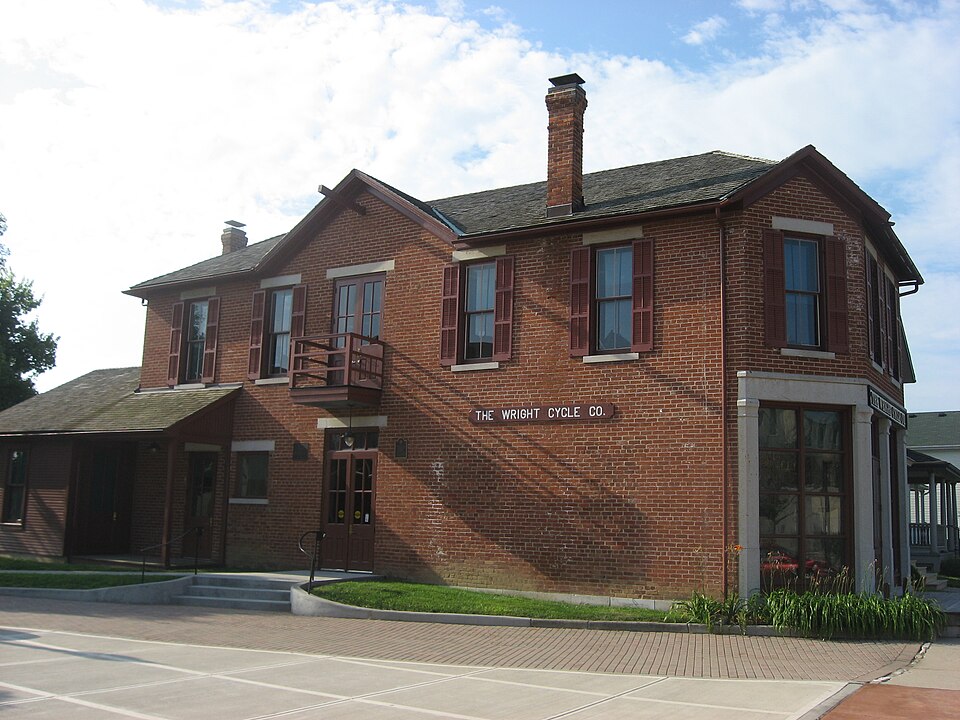
Wright Cycle Company--Wright and Wright Printing Offices
A National Historic Landmark. Listed on the National Register of Historic Places in
1986. A historic map-sheet match is not published yet. The record needs a coordinate-quality review before it can be joined to a sheet boundary.
From the record
“The bicycle business of the Wright brothers, the Wright Cycle Company successively occupied six different locations in Dayton, Ohio. Orville and Wilbur Wright began their bicycle repair, rental and sales business in 1892, while continuing to operate a print shop.”
Wikipedia article Wright Cycle Company, CC BY-SA 4.0.
one of 117 National Register listings in Montgomery County · listed in 1986 · category: Building · one of 4 National Historic Landmarks in Montgomery County.
National Register reference number.86000236- the number the National Park Service assigned this property when it was listed, and the key its nomination file is catalogued under at the National Archives.
What happened here
An account from the chapter on Dayton city, The inset identifies its exact
source book and publication year.
A Typical Frontier Vavern - Daytou Contained Nine Dwellings in 1799- - Several Roads Opened--Monument Avenue Cleared--Main Street a Narrow Wagon Road - Settlements Few and Far Between - Hardships of Pioneer Life--Tidian War Apprehended - Block House Built - Schooi Opened in the Block House- - First Distillery Started - Cooper's Saw Mill - Corn Cracker - Hogs Introduced - Feed on Mast - Attacked by Wild Animals--First Flat Boat Launched-Sheep Introduced - Cost of Groceries at Cinciunati - Little Money jin Circulation - Business Conducted by Barter - Value of Diffsrent Kinds of Skins--Cut Money - McDougal's Store - Trade with the Indians - First Child Boro in Dayton - Taxation in 1800 - First Wedding - Census in 1801 - First Miuister - - Methodists - Presbyterians--Log Meeting House - First Grave Yard - - Jobn W.
During the winter of 1796-97, Dayton Township and other township, were formed, making eleven in all in the county, viz., Cincinnati, Columbi; Miami, Anderson. Iron Ridge, South Bend, Colerain, Springfield, Fairfiel Deerfield and Dayton. Fairfield Township included the territory east of tl Big Miami, now in Butler County. Deerfield Township included the territoi west of the Little Miami, now in Warren County, and that part of Montgon irj County between the Miami Rivers south of the north line of the fifth range )f" townships. Dayton Township was bounded as follows: Beginning at a point >n the east bank of the Big Miami, where it was intersected by the north line )f the fifth range of townships; thence up that river in all its meanderings to he Indian boundary-lino, at a point where said river crossed the said Indian boundary -line, in Section 18, Township 2, in the fom-teenth range of townships, between the Miamis; thence along said line to Ludlow's line, and down that ine to the southeast corner of Section 5, Township 6, in the eighth range of townships between the Miamis, where was a branch of the Little Miami River; hence down the river to the north line of the fifth range of townships; thence (vest with said line to the place of beginning. The township thus described infiuded within its limits territory that now forms portions of the counties of Montgomery, Greene, Miami, Clark, Champaign, Logan and Shelby. All of Wayne, Mad River and Van Buren, with parts of Washington, Dayton and Miimi Townships, of Montgomery County, as at present formed, were in Dayton Township.
The Commissioners of Hamilton County, on the 10th of June, 1797, at a neeting held at the Mansion House, of Seth Cutter's, in Cincinnati, appointed Assessors and Collectors for the several townships. James Brady was made Issessor, and John Kitchell, Collector, of Dayton Township. John Kitchell, 'ailing to qualify, Calvin Morrill, was, on the 25th of August, appointed in his lead, and Cyrus Osborn was appointed Constable of Dayton Township. Constables made returns of persons and property to the Assessors, who made the iists and assessments, that were placed in the hands of the Township Collectors for collection. The Commissioners and Assessors jointly controlled the disbursenents, making regular reports to the County Court. The reports of assessments ind collections for Dayton Township for this year, were lost in transit, between Dayton and Cincinnati ; the Clerk was ordered to forward duplicates, and Collector Morrill was directed to make return by the 15th of January, 1798. There vere sixteen delinquents in the township, and the Collector made final return, fight of them non est, seven satisfied and one lost. After the lists were returned each year, the Commissioners and Assessors met as a Court of Appeals, to hear appeals against assessments. The following orders show the amount of fees paid to these first officers.
Regional context, not property-specific
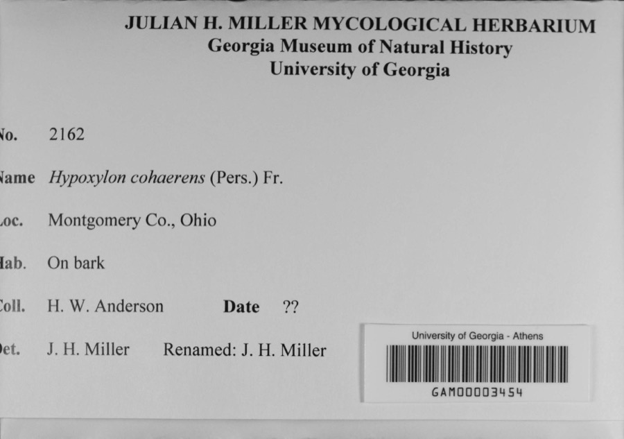
evidence. Museums hold 1,008 specimens
collected within 10 miles of Wright Cycle Company--Wright and Wright Printing Offices between 1835 and
1975: 846 Animalia, 90 Plantae, 60 Fungi, 4 Protozoa, 4 Unrecorded, 4 Chromista. 12 distinct Species records are shown.
Collected by A JOHN, A JOHN AND W E DUELLMAN, A. E. Foeerste and others. Each is a
physical object with a catalogue
number, and each entry opens the museum's record. This is what was
collected and kept, not a survey of what lives here - nothing can be
concluded from a species being absent.
Regional context, not property-specific
evidence. The federal mineral resources record lists
15 workings within 5 miles of Wright Cycle Company--Wright and Wright Printing Offices: 9 past producers, 5 producers, 1 plant.
6 still produce. What was taken out: Sand and Gravel, Construction, Limestone, General, Stone, Crushed/Broken. Distance is straight-line from the
map coordinates, so a quarry counted here may appear on a neighbouring
settlement's page as well.
Regional context, not property-specific
evidence. The National Weather Service names
Dayton, the town this property stands in, in 74 storm reports between 1994 and 2026: 41 thunderstorm wind, 15 hail, 8 flash flood, 7 flood.
The reports record 1 injury. Each account below is quoted exactly as the forecast office
filed it, from the NOAA Storm Events Database, and each date
opens the federal record of that event.
A University of Dayton student, Sean Ferguson, 23 of Pittsburgh, was struck by lightning as he ran across university parking lot C. The student was hospitalized with serious burns and a broken jaw.
Thunderstorms winds measured by spotters as high as 72 mph downed numerous trees, many of which fell on cars and blew on to and into homes. A construction trailer was severely damaged and some businesses received damage.
A roof was blown off of a residence in East Dayton as well as several utility poles that were snapped in half. Numerous trees were down in the vicinity of Glenrock Road and East Fifth Street. Several trees landed on parked automobiles and garages.
Large limbs were reported broken. A large tree was uprooted. Numerous large tree limbs were down in the road. These occurrences were due to damaging thunderstorm winds.
A car was stranded on Keowee Street under State Route 4 due to high water. Three feet of water was also reported on Webster Street at the underpass of State Route 4.
Numerous roads were flooded throughout the Dayton metropolitan area. A man had to be rescued when he drove his car into a flooded retention pond near the Dayton Mall.
8 papers published in this town,
digitised by the Library of Congress and free to read: 0 issues,
0 pages. Every page is searchable, so a name or a street can be
looked for directly in what the town printed about itself at the time.
No historic map-sheet match is published
for this property yet. That does not mean no map exists. This record needs
a coordinate-quality review before it can be joined to a sheet boundary.
Browse the county's mapped places while that work is
pending.
From the nomination file
3,282 words on record
When this property was proposed for the
National Register, someone wrote the case for it: what the building is,
and why it matters. That document is a federal record in the public domain.
It is quoted below word for word, never summarised. The text was read off the scanned case file by machine, so the
occasional stray character is the recogniser's and the 1970s
typewriter's.
Description of the property
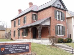
residential street, 22 South Williams Street is one block south of the seven blocks west of l 75 along West Third Street, directly across the Great The internationally known black poet Paul Laurence Dunbar, a friend of the revitalization of this section of Dayton. Between 1895 and 1897 when the building at 22 South Williams Street housed the section featured one projecting gable on the north side, and a diagonally wood shutters. The first floor facade was a storefront with a stone freize pulleys in the gable end above the door. A set of double doors directly A second stairway directly beneath the one tothe second floor provided access to the basement. Condition unexposed ruins moved 7.
Description Photograph #5).The entire building has been painted white, the shutters have addition was divided into two rooms.One stairway in the southeast corner of in the second floor opened onto a small metal balcony and was presumably used Check one contrasting stone Iintels and sills, and all of the windows had dark painted Wright showlight colored plaster walls with dark wood baseboards.The show-room and workspace.Photographs #2 and 3 taken by Wilbur and Orville and 1897,shows the 22 South Williams Street building at this period in time. Miami River from Dayton's Central Business District.At the turn of the north side of the building also had a frame porch attached to the addition.
have been added to the west end of the north side.According to the Sanborn shows light colored plaster walls with a decorative pattern at the freize The first floor interior of the main section was one large room used asa to move equipment in and out of the second floor by means of a hoist with - unaltered and middle class homes.
(in one paragraph) meets criteria #A and #B for listing in the National Register of Historic owned and operated by Wilbur and Orville Wright. The Wright Brothers became building at 22 South Williams Street, Wilbur and Orville Wright first became experimenting with kites and gliders, which eventually led them to develop a Wilbur and Orville moved their bicycle shop into the building at 22 South introduced its own brands of bicycles, the "Van Cleve" and the "St.
Clair", Wright designed and built a single cylinder gas engine to power bicycle Brothers used their experience of working with chain drives on bicycles when and later airplanes, were crafted with the same tools and machinery used to As part of Wright and Wright Printing, which Wilbur and Orville Wright operated out of the second floor of 22 South Williams Street, the Wrights October 24, 1894 to April_17, 1896.2 All of the printing was done on a press The building at 22 South William Street was the third of five locations of the was demolished during a 1927 expansion of the company. The second Wright Brothers bicycle shop, located at 1034 West Third Street, was torn down in the served as a downtown branch of the 22 South Williams Street Shop.
1700-1799 1400-1499 1600-1699 communications 1500-1599 commerce philosophy industry conservation engineering archeology-prehistoric economics humanitarian literature science exploration/settlement education sculpture X_1800-1899 law _communityplanning 8. Significance build bicycles. _archeology-historic well as add.4 -agriculture social/ they designed the chain drive for the propellers on their aircraft. prehistoric .architecture 1930s to make room for a two story commercial building,which was in turn 1900- .. religion The Wright Cycle Company Shop at 22 South Williams Street in Dayton, Ohio, Places.
Quoted from the National Register nomination
for reference 86000236, 26 pages, held by the National Archives in Record
Group 79. See the
catalogue record.
Listed places nearby
6 within 8 miles
Other National Register properties close
enough to walk or drive between, ordered by distance from this one. Both
positions come from the same geocoding pass that matched these properties
to their map sheets.
Listing record. National Park Service National Register of Historic Places, listed-properties dataset, current to 2026-05-22.
Map join. Address geocoded through the United States Census geocoder, then tested against the published boundary of every sheet in the USGS Historical Topographic Map Collection.
How this page is made. Listing fields come from federal records; map-sheet coverage is a labelled coordinate-to-boundary calculation, not a source-field claim.
Specimens. Global Biodiversity Information Facility (GBIF), https://www.gbif.org/. Only records licensed CC0 or CC BY are used. Records licensed CC BY-NC are excluded because this site carries advertising. Images are checked individually and any whose licence is non-commercial, no-derivatives or unreadable is refused.
Mines and quarries. USGS Mineral Resources Data System (MRDS) https://mrdata.usgs.gov/mrds/ A work of the United States government, no copyright under 17 U.S.C. 105.
Storms. NOAA National Centers for Environmental Information, Storm Events Database https://www.ncei.noaa.gov/stormevents/ A work of the United States government, no copyright under 17 U.S.C. 105. Narratives are quoted verbatim from the National Weather Service report and are not edited or summarised.
 Block
Block