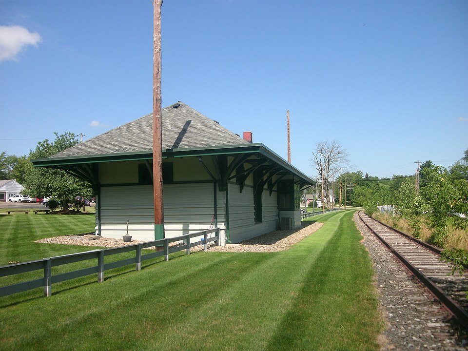
Built in 1872. Listed on the National Register of Historic Places in
1986. A historic map-sheet match is not published yet. The record needs a coordinate-quality review before it can be joined to a sheet boundary.
From the record
“Aurora is the former train station serving the residents of Aurora, Ohio, located within Portage County, Ohio, USA. The station was constructed in 1872 by the New York, Pennsylvania and Ohio Railroad, which had absorbed the former Cleveland and Mahoning Valley Railroad, which ran from Cleveland, Ohio to Leavittsburg, Ohio.”
Wikipedia article Aurora station (Ohio), CC BY-SA 4.0.
one of 42 National Register listings in Portage County · listed in 1986 · category: Building · built in 1872.
National Register reference number.86001131- the number the National Park Service assigned this property when it was listed, and the key its nomination file is catalogued under at the National Archives.
Regional context, not property-specific
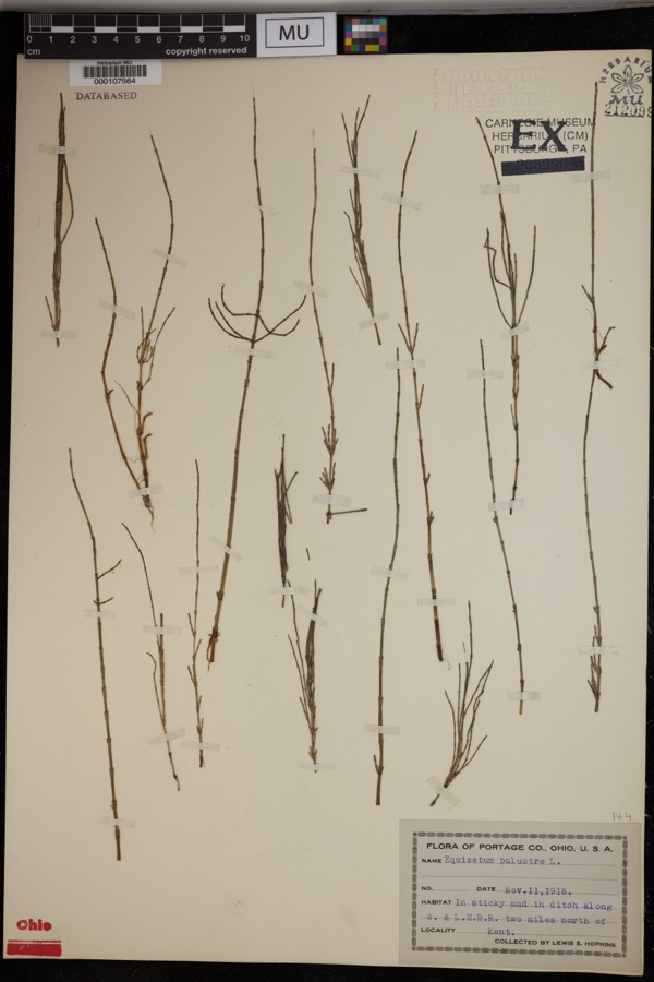
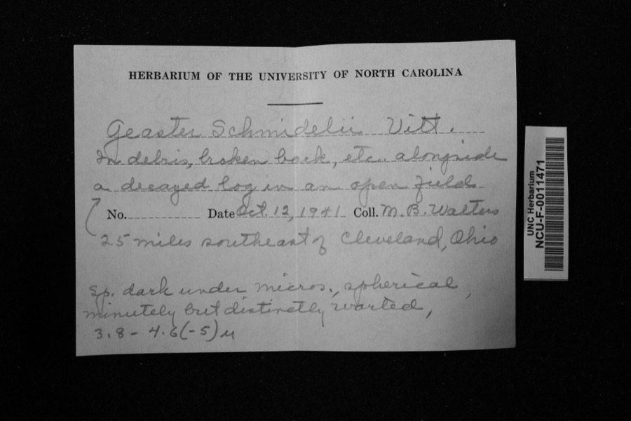
evidence. Museums hold 500 specimens
collected within 10 miles of Aurora Train Station between 1893 and
1975: 425 Animalia, 68 Plantae, 4 Unrecorded, 3 Fungi. 12 distinct Species records are shown.
Collected by A. Woolman, Allen, John, Bruyne P de and others. Each is a
physical object with a catalogue
number, and each entry opens the museum's record. This is what was
collected and kept, not a survey of what lives here - nothing can be
concluded from a species being absent.
Regional context, not property-specific
evidence. The federal mineral resources record lists
19 workings within 5 miles of Aurora Train Station: 10 producers, 6 past producers, 3 plants.
13 still produce. What was taken out: Sand and Gravel, Construction. Distance is straight-line from the
map coordinates, so a quarry counted here may appear on a neighbouring
settlement's page as well.
Regional context, not property-specific
evidence. The National Weather Service names
Aurora, the town this property stands in, in 15 storm reports between 1993 and 2025: 8 hail, 7 thunderstorm wind.
No death or injury is recorded in these reports. Each account below is quoted exactly as the forecast office
filed it, from the NOAA Storm Events Database, and each date
opens the federal record of that event.
No historic map-sheet match is published
for this property yet. That does not mean no map exists. This record needs
a coordinate-quality review before it can be joined to a sheet boundary.
Browse the county's mapped places while that work is
pending.
From the nomination file
2,288 words on record
When this property was proposed for the
National Register, someone wrote the case for it: what the building is,
and why it matters. That document is a federal record in the public domain.
It is quoted below word for word, never summarised. The text was read off the scanned case file by machine, so the
occasional stray character is the recogniser's and the 1970s
typewriter's.
Description of the property
soffits and.replaced with fire code gypsum board and a suspended acoustical The most distinctive element of the structure.are the.champered.6 x 6 brackets thirds of the building housed the public restrooms-and freight area which had fair have all been restored or duplicated in oak in their original locations.The center pivot four fight windowslocated high within the stuccoed area of the light upper sections with fwo solid lower panels. Above each door is a twenty is lapped with mitered corners exposure) up to within four feet of the supporting a heavy timber floor structure. Wall construction is 2 x 6 bal loon public doors are nine light with two solid panels in lower half.. The public G panel ing and chair, rails..
Above the chair rails the horizontal T& G lower than the original celling of fourteen feet to facilitate insulation and - good siding. The north and south freight doors were restored from-a partial door: the mechanical system. The heavy window trim with returning cove cornices ruins exterior of the building was restored and interior renovated subdividing the original interior doors have been restored.All new doors match the original Iight transom.
x 7i windows of the original waiting room to the extreme west of the building brackets.The soffit is sheathed with a y' grove T & G paneling matching the are 6/6.The five windows of the ticket bay are 1/1.The upper half of.the Areas of Significance - Check and justify below _ archeology-historic - agriculture - sculpture X architecture _ music X commerce .exploration/settlement - philosophy -_ 1900 The Aurora Train Station Ts significant under Criteria A for its association detalling common of small turn-of-the-century railroad stations.
/Architect social/ .literature community to prosper from the Cheese industry and tourism.The station is built,four million pounds of cheese was being shipped from its freight area. -conservation The station continued to serve commuters to and from Cleveland up to the -prehistoric with Aurora's early twentieth century transportation network which enabled the Statement of Significance (in one paragraph) commercial processing of cheese in Aurora.
---economics were split off of the railroad's right-of-way and turned over to private 1920's a golf course, were built within walking distance of the station, to --communications Aurora was also known as a fashionable area for recreation.A "Picnic Lake .science military Conrail tried to demolish the building in 1982,but Aurora was able to halt throughout the building. ...education -.-art __. archeology-prehistoric - _ community planning landscape architecture .. religion - other (specify) area, leaving the station the only significant structure associated with the richly detailed -inside and out. A massive seven 'foot overhang supported by* also eligible under Criteria C as representing the architectural form and Aurora.
Changes in production, economy and rising cost of raw milk accounted Period the destruction. for the abandoning of cheese production and a rebuilding of the industrial provide overnight accomodations for the Picnic Lake.The most prominant of Through public and private pressures, the structure and site The site housed two main east-west sets of tracks and two spurs to handle the public areas of the station are richly detailedwith heavily coved cornice considered the tourist trade of Aurora.The building being stickstyte was 9.
Quoted from the National Register nomination
for reference 86001131, 23 pages, held by the National Archives in Record
Group 79. See the
catalogue record.
Listed places nearby
6 within 8 miles
Other National Register properties close
enough to walk or drive between, ordered by distance from this one. Both
positions come from the same geocoding pass that matched these properties
to their map sheets.
Listing record. National Park Service National Register of Historic Places, listed-properties dataset, current to 2026-05-22.
Map join. Address geocoded through the United States Census geocoder, then tested against the published boundary of every sheet in the USGS Historical Topographic Map Collection.
How this page is made. Listing fields come from federal records; map-sheet coverage is a labelled coordinate-to-boundary calculation, not a source-field claim.
Specimens. Global Biodiversity Information Facility (GBIF), https://www.gbif.org/. Only records licensed CC0 or CC BY are used. Records licensed CC BY-NC are excluded because this site carries advertising. Images are checked individually and any whose licence is non-commercial, no-derivatives or unreadable is refused.
Mines and quarries. USGS Mineral Resources Data System (MRDS) https://mrdata.usgs.gov/mrds/ A work of the United States government, no copyright under 17 U.S.C. 105.
Storms. NOAA National Centers for Environmental Information, Storm Events Database https://www.ncei.noaa.gov/stormevents/ A work of the United States government, no copyright under 17 U.S.C. 105. Narratives are quoted verbatim from the National Weather Service report and are not edited or summarised.
 Block
Block