BlockBefore
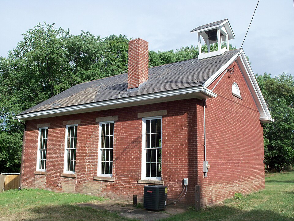
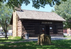
Photograph of Independent School District No. 2 Building
Photograph by Roseohioresident, CC BY-SA 3.0. Via Wikimedia Commons.

Independent School District No. 2 Building

Listed on the National Register of Historic Places in 1986. A historic map-sheet match is not published yet. The record needs a coordinate-quality review before it can be joined to a sheet boundary.

From the record

one of 17 National Register listings in Jefferson County · listed in 1986 · category: Building · one of 1 National Historic Landmarks in Jefferson County.

Sources: the case file at the National Archives · the National Register database, National Park Service

The listing

  • What is counted as historic. The nomination lists 1 building as contributing to the listing.
  • Address. 64520 OH 213, Steubenville, 43952
  • When was it listed? 1986-07-10
  • Category. building
  • Township. Island Creek township
  • National Register reference number. 86001569 - the number the National Park Service assigned this property when it was listed, and the key its nomination file is catalogued under at the National Archives.

Fires near this property

11 since 2010

Regional context, not property-specific evidence. The federal wildfire occurrence database lists 11 fires within 5 miles of Independent School District No. 2 Building between 2010 and 2020, burning about 26 acres in total. None started naturally. None was recorded as arson. Distance is straight-line from the map coordinates, so a fire counted here may appear on a neighbouring settlement's page as well.

Reported cause Fires
Debris and open burning4
Missing data/not specified/undetermined3
Other causes2
Power generation/transmission/distribution1
Recreation and ceremony1

The most recent of them, most recent first, with the day each was reported and the service that recorded it.

DateCause SizeReported by Name on the report
7 April 2013Debris and open burningunder an acreOhio Department of Natural Resourcesnot named
23 April 2010Debris and open burning5.0 acresOhio Department of Natural Resourcesnot named
1 April 2015Power generation/transmission/distributionunder an acreOhio Department of Natural Resources1783
1 April 2014Recreation and ceremony10 acresOhio Department of Natural Resourcesnot named
1 April 2014Debris and open burning6.0 acresOhio Department of Natural Resourcesnot named
29 March 2015Missing data/not specified/undeterminedunder an acreOhio Department of Natural Resources1782
20 March 2013Missing data/not specified/undeterminedunder an acreOhio Department of Natural Resourcesnot named
1 March 2016Missing data/not specified/undetermined2.0 acresOhio Department of Natural Resources3713

Every fire recorded in Jefferson County

Specimens collected near this property

12 of 593 shown

Regional context, not property-specific evidence. Museums hold 593 specimens collected within 10 miles of Independent School District No. 2 Building between 1836 and 1974: 335 Animalia, 221 Plantae, 36 Fungi, 1 Chromista. 12 distinct Species records are shown. Collected by A. Doolittle, A. W. Cusick, A.W. Cusick and others. Each is a physical object with a catalogue number, and each entry opens the museum's record. This is what was collected and kept, not a survey of what lives here - nothing can be concluded from a species being absent.

Image SpeciesYear Collected by Where, as recorded
Specimen of Vitis aestivalis Michx.Vitis aestivalis Michx.1836Jewett
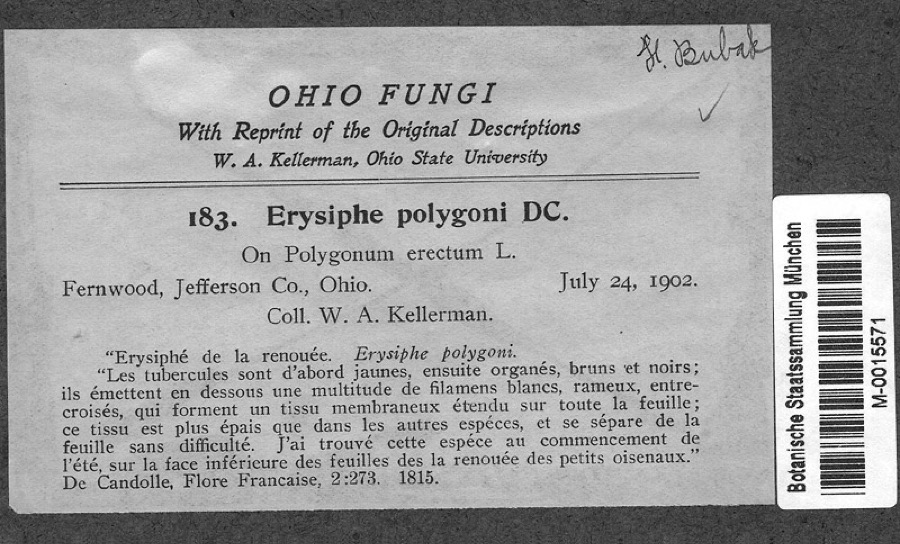
Specimen of Polygonum erectum L.Polygonum erectum L.1902Kellerman, W.A.Fernwood, Jefferson Co., Ohio
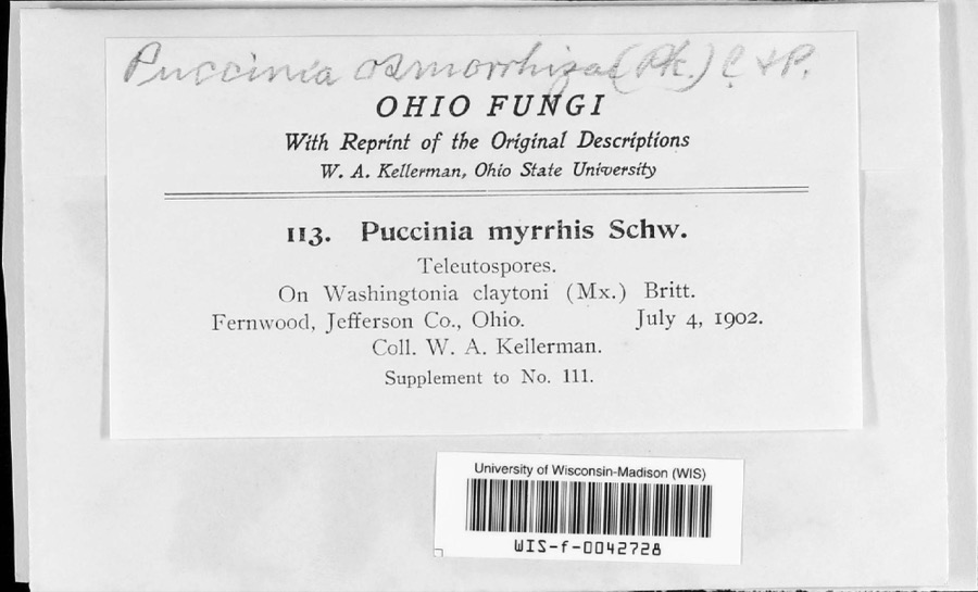
Specimen of Puccinia pimpinellae (F.Strauss) LinkPuccinia pimpinellae (F.Strauss) Link1902W. A. Kellerman
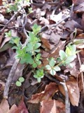
A photograph of the species Carex hirsutella, not of this specimenCarex hirsutella Mack.1877Mertz, H.N.Steubenville
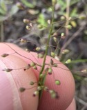
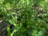
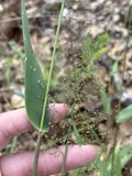
A photograph of the species Dichanthelium acuminatum, not of this specimenDichanthelium acuminatum subsp. fasciculatum (Torr.) Freckmann & Lelong1877Mertz, H.N.Steubenville
A photograph of the species Dichanthelium latifolium, not of this specimenDichanthelium latifolium (L.) Harvill1877Mertz, H.N.Steubenville
A photograph of the species Dichanthelium sphaerocarpon, not of this specimenDichanthelium sphaerocarpon (Elliott) Gould1877Mertz, H.N.Steubenville
A photograph of the species Elymus hystrix, not of this specimenElymus hystrix L.1877Mertz, H.N.Steubenville
A photograph of the species Galium circaezans, not of this specimenGalium circaezans Michx.1877Guttenberg, G.near Steubenville
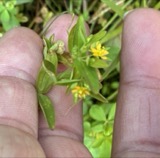
A photograph of the species Hypericum mutilum, not of this specimenHypericum mutilum L.1877Mertz, H.N.Steubenville
A photograph of the species Hypericum punctatum, not of this specimenHypericum punctatum Lam.1877Mertz, H.N.Steubenville
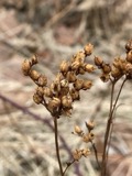
A photograph of the species Luzula echinata, not of this specimenLuzula echinata (Small) F.J.Herm.1877Mertz, H.N.Steubenville

All 593 specimens within 10 miles, at the Global Biodiversity Information Facility.

Mines and quarries near this property

3 within 5 miles

Regional context, not property-specific evidence. The federal mineral resources record lists 3 workings within 5 miles of Independent School District No. 2 Building: 1 plant, 1 producer, 1 past producer. 2 still produce. What was taken out: Iron, Chromium, Iron, Clay. Distance is straight-line from the map coordinates, so a quarry counted here may appear on a neighbouring settlement's page as well.

Where SiteCommodity StatusRecorded
(Facility) Steubenville SmelterIron, ChromiumPlant
Kaul Clay Company PitClayPast ProducerSedimentary
Wheeling-Pittsburgh/ SteubenvilleIronProducer

Every working recorded in Jefferson County

Storms near this property

60 of 62 shown

Regional context, not property-specific evidence. The National Weather Service names Steubenville, the town this property stands in, in 62 storm reports between 1994 and 2025: 46 thunderstorm wind, 13 hail, 1 flash flood, 1 heavy rain. The reports record 1 injury. Each account below is quoted exactly as the forecast office filed it, from the NOAA Storm Events Database, and each date opens the federal record of that event.

WhenEvent Place namedHarm What the report says
May 2017Thunderstorm WindSteubenville1 hurt, $10,000Broadcast media reported trees down on Highland Avenue and one tree landed on a house prompting a hospital visit for a mother and her two children.
June 2008Thunderstorm WindSteubenville$150,000A trained spotter reported trees and power lines down in and around Steubenville.
July 2012Thunderstorm WindSteubenville$100,000Reports from newspapers showed numerous trees and power lines down across the city of Steubenvile.
May 2002Thunderstorm WindSteubenville$20,000Thunderstorm winds blew the roof off of a business in Steubenville.
January 1996Flash FloodSteubenville$20,000no account filed
July 2011Thunderstorm WindSteubenville$15,000Law enforcement in Jefferson county reports of trees and power lines down countywide.
June 2023LightningSteubenville$10,000Lightning struck a home. Damage unknown.
June 2016Thunderstorm WindSteubenville$10,000Law enforcement reported trees down.
July 2012Thunderstorm WindSteubenville$10,000A trained spotter reported trees down on Route 7.
May 2002Thunderstorm WindSteubenville$10,000Thunderstorm winds downed numerous trees and power lines.
July 2001Thunderstorm WindSteubenville$10,000Thunderstorm winds downed numerous trees and power lines in Steubenville, with the heaviest damage occurring in the city's West End.
June 1998Thunderstorm WindSteubenville$10,000Thunderstorm winds downed numerous trees across the area.
July 2003Thunderstorm WindSteubenville$7,000Numerous large trees and power lines down.
July 2023Thunderstorm WindSteubenville$5,000A few trees were reported to be blown down near Steubenville.
June 2019Thunderstorm WindSteubenville$5,000Large branches were blown down, and power outages were reported along Sunset Boulevard.
April 2017Thunderstorm WindSteubenville$5,000Local 911 reported numerous trees down across the Steubenville area.
May 2017Thunderstorm WindSteubenville$5,000State official reported multiple trees down.
July 2013Thunderstorm WindSteubenville$5,000A small cluster of snapped trees and limbs were found during an NWS storm survey.
June 2012Thunderstorm WindSteubenville$5,000The public reported large branches broken.
July 2005Thunderstorm WindSteubenville$5,000Tree down along Rte 7.
August 2004Thunderstorm WindSteubenville$5,000Large trees blown down on Lawson Ave, Ross St, and N 5th St. 5000 customers lost electricity.
August 2002Thunderstorm WindSteubenville$5,000Thunderstorm winds downed several trees.
May 1997Thunderstorm WindSteubenville$5,000Some small trees and several large branches were downed by thunderstorm winds throughout the county.
May 1994Thunderstorm WindSteubenville$5,000Trees were downed on Maiden Lane.
August 2005Thunderstorm WindSteubenville$4,000Trees down.
April 2025Thunderstorm WindSteubenville$3,000Several large trees were reported to be snapped.
August 2024Thunderstorm WindSteubenville$3,000State officials reported trees down at the intersection of Sinclaire Avenue and John Scott Highway.
August 2024Thunderstorm WindSteubenville$3,000State officials reported downed trees.
June 2007Thunderstorm WindSteubenville$3,000Trees and power lines reported down.
July 1999Thunderstorm WindSteubenville$3,000Thunderstorm winds downed several trees.
July 2022Thunderstorm WindSteubenville$2,000Over a dozen shingles were blown from the roof of a house.
July 2011Thunderstorm WindSteubenville$2,000Emergency management reports a tree down in Steubenville.
June 2004Thunderstorm WindSteubenville$2,00060 mph wind gust in Steubenville. Trees down in Steubenville and Wintersville.
May 2000Thunderstorm WindSteubenville$2,000Thunderstorm winds downed a few trees.
May 1995Thunderstorm WindSteubenville$2,000Large branches and a few trees downed by thunderstorm winds.
July 1995Thunderstorm WindSteubenville$2,000Trees and power lines downed by thunderstorm winds.
June 2025Thunderstorm WindSteubenville$1,000A tree was reported down on Sinclair Avenue and Coal Hill Road.
June 1995Thunderstorm WindSteubenville$1,000Trees downed by thunderstorm winds.
June 1995Thunderstorm WindSteubenville$1,000Large branches and a tree downed by thunderstorm winds near Steubenville.
June 1996Thunderstorm WindSteubenville$1,000no account filed
June 2021Thunderstorm WindSteubenville-Tree down on parked cars along Sunset Blvd in Steubenville.
June 2021Thunderstorm WindSteubenville-Tree fell on car.
August 2021Thunderstorm WindSteubenville-Social media report of snapped trees in Steubenville.
August 2021Thunderstorm WindSteubenville-A 911 Call Center reported multiple reports of trees down across the county.
May 2019Thunderstorm WindSteubenville-A trained spotter reported trees down along Braybarton Boulevard.
September 2018Heavy RainSteubenville-A COOP observer recorded 5.77 inches of rain for a 72 hour storm total.
May 2011Thunderstorm WindSteubenville-The public reports and estimated wind gust of 58mph.
November 2002Thunderstorm WindSteubenville-60 mph gust knocked down power lines, cutting power to 800 customers.
May 2017HailSteubenville-no account filed
May 2014HailSteubenville-no account filed
July 2013HailSteubenville-no account filed
April 2011HailSteubenville-no account filed
March 2011HailSteubenville-no account filed
April 2002HailSteubenville-no account filed
May 2002HailSteubenville-no account filed
April 2001HailSteubenville-no account filed

Every storm recorded in Jefferson County

Newspapers printed here

0 digitised pages

1 paper published in this town, digitised by the Library of Congress and free to read: 0 issues, 0 pages. Every page is searchable, so a name or a street can be looked for directly in what the town printed about itself at the time.

NewspaperPublished
True American1855 to 1861

Map coverage status

No historic map-sheet match is published for this property yet. That does not mean no map exists. This record needs a coordinate-quality review before it can be joined to a sheet boundary. Browse the county's mapped places while that work is pending.

From the nomination file

1,644 words on record

When this property was proposed for the National Register, someone wrote the case for it: what the building is, and why it matters. That document is a federal record in the public domain. It is quoted below word for word, never summarised. The text was read off the scanned case file by machine, so the occasional stray character is the recogniser's and the 1970s typewriter's.

Description of the property

The Independent School District #2 Building located about 15' from a busy has been converted (date unknown, although early) to a doorway, with the upper elevation displays a three-light transom, and all windows are 6/6 double-hung The gable roof exhibits diminutive cornice returns, with the date 1880 interior, although bare, has not been altered substantially and still retains Condition date fair excellent unexposed state highway in Island Creek Township,is a one story brick rectangle.The Check one original wainscoting beneath the windows and a pressed metal ceiling.

windows with plain sandstone lug sills and lintels.The northern-most window alteration has been the removal unknown)of the school bell tower.The foundation is sandstone with cut stone water table and the walls are common bond brick.The 3-bay east gable end features two double-hung 6/6 sash outlined in the slate and a tall brick chimney on the north slope.A wooden sunburst molding is found.in the rear gable end. The only other exterior Areas of Significance-Check and justify below .archeology-prehistoric community planning landscape architecture X architecture X 1800-1899 X 1900 - other (specify) Builder Architect Statement of

Statement of significance

(in one paragraph) The Independent School District #2 Building is significant under criteria A County, and is one of only two examples of one-room schoolhouse architecture Like most areas of the state, during the late 19th century there were many rural district schoolhouses scattered about Jefferson County, but all other examples have been drastically altered or demolished. Collectively these The Bantam Ridge Schoolhouse (NR 10/81) in nearby Cross Creek Township is the best preserved examples of rural schoolhouse architecture of this period in the country from this era were built of frame, so the use of brick further The first mention of a schoolhouse here is in 1866 when the nearby church in 1876.

Apparently the local school districts went through some sort of reorganization in the late 1870s or early 1880s for the land was purchased school system until 1950 when it was sold to a private firm who has since 1600-1699 1400-1499 1500-1599 economics commerce conservation 1700-1799 communications invention philosophy industry humanitarian Period exploration/settlement archeology-historic transportation theater engineering science prehistoric unknown Xeducation sculpture military agriculture literature Specific dates law -politics/government social/ maintained its structural condition. 8. Significance .religion design and cornice returns. and C.It isbelieved to be the oldest school building remaining in Jefferson _music ca. 1865 still intact in the county.

school was designed to be accessible to the local rural "community" where they had an immense impact on social development of youth. al though clearly from the late 19th century. Together these two represent the distinguishes the Independent School District building. This brick schoolhouse appears to date from the 1860s and is remarkably well preserved, displaying a modest form of Greek Revival styling with its simple window 1880 date in the slate roof.

Read the complete 1,644-word case file.

The whole case file for this property - 1,644 words, 16 pages, reproduced complete.

Quoted from the National Register nomination for reference 86001569, 16 pages, held by the National Archives in Record Group 79. See the catalogue record.

Listed places nearby

6 within 8 miles

Other National Register properties close enough to walk or drive between, ordered by distance from this one. Both positions come from the same geocoding pass that matched these properties to their map sheets.

Sources for this property

National Archives recordThe nomination case file for reference 86001569 in Record Group 79.
Jefferson CountyAll 17 listed properties in this county.

Provenance

  • Listing record. National Park Service National Register of Historic Places, listed-properties dataset, current to 2026-05-22.
  • Map join. Address geocoded through the United States Census geocoder, then tested against the published boundary of every sheet in the USGS Historical Topographic Map Collection.
  • How this page is made. Listing fields come from federal records; map-sheet coverage is a labelled coordinate-to-boundary calculation, not a source-field claim.
  • Wildfire. Short, Karen C. 2022. Spatial wildfire occurrence data for the United States, 1992-2020 [FPA_FOD_20221014]. 6th Edition. Fort Collins, CO: Forest Service Research Data Archive. https://doi.org/10.2737/RDS-2013-0009.6 Collected with United States Government funding and usable without additional permissions or fees.
  • Specimens. Global Biodiversity Information Facility (GBIF), https://www.gbif.org/. Only records licensed CC0 or CC BY are used. Records licensed CC BY-NC are excluded because this site carries advertising. Images are checked individually and any whose licence is non-commercial, no-derivatives or unreadable is refused.
  • Mines and quarries. USGS Mineral Resources Data System (MRDS) https://mrdata.usgs.gov/mrds/ A work of the United States government, no copyright under 17 U.S.C. 105.
  • Storms. NOAA National Centers for Environmental Information, Storm Events Database https://www.ncei.noaa.gov/stormevents/ A work of the United States government, no copyright under 17 U.S.C. 105. Narratives are quoted verbatim from the National Weather Service report and are not edited or summarised.