BlockBefore
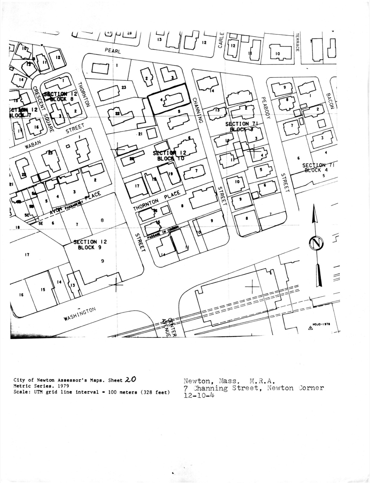
Farquhar, Samuel, House, photograph from the federal nomination

Photographs from the nomination case file, National Park Service records.

Farquhar, Samuel, House

Listed on the National Register of Historic Places in 1986. A historic map-sheet match is not published yet. The record needs a coordinate-quality review before it can be joined to a sheet boundary.

From the record

one of 1100 National Register listings in Middlesex County · listed in 1986 · category: Building · one of 3 National Historic Landmarks in Middlesex County.

Sources: the case file at the National Archives · the National Register database, National Park Service

The listing

  • What is counted as historic. The nomination lists 1 building as contributing to the listing.
  • Address. 7 Channing St., Newton, 02764
  • When was it listed? 1986-09-04
  • Category. building
  • Also known as. Newton MRA
  • National Register reference number. 86001798 - the number the National Park Service assigned this property when it was listed, and the key its nomination file is catalogued under at the National Archives.

Storms near this property

17 since 1997

Regional context, not property-specific evidence. The National Weather Service names Newton, the town this property stands in, in 17 storm reports between 1997 and 2025: 8 thunderstorm wind, 4 hail, 3 flood, 1 flash flood. The reports record 1 injury. Each account below is quoted exactly as the forecast office filed it, from the NOAA Storm Events Database, and each date opens the federal record of that event.

WhenEvent Place namedHarm What the report says
June 2020LightningWest Newton1 hurtA 62-year old woman was struck by lightning. She endured a side flash after lightning struck a tree near her. She was alert and breathing at the scene but was transported to a hospital for further evaluation.
July 2021Thunderstorm WindWest Newton$10,500In Newton, a tree was down on a car near 1750 Commonwealth Avenue. Also, a tree was down on a house at 111 Prospect Street. A tree was down on Park Drive. A tree was down on Adams Street at Wiltshire Road.
July 2020Thunderstorm WindWest Newton$8,000In West Newton, a tree was down on a car on Columbus Place. In the Waban section of western Newton, a tree fell onto a house on Larch Street.
May 2010Thunderstorm WindNewton$7,000A utility pole on Wyman Street was downed by thunderstorm winds.
June 2020FloodNewton$5,000In Newton, urban flooding caused two cars to have to be removed from flood waters near 100 Walnut Street. Also, Adams Street was flooded and impassable from Watertown Street (Route 16) to Cottage Court.
August 2015Thunderstorm WindNewton$5,000A tree was downed onto a house on Glastonbury Oval.
July 2012FloodNewton$5,000In Newton, a 20 foot stretch of Beacon Street was flooded with 1 foot of water. Also, Route 9 at the Parker Street underpass was flooded with 6 to 12 inches of water. Route 9 westbound near the Chestnut Hill Mall was flooded with 10 to 12 inches of water. In Natick, Speen Street near the Natick Mall was flooded with a foot of water. A few cars stalled out in the water.
August 2011FloodWest Newton$5,000After receiving two to three inches of rain with Tropical Storm Irene, the intersection of Commonwealth Avenue and Washington Street was impassable due to flooding in Newton. A car was stuck in flood waters on Commonwealth Avenue.
June 2020Thunderstorm WindNewton$1,300In Newton, a tree was down blocking Lewis Terrace at Washington Street. A second tree and wires were down in the same area.
July 2025Thunderstorm WindNewton$800In Newton, a tree was down on wires on Fairway Dr.
June 2020Thunderstorm WindNewton$700In Newton, a tree and power lines were down on Highland Avenue.
July 2023Thunderstorm WindWest Newton$500In Newton, there was a tree down on Henshaw Terrace.
August 2015HailNewton-no account filed
July 2000HailNewton-no account filed
September 1999Flash FloodNewton-no account filed
May 1997HailNewton-no account filed

Every storm recorded in Middlesex County

Map coverage status

No historic map-sheet match is published for this property yet. That does not mean no map exists. This record needs a coordinate-quality review before it can be joined to a sheet boundary. Browse the county's mapped places while that work is pending.

From the nomination file

971 words on record

When this property was proposed for the National Register, someone wrote the case for it: what the building is, and why it matters. That document is a federal record in the public domain. It is reproduced in full on its own page, word for word and never summarised. The text was read off the scanned case file by machine, so the occasional stray character is the recogniser's and the 1970s typewriter's.

The whole case file for this property - 971 words, 7 pages, reproduced complete.

Quoted from the National Register nomination for reference 86001798, 7 pages, held by the National Archives in Record Group 79. See the catalogue record.

Sources for this property

National Archives recordThe nomination case file for reference 86001798 in Record Group 79.
Middlesex CountyAll 1100 listed properties in this county.

Provenance

  • Listing record. National Park Service National Register of Historic Places, listed-properties dataset, current to 2026-05-22.
  • Map join. Address geocoded through the United States Census geocoder, then tested against the published boundary of every sheet in the USGS Historical Topographic Map Collection.
  • How this page is made. Listing fields come from federal records; map-sheet coverage is a labelled coordinate-to-boundary calculation, not a source-field claim.
  • Storms. NOAA National Centers for Environmental Information, Storm Events Database https://www.ncei.noaa.gov/stormevents/ A work of the United States government, no copyright under 17 U.S.C. 105. Narratives are quoted verbatim from the National Weather Service report and are not edited or summarised.