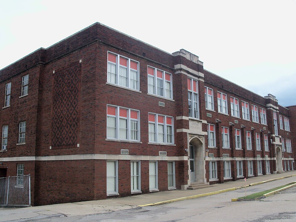
Listed on the National Register of Historic Places in
1987. A historic map-sheet match is not published yet. The record needs a coordinate-quality review before it can be joined to a sheet boundary.
From the record
one of 17 National Register listings in Jefferson County · listed in 1987 · category: Building · one of 1 National Historic Landmarks in Jefferson County.
National Register reference number.87000471- the number the National Park Service assigned this property when it was listed, and the key its nomination file is catalogued under at the National Archives.
What happened here
An account from the chapter on Steubenville township, The inset identifies its exact
source book and publication year.
AWFUL ACCIDENT---One of the most horrible accidents on the Panhandle R.R. for some years occurred near Coshocton Tuesday evening. . . in which WHEELER BURGESS was fatally injured, JOHN CURN and ROBERT DAVIS of THOS. FRITH's crew of stone bridge builders from this city were killed. . . (men were riding on a hand car, overtaken by train, these three had no time to jump from car).
Regional context, not property-specific
evidence. The
federal wildfire occurrence database
lists 8 fires within 5 miles of Central High School between
2000 and 2015, burning about 3 acres in total. None started naturally. 2 were recorded as arson.
Distance is straight-line from the map coordinates, so a fire counted
here may appear on a neighbouring settlement's page as well.
Reported cause
Fires
Debris and open burning
3
Arson/incendiarism
2
Smoking
1
Equipment and vehicle use
1
Misuse of fire by a minor
1
The most recent of
them, most recent first, with the day each was reported and the service
that recorded it.
Regional context, not property-specific
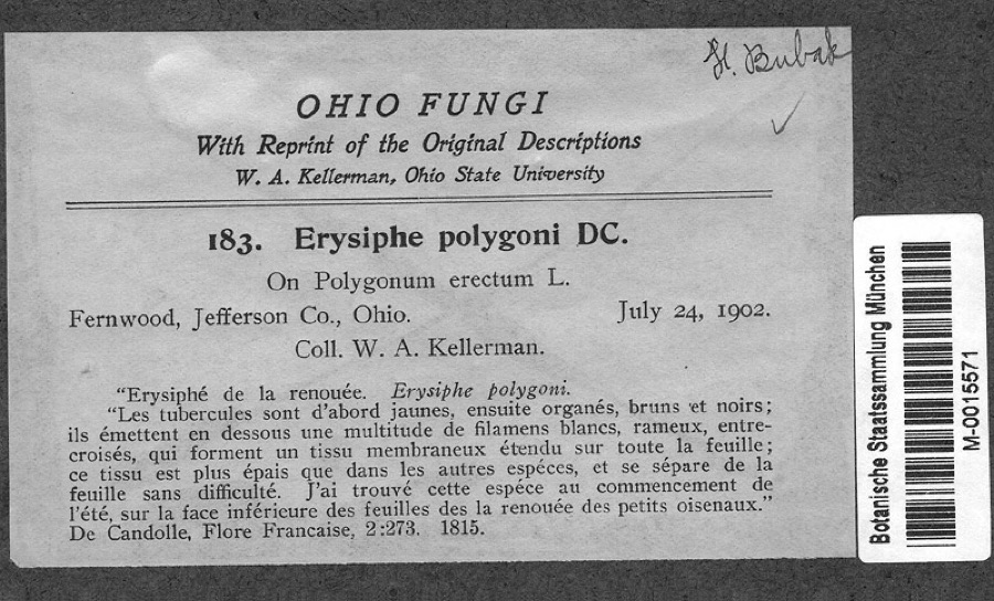
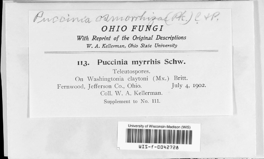
evidence. Museums hold 516 specimens
collected within 10 miles of Central High School between 1836 and
1974: 295 Animalia, 179 Plantae, 41 Fungi, 1 Chromista. 12 distinct Species records are shown.
Collected by A. W. Cusick, Allison W. Cusick, BANKS, C S and others. Each is a
physical object with a catalogue
number, and each entry opens the museum's record. This is what was
collected and kept, not a survey of what lives here - nothing can be
concluded from a species being absent.
Regional context, not property-specific
evidence. The federal mineral resources record lists
5 workings within 5 miles of Central High School: 4 producers, 1 plant.
All of them still produce. What was taken out: Iron, Zirconium, Sand and Gravel, Construction, Iron, Chromium. Distance is straight-line from the
map coordinates, so a quarry counted here may appear on a neighbouring
settlement's page as well.
No historic map-sheet match is published
for this property yet. That does not mean no map exists. This record needs
a coordinate-quality review before it can be joined to a sheet boundary.
Browse the county's mapped places while that work is
pending.
From the nomination file
1,192 words on record
When this property was proposed for the
National Register, someone wrote the case for it: what the building is,
and why it matters. That document is a federal record in the public domain.
It is quoted below word for word, never summarised. The text was read off the scanned case file by machine, so the
occasional stray character is the recogniser's and the 1970s
typewriter's.
Description of the property
summary paragraph yes alterations/integrity resubmission Accessible dates ruins clarity Category Status REJECT Discipline OHIO Reviewer deteriorated Recom./Criteria RETURN completeness fair Jefferson County boundary selection Substantive Review: 3-17-87 Working No. owner objection Condition Reviewer's comments: Ownership NR decision unexposed ACCEPT 8.
Statement of significance
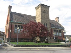
: architecturally significant in Mingo Junction.A side addition to Central growth of the community during the 1920s and 30s when the population was Central High School meets National Register Criterion C.The building is Central High School significant for its intact Jacobethan Revivalarchitectural style and for High School was built in 1957 in a complementary scale and with similar Indian Creek Local School District nearing 5,000. city's first high school.Built in 1929,Central High School was character of the building. separate high school to serve Mingo Junction and illustrates the rapid location on either side of "School Way" on Church Hill. The high school materials and workmanship. Jefferson Co., OH 1. Commercial Street Keeper 2. North Hill Historic 3. Central High School 4.
Central Public School 5. St. Agnes Roman . Date/Signature Attest Expires Name District Thematic Group Continuation sheet State Inventory-Nomination Form Historic District Page Item number Multiple Resource Area National Register of Historic Places Catholic Church dnr-11 Nomination/Type of Review National Park Service Mingo Junction MRA United States Department of the Interior NPS Form 10-900-a 10-31-87 (3-82) WASO Form - 177 UNITED STATES DEPARTMENT OF THE INTERIOR ("R" June 1984) NATIONAL PARK SERVICE NATIONAL REGISTER OF HISTORIC PLACES EVALUATION/RETURN SHEET Central High School (Mingo Junction MRA) Fed. Reg.
Date: o2 Date Due: _ nomination by person or local government Federal Agency: - Lappeal I sample J request - see continuation sheet Nomination returned for: - _ technical corrections cited below _substantive reasons discussed below 1. Name 2. Location 3. Classification Present Use Public Acquisition 4. Owner of Property 5. Location of Legal Description 6. Representation in Existing Surveys Has this property been determined eligible?
Quoted from the National Register nomination
for reference 87000471, 9 pages, held by the National Archives in Record
Group 79. See the
catalogue record.
Listed places nearby
6 within 8 miles
Other National Register properties close
enough to walk or drive between, ordered by distance from this one. Both
positions come from the same geocoding pass that matched these properties
to their map sheets.
Listing record. National Park Service National Register of Historic Places, listed-properties dataset, current to 2026-05-22.
Map join. Address geocoded through the United States Census geocoder, then tested against the published boundary of every sheet in the USGS Historical Topographic Map Collection.
How this page is made. Listing fields come from federal records; map-sheet coverage is a labelled coordinate-to-boundary calculation, not a source-field claim.
Wildfire. Short, Karen C. 2022. Spatial wildfire occurrence data for the United States, 1992-2020 [FPA_FOD_20221014]. 6th Edition. Fort Collins, CO: Forest Service Research Data Archive. https://doi.org/10.2737/RDS-2013-0009.6 Collected with United States Government funding and usable without additional permissions or fees.
Specimens. Global Biodiversity Information Facility (GBIF), https://www.gbif.org/. Only records licensed CC0 or CC BY are used. Records licensed CC BY-NC are excluded because this site carries advertising. Images are checked individually and any whose licence is non-commercial, no-derivatives or unreadable is refused.
Mines and quarries. USGS Mineral Resources Data System (MRDS) https://mrdata.usgs.gov/mrds/ A work of the United States government, no copyright under 17 U.S.C. 105.
 Block
Block