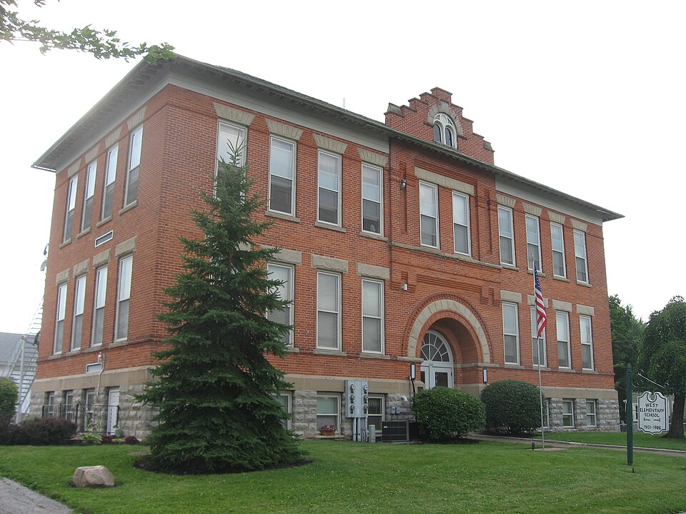
Built in 1905. Listed on the National Register of Historic Places in
1987. A historic map-sheet match is not published yet. The record needs a coordinate-quality review before it can be joined to a sheet boundary.
From the record
“The first regular thoroughfare constructed in the township extended from T'ymochtee to Carey's mill. It passed through sections 25 and 26, and in Tymochtee extended through section 16 and 20.”
Past and Present of Wyandot County Ohio (1913). Machine-read text.
one of 8 National Register listings in Wyandot County · listed in 1987 · category: Building · built in 1905.
National Register reference number.87001989- the number the National Park Service assigned this property when it was listed, and the key its nomination file is catalogued under at the National Archives.
As has already been stated, Asa Lake was first to locate in this township, and in 1819, he erected the first abode that graced the primeval solitudes of this locality. It was a double log cabin, about 18x20 feet, and was located on Section 26. About two years later, Daniel Hodges founded a home near the village of Crawfordsville, and in 1823 John Carey built a hewed-log house on the south bank of the Tymochtee, nearly opposite the old Delaware village of Captain Pipe. William Brown erected his cabin in the same year, but probably after Mr. Carey had built his. However, this is uncertain, as we arrive at this conclusion by the fact that Carey was already in the vicinity at the time of Brown's arrival.
The first regular thoroughfare constructed in the township extended from T'ymochtee to Carey's mill. It passed through sections 25 and 26, and in Tymochtee extended through section 16 and 20. The early settlers went to Delaware for supplies usually, though as early as 1823, John Carey, and Elijah Brayton erected a saw and grist mill on lands owned by Mr. Carey, in what is now Tymochtee township. <A carding machine was also operated in connection with this mill. At present the township can boast of five mills - one saw mill' at Crawford, two.saw mills at Carey and two grist mills at the latter place. The first store of this territory was kept at Crawfordsville, by William M. Buell, who was also the first merchant of Carey.
Regional context, not property-specific
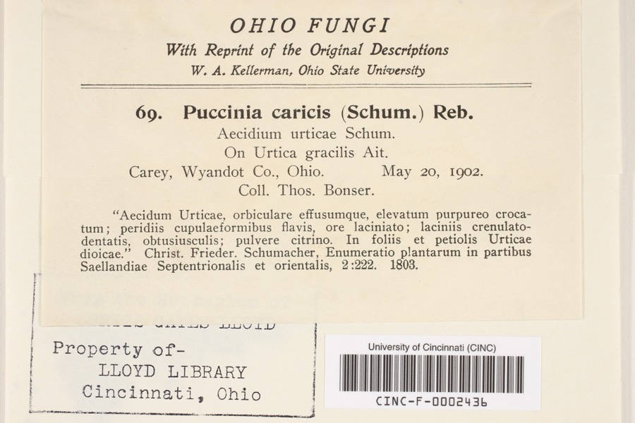
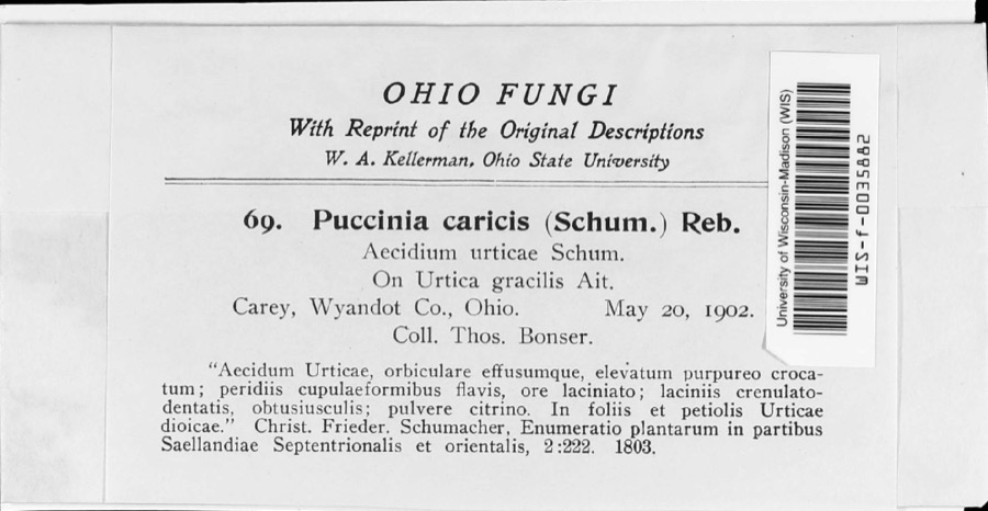
evidence. Museums hold 181 specimens
collected within 10 miles of West End Elementary School between 1885 and
1975: 150 Animalia, 28 Fungi, 3 Plantae. 12 distinct Species records are shown.
Collected by Allen, J. M., Blyth & Katz, Blyth, D. (David) & Katz, D. (David) and others. Each is a
physical object with a catalogue
number, and each entry opens the museum's record. This is what was
collected and kept, not a survey of what lives here - nothing can be
concluded from a species being absent.
Regional context, not property-specific
evidence. The federal mineral resources record lists
2 workings within 5 miles of West End Elementary School: 1 plant, 1 producer.
All of them still produce. What was taken out: Stone, Crushed/Broken. Distance is straight-line from the
map coordinates, so a quarry counted here may appear on a neighbouring
settlement's page as well.
Regional context, not property-specific
evidence. The National Weather Service names
Carey, the town this property stands in, in 40 storm reports between 1994 and 2025: 20 thunderstorm wind, 11 hail, 5 flash flood, 2 flood.
No death or injury is recorded in these reports. Each account below is quoted exactly as the forecast office
filed it, from the NOAA Storm Events Database, and each date
opens the federal record of that event.
Heavy rainfall on the morning of July 13th caused the Spring Run to over-top its levees around 1045 am. By 11 am State Route 103 and 23 north were shut down. By 1140 am water started to inundate downtown Carey. Major flooding into homes and businesses in Carey occurred around 5 pm when water was at its deepest up to 6 deep. Sixty homes were affected, many from backups of storm drainage. Six to seven homes had water on West Ogg Street mainly from Spring Run. Dozens of businesses directly impacted, mostly with basement flooding. The water receded by 3 am Friday morning. The Tymochee Creek washed out some cross roads near ST RT 103 and RT 106. The waste water plant measured 3.8 in the southeast part of town, while unofficial reports of 5.5 in northern part of town. Radar estimates rainfall amounts between 4 and 6 inches of rain fell between 4 and 7 inches of rainfall during the same time period.
A tornado touched down along County Road 25A just south of Carey. A storm survey was conducted and this tornado was determined to be an EF0. This tornado damaged a couple of homes and destroyed at least two barns. The damage path was about three quarters of a mile long and about 10 yards in width. The tornado lifted near the intesection of County Road 25A and County Road 98B.
Numerous trees were reported down across the area. A building in downtown Carey had its roof stripped off of it, and a barn suffered severe structural damage.
Heavy rain producing thunderstorms affected Wyandot County during the late evening hours of August 20th and early morning hours of August 21st. Rainfall rates with the strongest storms exceeded three inches per hour. Up to six inches of rain was reported in the Upper Sandusky area by 4 am. A Cooperative Observer in Upper Sandusky reported a 24 hour rainfall total of 9.35 inches at 7 am with most of this rain falling between 11 pm and 4 am. An automated gauge at Kildeer Plain State Park recorded 4.10 inches. Runoff from this rain combined with ground already saturated from earlier rains led to catastrophic flooding across portions of Wyandot County. The Carey area was especially hard hit as flooding destroyed or heavily damaged several dozen homes. A total of 176 homes and 42 businesses in the town were damaged. 9 of 15 homes along West South Street were destroyed. By 3 am the flood waters were over knee deep in many locations and many streets were closed. Significant flooding was also reported in the Upper Sandusky and Sycamore areas. Near Sycamore, two teenagers had to be rescued after they were swept into Sycamore Creek by surging flood waters. Hundreds of people had to be evacuated from their homes in the county, including several dozen from a nursing home in Carey. A total of 159 homes are believed to have been destroyed or sustained more than 50 percent losses in the county. Over 500 additional homes and businesses sustained lesser damages from the flooding. At the peak of the flooding, around daybreak on the 21st, nearly every federal, state and county road in the county was closed because of flooding. Damage to roads, bridges and culverts was extensive. Cleanup and overtime costs incurred by local government agencies was substantial. In the City of Carey alone, nearly 600 tons of flood debris had to be removed. Finally, standing water and erosion from the runoff caused damage to agricultural interests in the county. |
Red Cross reports downtown Carey Ohio was flooded by heavy rain on the night of December 21st into 22nd. One home was flooded as a result of 1.5-2 of rain falling within a 6 hour time frame that evening before. The main street in Carey, U.S. 23, was closed by the flooding.
The public reported quarter size hail from the thunderstorm in Carey. Telephone lines were also brought down by gusty thunderstorm winds along with a trampoline that blew away.
Flash flooding across the area during the morning hours of the 21st turned into flooding conditions during the late morning hours as floodwaters affected homes, businesses, and closed many roads across the area. By midday, shelters were opened to accomodate people flooded out of their homes. The shelters remained opened for the next few days as people across the area coped with the flooding. By the afternoon of the 22nd, water began receding across the county and some roads started to open. By the 23rd, much of the water receded enough across the county for roads to reopen, and many people were able to return to their homes. See the flash flood write up for Wyandot County for damage estimates for this event.
No historic map-sheet match is published
for this property yet. That does not mean no map exists. This record needs
a coordinate-quality review before it can be joined to a sheet boundary.
Browse the county's mapped places while that work is
pending.
From the nomination file
2,067 words on record
When this property was proposed for the
National Register, someone wrote the case for it: what the building is,
and why it matters. That document is a federal record in the public domain.
It is quoted below word for word, never summarised. The text was read off the scanned case file by machine, so the
occasional stray character is the recogniser's and the 1970s
typewriter's.
Statement of significance
Certifying official has considered the significance of this property in relation to other properties: Areas of Significance (enter categories from instructions) Significant Person H.O. Wusmer - W.L. Kramer Assoc. -W.H. Snyder - builder in its stylistic influences, the building displays distinctive architectural Company is a family owned lumber business that was founded in 1884 and is Elementary School has served the community ever since, but due to decreasing the school as of May, 1986.
1905 Architecture Architect/Builder Cultural Affiliation students moved into one of the newly completed classrooms.The West End features including a raised basement of rough-faced stone, double doors with The West End Elementary School was constructed at a time of growth and Elementary School was the only school built from the revenue of the special Significant Dates fanlight recessed within a massive arched entrance way, corbelled brick Construction began in June of 1905 and by November of 1905 the first group Designed by the Lorain architectural firm of H.o.Wusmer-W.L.Kramer Period of Significance school design and for its association with the educational history of Carey. earlier Union School has been demolished.
enrollment in the Carey Public Schools the Board of Education decided to close region in the early 20th century.Distinct characteristics of their work is See continuation sheet children on the west side to the Union School located on the east side.In Associates, the building's massing with central hall plan and larger corner The West End Elementary School is significant for its early 20th century commissioned Harry Recker of Findlay,'Ohio to do the stonework. Applicable National Register Criteria State significance of property,and justify criteria,criteria considerations,and areas and periods of significance noted above.
election and the only school now remaining in Carey from this period.The Criteria Considerations (Exceptions) Xlocally constructed by the local construction company of W.H. Snyder. The W.H.
Quoted from the National Register nomination
for reference 87001989, 19 pages, held by the National Archives in Record
Group 79. See the
catalogue record.
Listed places nearby
1 within 8 miles
Other National Register properties close
enough to walk or drive between, ordered by distance from this one. Both
positions come from the same geocoding pass that matched these properties
to their map sheets.
Listing record. National Park Service National Register of Historic Places, listed-properties dataset, current to 2026-05-22.
Map join. Address geocoded through the United States Census geocoder, then tested against the published boundary of every sheet in the USGS Historical Topographic Map Collection.
How this page is made. Listing fields come from federal records; map-sheet coverage is a labelled coordinate-to-boundary calculation, not a source-field claim.
Specimens. Global Biodiversity Information Facility (GBIF), https://www.gbif.org/. Only records licensed CC0 or CC BY are used. Records licensed CC BY-NC are excluded because this site carries advertising. Images are checked individually and any whose licence is non-commercial, no-derivatives or unreadable is refused.
Mines and quarries. USGS Mineral Resources Data System (MRDS) https://mrdata.usgs.gov/mrds/ A work of the United States government, no copyright under 17 U.S.C. 105.
Storms. NOAA National Centers for Environmental Information, Storm Events Database https://www.ncei.noaa.gov/stormevents/ A work of the United States government, no copyright under 17 U.S.C. 105. Narratives are quoted verbatim from the National Weather Service report and are not edited or summarised.
 Block
Block