Built in 1870. Listed on the National Register of Historic Places in
1982. A historic map-sheet match is not published yet. The record needs a coordinate-quality review before it can be joined to a sheet boundary.
From the record
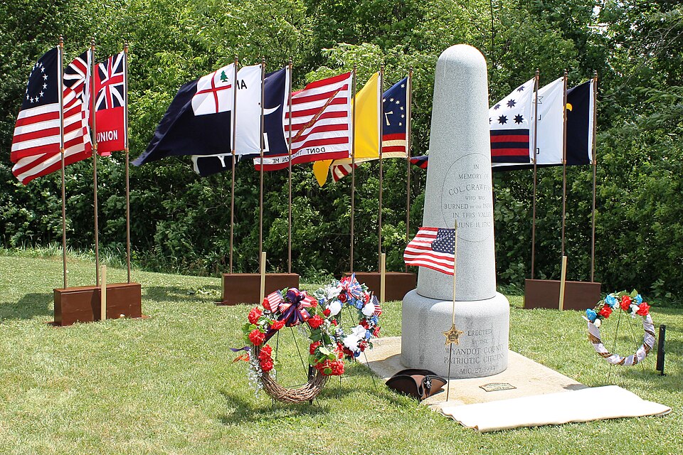
“The Colonel Crawford Burn Site Monument is a war monument in rural Wyandot County, Ohio, United States. Placed in the 1870s, it commemorates the death by burning of Colonel William Crawford during the concluding years of the American Revolution.”
Wikipedia article Col. Crawford Burn Site Monument, CC BY-SA 4.0.
one of 8 National Register listings in Wyandot County · listed in 1982 · category: Object · built in 1870.
National Register reference number.82003667- the number the National Park Service assigned this property when it was listed, and the key its nomination file is catalogued under at the National Archives.
The ground it stands on
1,621 words
The chapter on Crawford Township in Past and Present of Wyandot County Ohio, published 1913 names Crawford. This is what it says, exactly as the scans read.
Crawford township is perhaps more replete with historic incidents than any other township in Wvyandot county, for it was here that the lamented Colonel Crawford suffered death by the Indians by being burnt at the stake, in 1782, and here a monument has since been erected to his memory. And it was in the wilds of this locality that the seven-year-old child of Mathew Brayton was captured by the Indians and never found.
Crawford township was organized in the county of Crawford in 1825, and became a part of Wyandot county in 1845. It is one of the northern tiers of townships of the county, and is bounded on the north by Seneca county, on the east by Tymochtee township, on the south by Salem township and on the west by Ridge township.
Regional context, not property-specific
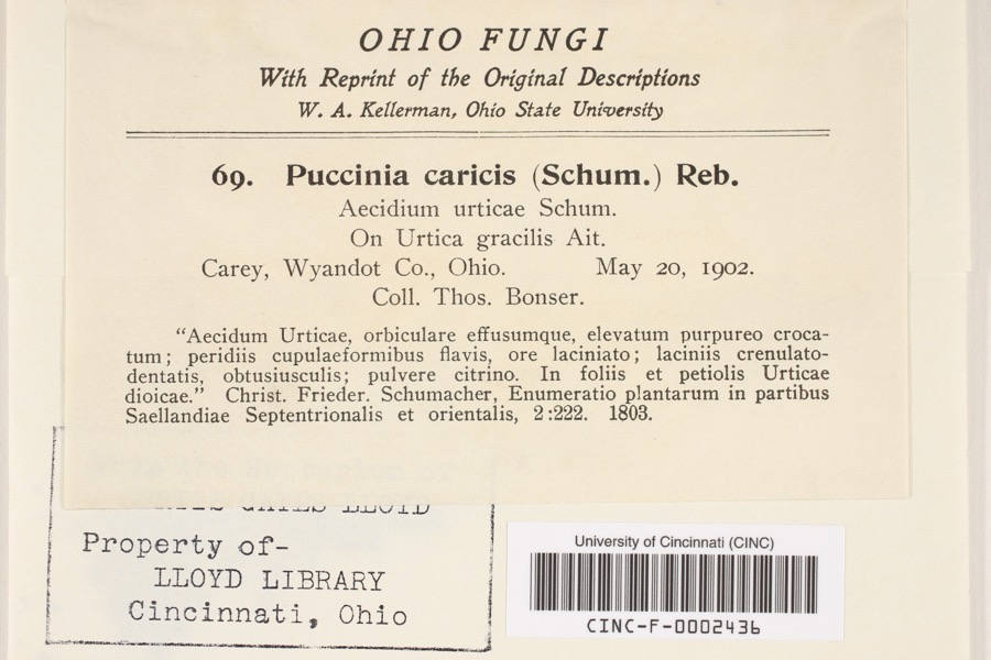
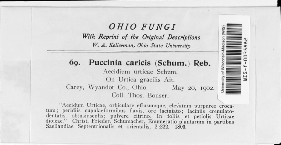
evidence. Museums hold 247 specimens
collected within 10 miles of Crawford, Col., Burn Site Monument between 1885 and
1975: 216 Animalia, 28 Fungi, 3 Plantae. 12 distinct Species records are shown.
Collected by Allen, J. M., Blyth & Katz, Blyth, D. (David) & Katz, D. (David) and others. Each is a
physical object with a catalogue
number, and each entry opens the museum's record. This is what was
collected and kept, not a survey of what lives here - nothing can be
concluded from a species being absent.
Regional context, not property-specific
evidence. The federal mineral resources record lists
2 workings within 5 miles of Crawford, Col., Burn Site Monument: 1 plant, 1 producer.
All of them still produce. What was taken out: Stone, Crushed/Broken. Distance is straight-line from the
map coordinates, so a quarry counted here may appear on a neighbouring
settlement's page as well.
Regional context, not property-specific
evidence. The National Weather Service names
Crawford, the town this property stands in, in 2 storm reports between 2020 and 2025: 2 thunderstorm wind.
No death or injury is recorded in these reports. Each account below is quoted exactly as the forecast office
filed it, from the NOAA Storm Events Database, and each date
opens the federal record of that event.
No historic map-sheet match is published
for this property yet. That does not mean no map exists. This record needs
a coordinate-quality review before it can be joined to a sheet boundary.
Browse the county's mapped places while that work is
pending.
From the nomination file
3,303 words on record
When this property was proposed for the
National Register, someone wrote the case for it: what the building is,
and why it matters. That document is a federal record in the public domain.
It is quoted below word for word, never summarised. The text was read off the scanned case file by machine, so the
occasional stray character is the recogniser's and the 1970s
typewriter's.
Description of the property
- archeology-prehistoric - community planning - landscape architecture. _ religion _ conservation -law - literature x military (commemorative)ocial/ _ art - engineering - music X 1800-1899 - exploration/settlement - philosophy . industry .transportation _ invention in Mansfield, Ohio, the burn site monument has acquired its own
Statement of significance
(in one paragraph) by some 5000 people; the locally famous orator, William Henry Gibson of Tiffin, and has assumed an important role as a pilgimage site in the county for anyone interested in the history of the county or Crawford's famous campaign.
The monument the Tymochtee Creek, and Crawford's torture began; he was tied to a stake, shot full of the famous picnics that grew of the dedication ceremony, but this has disappeared, county and secretary of the Pioneer Association.He had been suggesting it for several The Colonel Crawford Burn Site Monument is being nominated as the only tangible supposedly passed down in oral tradition for some years, with the stories included in Therefore the famous site itself cannot be nominated for the was erected by the Wyandot Pioneer Association on August 30,1877 at a picnic attended not attempt to locate." Tymochtee Creek valley near this monument in 1782.Crawford's death was the first but Girty was unable to help.Crawford and Knight were then taken to the east bank of that "it was somewhere on what is now the south half of section twenty-six, of township county 1ife until the last one was held June 13,1935.Like the Mansfield Blockhouse Gottfried, Ray D.
Watkins Printing Co, 1976 Acreage of nominated property Less than I acre 11.
Quoted from the National Register nomination
for reference 82003667, 23 pages, held by the National Archives in Record
Group 79. See the
catalogue record.
Listed places nearby
6 within 8 miles
Other National Register properties close
enough to walk or drive between, ordered by distance from this one. Both
positions come from the same geocoding pass that matched these properties
to their map sheets.
Listing record. National Park Service National Register of Historic Places, listed-properties dataset, current to 2026-05-22.
Map join. Address geocoded through the United States Census geocoder, then tested against the published boundary of every sheet in the USGS Historical Topographic Map Collection.
How this page is made. Listing fields come from federal records; map-sheet coverage is a labelled coordinate-to-boundary calculation, not a source-field claim.
Specimens. Global Biodiversity Information Facility (GBIF), https://www.gbif.org/. Only records licensed CC0 or CC BY are used. Records licensed CC BY-NC are excluded because this site carries advertising. Images are checked individually and any whose licence is non-commercial, no-derivatives or unreadable is refused.
Mines and quarries. USGS Mineral Resources Data System (MRDS) https://mrdata.usgs.gov/mrds/ A work of the United States government, no copyright under 17 U.S.C. 105.
Storms. NOAA National Centers for Environmental Information, Storm Events Database https://www.ncei.noaa.gov/stormevents/ A work of the United States government, no copyright under 17 U.S.C. 105. Narratives are quoted verbatim from the National Weather Service report and are not edited or summarised.
 Block
Block