Listed on the National Register of Historic Places in
1987. A historic map-sheet match is not published yet. The record needs a coordinate-quality review before it can be joined to a sheet boundary.
From the record
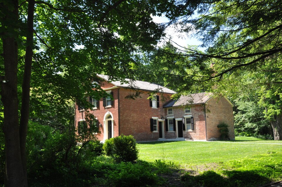
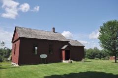
“The Nichols-Sterner House is a historic house at 428 Swamp Road in Richmond, Massachusetts. Built about 1820, it is one of only two brick houses built in a Federalist-Greek Revival transition style in Richmond.”
Wikipedia article Nichols-Sterner House, CC BY-SA 4.0.
one of 94 National Register listings in Berkshire County · listed in 1987 · category: Building · one of 1 National Historic Landmarks in Berkshire County.
National Register reference number.87001997- the number the National Park Service assigned this property when it was listed, and the key its nomination file is catalogued under at the National Archives.
THE second pilgrimage of the Knights Templars of Massachusetts and Rhode Island to Richmond, calls for the addition of another volume to the history of the friendly relations between the Sir Knights of New England and Virginia. The interchange of visits between the De Molay and St. John's and the Richmond Commanderies has been a notable illustration of the strength of the tie which binds together the Order throughout the Christian world, for the hearty good-will which has been shown in all the intercourse between the "two colonies of Virginia" has not been interrupted even by the sad events of the war. A brief resume of the visits exchanged by the Commanderies of the two sections of the country will best introduce the events of the second pilgrimage of the De Molay and St. John's Commands. An invitation was extended in the year 1858 by the De Molay Commandery, of Boston, to the Richmond Commandery, No. 2, of Richmond, Virginia, to visit Boston and participate in the celebration of St. John's Day of 2 (7) that year, and in response to the invitation, the Richmond Sir Knights arrived in Boston, Thursday, June 23, 1858, to take part in the events of the following day. In addition to the parade on Friday, the visiting Commandery were hospitably entertained in Boston until Saturday evening, and the St. John's Commandery, of Providence, extended courtesies to the Richmond Sir Knights upon their arrival and departure from that city en route. Upon reaching home, the Richmond Commandery passed a series of resolutions acknowledging the courtesies extended during the visit to Boston, and concluding with the statement :
In February, 1859, correspondence between the two Commands resulted in an arrangement for a return visit of the De Molays in the following May, the events of which have already been duly recorded in a permanent form. Early in the year 1875, when the plans for the celebration of the Centennial of the Battle of Bunker Hill were under discussion, it was decided by the De Molay Commandery to invite the Richmond Commandery to take part in the Masonic parade on that occasion, and renew the acquaintances so long interrupted by the strife of the civil war. Under date of March 31, 1875, ^ cordial letter of invitation was sent by the De Molay Commandery to Richmond, askinsf the Fraters of Vircrinia to come to Massachusetts and allow an opportunity for a return of the generous hospitality extended to the Sir Knights of De Molay and St. John's Commands in 1859. The invitation was accepted by the Richmond Commandery, under date of April 8, 1875, and on Wednesday afternoon, June 16, 1875, the Knights Templars of Boston and vicinity turned out with full ranks and received their Virginia brethren and escorted them to Faneuil Hall, where the city officials welcomed the Southern guests. On the following day the Richmond Knights took part in the great parade and an excursion down the harbor, on Friday they enjoyed a carriage drive through the suburbs, and a banquet on Saturday concluded the festivities of the visit. On Sunday the Sir Knights attended the services at Music Hall, which w^ere led by Rev. W. H. H. Murray, and at 7.30 on Monday morning took the train for Providence. All the courtesies possible to the limited stay of the Virginians in Providence were extended by the Sir Knights of that city. The visit was a fitting part of the long history of friendly intercourse between the Commanderies of the "two colonies of Virginia," and the Richmond guests did not depart for their homes without a promise from their Northern brethren that they should again welcome the De Molays and St. John's to the hospitalities of Richmond. It was in February, 1881, that this promise was recalled
Regional context, not property-specific
evidence. The
federal wildfire occurrence database
lists 89 fires within 5 miles of Nichols--Sterner House between
2002 and 2020, burning about 73 acres in total. 3 started naturally. None was recorded as arson.
Distance is straight-line from the map coordinates, so a fire counted
here may appear on a neighbouring settlement's page as well.
Reported cause
Fires
Debris and open burning
47
Recreation and ceremony
13
Railroad operations and maintenance
7
Missing data/not specified/undetermined
6
Equipment and vehicle use
5
Smoking
5
Natural
3
Misuse of fire by a minor
2
Power generation/transmission/distribution
1
The most recent of
them, most recent first, with the day each was reported and the service
that recorded it.
Regional context, not property-specific
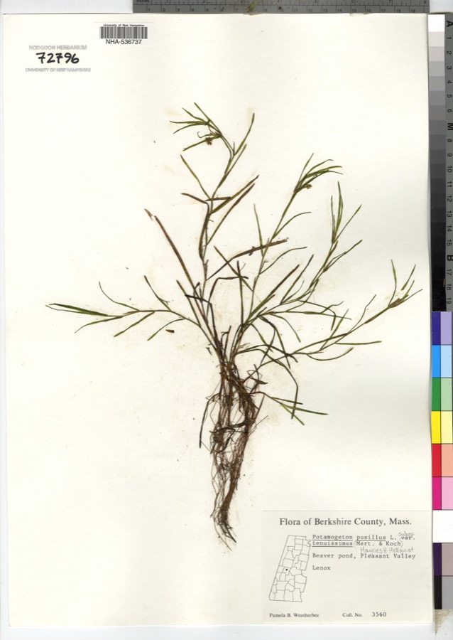
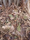
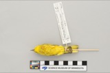
evidence. Museums hold 1,156 specimens
collected within 10 miles of Nichols--Sterner House between 1833 and
1975: 580 Plantae, 290 Fungi, 279 Animalia, 3 Unrecorded, 2 Chromista, 2 Protozoa. 12 distinct Species records are shown.
Collected by A W Evans, A. Brown, A. H. Mead and others. Each is a
physical object with a catalogue
number, and each entry opens the museum's record. This is what was
collected and kept, not a survey of what lives here - nothing can be
concluded from a species being absent.
Regional context, not property-specific
evidence. The federal mineral resources record lists
31 workings within 5 miles of Nichols--Sterner House: 20 past producers, 7 producers, 4 occurrences.
7 still produce. What was taken out: Iron, Iron, Manganese, Magnesite, Zinc, Manganese. Distance is straight-line from the
map coordinates, so a quarry counted here may appear on a neighbouring
settlement's page as well.
Regional context, not property-specific
evidence. The National Weather Service names
Richmond, the town this property stands in, in 3 storm reports between 1993 and 2002: 2 thunderstorm wind, 1 tornado.
No death or injury is recorded in these reports. Each account below is quoted exactly as the forecast office
filed it, from the NOAA Storm Events Database, and each date
opens the federal record of that event.
Emergency Management, state police and Skywarn observers reported trees and wires downed in many parts of Berkshire County. Some roads were blocked in Stockbridge. About 1,500 customers were without power.
No historic map-sheet match is published
for this property yet. That does not mean no map exists. This record needs
a coordinate-quality review before it can be joined to a sheet boundary.
Browse the county's mapped places while that work is
pending.
From the nomination file
6,931 words on record
When this property was proposed for the
National Register, someone wrote the case for it: what the building is,
and why it matters. That document is a federal record in the public domain.
It is quoted below word for word, never summarised. The text was read off the scanned case file by machine, so the
occasional stray character is the recogniser's and the 1970s
typewriter's.
Description of the property
The Nichols-Sterner House is located on Pittsfield Road (also known as Swamp Road and Barker Road) in Richmond, a rural hill town on the New York/Massachusetts border in the Berkshire Mountains. Built ca. 1820, the brick house is set on a lot of 2.2 acres on a low rise, enclosed on the south and west by a stone retaining wall, and thickly wooded with deciduous trees and lilac bushes. The house faces south and is approached via a short driveway. It is located in a rural setting.
Richmond Pond, a 210-acre body of water beyond which rise the Taconic Mountains, is located 1/2 mile to the north; Stevens Corner, a junction at which are located the remains of an early village center (including several early 19th century residences and a former general store), is 3/4 mile to the southwest; the Lenox Mountains (2,124 feet at their highest point) are 3/4 mile to the southeast. A short distance to the east of the Nichols-Sterner House stands the ca. 1830-1858 Kimball House, a Greek Revival-style wood-frame dwelling that once was owned by members of the Nichols family but that has undergone alterations. The house, a late Federal-style residence with Greek Revival features, is 2 1/2 stories in height with a gabled front.
It is constructed of common-laid brick, with a 1 1/2-story brick ell, also gable roofed, set at the building's northeast side and a single-story greenhouse ell extending from the rear, northern facade. The brick ell is contemporary with the main block, while the greenhouse addition at the rear of the building was added in 1985. The house rests on a dry-laid granite foundation faced with a dressed marble watercourse.
(in one paragraph) The Nichols-Sterner House, in Richmond, Massachusetts, retains integrity of Built ca. 1820, the house is a well-preserved and stylish example of the transition from the Federal to Greek Revival style, and is one of only two brick houses of the period in Richmond. The house holds associations with the Nichols family, who occupied the property year-round from ca. 1820 to 1925, and with New York artist Albert Sterner, who used the house as a summer residence from 1925 until his death in 1946. Examples of Sterner's wall paintings and faux detailing remain in the house. The Nichols-Sterner House thus fulfils Criteria B and C of the National Register of Historic Places on the local level. Richmond was first settled in 1760, and incorporated in 1765.
Because of its rugged and isolated location in the Berkshire hills, the town has been sparsely populated for much of its history. In 1775, the population stood at 921, a figure that would fluctuate little over the next two centuries (1840: 1,152; 1980: 1,659). Until the late 1820s, Richmond was wholly an agricultural community whose 1and supported some grazing animals, primarily sheep. One woolen mill was in operation by 1830; it was located east of Stevens Corner, the town's early 19th century node of settlement. Stevens Corner grew along a valley at the northeastern corner of Richmond, at the junction of several early roads. One was Pittsfield Road, also known as Swamp Road and, by 1800, the 10th Massachusetts Turnpike.
This was the major north/south route over Osceola Mountain (elevation: 1,460 feet), 1 inking Pittsfield to the north and West Stockbridge to the south. The other roadway, Summit Road, led west to neighboring New York State.
Quoted from the National Register nomination
for reference 87001997, 27 pages, held by the National Archives in Record
Group 79. See the
catalogue record.
Listed places nearby
6 within 8 miles
Other National Register properties close
enough to walk or drive between, ordered by distance from this one. Both
positions come from the same geocoding pass that matched these properties
to their map sheets.
Listing record. National Park Service National Register of Historic Places, listed-properties dataset, current to 2026-05-22.
Map join. Address geocoded through the United States Census geocoder, then tested against the published boundary of every sheet in the USGS Historical Topographic Map Collection.
How this page is made. Listing fields come from federal records; map-sheet coverage is a labelled coordinate-to-boundary calculation, not a source-field claim.
Wildfire. Short, Karen C. 2022. Spatial wildfire occurrence data for the United States, 1992-2020 [FPA_FOD_20221014]. 6th Edition. Fort Collins, CO: Forest Service Research Data Archive. https://doi.org/10.2737/RDS-2013-0009.6 Collected with United States Government funding and usable without additional permissions or fees.
Specimens. Global Biodiversity Information Facility (GBIF), https://www.gbif.org/. Only records licensed CC0 or CC BY are used. Records licensed CC BY-NC are excluded because this site carries advertising. Images are checked individually and any whose licence is non-commercial, no-derivatives or unreadable is refused.
Mines and quarries. USGS Mineral Resources Data System (MRDS) https://mrdata.usgs.gov/mrds/ A work of the United States government, no copyright under 17 U.S.C. 105.
Storms. NOAA National Centers for Environmental Information, Storm Events Database https://www.ncei.noaa.gov/stormevents/ A work of the United States government, no copyright under 17 U.S.C. 105. Narratives are quoted verbatim from the National Weather Service report and are not edited or summarised.
 Block
Block