Listed on the National Register of Historic Places in
1993. A historic map-sheet match is not published yet. The record needs a coordinate-quality review before it can be joined to a sheet boundary.
From the record
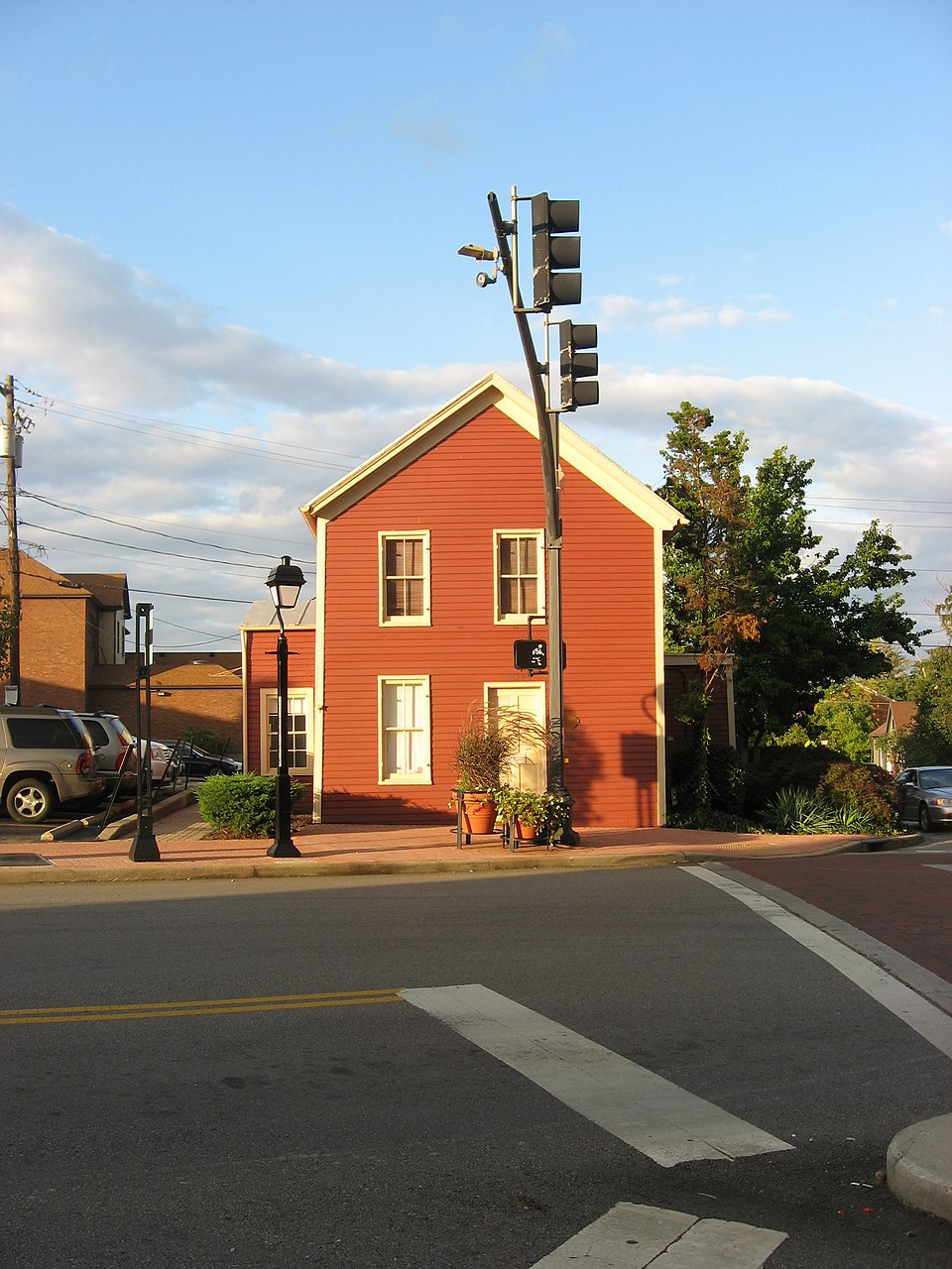
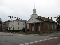
“The Yost Tavern is a historic former inn in the city of Montgomery, Ohio, United States. Built in 1805, when Montgomery was founded, it remained in operation as a lodging establishment until a long period of use as a house, and it was donated to the city after being owned by the local Kiwanis chapter.”
Wikipedia article Yost Tavern, CC BY-SA 4.0.
one of 314 National Register listings in Hamilton County · listed in 1993 · category: Building · one of 9 National Historic Landmarks in Hamilton County.
National Register reference number.93000406- the number the National Park Service assigned this property when it was listed, and the key its nomination file is catalogued under at the National Archives.
It is thought by some that inroads were made upon the forest and improvements begun by white men upon the present site of Montgomery as early as the fall of 1794; but the earliest trustworthy date is fixed one year from that time, when a colony of six families came in from Ulster county. New York. They were headed, respectively, by three brothers Felter - Jacob, Irominius, and David - Cornelius Snyder, Nathaniel Terwilliger, and Jacob Rosa. All were Felter families, indeed, in this, that the three brothers sired one-half of them, and their three sisters - Mesdames Snyder, TerwiIITgef,"and~ Rosa - were mothers to the other three. It is seldom that a pioneer colony is thus uniquely made up. Snyder bought of Thomas Espy, June 27, 1796, the whole of section four, for one thousand four hundred and forty dollars. Here the first improvements v?ere made by the party. August ist of the same year Terwilliger bought of Judge Symmes the southwest quarter of section three, upon which section Montgomery is situated, and began the clearing of that tract shortly after. Nearly five years afterwards - May 5, 1801 - he also bought the north half of the section, and upon it laid out the town of Montgomery. It was surveyed in 1802; but the recorded plat of this bears date the ninth of August, 1805. It is situated on the Montgomery pike, two and one-half miles from the south line of the township, and one and a half miles from Montgomery station, in Symmes township.
Like most towns of its size Montgomery has no written history. Situated on a leading road, it became a resting place for teamsters and travellers, and so grew up from a single tavern to what it now is, a town of five hundred inhabitans. A log cabin formed the first tavern of the place. This was situated on the southeast corner of Main and Mechanic streets, on what is now known as the Station road, and kept by John Osborn. A man named Yost opened another tavern on the diagonel corner. Some idea of the extent of travel, or the drinking habits of the people of that time (1809), may be formed when we state that a fifty-barrel supply of whiskey for the year failed to meet the demand upon Yost's bar.
Regional context, not property-specific
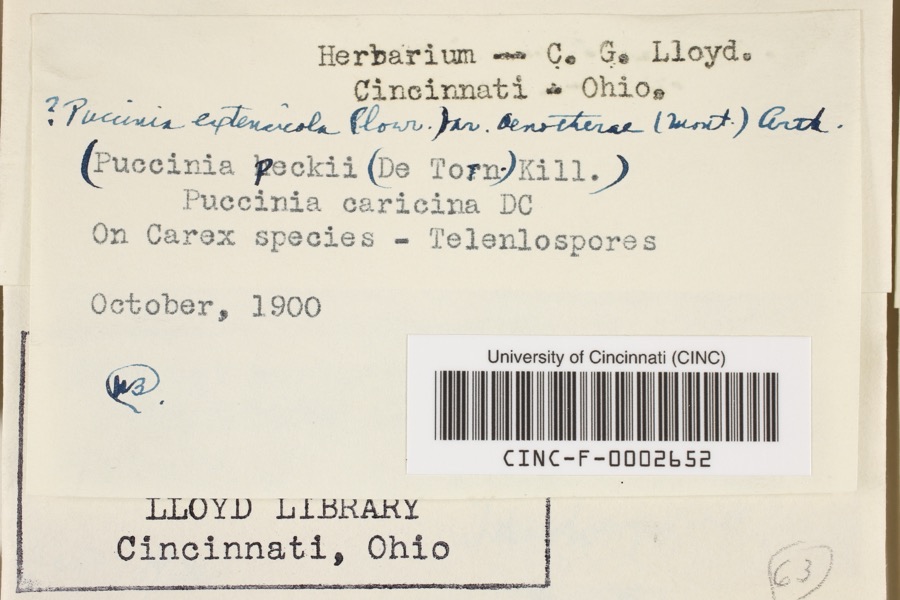
evidence. Museums hold 5,197 specimens
collected within 10 miles of Yost Tavern between 1819 and
1975: 3,401 Fungi, 1,000 Animalia, 434 Plantae, 326 Protozoa, 25 Unrecorded, 11 Chromista. 12 distinct Species records are shown.
Collected by 14753, A. Braun, A. Gaufin and others. Each is a
physical object with a catalogue
number, and each entry opens the museum's record. This is what was
collected and kept, not a survey of what lives here - nothing can be
concluded from a species being absent.
Regional context, not property-specific
evidence. The federal mineral resources record lists
3 workings within 5 miles of Yost Tavern: 1 unknown, 1 past producer, 1 plant.
1 still produces. What was taken out: Sand and Gravel, Construction, Zirconium, Titanium. Distance is straight-line from the
map coordinates, so a quarry counted here may appear on a neighbouring
settlement's page as well.
Regional context, not property-specific
evidence. The National Weather Service names
Montgomery, the town this property stands in, in 8 storm reports between 2009 and 2020: 5 hail, 2 flood, 1 thunderstorm wind.
No death or injury is recorded in these reports. Each account below is quoted exactly as the forecast office
filed it, from the NOAA Storm Events Database, and each date
opens the federal record of that event.
No historic map-sheet match is published
for this property yet. That does not mean no map exists. This record needs
a coordinate-quality review before it can be joined to a sheet boundary.
Browse the county's mapped places while that work is
pending.
From the nomination file
2,842 words on record
When this property was proposed for the
National Register, someone wrote the case for it: what the building is,
and why it matters. That document is a federal record in the public domain.
It is quoted below word for word, never summarised. The text was read off the scanned case file by machine, so the
occasional stray character is the recogniser's and the 1970s
typewriter's.
Statement of significance
Applicable National Register Criteria Areas of Significance (enter categories from instructions) Period of Significance Significant Dates transportation in the area from its earliest days. As the small settlement grew, the increasing traffic widened the Indian trails, which were building sometime between 1802, when the town was laid out, and 1809 when tax records gathering place for local residents and a rest stop for travelers in the years that Turnpike, which linked the village with Cincinnati to the southwest and reached out to the Montgomery, Hopkinsville, Rochester, Clarksville Macadamized Turnpike Company. Yost's Tavern offered travelers refreshments and a place to recover from the rigors of the road.
For the local residents, it offered food and drink but was also served as a public gathering place where they could discuss business and hear the latest news from travelers. In this manner the tavern played an integral role in the development of the road and the Tavern, which, in turn, provided a place to plan and discuss the future growth of that another nearby establishment, Sage Tavern, expanded to accommodate overnight guests. The expansion of Sage Tavern appears to coincide with the demise of Yost's Tavern. The building became a private residence in the late 1840s.
Commerce unknown Architect/Builder Significant Person circa 1802--circa 1850 Cultural Affiliation See continuation sheet Certifying official has considered the significance of this property in relation to other properties: Xlocally Criteria Considerations (Exceptions) State significance of property, and justify criteria, criteria considerations, and areas and periods of significance noted above. relationships between commerce and transportation in southwestern Ohio. The first settlers the scene were a group of sixe related families from Orange County, New York, who arrived in 1796.
Quoted from the National Register nomination
for reference 93000406, 16 pages, held by the National Archives in Record
Group 79. See the
catalogue record.
Listed places nearby
6 within 8 miles
Other National Register properties close
enough to walk or drive between, ordered by distance from this one. Both
positions come from the same geocoding pass that matched these properties
to their map sheets.
Listing record. National Park Service National Register of Historic Places, listed-properties dataset, current to 2026-05-22.
Map join. Address geocoded through the United States Census geocoder, then tested against the published boundary of every sheet in the USGS Historical Topographic Map Collection.
How this page is made. Listing fields come from federal records; map-sheet coverage is a labelled coordinate-to-boundary calculation, not a source-field claim.
Specimens. Global Biodiversity Information Facility (GBIF), https://www.gbif.org/. Only records licensed CC0 or CC BY are used. Records licensed CC BY-NC are excluded because this site carries advertising. Images are checked individually and any whose licence is non-commercial, no-derivatives or unreadable is refused.
Mines and quarries. USGS Mineral Resources Data System (MRDS) https://mrdata.usgs.gov/mrds/ A work of the United States government, no copyright under 17 U.S.C. 105.
Storms. NOAA National Centers for Environmental Information, Storm Events Database https://www.ncei.noaa.gov/stormevents/ A work of the United States government, no copyright under 17 U.S.C. 105. Narratives are quoted verbatim from the National Weather Service report and are not edited or summarised.
 Block
Block