BlockBefore
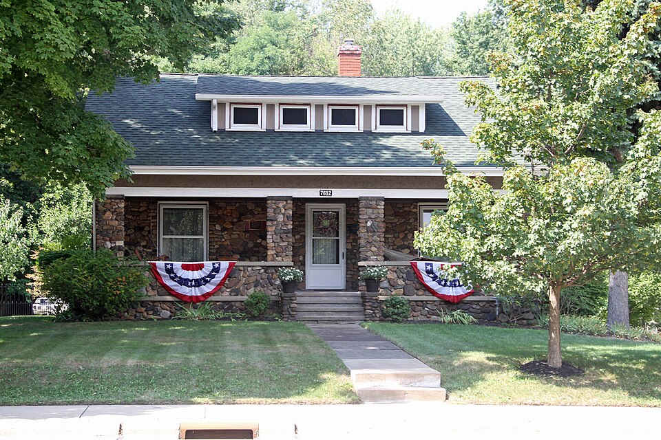
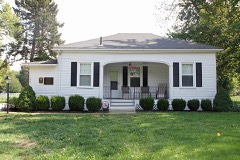
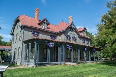
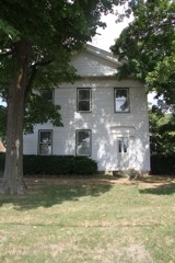
Photograph of John and Carrie Yager House
Photograph by LeeG7144, CC BY-SA 3.0. Via Wikimedia Commons.

Yager, John and Carrie, House

Listed on the National Register of Historic Places in 1994. A historic map-sheet match is not published yet. The record needs a coordinate-quality review before it can be joined to a sheet boundary.

From the record

one of 75 National Register listings in Lake County · listed in 1994 · category: Building · one of 2 National Historic Landmarks in Lake County.

Sources: the case file at the National Archives · the National Register database, National Park Service

The listing

  • What is counted as historic. The nomination lists 3 structuress, 2 buildingss as contributing to the listing.
  • Address. 7612 S. Center St., Mentor, 44060
  • When was it listed? 1994-03-17
  • Category. building
  • Township. Mentor city
  • Architectural style. bungalow
  • National Register reference number. 94000240 - the number the National Park Service assigned this property when it was listed, and the key its nomination file is catalogued under at the National Archives.

Fires near this property

1 since 2003

Regional context, not property-specific evidence. The federal wildfire occurrence database lists 1 fire within 5 miles of Yager, John and Carrie, House between 2003 and 2003, burning about 400 acres in total. None started naturally. None was recorded as arson. Distance is straight-line from the map coordinates, so a fire counted here may appear on a neighbouring settlement's page as well.

Reported cause Fires
Missing data/not specified/undetermined1

The most recent of them, most recent first, with the day each was reported and the service that recorded it.

DateCause SizeReported by Name on the report
28 April 2003Missing data/not specified/undetermined400 acresOhio Department of Natural ResourcesMENTOR

Every fire recorded in Lake County

Specimens collected near this property

12 of 1,474 shown

Regional context, not property-specific evidence. Museums hold 1,474 specimens collected within 10 miles of Yager, John and Carrie, House between 1864 and 1975: 1,245 Animalia, 150 Plantae, 69 Fungi, 6 Protozoa, 3 Unrecorded, 1 Chromista. 12 distinct Species records are shown. Collected by A. Doolittle, A. F. Clewell, A. Woolman and others. Each is a physical object with a catalogue number, and each entry opens the museum's record. This is what was collected and kept, not a survey of what lives here - nothing can be concluded from a species being absent.

Image SpeciesYear Collected by Where, as recorded
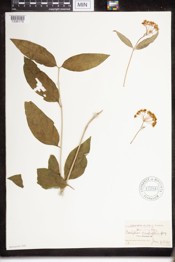
Specimen of Asclepias quadrifolia Jacq.Asclepias quadrifolia Jacq.1885Werner, WM.C.near Painesville
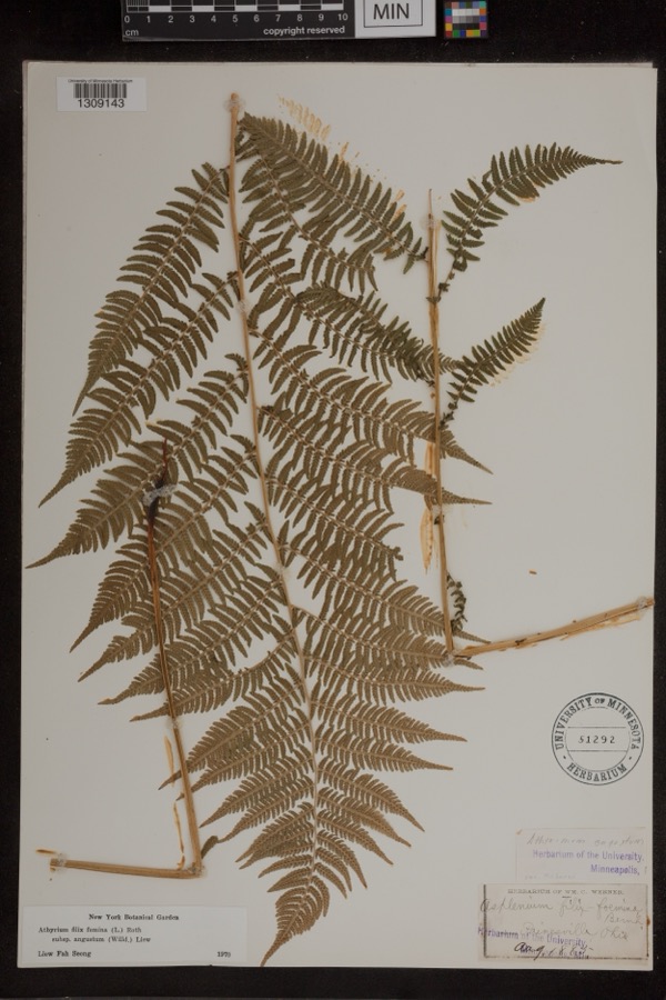
Specimen of Athyrium filix-femina subsp. angustum (Willd.) R.T.ClausenAthyrium filix-femina subsp. angustum (Willd.) R.T.Clausen1885Werner, Wm. C.Painesville
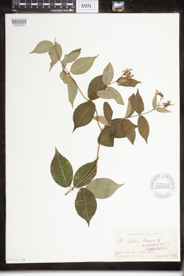
Specimen of Periploca graeca L.Periploca graeca L.1886Werner, WM.C.Near Painesville
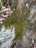
A photograph of the species Leucodon brachypus, not of this specimenLeucodon brachypus Brid.1864E. J. Ferris
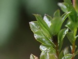
A photograph of the species Mnium spinulosum, not of this specimenMnium spinulosum Bruch & Schimp.1864E. J. FerrisPainesville
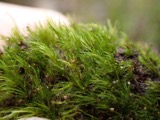
A photograph of the species Dicranella heteromalla, not of this specimenDicranella heteromalla (Hedw.) Schimp.1871H. C. Beardslee, Sr.
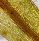
A photograph of the species Didymodon tophaceus, not of this specimenDidymodon tophaceus (Brid.) Lisa1871H. C. Beardslee, Sr.
A photograph of the species Discelium nudum, not of this specimenDiscelium nudum (Dicks.) Brid.1871H. C. Beardslee, Sr.
A photograph of the species Drepanocladus polycarpos, not of this specimenDrepanocladus polycarpos (Blandow ex Voit) Warnst.1871H. C. Beardslee, Sr.
Eurhynchium pulchellum (Hedw.) Jenn.1871H. C. Beardslee, Sr.
A photograph of the species Fontinalis sphagnifolia, not of this specimenFontinalis sphagnifolia (Müll.Hal.) Wijk & Margad.1871H. C. Beardslee, Sr.
A photograph of the species Orthotrichum stellatum, not of this specimenOrthotrichum stellatum Brid.1871H. C. Beardslee, Sr.

All 1,474 specimens within 10 miles, at the Global Biodiversity Information Facility.

Mines and quarries near this property

2 within 5 miles

Regional context, not property-specific evidence. The federal mineral resources record lists 2 workings within 5 miles of Yager, John and Carrie, House: 2 producers. All of them still produce. What was taken out: Silica, Sand and Gravel, Construction. Distance is straight-line from the map coordinates, so a quarry counted here may appear on a neighbouring settlement's page as well.

Where SiteCommodity StatusRecorded
Gen. Electric/ Willoughby, OhioSilicaProducer
Mentor Sand and Supply PitSand and Gravel, ConstructionProducer

Every working recorded in Lake County

Storms near this property

46 since 1996

Regional context, not property-specific evidence. The National Weather Service names Mentor, the town this property stands in, in 46 storm reports between 1996 and 2026: 24 thunderstorm wind, 13 hail, 4 flash flood, 2 waterspout. The reports record 2 injuries. Each account below is quoted exactly as the forecast office filed it, from the NOAA Storm Events Database, and each date opens the federal record of that event.

WhenEvent Place namedHarm What the report says
November 2020Thunderstorm WindMentor2 hurtLarge tree down in Mentor. Another tree fell on a car in Painesville and caused two injuries.
August 2011HailMentor$150,000Penny to hen egg sized hail was observed for several minutes in Mentor. Much of the hail was golf ball sized or larger. This resulted in many vehicles being damaged.
May 2011Thunderstorm WindMentor$50,000Thunderstorm winds downed many trees in the Holly Hills Development along Cannon Ridge Drive and Brayes Manor Drive in Mentor.
June 2013Thunderstorm WindMentor$25,000Thunderstorm winds downed several trees and knocked down some power lines. Scattered power outages were reported.
August 2000Tornado (F0)Mentor$25,000A weak tornado moved inland from Lake Erie and was on the ground in Mentor for a little less than one mile. Many trees were knocked down with a few homes sustaining minor damage.
March 2020Flash FloodMentor$20,000A portion of Interstate 90, a main throughway, was closed between State Route 306 and State Route 615 due to flooding. Several disabled semi trucks that stalled in high water.
November 2002Thunderstorm WindMentor$20,000Thunderstorm winds downed several trees south of Mentor.
August 2016Thunderstorm WindMentor$12,000The media relayed reports of several trees down in the Mentor area.
July 1998Thunderstorm WindMentor$10,000Trees were downed, some closing the westbound lane of State Route 2.
June 2007Thunderstorm WindMentor$8,000Several trees and large limbs were reported down.
July 2023Thunderstorm WindMentor$6,000Large tree downed onto car and large tree branch downed onto another car in Mentor.
July 2007Thunderstorm WindMentor$6,000A few trees and large limbs were reported down.
May 2025Thunderstorm WindMentor$5,000Tree downed onto house in Mentor, which caused structural damage.
May 2018Thunderstorm WindMentor$5,000Thunderstorm winds tore some siding off of a house near the intersection of Center Street and Mentor Avenue in Mentor. Some tree limbs were also down in the area.
June 2008Thunderstorm WindMentor$5,000Several large limbs were reported down.
June 2007Thunderstorm WindMentor$5,000Several trees and a few large limbs were reported down.
June 2007Thunderstorm WindMentor$5,000Two large trees and several large limbs were reported down from thunderstorm winds.
July 2004HailMentor$5,000Thunderstorm winds downed one tree and a few large limbs.
August 2000Thunderstorm WindMentor$5,000Thunderstorm winds downed two large trees on Jackson Street.
June 2007Thunderstorm WindMentor$3,000Several large limbs were reported down.
June 2005Thunderstorm WindMentor$3,000A few large limbs along with a tree were reported down from thunderstorm winds.
November 1998Thunderstorm WindMentor$2,000Trees were downed.
July 2018Thunderstorm WindMentor$1,000Thunderstorm winds downed a tree.
March 2011HailMentor$1,000Pea sized hail was reported with this thunderstorm.
May 2009Thunderstorm WindMentor$1,000Thunderstorm winds downed a small tree.
March 2026Thunderstorm WindMentor-Tree downed along Hopkins Road, near OH Route 2, in Mentor.
May 2025Thunderstorm WindMentor-Trees snapped on east side of Mentor.
August 2024Thunderstorm WindMentor-Trees downed in Mentor.
August 2021Thunderstorm WindMentor-Trees damaged about one-mile north of Mentor. One tree limb fell onto a vehicle.
May 2020FloodMentor-Standing water on both SR-2 and I-90 near SR 615 in Mentor.
November 2020HailMentor-Penny to nickel-size hail in Mentor area.
March 2012HailMentor-Penny sized hail was observed.
August 2011HailMentor-Penny sized hail was observed.
April 2009HailMentor-Penny size hail was reported.
August 2009HailMentor-Penny size hail was observed.
July 2008Heavy RainMentor-Rainfall of 3.75 inches in less than two hours was reported by a spotter in Mentor.
May 2007HailMentor-Quarter size hail was observed.
June 2006HailMentor-Quarter size hail was observed, and lasted for several minutes accumulating enough to cover the ground.
July 2000WaterspoutMentor-Several large waterspouts were observed on Lake Erie just north of Mentor.
September 1999WaterspoutMentor-A waterspout was sighted on Lake Erie approximately five miles offshore from Mentor. No damage was reported.
August 2000HailMentor-no account filed
June 1996Flash FloodMentor-no account filed
June 1996HailMentor-no account filed
August 1996HailMentor-no account filed
September 1996Flash FloodMentor-no account filed

Every storm recorded in Lake County

Map coverage status

No historic map-sheet match is published for this property yet. That does not mean no map exists. This record needs a coordinate-quality review before it can be joined to a sheet boundary. Browse the county's mapped places while that work is pending.

From the nomination file

2,024 words on record

When this property was proposed for the National Register, someone wrote the case for it: what the building is, and why it matters. That document is a federal record in the public domain. It is quoted below word for word, never summarised. The text was read off the scanned case file by machine, so the occasional stray character is the recogniser's and the 1970s typewriter's.

Statement of significance

for National Register listing.) Narrative Statement of Significance Period of Significance Name of Property our history. categories from instructions) represents the work of a master, or possesses Name of repository: County and State A owned bya religious institution or used for (Cite the books, articles, and other sources used in preparing this form on one or more continuation sheets.) a significant contribution to the broad patterns of CFR 67) has been requested Previous documentation on file (NPS): (Complete if Criterion B is marked above) Record # G less than 50 years of age or achieved significance (Explain the significance of the property on one or more continuation sheets.) Lake Co., Ohio

The whole case file for this property - 2,024 words, 18 pages, reproduced complete.

Quoted from the National Register nomination for reference 94000240, 18 pages, held by the National Archives in Record Group 79. See the catalogue record.

Listed places nearby

6 within 8 miles

Other National Register properties close enough to walk or drive between, ordered by distance from this one. Both positions come from the same geocoding pass that matched these properties to their map sheets.

Photograph PropertyDistance Listed
Young, Benjamin and Mary, Houseunder 500 feet1996
Mentor Village Hallunder 500 feet2014
Corning-White House0.2 miles1972
Mentor Village School0.2 miles2005
James A. Garfield National Historic Site0.4 miles1966
Mason, James, House0.5 miles1975

Sources for this property

National Archives recordThe nomination case file for reference 94000240 in Record Group 79.
Lake CountyAll 75 listed properties in this county.

Provenance

  • Listing record. National Park Service National Register of Historic Places, listed-properties dataset, current to 2026-05-22.
  • Map join. Address geocoded through the United States Census geocoder, then tested against the published boundary of every sheet in the USGS Historical Topographic Map Collection.
  • How this page is made. Listing fields come from federal records; map-sheet coverage is a labelled coordinate-to-boundary calculation, not a source-field claim.
  • Wildfire. Short, Karen C. 2022. Spatial wildfire occurrence data for the United States, 1992-2020 [FPA_FOD_20221014]. 6th Edition. Fort Collins, CO: Forest Service Research Data Archive. https://doi.org/10.2737/RDS-2013-0009.6 Collected with United States Government funding and usable without additional permissions or fees.
  • Specimens. Global Biodiversity Information Facility (GBIF), https://www.gbif.org/. Only records licensed CC0 or CC BY are used. Records licensed CC BY-NC are excluded because this site carries advertising. Images are checked individually and any whose licence is non-commercial, no-derivatives or unreadable is refused.
  • Mines and quarries. USGS Mineral Resources Data System (MRDS) https://mrdata.usgs.gov/mrds/ A work of the United States government, no copyright under 17 U.S.C. 105.
  • Storms. NOAA National Centers for Environmental Information, Storm Events Database https://www.ncei.noaa.gov/stormevents/ A work of the United States government, no copyright under 17 U.S.C. 105. Narratives are quoted verbatim from the National Weather Service report and are not edited or summarised.