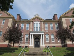
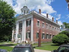
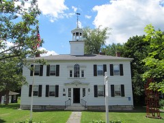
Listed on the National Register of Historic Places in
1996. A historic map-sheet match is not published yet. The record needs a coordinate-quality review before it can be joined to a sheet boundary.
From the record
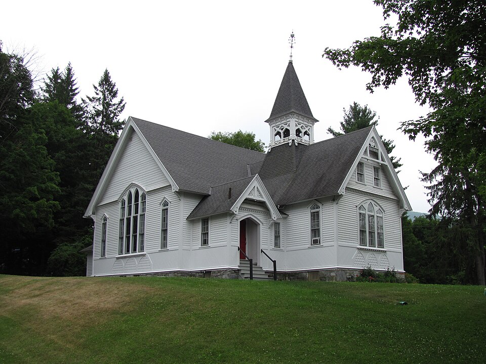
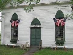
“The Congregational Church of West Stockbridge is an historic Congregational church building at 45 Main Street in West Stockbridge, Massachusetts. Completed in 1882 for a congregation founded in 1774, it is the town's best example of Stick style architecture.”
Wikipedia article Congregational Church of West Stockbridge, CC BY-SA 4.0.
one of 94 National Register listings in Berkshire County · listed in 1996 · category: Building · one of 1 National Historic Landmarks in Berkshire County.
National Register reference number.96000899- the number the National Park Service assigned this property when it was listed, and the key its nomination file is catalogued under at the National Archives.
Fires near this property
50 since 2002
Regional context, not property-specific
evidence. The
federal wildfire occurrence database
lists 50 fires within 5 miles of Congregational Church of West Stockbridge between
2002 and 2020, burning about 67 acres in total. None started naturally. 3 were recorded as arson.
Distance is straight-line from the map coordinates, so a fire counted
here may appear on a neighbouring settlement's page as well.
Reported cause
Fires
Debris and open burning
19
Missing data/not specified/undetermined
12
Recreation and ceremony
7
Equipment and vehicle use
4
Arson/incendiarism
3
Power generation/transmission/distribution
2
Railroad operations and maintenance
2
Other causes
1
The most recent of
them, most recent first, with the day each was reported and the service
that recorded it.
Regional context, not property-specific
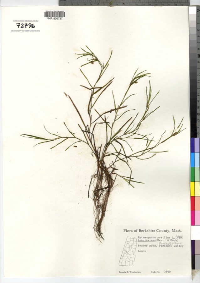
evidence. Museums hold 1,127 specimens
collected within 10 miles of Congregational Church of West Stockbridge between 1833 and
1975: 645 Plantae, 242 Animalia, 234 Fungi, 2 Chromista, 2 Protozoa, 2 Unrecorded. 12 distinct Species records are shown.
Collected by A W Evans, A. Brown, A. F. Beale and others. Each is a
physical object with a catalogue
number, and each entry opens the museum's record. This is what was
collected and kept, not a survey of what lives here - nothing can be
concluded from a species being absent.
Regional context, not property-specific
evidence. The federal mineral resources record lists
52 workings within 5 miles of Congregational Church of West Stockbridge: 32 past producers, 15 producers, 4 occurrences, 1 prospect.
15 still produce. What was taken out: Iron, Sand and Gravel, Construction, Lead, Silver, Zinc. Distance is straight-line from the
map coordinates, so a quarry counted here may appear on a neighbouring
settlement's page as well.
Regional context, not property-specific
evidence. The National Weather Service names
West Stockbridge, the town this property stands in, in 18 storm reports between 1997 and 2025: 10 thunderstorm wind, 4 flash flood, 3 hail, 1 lightning.
The reports record 1 death. Each account below is quoted exactly as the forecast office
filed it, from the NOAA Storm Events Database, and each date
opens the federal record of that event.
Lenox Police reported that a 56 year old man was killed when a large tree came down in the travel line onto his pickup truck at the intersection of Route 7 and Old Stockbridge Road. Report was obtained via a local newspaper.
A cold front, moving into a very warm humid and unstable airmass, produced scattered thunderstorms across Berkshire County during the afternoon of August 3. One of the storms became severe, as wind gusts knocked trees down in the town of West Stockbridge.
Flash flooding was reported in West Stockbridge as a result of heavy rainfall from thunderstorms. Several roads in the town was reported to be impacted by the flooding.
Trees were reported down on houses in the vicinity of the Stockbridge Bowl in Stockbridge along Interlaken and Mahkeenac Roads due to strong thunderstorm winds.
A 40 year old male from New Jersey was struck by lightning at the Tanglewood Music Center in Lenox. He was running to seek shelter at a concert hall when he was struck. He was holding an umbrella at the time of the incident.
No historic map-sheet match is published
for this property yet. That does not mean no map exists. This record needs
a coordinate-quality review before it can be joined to a sheet boundary.
Browse the county's mapped places while that work is
pending.
From the nomination file
7,105 words on record
When this property was proposed for the
National Register, someone wrote the case for it: what the building is,
and why it matters. That document is a federal record in the public domain.
It is quoted below word for word, never summarised. The text was read off the scanned case file by machine, so the
occasional stray character is the recogniser's and the 1970s
typewriter's.
Statement of significance
Applicable National Register Criteria (Mark "x" in one or more boxes for the criteria qualifying the property for National Register listing.) XA Property is associated with events that have made a significant contribution to the broad patterns of our history. _B Property is associated with the lives of persons significant in our past. X C Property embodies the distinctive characteristics of a type, period, or method of construction or represents the work of a master, or possesses high artistic values, or represents a significant and distinguishable entity whose components lack individual distinction. _D Property has yielded, or is likely to yield, information important in prehistory or history.
Criteria Considerations (Mark "x" in all the boxes that apply.) Property is: XA owned by religious institution or used for religious purposes. _B removed from its original location. _C a birthplace or grave. _D a cemetery. _E a reconstructed building, object, or structure. Berkshire County, Massachusetts County and State Areas of Significance (Enter categories from instructions) ARCHITECTURE COMMUNITY PLANNING AND DEVELOPMENT Period of Significance 1843-1946 Significant Dates 1843, 1882 Significant Person (Complete if Criterion B is marked above) N/A Cultural Affiliation N/A _F a commemorative property. _G less than 50 years of age or achieved significance within the past 50 years.
Narrative Statement of Significance (Explain the significance of the property on one or more continuation sheets.) Architect/Builder C. T. Rathbun / Billy H. Hatch 9.
Quoted from the National Register nomination
for reference 96000899, 24 pages, held by the National Archives in Record
Group 79. See the
catalogue record.
Listed places nearby
6 within 8 miles
Other National Register properties close
enough to walk or drive between, ordered by distance from this one. Both
positions come from the same geocoding pass that matched these properties
to their map sheets.
Listing record. National Park Service National Register of Historic Places, listed-properties dataset, current to 2026-05-22.
Map join. Address geocoded through the United States Census geocoder, then tested against the published boundary of every sheet in the USGS Historical Topographic Map Collection.
How this page is made. Listing fields come from federal records; map-sheet coverage is a labelled coordinate-to-boundary calculation, not a source-field claim.
Wildfire. Short, Karen C. 2022. Spatial wildfire occurrence data for the United States, 1992-2020 [FPA_FOD_20221014]. 6th Edition. Fort Collins, CO: Forest Service Research Data Archive. https://doi.org/10.2737/RDS-2013-0009.6 Collected with United States Government funding and usable without additional permissions or fees.
Specimens. Global Biodiversity Information Facility (GBIF), https://www.gbif.org/. Only records licensed CC0 or CC BY are used. Records licensed CC BY-NC are excluded because this site carries advertising. Images are checked individually and any whose licence is non-commercial, no-derivatives or unreadable is refused.
Mines and quarries. USGS Mineral Resources Data System (MRDS) https://mrdata.usgs.gov/mrds/ A work of the United States government, no copyright under 17 U.S.C. 105.
Storms. NOAA National Centers for Environmental Information, Storm Events Database https://www.ncei.noaa.gov/stormevents/ A work of the United States government, no copyright under 17 U.S.C. 105. Narratives are quoted verbatim from the National Weather Service report and are not edited or summarised.
 Block
Block