 Block
Batesburg, South Carolina
11 topographic sheets cover this place, the earliest surveyed in 1954 and the latest in 1983. It stands in the Batesburg-Leesville census division. It lies in ZIP code area 29006. The Survey maps it on the Batesburg quadrangle. It stands 659 feet above sea level.
On record in Batesburg
Buildings and businesses the archive holds for this place. Each opens its own page, with the source record it came from.
On the National Register 12 records
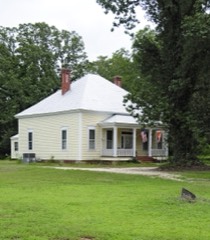 D. D. D. Barr Houselisted 1983
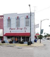 Batesburg Commercial Historic Districtlisted 1982
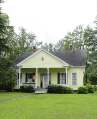 Simon Bouknight Houselisted 1982
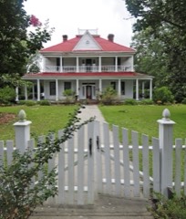 Cartledge Houselisted 1982
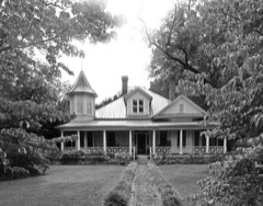 Broadus Edwards Houselisted 1982
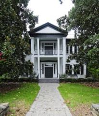 Hartley Houselisted 1982
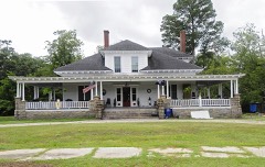 A. C. Jones Houselisted 1982
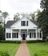 McKendree Mitchell Houselisted 1982
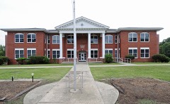 Old Batesburg Grade Schoollisted 1983
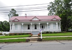 John Jacob Rawl Houselisted 1982
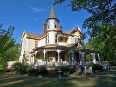 Rawl-Couch Houselisted 1982
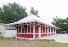 Southern Railway Depotlisted 1983
Topographic sheets covering this place
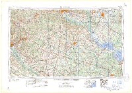
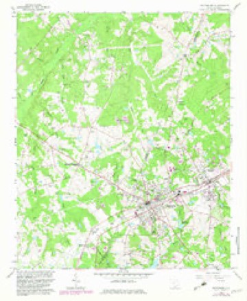
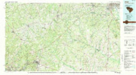
7 surveys from 11 printed sheetsMatched by testing this settlement's coordinate against the published boundary of every sheet in the United States Geological Survey's historical collection. Each opens the scanned sheet at the Survey.
- 1954 USGS Augusta quadrangle1:250000
- 1957 USGS Augusta quadrangle1:250000, 3 printings
- 1958 USGS Augusta quadrangle1:250000
- 1961 USGS Augusta quadrangle1:250000, 2 printings
- 1962 USGS Augusta quadrangle1:250000
- 1964 USGS Batesburg quadrangle1:24000, 2 printings
- 1983 USGS Aiken quadrangle1:100000
Fires near this place
90 since 1992Regional context, not property-specific evidence. The federal wildfire occurrence database lists 90 fires within 5 miles of Batesburg between 1992 and 2020, burning about 410 acres in total. 5 started naturally. 8 were recorded as arson. Distance is straight-line from the map coordinates, so a fire counted here may appear on a neighbouring settlement's page as well.
| Reported cause | Fires |
|---|---|
| Debris and open burning | 35 |
| Missing data/not specified/undetermined | 28 |
| Arson/incendiarism | 8 |
| Equipment and vehicle use | 5 |
| Natural | 5 |
| Power generation/transmission/distribution | 3 |
| Smoking | 2 |
| Misuse of fire by a minor | 2 |
| Recreation and ceremony | 2 |
The most recent of them, most recent first, with the day each was reported and the service that recorded it.
| Date | Cause | Size | Reported by | Name on the report |
|---|---|---|---|---|
| 9 September 2018 | Debris and open burning | 1.0 acres | South Carolina Forestry Commission | not named |
| 7 September 1997 | Debris and open burning | 20 acres | South Carolina Forestry Commission | not named |
| 4 September 1999 | Debris and open burning | under an acre | South Carolina Forestry Commission | not named |
| 30 September 1993 | Missing data/not specified/undetermined | 3.0 acres | South Carolina Forestry Commission | not named |
| 12 September 2006 | Debris and open burning | 1.0 acres | South Carolina Forestry Commission | not named |
| 26 August 2002 | Natural | under an acre | South Carolina Forestry Commission | not named |
| 24 August 2011 | Debris and open burning | 1.0 acres | South Carolina Forestry Commission | not named |
| 22 August 2011 | Power generation/transmission/distribution | 1.5 acres | South Carolina Forestry Commission | not named |
Settlements close enough to share some of these fires:
Mines and quarries near this place
2 within 5 milesRegional context, not property-specific evidence. The federal mineral resources record lists 2 workings within 5 miles of Batesburg: 1 past producer, 1 unknown. None of them still produces. What was taken out: Clay, Granite, Stone, Dimension. Distance is straight-line from the map coordinates, so a quarry counted here may appear on a neighbouring settlement's page as well.
| Where | Site | Commodity | Status | Recorded |
|---|---|---|---|---|
| Marlowe Creek | Clay | Past Producer | Sedimentary | |
| Whittle Quarry | Granite, Stone, Dimension | Unknown | Igneous |
Storms near this place
35 since 1994Regional context, not property-specific evidence. The National Weather Service names Batesburg in 35 storm reports between 1994 and 2025: 21 thunderstorm wind, 8 hail, 3 flash flood, 1 lightning. The reports record 6 injuries. Each account below is quoted exactly as the forecast office filed it, from the NOAA Storm Events Database, and each date opens the federal record of that event.
| When | Event | Place named | Harm | What the report says |
|---|---|---|---|---|
| May 1999 | Thunderstorm Wind | Batesburg | 6 hurt | Sheriff reported trees down throughout county and damage to homes and buildings, including Airport High School where several students and faculty were injurred by flying debris. |
| June 2023 | Flash Flood | Batesburg | $500,000 | Batesburg-Leesville police reported numerous road closures with multiple stalled vehicles including Hall Street at Elizabeth Street, Liberty Street at S. Oak Street, and Railroad Ave at Fox Street. A vehicle was submerged by flood water on Bethlehem Rd.|Significant flooding along Hwy 1 near Broad St under the Railroad bridge with at least 2 feet of water crossing the road resulted in a permanent road closure until CSX railroad could come and inspect the railroad bridge due to unstable tracks from wash out. |Water was also entering 4 homes in and around Batesburg-Leesville. |
| July 2008 | Thunderstorm Wind | Batesburg | $150,000 | Reported large trees down in Batesburg and power poles down in Leesville. Significant damage also occurred at Wiz's Southern Convenience storm and Oswald Lumber company. |
| April 2015 | Thunderstorm Wind | Batesburg | $36,000 | Sheriff reported trees fell on a house and parked vehicle on Madera Road between Hwys 391 and 178. |
| July 2011 | Lightning | Batesburg | $28,000 | Spotter reported a barn was completely destroyed be fire caused from a lightning strike. |
| July 2010 | Thunderstorm Wind | Batesburg | $10,000 | EM reported numerous trees down at Hwy 178 and Fairview Road and also at I-20 exit 39. |
| July 2009 | Thunderstorm Wind | Batesburg | $3,000 | DOT reported several trees down in Batesburg. |
| July 2011 | Thunderstorm Wind | Batesburg | $2,000 | Highway Patrol reported several trees down near Batesburg. |
| February 2003 | Thunderstorm Wind | Batesburg | $2,000 | Sheriff and SKYWARN spotters AF4VN and KE4LHS reported a shed destroyed in Batesburg and trees down in eastern portions of the county from Swansea to Chapin. |
| June 2025 | Thunderstorm Wind | Batesburg | - | Spotter report with video. Estimated 50-60 mph winds near Batesburg. |
| June 2023 | Heavy Rain | Batesburg | - | USGS rain gage at Batesburg-Leesville Municipal Building measured 3.01 inches of rain in one hour. The two day rainfall total was 8.02 inches. |
| July 2021 | Flash Flood | Batesburg | - | Heavy rain overwhelmed a culvert along Duncan Creek causing part of Hwy 391 south of Bethlehem Rd to be closed off by law enforcement. Video sent on social media showed water along the road which was estimated to be around 2 ft deep. Time of flash flooding estimated. |
| October 2014 | Funnel Cloud | Batesburg | - | Public reported and provided video of a wall cloud and funnel cloud. |
| July 2012 | Thunderstorm Wind | Batesburg | - | Trained spotter measured a 52 kt wind gust. |
| July 2011 | Hail | Batesburg | - | Public reported nickel to quarter size hail in Batesburg. |
| May 2006 | Thunderstorm Wind | Batesburg | - | Public reported a couple of trees down on CR 23. |
| August 2006 | Flash Flood | Batesburg | - | Police reported several roads cclosed due to flooded waters. A couple of cars were stalled in the water with no occupants inside. |
| July 2005 | Thunderstorm Wind | Batesburg | - | Highway Patrol reported trees down on I-20 between mile marker 40 and 44. |
| June 2004 | Thunderstorm Wind | Batesburg | - | City police reported several trees down on powerlines. |
| September 2003 | Thunderstorm Wind | Batesburg | - | Police reported a few trees down in Batesburg around Summerland and Youman streets. |
| May 2003 | Thunderstorm Wind | Batesburg | - | Sheriff reported trees down at Bethany School House in Batesburg. |
| July 2003 | Hail | Batesburg | - | Police reported 3/4 inch hail. |
| July 2003 | Thunderstorm Wind | Batesburg | - | Police reported trees and powerlines down. |
| July 2003 | Hail | Batesburg | - | Public reported 3/4 inch hail. |
| May 2001 | Hail | Batesburg | - | Police reported dime size hail. |
| August 2000 | Thunderstorm Wind | Batesburg | - | Highway Maintenance reported trees down in the Batesburg area. |
| April 1999 | Hail | Batesburg | - | Sheriff reported nickel size hail at I20 and hwy 178. |
| April 1999 | Hail | Batesburg | - | Police reported dime size hail. |
| June 1998 | Thunderstorm Wind | Batesburg | - | Sheriff reported powerlines down. |
| June 1998 | Hail | Batesburg | - | SKYWARN spotter reported 3/4 inch hail. |
| June 1998 | Thunderstorm Wind | Batesburg | - | SKYWARN spotter reported trees down. |
| April 1998 | Hail | Batesburg | - | Spotter reported dime size hail. |
| July 1997 | Thunderstorm Wind | Batesburg | - | Sheriff reports trees down along U.S.1. |
| October 1995 | Thunderstorm Wind | Batesburg | - | no account filed |
| June 1994 | Thunderstorm Wind | Batesburg | - | no account filed |
Newspapers printed here
1,630 digitised pages1 paper published in this town, digitised by the Library of Congress and free to read: 261 issues, 1,630 pages. Every page is searchable, so a name or a street can be looked for directly in what the town printed about itself at the time.
| Newspaper | Published |
|---|---|
| The Batesburg Advocate | 1901 to 1911 |
What the paper printed
9,371 wordsFront pages of the local paper, read from the Library of Congress scans: 3 issues all from 1901, 9,371 words in total. Each is reproduced on its own page, exactly as the recogniser returned it.
These pages read less well than anything else here, and the number is worth stating: about three words in four come through cleanly, against nine in ten for the building records. An 1896 broadsheet sets eight-point type in seven columns on microfilm, which is the hardest thing in this archive to read by machine. We tested our own recognisers against the Library's and they were not better, so the Library's text is what appears, with the wholly unreadable columns removed. Read it as a guide to what the paper covered, and follow the link to the scan before quoting anything.
| Issue | Paper | Length |
|---|---|---|
| 1901-01-16 | The Batesburg Advocate | 3,285 words |
| 1901-03-13 | The Batesburg Advocate | 2,999 words |
| 1901-05-22 | The Batesburg Advocate | 3,087 words |
Nearest settlements
The eight closest, with where each one stands in the county. Distances are straight-line, computed from the Geographic Names Information System coordinates.
| Map | Place | Distance | Sheets |
|---|---|---|---|
| Batesburg-Leesville | 0.6 miles | 11 | |
| Leesville | 1.9 miles | 11 | |
| Kneece | 3.1 miles | 11 | |
| Fredonia | 4.7 miles | 12 | |
| Mims | 5.1 miles | 12 | |
| Chinquapin Falls | 5.8 miles | 11 | |
| Hall (historical) | 6.3 miles | 12 | |
| Summit | 6.7 miles | 12 |
Elsewhere
Matched on this settlement's Geographic Names Information System number rather than its name, so it cannot be a different place of the same name in another state.
| Wikidata item Q34676391 | The structured record the population and elevation above come from. Public domain (CC0). |
Provenance
This settlement is recorded in the Geographic Names Information System as feature 1244979. The sheet list is computed by point-in-boundary test against the United States Geological Survey's historical topographic inventory. Both are works of the United States government and carry no copyright under 17 U.S.C. 105.
Wildfire. Short, Karen C. 2022. Spatial wildfire occurrence data for the United States, 1992-2020 [FPA_FOD_20221014]. 6th Edition. Fort Collins, CO: Forest Service Research Data Archive. https://doi.org/10.2737/RDS-2013-0009.6 Collected with United States Government funding and usable without additional permissions or fees.
Mines and quarries. USGS Mineral Resources Data System (MRDS) https://mrdata.usgs.gov/mrds/ A work of the United States government, no copyright under 17 U.S.C. 105.
Storms. NOAA National Centers for Environmental Information, Storm Events Database https://www.ncei.noaa.gov/stormevents/ A work of the United States government, no copyright under 17 U.S.C. 105. Narratives are quoted verbatim from the National Weather Service report and are not edited or summarised.