 Block
Bennettsville, South Carolina
8 topographic sheets cover this place, the earliest surveyed in 1942 and the latest in 1983. It stands in the Bennettsville census division. It lies in ZIP code area 29512. The Survey maps it on the Bennettsville South quadrangle. 7,020 people lived here at the 2020 count. It stands 157 feet above sea level.
Research this city
On record in Bennettsville
Buildings and businesses the archive holds for this place. Each opens its own page, with the source record it came from.
On the National Register 8 records
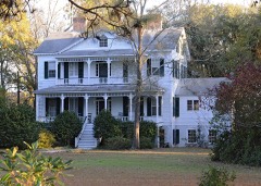 Appinlisted 1982
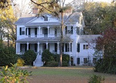 Appin (Boundary Increase)listed 2007
 Bennettsville Historic Districtlisted 1978
 Bennettsville Historic District (Boundary Increase)listed 1993
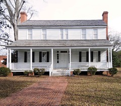 Jennings-Brown Houselisted 1972
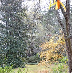 Magnolialisted 1973
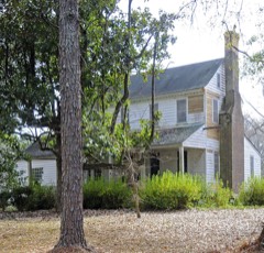 Robertson-Easterling-McLaurin Houselisted 1984
- Marlboro County Training Schoollisted 2025
Surveyed buildings and structures 3 records
- Courthouse (Entrance), Bennettsvillefederal building survey, 1 photograph
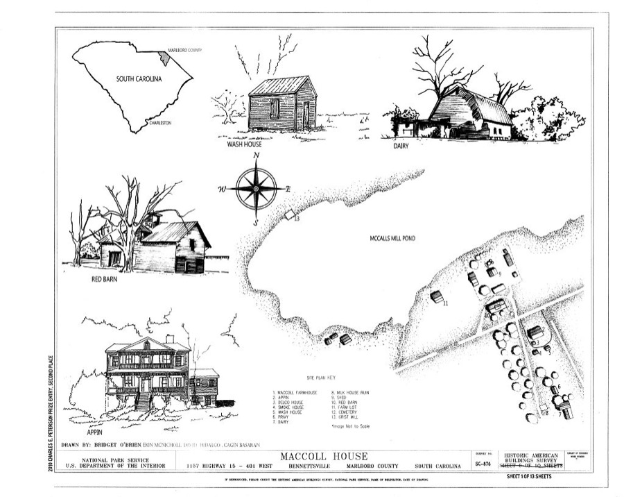
- MacColl House, 1157 Highway 15/401 West, Bennettsvillefederal building survey, 13 photographs
- Ruins, Adjoining Golf Club, Bennettsvillefederal building survey, 1 photograph
Population over time
2 figuresBennettsville fell from 9,069 to 7,020 between 2010 and 2020. These are the recorded population figures Wikidata holds for this place, reached through the Geographic Names Information System number this page is keyed on rather than by name, so they belong to this place and not to another of the same name. Most are census counts, but not all are: an early figure may be a founding or settlement estimate, and an estimate published within five years of a census is left out. The change column is computed, and is left blank where more than 20 years separate a figure from the one before it, because a gap that long is not a change between two counts.
| Year | People | Change |
|---|---|---|
| 2010 | 9,069 | |
| 2020 | 7,020 | -2,049 (-23%) |
Topographic sheets covering this place
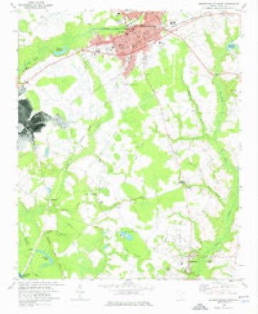
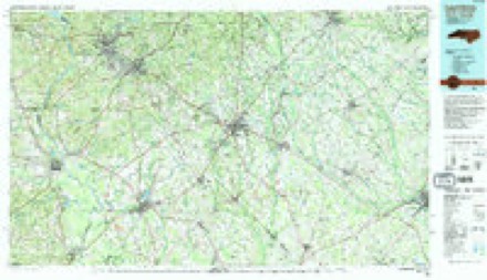
5 surveys from 8 printed sheetsMatched by testing this settlement's coordinate against the published boundary of every sheet in the United States Geological Survey's historical collection. Each opens the scanned sheet at the Survey.
- 1942 USGS Rockingham quadrangle1:125000
- 1953 USGS Florence quadrangle1:250000, 3 printings
- 1954 USGS Florence quadrangle1:250000
- 1972 USGS Bennettsville South quadrangle1:24000
- 1983 USGS Laurinburg quadrangle1:100000, 2 printings
Photographs
3 photographs,Taken for the Office of War Information and the Farm Security Administration, who photographed the country between 1935 and 1944. Works of United States government photographers, with no known restriction on use. Each opens its catalogue record.
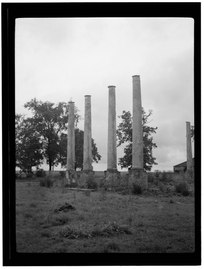
Photographer not recorded. Library of Congress
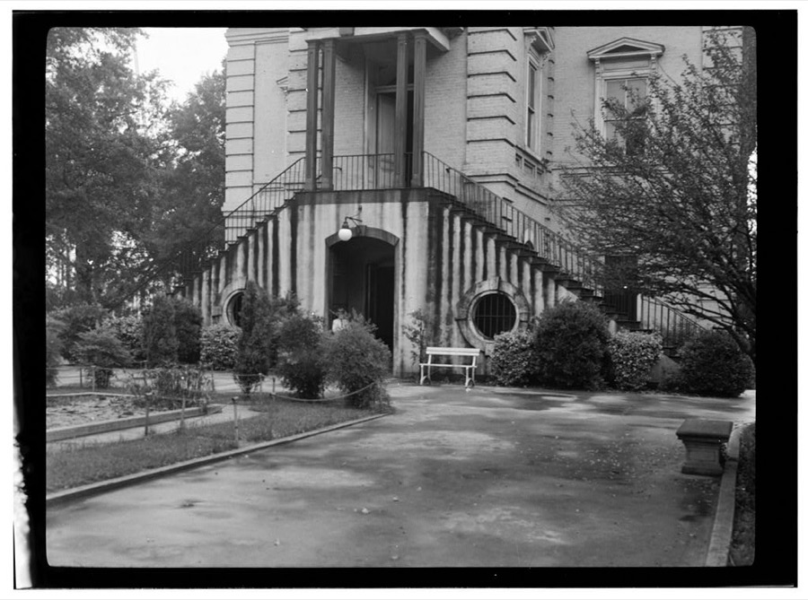
Photographer not recorded. Library of Congress
Photographer not recorded. Library of Congress
Fires near this place
353 since 1992Regional context, not property-specific evidence. The federal wildfire occurrence database lists 353 fires within 5 miles of Bennettsville between 1992 and 2020, burning about 1,187 acres in total. 2 started naturally. 70 were recorded as arson. Distance is straight-line from the map coordinates, so a fire counted here may appear on a neighbouring settlement's page as well.
| Reported cause | Fires |
|---|---|
| Debris and open burning | 116 |
| Missing data/not specified/undetermined | 107 |
| Arson/incendiarism | 70 |
| Equipment and vehicle use | 29 |
| Misuse of fire by a minor | 17 |
| Railroad operations and maintenance | 5 |
| Smoking | 5 |
| Natural | 2 |
| Power generation/transmission/distribution | 1 |
| Fireworks | 1 |
The most recent of them, most recent first, with the day each was reported and the service that recorded it.
| Date | Cause | Size | Reported by | Name on the report |
|---|---|---|---|---|
| 3 September 2010 | Debris and open burning | under an acre | South Carolina Forestry Commission | not named |
| 3 September 1993 | Missing data/not specified/undetermined | under an acre | South Carolina Forestry Commission | not named |
| 25 September 2007 | Missing data/not specified/undetermined | 2.0 acres | South Carolina Forestry Commission | not named |
| 24 September 2007 | Debris and open burning | 1.0 acres | South Carolina Forestry Commission | not named |
| 21 September 2019 | Arson/incendiarism | under an acre | South Carolina Forestry Commission | not named |
| 20 September 2005 | Missing data/not specified/undetermined | 1.0 acres | South Carolina Forestry Commission | not named |
| 2 September 2011 | Debris and open burning | under an acre | South Carolina Forestry Commission | not named |
| 2 September 1999 | Arson/incendiarism | 20 acres | South Carolina Forestry Commission | not named |
Settlements close enough to share some of these fires:
Mines and quarries near this place
9 within 5 milesRegional context, not property-specific evidence. The federal mineral resources record lists 9 workings within 5 miles of Bennettsville: 3 producers, 3 unknowns, 2 past producers, 1 plant. 4 still produce. What was taken out: Sand and Gravel, Construction. Distance is straight-line from the map coordinates, so a quarry counted here may appear on a neighbouring settlement's page as well.
| Where | Site | Commodity | Status | Recorded |
|---|---|---|---|---|
| Field Plant Pit | Sand and Gravel, Construction | Unknown | ||
| Harrel Pit | Sand and Gravel, Construction | Past Producer | ||
| Hollis Mine | Sand and Gravel, Construction | Unknown | Sedimentary | |
| Hollis Mine | Sand and Gravel, Construction | Past Producer | ||
| Marboro Plant | Sand and Gravel, Construction | Plant | ||
| Marlboro Field Plant | Sand and Gravel, Construction | Producer | Sedimentary | |
| Marlboro Mine | Sand and Gravel, Construction | Producer | ||
| Marlboro Plant | Sand and Gravel, Construction | Producer | Sedimentary | |
| Unnamed Gravel Pit | Sand and Gravel, Construction | Unknown | Sedimentary |
Storms near this place
53 since 1994Regional context, not property-specific evidence. The National Weather Service names Bennettsville in 53 storm reports between 1994 and 2024: 27 thunderstorm wind, 12 hail, 4 flash flood, 4 heavy rain. The reports record 1 death. Each account below is quoted exactly as the forecast office filed it, from the NOAA Storm Events Database, and each date opens the federal record of that event.
| When | Event | Place named | Harm | What the report says |
|---|---|---|---|---|
| August 1996 | Flash Flood | Bennettsville | 1 killed, $100,000 | no account filed |
| October 2016 | Flash Flood | Bennettsville | $250,000 | Crooked Creek was out of its banks and caused considerable flooding in the town of Bennettsville. Flood waters did impact some homes in town. Evacuations were reported to include the communities of Richardson Park and Shady Rest. The time was estimated. |
| October 2016 | Flash Flood | Bennettsville | $100,000 | A portion of Covington Mill Pond Road was washed out. The time was estimated. |
| July 1998 | Thunderstorm Wind | Bennettsville | $80,000 | Thunderstorm winds caused damage to buildings and sheds at Gold Kist, cotton trailers were overturned at McColl Ginnerry, and the sign, a light pole and car windows were broken at a car dealership. |
| May 2019 | Thunderstorm Wind | Bennettsville | $50,000 | Call center reported multiple trees and power lines down in Bennettsville. |
| July 2008 | Thunderstorm Wind | Bennettsville | $30,000 | Trees were blown down. The walls and rafters of a funeral home that was under construction collapsed. |
| May 2003 | Thunderstorm Wind | Bennettsville | $30,000 | 911 reported numerous trees down. A mobile home was significantly damage. |
| March 1999 | Lightning | Bennettsville | $30,000 | A morning thunderstorm lightning strike caused a fire to a residence. No injuries. |
| July 2003 | Thunderstorm Wind | Bennettsville | $20,000 | An apparent microburst snapped three large oak trees that fell on two cars. A home had the shingles blown off, and a shed had the roof blown off. Trees were reported down on State St. and South Parsonidge. Small hail was also reported. |
| September 2004 | Tornado (F0) | Bennettsville | $15,000 | A tornado damaged a steel conveyor belt track at a sand and gravel mine. Several trees were snapped, and the roof of a front porch of a church was lifted off. |
| July 2016 | Thunderstorm Wind | Bennettsville | $12,000 | Numerous trees were reported down across Bennettsville. The time was estimated based on radar data. |
| May 1998 | Thunderstorm Wind | Bennettsville | $10,000 | Strong winds downed trees, signs, and blew debris around Bennettsville. Heavy rains measured up to 4.5 inches, causing curb-deep water in the city. Hail reports ranged to 1 inch diameter. |
| August 2011 | Flood | Bennettsville | $5,000 | Flooding was reported on Beauty Spot Road East. A car hydroplaned and wrecked. |
| April 2001 | Thunderstorm Wind | Bennettsville | $5,000 | Spotter reported trees down on power lines on Hickory Grove Road. A metal carport was also destroyed. A Bennettsville city administrator reported trees down on East Main Street, Breeden Heights, Crestview Street, and Kinney Circle. |
| June 1999 | Thunderstorm Wind | Bennettsville | $5,000 | Downed trees and power outages were reported. |
| June 2010 | Thunderstorm Wind | Bennettsville | $3,000 | A few large trees were reported down along Broad Street. |
| August 2024 | Flood | Bennettsville | $2,000 | Flood waters were flowing over the intersection of Beauty Spot Road and East Main Street. |
| April 2010 | Thunderstorm Wind | Bennettsville | $1,500 | A tree was reported down on a house along Spruce Street. No damage to the house was reported. |
| May 2020 | Thunderstorm Wind | Bennettsville | $1,000 | A large tree was blown down in the road. |
| July 2016 | Thunderstorm Wind | Bennettsville | $1,000 | A tree was reported down near the intersection of Stornaway Street and West Main Street. The time was estimated based on radar data. |
| April 2012 | Hail | Bennettsville | $1,000 | Hail to the size of quarters was reported. |
| August 2011 | Thunderstorm Wind | Bennettsville | $1,000 | A large tree was reported down across Highway 9. The time was estimated based on radar data. |
| July 2005 | Thunderstorm Wind | Bennettsville | $1,000 | Strong winds knocked large limbs down and blew a fence over. |
| July 2012 | Hail | Bennettsville | $250 | Hail to the size of nickels was reported. |
| January 2024 | Thunderstorm Wind | Bennettsville | - | Several reports of trees and power lines down including along Willamette Road, Hodges Ave, Salem Road, and Ancil Street. |
| May 2024 | Hail | Bennettsville | - | Quarter-sized hail fell in Bennettsville. Photo evidence tweeted by broadcast media. Event time estimated by radar. |
| July 2023 | Thunderstorm Wind | Bennettsville | - | Multiple trees down across the county per 911 call center, including 1000 block of Airport Rd. |
| August 2023 | Thunderstorm Wind | Bennettsville | - | Trees and power lines down off Main Street. |
| May 2013 | Flood | Bennettsville | - | Flooding on Main Street in Bennettsville. Water was covering the sidewalks. |
| July 2010 | Heavy Rain | Bennettsville | - | Flooding was reported along Hwy 15-401 near the Sanders Auction House. Several lanes were closed. |
| August 2008 | Thunderstorm Wind | Bennettsville | - | A large tree was reported down on power lines on Breeden Street. |
| June 2007 | Hail | Bennettsville | - | Nickel size hail fell along SR 79. |
| June 2007 | Hail | Bennettsville | - | Nickel size hail covered the ground one mile west of Chavistown on State Route 9. |
| June 2006 | Thunderstorm Wind | Bennettsville | - | Trees down near the intersection of SR 9 and SR 79. |
| March 2005 | Thunderstorm Wind | Bennettsville | - | Trees down on Hwy 38 (Blenheim Highway). |
| July 2005 | Heavy Rain | Bennettsville | - | The 911 center reported numerous flooded roadways. |
| August 2004 | Tornado (F0) | Bennettsville | - | A tornado touched down near the intersection of Hwy 79 and Hwy 38. The tornado moved northeast, with F0 damage to trees. The tornado dissipated about one mile south of Goodwins Millpond. |
| July 2004 | Heavy Rain | Bennettsville | - | Flooding was reported on W Main Street. Many other streets were flooded, and portions of Hwy 15 and Hwy 401 were closed. |
| April 2003 | Hail | Bennettsville | - | The Sheriff's department reported quarter size hail. |
| July 2003 | Hail | Bennettsville | - | Emergency manager reported nickel size hail. |
| July 2003 | Heavy Rain | Bennettsville | - | Heavy rain caused widespread street flooding. |
| March 2002 | Hail | Bennettsville | - | Spotter reported pea to ping pong ball size hail. |
| April 2001 | Thunderstorm Wind | Bennettsville | - | Spotter reported large tree down on Grants Mill Road east. |
| June 2001 | Thunderstorm Wind | Bennettsville | - | Spotter's wind equipment measured a 58 mph wind gust. |
| June 2000 | Thunderstorm Wind | Bennettsville | - | Marlboro county 911 reported two trees down. |
| August 2000 | Flash Flood | Bennettsville | - | Marlboro 911 reported street flooding. |
| May 1999 | Hail | Bennettsville | - | Slow moving thunderstorm dropped hailstones measuring up to golf ball size, covering the ground. |
| May 1998 | Hail | Bennettsville | - | Hail occurred with winds strong enough to cause power outages. |
| April 1998 | Hail | Bennettsville | - | Reported by 911 dispatcher |
| November 1995 | Thunderstorm Wind | Bennettsville | - | Small pine trees knocked down. |
| September 1996 | Thunderstorm Wind | Bennettsville | - | no account filed |
| May 1995 | Thunderstorm Wind | Bennettsville | - | no account filed |
| April 1994 | Hail | Bennettsville | - | no account filed |
Newspapers printed here
1,967 digitised pages2 papers published in this town, digitised by the Library of Congress and free to read: 358 issues, 1,967 pages. Every page is searchable, so a name or a street can be looked for directly in what the town printed about itself at the time.
| Newspaper | Published |
|---|---|
| The Marlboro Democrat | 1882 to 1908 |
| The Marlboro Democrat | 1911 |
What the paper printed
34,730 wordsFront pages of the local paper, read from the Library of Congress scans: 7 issues spread across its run from 1885 to 1911, 34,730 words in total. Each is reproduced on its own page, exactly as the recogniser returned it.
These pages read less well than anything else here, and the number is worth stating: about three words in four come through cleanly, against nine in ten for the building records. An 1896 broadsheet sets eight-point type in seven columns on microfilm, which is the hardest thing in this archive to read by machine. We tested our own recognisers against the Library's and they were not better, so the Library's text is what appears, with the wholly unreadable columns removed. Read it as a guide to what the paper covered, and follow the link to the scan before quoting anything.
| Issue | Paper | Length |
|---|---|---|
| 1911-10-20 | The Marlboro Democrat | 1,825 words |
| 1911-10-27 | The Marlboro Democrat | 665 words |
| 1885-02-25 | The Marlboro Democrat | 3,197 words |
| 1905-07-07 | The Marlboro Democrat | 8,479 words |
| 1905-07-21 | The Marlboro Democrat | 8,319 words |
| 1905-07-28 | The Marlboro Democrat | 8,465 words |
| 1908-08-21 | The Marlboro Democrat | 3,780 words |
Nearest settlements
The eight closest, with where each one stands in the county. Distances are straight-line, computed from the Geographic Names Information System coordinates.
| Map | Place | Distance | Sheets |
|---|---|---|---|
| Grace Heights | 1.0 miles | 8 | |
| Ayers (historical) | 1.0 miles | 8 | |
| Country Club Heights | 1.1 miles | 8 | |
| Sunnybrook Heights | 1.1 miles | 8 | |
| Lake Terrace | 1.3 miles | 8 | |
| Dundee Acres | 1.6 miles | 8 | |
| Lakeside | 1.7 miles | 8 | |
| Century Acres | 1.7 miles | 8 |
Elsewhere
Matched on this settlement's Geographic Names Information System number rather than its name, so it cannot be a different place of the same name in another state.
| Wikipedia article on Bennettsville | An encyclopaedic summary. Its text is share-alike, so it is linked here rather than copied. |
| Wikidata item Q2007316 | The structured record the population and elevation above come from. Public domain (CC0). |
Provenance
This settlement is recorded in the Geographic Names Information System as feature 1246743. The sheet list is computed by point-in-boundary test against the United States Geological Survey's historical topographic inventory. Both are works of the United States government and carry no copyright under 17 U.S.C. 105.
Wildfire. Short, Karen C. 2022. Spatial wildfire occurrence data for the United States, 1992-2020 [FPA_FOD_20221014]. 6th Edition. Fort Collins, CO: Forest Service Research Data Archive. https://doi.org/10.2737/RDS-2013-0009.6 Collected with United States Government funding and usable without additional permissions or fees.
Mines and quarries. USGS Mineral Resources Data System (MRDS) https://mrdata.usgs.gov/mrds/ A work of the United States government, no copyright under 17 U.S.C. 105.
Storms. NOAA National Centers for Environmental Information, Storm Events Database https://www.ncei.noaa.gov/stormevents/ A work of the United States government, no copyright under 17 U.S.C. 105. Narratives are quoted verbatim from the National Weather Service report and are not edited or summarised.