 Block
Chapin, South Carolina
16 topographic sheets cover this place, the earliest surveyed in 1904 and the latest in 1986. It stands in the Chapin census division. It lies in ZIP code area 29036. The Survey maps it on the Chapin quadrangle. 1,809 people lived here at the 2020 count. It stands 466 feet above sea level.
On record in Chapin
Buildings and businesses the archive holds for this place. Each opens its own page, with the source record it came from.
On the National Register 2 records
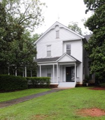 Robinson-Hiller Houselisted 1998
- Chapin Commercial Historic Districtlisted 2019
Population over time
2 figuresChapin grew from 1,445 to 1,809 between 2010 and 2020. These are the recorded population figures Wikidata holds for this place, reached through the Geographic Names Information System number this page is keyed on rather than by name, so they belong to this place and not to another of the same name. Most are census counts, but not all are: an early figure may be a founding or settlement estimate, and an estimate published within five years of a census is left out. The change column is computed, and is left blank where more than 20 years separate a figure from the one before it, because a gap that long is not a change between two counts.
| Year | People | Change |
|---|---|---|
| 2010 | 1,445 | |
| 2020 | 1,809 | +364 (+25%) |
Topographic sheets covering this place
8 surveys from 16 printed sheetsMatched by testing this settlement's coordinate against the published boundary of every sheet in the United States Geological Survey's historical collection. Each opens the scanned sheet at the Survey.
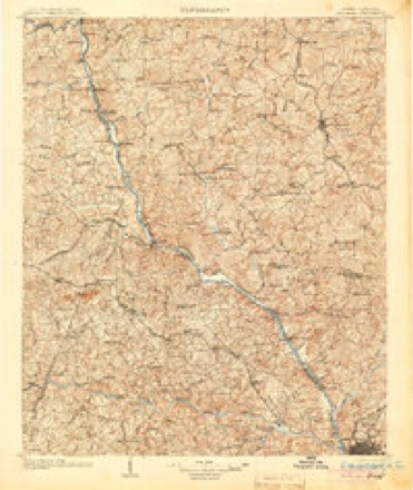
- 1904 USGS Columbia quadrangle1:125000, 2 printings
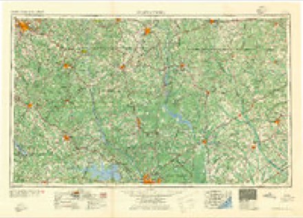
- 1941 USGS Spartanburg quadrangle1:250000
- 1953 USGS Spartanburg quadrangle1:250000, 4 printings
- 1960 USGS Spartanburg quadrangle1:250000, 2 printings
- 1963 USGS Spartanburg quadrangle1:250000
- 1964 USGS Spartanburg quadrangle1:250000
- 1971 USGS Chapin quadrangle1:24000, 3 printings
- 1986 USGS Newberry quadrangle1:100000, 2 printings

Fires near this place
169 since 1992Regional context, not property-specific evidence. The federal wildfire occurrence database lists 169 fires within 5 miles of Chapin between 1992 and 2019, burning about 279 acres in total. 4 started naturally. 6 were recorded as arson. Distance is straight-line from the map coordinates, so a fire counted here may appear on a neighbouring settlement's page as well.
| Reported cause | Fires |
|---|---|
| Missing data/not specified/undetermined | 82 |
| Debris and open burning | 47 |
| Misuse of fire by a minor | 10 |
| Equipment and vehicle use | 10 |
| Arson/incendiarism | 6 |
| Natural | 4 |
| Smoking | 3 |
| Recreation and ceremony | 3 |
| Railroad operations and maintenance | 2 |
| Power generation/transmission/distribution | 2 |
The most recent of them, most recent first, with the day each was reported and the service that recorded it.
| Date | Cause | Size | Reported by | Name on the report |
|---|---|---|---|---|
| 8 September 2010 | Equipment and vehicle use | 1.5 acres | South Carolina Forestry Commission | not named |
| 5 September 1997 | Equipment and vehicle use | under an acre | South Carolina Forestry Commission | not named |
| 30 September 1993 | Missing data/not specified/undetermined | 5.0 acres | South Carolina Forestry Commission | not named |
| 3 September 2010 | Debris and open burning | under an acre | South Carolina Forestry Commission | not named |
| 28 September 2019 | Equipment and vehicle use | 1.0 acres | South Carolina Forestry Commission | not named |
| 23 September 1997 | Equipment and vehicle use | under an acre | South Carolina Forestry Commission | not named |
| 20 September 2005 | Recreation and ceremony | under an acre | South Carolina Forestry Commission | not named |
| 20 September 1997 | Debris and open burning | under an acre | South Carolina Forestry Commission | not named |
Settlements close enough to share some of these fires:
Mines and quarries near this place
2 within 5 milesRegional context, not property-specific evidence. The federal mineral resources record lists 2 workings within 5 miles of Chapin: 1 occurrence, 1 unknown. None of them still produces. What was taken out: Kyanite, Pyrophyllite, Kyanite. Distance is straight-line from the map coordinates, so a quarry counted here may appear on a neighbouring settlement's page as well.
| Where | Site | Commodity | Status | Recorded |
|---|---|---|---|---|
| Little Mountain Kyn Occurrence | Pyrophyllite, Kyanite | Unknown | Pyrophyllite, Kyanite | |
| Little Mtn Deposit | Kyanite | Occurrence |
Storms near this place
60 of 68 shownRegional context, not property-specific evidence. The National Weather Service names Chapin in 68 storm reports between 1996 and 2025: 52 thunderstorm wind, 14 hail, 1 flash flood, 1 heavy rain. The reports record 1 injury. Each account below is quoted exactly as the forecast office filed it, from the NOAA Storm Events Database, and each date opens the federal record of that event.
| When | Event | Place named | Harm | What the report says |
|---|---|---|---|---|
| June 2000 | Thunderstorm Wind | Chapin | 1 hurt | Sheriff reported trees down. |
| July 2012 | Hail | Chapin | $65,000 | Public reported golfball size hail causing damage to roofs and vehicles and covering much of the ground. |
| April 2011 | Thunderstorm Wind | Chapin | $24,000 | Highway Patrol reported numerous trees down from Chapin to Irmo. |
| May 2011 | Thunderstorm Wind | Chapin | $8,000 | Public reported trees and powerlines down at Chapin Elementary School. |
| August 2009 | Thunderstorm Wind | Chapin | $8,000 | Sheriff reported trees and powerlines down from Chapin to Irmo. |
| February 1997 | Thunderstorm Wind | Chapin | $5,000 | no account filed |
| June 2009 | Thunderstorm Wind | Chapin | $4,000 | NWS employee reported several trees down from Chapin to Ballentine to Irmo. |
| July 2012 | Thunderstorm Wind | Chapin | $3,000 | Police reported trees down on St. Peter Church Road. |
| July 2013 | Thunderstorm Wind | Chapin | $2,000 | Highway Patrol reported a couple of trees down on roads in the Chapin area. |
| July 2012 | Thunderstorm Wind | Chapin | $2,000 | Highway Patrol repoted trees down along I-26 near mile markers 98 and 99. |
| June 2011 | Thunderstorm Wind | Chapin | $2,000 | Sheriff reported a few trees down around the Chapin community. |
| August 2011 | Thunderstorm Wind | Chapin | $2,000 | Highway Partrol reported trees down along I-26 near the 89 mile marker on the west bound side. |
| June 2010 | Thunderstorm Wind | Chapin | $2,000 | Police department reported powerlines down on Chapin road. |
| August 2011 | Hail | Chapin | $1,000 | Hail the size of quarters mixed with hail the size of Ping Pong balls were reported. Also, trees were down in one yard.. |
| February 2011 | Thunderstorm Wind | Chapin | $1,000 | DOT found a couple of trees down near Gardenia and Archway Courts west of Chapin. |
| July 2020 | Flash Flood | Chapin | $100 | Public reported, via social media, flooding on Murray Lindler Rd near Old Bush River Rd at Lake Murray, and provided a photo. |
| July 2021 | Hail | Chapin | $10 | Trained spotter measured pea sized hail near the intersection of old Bush River Rd and Murray Lindler Rd. |
| March 2025 | Thunderstorm Wind | Chapin | - | NWS storm survey near Little Mountain found straight line wind damage near Ponderosa Road, extending sporadically northeast towards Nursery Road. Several small trees and branches were down. |
| June 2025 | Thunderstorm Wind | Chapin | - | Lexington County Communications Center reported power lines down along Brentwood Court. Time estimated by radar. |
| June 2025 | Thunderstorm Wind | Chapin | - | SC Highway Patrol reports a tree down at the intersection of Amicks Ferry Rd and Lake Tide Dr. Time estimated by radar. |
| June 2025 | Thunderstorm Wind | Chapin | - | Columbia news affiliate posted a picture from a viewer in Chapin of a large branch snapped off a tree. Time estimated by radar. |
| June 2025 | Thunderstorm Wind | Chapin | - | SC Highway Patrol reported trees down near I-26 in Chapin. |
| August 2023 | Thunderstorm Wind | Chapin | - | NWS Employee reported a large tree down in the woods on Broad River Road near Chapin Middle School. |
| September 2023 | Hail | Chapin | - | Report from individual driving through the Town of Chapin of nickel to quarter sized hail. |
| September 2023 | Thunderstorm Wind | Chapin | - | Lexington County EM reported downed trees at the intersection of I-26 and Columbia Ave. Time estimated by radar. |
| October 2023 | Thunderstorm Wind | Chapin | - | A tree fell on a power line along Columbia Ave near Eagle Chase Ct in Chapin. |
| August 2022 | Hail | Chapin | - | Convenience store employee reported penny size hail at I-26 and Columbia Ave. Time estimated. |
| August 2022 | Thunderstorm Wind | Chapin | - | DOT reported a tree down at Peak Street and Columbia Avenue. Time estimated by radar. |
| May 2021 | Thunderstorm Wind | Chapin | - | A microburst, with estimated wind speeds up to 80 mph, caused damage in the Melvin Park area. Partial roof and siding damage occurred to some homes near Chapin Elementary School. Several trees were also downed in that area, along with downed trees at Old Lexington Hwy and Sid Bickley Rd. Time estimated. |
| June 2020 | Thunderstorm Wind | Chapin | - | Tree down in roadway at the intersection of Meadowlark Rd and Mountview Circle. Time estimated. |
| July 2020 | Heavy Rain | Chapin | - | A CoCoRaHS observer just north of Crooked Creek Park in Chapin reported a 24 hour total rainfall amount, on the morning of Thursday July 2, 2020, of 4.86 inches. However, most, if not all, of that rain fell between 1300 EDT (1200 EST) and 1630 EDT (1530 EST) on Wednesday July 1, 2020. |
| February 2019 | Thunderstorm Wind | Chapin | - | SCDOT reported tree in the road on Interstate 26 westbound about 1 mile west of exit 91. |
| July 2019 | Thunderstorm Wind | Chapin | - | SCHP reported tree in roadway on St. Peters Church Rd at Stevens Creek Rd. |
| June 2019 | Thunderstorm Wind | Chapin | - | A line of severe thunderstorms produced widespread damaging winds, knocking down numerous trees over a large swath, many of which blocked roadways. |
| July 2018 | Thunderstorm Wind | Chapin | - | Tree down on a home near the intersection of Long Pine Rd and John Kinards Ct. |
| June 2018 | Thunderstorm Wind | Chapin | - | SCHP reported a tree in roadway on I-26 at mile marker 89. |
| June 2018 | Thunderstorm Wind | Chapin | - | SCHP reported tree down on I-26 at mile marker 91. |
| May 2017 | Thunderstorm Wind | Chapin | - | Trees down at Long Pine Rd and Strawfield Rd. Time estimated. |
| April 2016 | Thunderstorm Wind | Chapin | - | Several public reports of trees down around the town of Chapin. |
| September 2016 | Thunderstorm Wind | Chapin | - | SC Highway Patrol reported a tree down near the intersection of Columbia Ave. and Peak St. |
| July 2016 | Thunderstorm Wind | Chapin | - | Trees down along St. Peters Church Rd from Lee Roy Frick Ln to Dreher Island Rd. |
| December 2015 | Thunderstorm Wind | Chapin | - | Highway Patrol reported trees down across Murray Lindler Road. |
| March 2012 | Hail | Chapin | - | WIS-TV weather reported quarter size hail in Chapin. |
| September 2011 | Thunderstorm Wind | Chapin | - | Reported that several homes in the Chapin area had sidding removed from strong winds. |
| April 2009 | Hail | Chapin | - | Post Office reported nickel size hail just west of Chapin from people who got their mail in the morning. |
| May 2009 | Hail | Chapin | - | Public reported 3/4 inch hail on Chapin Road. |
| May 2009 | Hail | Chapin | - | Public reporte quarter size hail in north Chapin. |
| May 2008 | Thunderstorm Wind | Chapin | - | Emergency Manager reported several trees down in the Chapin area. |
| July 2008 | Thunderstorm Wind | Chapin | - | Reported damage to a home from downed trees and large limbs. |
| August 2008 | Thunderstorm Wind | Chapin | - | Chapin police and public reported trees down from Chapin to Friars Gate in Irmo. One tree was on a home in the Stoney Pointe Subdivision just south of Chapin. |
| March 2008 | Hail | Chapin | - | SKYWARN spotter reported penny size hail. |
| July 2008 | Thunderstorm Wind | Chapin | - | Reported power lines down in two areas of the town of Chapin. |
| August 2007 | Thunderstorm Wind | Chapin | - | DOT reported trees dwon on Haltiwanger road. |
| February 2007 | Thunderstorm Wind | Chapin | - | Public reported many trees down in the Hilton area south of Chapin and a NWS employee reported several trees down on Eptien Landing road. |
| May 2006 | Thunderstorm Wind | Chapin | - | Sheriff reported trees and powerlines down. |
| December 2005 | Hail | Chapin | - | SKYWARN spotter reported 3/4 inch hail. |
| November 2003 | Thunderstorm Wind | Chapin | - | Sheriff reported scattered trees and powerlines down. |
| July 2003 | Thunderstorm Wind | Chapin | - | Sheriff reported trees and powerlines down on Old Lexington Highway. |
| August 2003 | Thunderstorm Wind | Chapin | - | NWS Storm Survey found several trees down on I-20 near Chapin. |
| May 2002 | Thunderstorm Wind | Chapin | - | EOC reported trees down on a home near Amicks Ferry Rd. |
Nearest settlements
The eight closest, with where each one stands in the county. Distances are straight-line, computed from the Geographic Names Information System coordinates.
| Map | Place | Distance | Sheets |
|---|---|---|---|
| Green Valley Estates | 2.8 miles | 16 | |
| Dutchman Shores | 2.9 miles | 14 | |
| Milmont Shores | 4.4 miles | 14 | |
| Shady Acres | 4.5 miles | 14 | |
| Snug Harbor | 4.6 miles | 14 | |
| Lake Point | 5.9 miles | 14 | |
| Ella | 8.1 miles | 14 | |
| Selwood Shores | 8.2 miles | 20 |
Elsewhere
Matched on this settlement's Geographic Names Information System number rather than its name, so it cannot be a different place of the same name in another state.
| Wikipedia article on Chapin | An encyclopaedic summary. Its text is share-alike, so it is linked here rather than copied. |
| Wikidata item Q1958217 | The structured record the population and elevation above come from. Public domain (CC0). |
Provenance
This settlement is recorded in the Geographic Names Information System as feature 1231155. The sheet list is computed by point-in-boundary test against the United States Geological Survey's historical topographic inventory. Both are works of the United States government and carry no copyright under 17 U.S.C. 105.
Wildfire. Short, Karen C. 2022. Spatial wildfire occurrence data for the United States, 1992-2020 [FPA_FOD_20221014]. 6th Edition. Fort Collins, CO: Forest Service Research Data Archive. https://doi.org/10.2737/RDS-2013-0009.6 Collected with United States Government funding and usable without additional permissions or fees.
Mines and quarries. USGS Mineral Resources Data System (MRDS) https://mrdata.usgs.gov/mrds/ A work of the United States government, no copyright under 17 U.S.C. 105.
Storms. NOAA National Centers for Environmental Information, Storm Events Database https://www.ncei.noaa.gov/stormevents/ A work of the United States government, no copyright under 17 U.S.C. 105. Narratives are quoted verbatim from the National Weather Service report and are not edited or summarised.