 Block
Moncks Corner, South Carolina
18 topographic sheets cover this place, the earliest surveyed in 1919 and the latest in 1990. It stands in the Moncks Corner census division. It lies in ZIP code area 29461. The Survey maps it on the Moncks Corner quadrangle. 13,297 people lived here at the 2020 count. It stands 52 feet above sea level.
On record in Moncks Corner
Buildings and businesses the archive holds for this place. Each opens its own page, with the source record it came from.
On the National Register 7 records
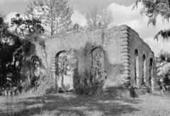 Biggin Church Ruinslisted 1977
 Gippy Plantationlisted 2016
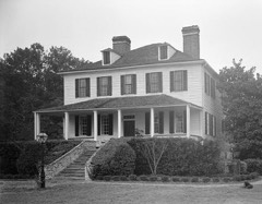 Lewisfield Plantationlisted 1973
 Mulberry Plantationlisted 1966
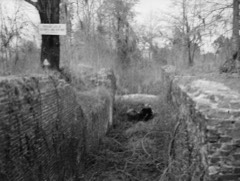 Santee Canallisted 1982
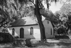 Strawberry Chapel and Childsbury Town Sitelisted 1972
- Cooper River Historic Districtlisted 2003
Surveyed buildings and structures 7 records
- Biggin Church (Ruins), Cooper River, West Branch, Moncks Cornerfederal building survey, 3 photographs
- Exeter, Cooper River, West Branch, Moncks Cornerfederal building survey, 17 photographs
- Gippy, Cooper River, West Branch, Moncks Cornerfederal building survey, 2 photographs
- Lewisfield, U.S. Route 52 vicinity, Moncks Cornerfederal building survey, 18 photographs
- Mulberry, Cooper River, West Branch, Moncks Cornerfederal building survey, 42 photographs
- Santee Canal Structures (Area Survey), Moncks Cornerfederal building survey, 4 photographs
- Wappaola, Cooper River, West Branch, Moncks Cornerfederal building survey, 2 photographs
Population over time
2 figuresMoncks Corner grew from 7,885 to 13,297 between 2010 and 2020. These are the recorded population figures Wikidata holds for this place, reached through the Geographic Names Information System number this page is keyed on rather than by name, so they belong to this place and not to another of the same name. Most are census counts, but not all are: an early figure may be a founding or settlement estimate, and an estimate published within five years of a census is left out. The change column is computed, and is left blank where more than 20 years separate a figure from the one before it, because a gap that long is not a change between two counts.
| Year | People | Change |
|---|---|---|
| 2010 | 7,885 | |
| 2020 | 13,297 | +5,412 (+69%) |
Topographic sheets covering this place
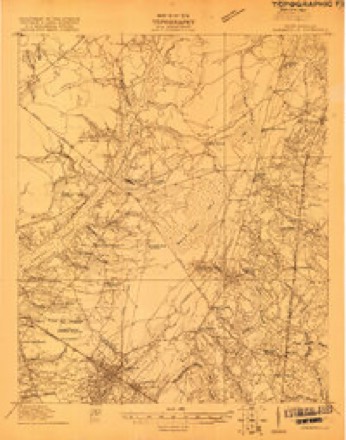
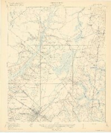
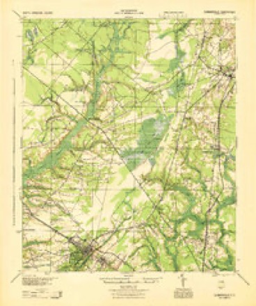
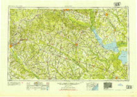
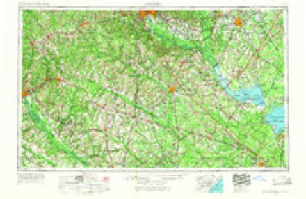
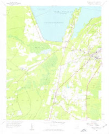
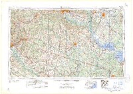
11 surveys from 18 printed sheetsMatched by testing this settlement's coordinate against the published boundary of every sheet in the United States Geological Survey's historical collection. Each opens the scanned sheet at the Survey.
- 1919 USGS Summerville quadrangle1:48000
- 1920 USGS Summerville quadrangle1:62500, 3 printings
- 1944 USGS Summerville quadrangle1:62500
- 1954 USGS Augusta quadrangle1:250000
- 1957 USGS Augusta quadrangle1:250000, 3 printings
- 1958 USGS Augusta quadrangle1:250000
- 1958 USGS Moncks Corner quadrangle1:24000, 3 printings
- 1961 USGS Augusta quadrangle1:250000, 2 printings
- 1962 USGS Augusta quadrangle1:250000
- 1985 USGS Saint George quadrangle1:100000
- 1990 USGS Saint George quadrangle1:100000
Photographs
4 photographs, 1938 to 1941Taken for the Office of War Information and the Farm Security Administration, who photographed the country between 1935 and 1944. Works of United States government photographers, with no known restriction on use. Each opens its catalogue record.
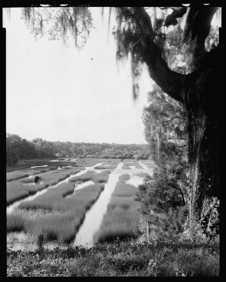
Johnston, Frances Benjamin, 1938. Library of Congress

Delano, Jack, 1941. Library of Congress
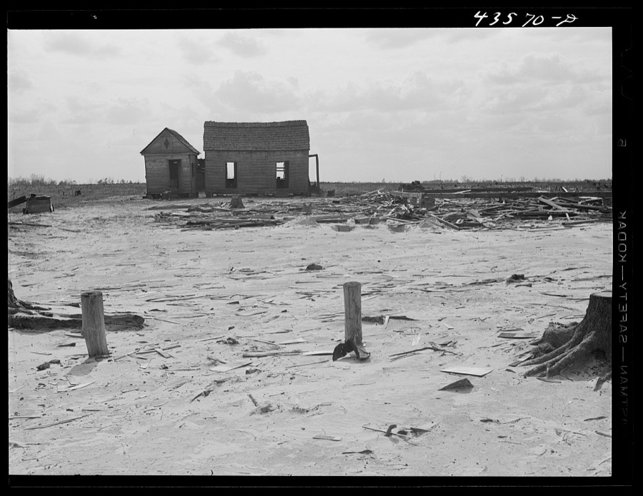
Delano, Jack, 1941. Library of Congress
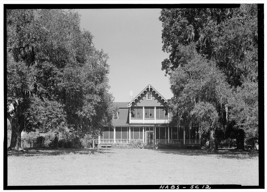
Photographer not recorded. Library of Congress
Fires near this place
441 since 1992Regional context, not property-specific evidence. The federal wildfire occurrence database lists 441 fires within 5 miles of Moncks Corner between 1992 and 2020, burning about 1,484 acres in total. 4 started naturally. 95 were recorded as arson. Distance is straight-line from the map coordinates, so a fire counted here may appear on a neighbouring settlement's page as well.
| Reported cause | Fires |
|---|---|
| Debris and open burning | 186 |
| Missing data/not specified/undetermined | 115 |
| Arson/incendiarism | 95 |
| Misuse of fire by a minor | 17 |
| Equipment and vehicle use | 7 |
| Smoking | 6 |
| Natural | 4 |
| Other causes | 3 |
| Recreation and ceremony | 3 |
| Power generation/transmission/distribution | 2 |
| Railroad operations and maintenance | 2 |
| Fireworks | 1 |
The most recent of them, most recent first, with the day each was reported and the service that recorded it.
| Date | Cause | Size | Reported by | Name on the report |
|---|---|---|---|---|
| 9 September 1997 | Debris and open burning | 4.0 acres | South Carolina Forestry Commission | not named |
| 6 September 1999 | Debris and open burning | under an acre | South Carolina Forestry Commission | not named |
| 4 September 2005 | Missing data/not specified/undetermined | under an acre | South Carolina Forestry Commission | not named |
| 4 September 1999 | Misuse of fire by a minor | under an acre | South Carolina Forestry Commission | not named |
| 17 September 2001 | Arson/incendiarism | 1.0 acres | South Carolina Forestry Commission | not named |
| 12 September 1999 | Equipment and vehicle use | under an acre | South Carolina Forestry Commission | not named |
| 9 August 1999 | Missing data/not specified/undetermined | 2.0 acres | South Carolina Forestry Commission | not named |
| 7 August 1999 | Debris and open burning | under an acre | South Carolina Forestry Commission | not named |
Settlements close enough to share some of these fires:
Mines and quarries near this place
3 within 5 milesRegional context, not property-specific evidence. The federal mineral resources record lists 3 workings within 5 miles of Moncks Corner: 3 past producers. None of them still produces. What was taken out: Clay, Sand and Gravel, Construction. Distance is straight-line from the map coordinates, so a quarry counted here may appear on a neighbouring settlement's page as well.
| Where | Site | Commodity | Status | Recorded |
|---|---|---|---|---|
| Consolidated Enterprises Clay Mine | Clay | Past Producer | Sedimentary | |
| Consolidated Pit Number 1 | Sand and Gravel, Construction, Clay | Past Producer | ||
| Unnamed Sand/Clay Pit | Sand and Gravel, Construction | Past Producer | Sedimentary |
Storms near this place
60 of 93 shownRegional context, not property-specific evidence. The National Weather Service names Moncks Corner in 93 storm reports between 1994 and 2025: 36 thunderstorm wind, 36 hail, 11 flash flood, 4 tornado. The reports record 1 death and 24 injuries. Each account below is quoted exactly as the forecast office filed it, from the NOAA Storm Events Database, and each date opens the federal record of that event.
| When | Event | Place named | Harm | What the report says |
|---|---|---|---|---|
| June 2004 | Lightning | Moncks Corner | 1 killed, 1 hurt | Lightning struck a couple while they were riding a jet ski. The man was killed and the woman received minor injuries. |
| September 1998 | Tornado (F2) | Moncks Corner | 9 hurt, $2,800,000 | Seventy-three (73) homes were damaged, fourteen mobile homes destroyed and seven (7) homes destroyed. The Fairlawn sobdivision, just southeast of Moncks corner was hardest hit. |
| April 2020 | Tornado (EF3) | Moncks Corner | 6 hurt | The National Weather Service Storm Survey Team confirmed an EF-3 tornado with an estimated maximum wind speed of 145 mph just east of Moncks Corner, South Carolina. The tornado began in the Fairlawn Subdivision, just east of Moncks Corner. Several homes had significant damage along Old Fort Road and Dennis Boulevard. There was a home at the east end of Dennis Boulevard that had significant damage to justify the EF-3 tornado rating. There was also extensive snapping and uprooting of trees, as well as vehicle and trailer damage in the area. The tornado moved east-southeast, generally down Dennis Boulevard, then east across the west branch of the Cooper River, before turning east-northeast across South Carolina 402 and Cane Gully Road. At this location, a mobile home was completely destroyed and several other homes and structures sustained significant damage. The tornado then continued east-northeast snapping and uprooting trees, with significant damage to at least one home off of Myrtle Lane, and minor roof and siding damage to approximately four additional homes just south of Bullhead Road. The tornado then dissipated near the intersection of Myrtle Lane and Wright Road. This tornado was part of a family of tornadoes that began more than 100 miles to the southwest, in Screven County, Georgia. |
| June 2000 | Thunderstorm Wind | Moncks Corner | 6 hurt | Pontoon boat capsized on Lake Moultrie. All six passengers were safely rescued. |
| August 2024 | Tornado (EF1) | Moncks Corner | 2 hurt | A National Weather Service Storm Survey Team confirmed an EF1 tornado with an estimated maximum wind speed of 95 mph in Moncks Corner, South Carolina occurring from 153 AM to 200 AM EST.||The tornado, which originated in an outer rainband associated with Tropical Storm Debby, touched down just east of McCormick Circle, snapping two trees in the woods behind an Applebee's. The tornado then moved northwest, causing damage to the Applebee's sign and then turned west, flipping vehicles that led to 2 minor injuries. The tornado then continued on a west track, impacting an Arby's. This was the location of the strongest damage as numerous windows were blown out at the Arby's on both the west and east-facing sides of the building. The rooftop A/C was also blown into the Arby's parking lot. However, no other structural damage was noted and therefore the degree of damage was kept near the middle of the expected wind speed, or at 95 mph. The Walmart Supercenter to the northwest of Arby's also sustained some very minor roof fascia damage, which was starting to peel off from the main structure. The tornado then continued to move northwest and passed Mitton Road, where several trees were uprooted with a few branches greater than 3 inches in diameter broken. There was also a residence on Mitton Road that had roof damage to less than 20% of the structure. The tornado then moved northwest and weakened as it crossed Kitfield Road, where some branches (mostly 1-3 in diameter) were broken. There were also branches (1-3 in diameter) snapped northwest of this location on Lois Circle and Broughton Road. The tornado then continued a path northwest, before dissipating on the northern end of the Pinopolis Peninsula along the south end of Lake Moultrie. |
| May 2019 | Lightning | Moncks Corner | $50,000 | Lightning struck and caused a fire at the Nazareth Reformed Episcopal Church on West End Drive in Moncks Corner. The fire was contained to the front of the church, but the church's steeple collapsed backward into the structure. |
| August 2006 | Lightning | Moncks Corner | $10,000 | Lightning struck a tree, knocking it down and damaging two vehicles at the Piggly Wiggly grocery store in Moncks Corner. |
| May 2008 | Thunderstorm Wind | Moncks Corner | $7,000 | A trained weather spotter reported a tree knocked down on a house in Shamrock Court on the north side of Moncks Corner, South Carolina. |
| July 2008 | Thunderstorm Wind | Moncks Corner | $5,500 | A 40 foot tree that was 15 inches in diameter was reported down in Moncks Corner, South Carolina. A shed at Central Hardware along Highway 52 was also destroyed. |
| May 2008 | Lightning | Moncks Corner | $5,000 | A trained weather spotter reported some minor damage to a home after lightning struck it. |
| June 1994 | Tornado (F0) | Moncks Corner | $5,000 | A funnel cloud that passed over Carnes Crossroads area (11 SW of Moncks Corner) touched down briefly seven miles southwest of Moncks Corner as a F0 tornado, damaging a mobile home and nearby metal sheds. |
| July 2012 | Thunderstorm Wind | Moncks Corner | $3,000 | Fire Department personnel reported a 4 foot diameter oak tree down along Wildwood Lane. The oak tree was 50 feet tall. |
| June 2009 | Thunderstorm Wind | Moncks Corner | $3,000 | A Berkeley County official reported trees down in Moncks Corner, South Carolina. |
| April 2007 | Thunderstorm Wind | Moncks Corner | $2,500 | Numerous Trees and Limbs were reported down. Metal sheeting was torn off a building. |
| May 2012 | Thunderstorm Wind | Moncks Corner | $1,500 | Three trees blown down in Moncks Corner. |
| July 2007 | Thunderstorm Wind | Moncks Corner | $500 | A tree was reported down in Moncks Corner. |
| June 2025 | Thunderstorm Wind | Moncks Corner | - | A Berkeley County emergency manager reported trees down on power lines in the 100 Block of West Main Street. |
| August 2024 | Flash Flood | Moncks Corner | - | A video posted on social media shows water rapidly flowing across a commercial parking lot and across a boat ramp near Reid Hill Road. |
| August 2024 | Flash Flood | Moncks Corner | - | Emergency officials in Moncks Corner reported that high water rescues were in progress, homes were flooded throughout the city and roads were closed due to 2-3 feet of fast moving water. |
| August 2024 | Flash Flood | Moncks Corner | - | Berkeley County Emergency Management reported Heatly Street in Moncks Corner being closed due to high water caused by flash flooding. |
| August 2024 | Flash Flood | Moncks Corner | - | A Berkeley County emergency manager reported a tree blocking the Haynesville Road due to flash flooding. |
| August 2024 | Flash Flood | Moncks Corner | - | The public relayed a video of a flooded house on Fairlawn Drive in Moncks Corner. |
| August 2024 | Flash Flood | Moncks Corner | - | Berkeley County Emergency Management reported approximately 30 swift water rescues within Berkeley County, mainly in Moncks Corner. No injuries have been reported. |
| April 2022 | Hail | Moncks Corner | - | The public reported quarter size hail at a residence on Dennis Boulevard. |
| April 2022 | Hail | Moncks Corner | - | The public reported hail as large as golf balls at a residence on Dennis Boulevard. |
| June 2022 | Thunderstorm Wind | Moncks Corner | - | The Berkeley County 911 Call Center reported a tree down at 401 North Live Oak Road. |
| June 2021 | Thunderstorm Wind | Moncks Corner | - | The public reported a large branch split off a tree near the intersection of Highway 52 and Highway 17A. |
| May 2021 | Hail | Moncks Corner | - | A trained spotter reported quarter sized hail in Moncks Corner. The hail lasted about 5 minutes and shredded a canvas deck cover. |
| May 2021 | Hail | Moncks Corner | - | A trained spotter reported hail up to the size of golf balls in Moncks Corner. |
| May 2021 | Hail | Moncks Corner | - | A CoCoRaHS observer reported quarter sized hail near Moncks Corner. |
| December 2021 | Hail | Moncks Corner | - | The public reported quarter size hail in Moncks Corner, South Carolina. |
| July 2019 | Thunderstorm Wind | Moncks Corner | - | Berkeley County dispatch reported a tree down in a wooded area behind a large department store. |
| July 2019 | Thunderstorm Wind | Moncks Corner | - | Multiple reports received of structural damage to a strip mall on Highway 52. Damage included the roof of the South Carolina Department of Motor Vehicles building and several other businesses within the strip mall. A few billboards in the area were also reported to be damaged. |
| March 2018 | Hail | Moncks Corner | - | Berkeley County dispatch reported quarter sized hail in Moncks Corner. |
| March 2018 | Hail | Moncks Corner | - | Berkeley County dispatch reported quarter sized hail at their office. |
| June 2018 | Thunderstorm Wind | Moncks Corner | - | Law enforcement reported a tree down on Highway 17A near Church Street. |
| September 2015 | Thunderstorm Wind | Moncks Corner | - | South Carolina Highway Patrol reported a tree down near the intersection of Sandy Drive and Hill Street. |
| July 2014 | Thunderstorm Wind | Moncks Corner | - | South Carolina Highway Patrol reports a tree down at the intersection of Kitfield Road and Broughton Road. |
| July 2014 | Thunderstorm Wind | Moncks Corner | - | Trees reported down at several locations around Moncks Corner. |
| July 2013 | Hail | Moncks Corner | - | Nickel size hail and minor street flooding was reported in Moncks Corner. |
| May 2012 | Hail | Moncks Corner | - | The public reports nickel size hail in Moncks Corner. |
| March 2012 | Hail | Moncks Corner | - | Berkeley County Law Enforcement reported quarter sized hail in Moncks Corner. |
| August 2012 | Hail | Moncks Corner | - | The public reported nickel sized hail and 30 to 40 miles per hour wind gusts. The hail briefly covered the ground. |
| August 2012 | Hail | Moncks Corner | - | The public reported quarter sized hail in Moncks Corner. |
| August 2012 | Hail | Moncks Corner | - | A report of golf ball hail falling at the Berkeley County Emergency Operations Center. |
| August 2012 | Hail | Moncks Corner | - | A trained spotter reported hail ranging from pea to quarter sized falling along Whitesville Road in Moncks Corner. |
| May 2009 | Hail | Moncks Corner | - | The public reported nickel size hail in the Brook Valley subdivision in Moncks Corner, South Carolina. |
| May 2009 | Hail | Moncks Corner | - | The public reported nickel size hail in Moncks Corner, South Carolina. |
| May 2009 | Hail | Moncks Corner | - | The public reported nickel size hail at the in the Windward subdivision at the intersection of Highway 17A and Route 176 in Moncks Corner, South Carolina. |
| June 2009 | Hail | Moncks Corner | - | A trained weather spotter reported penny to nickel size hail in Moncks Corner, South Carolina. |
| May 2008 | Funnel Cloud | Moncks Corner | - | Law enforcement reported a brief funnel cloud in Moncks Corner, South Carolina. |
| May 2008 | Thunderstorm Wind | Moncks Corner | - | A trained weather spotter reported that a small tree was knocked down by thunderstorm winds in Moncks Corner, South Carolina. |
| July 2008 | Hail | Moncks Corner | - | Quarter size hail was reported in the Sterling Oaks subdivision in Moncks Corner, South Carolina. |
| July 2008 | Hail | Moncks Corner | - | Penny to quarter size hail was reported by law enforcement in Moncks Corner, South Carolina. |
| June 2008 | Hail | Moncks Corner | - | The public reported penny size hail in Moncks Corner, South Carolina. |
| May 2008 | Hail | Moncks Corner | - | A trained weather spotter reported quarter size hail on Highway 17A South. The hail fell for 10 minutes. |
| May 2008 | Hail | Moncks Corner | - | Nickel size hail was reported in Moncks Corner, South Carolina. |
| July 2008 | Hail | Moncks Corner | - | Nickel to quarter size hail was reported by the public at the intersection of Highway 52 and Old Highway 52 in Moncks Corner, South Carolina. |
| May 2008 | Hail | Moncks Corner | - | Nickel size hail was reported in Moncks Corner, South Carolina. |
| June 2006 | Heavy Rain | Moncks Corner | - | Estimated 3 to 4 inches rainfall. 6 inches standing water on Broughton Road near the High School. |
Nearest settlements
The eight closest, with where each one stands in the county. Distances are straight-line, computed from the Geographic Names Information System coordinates.
| Map | Place | Distance | Sheets |
|---|---|---|---|
| Oak Hill | 0.6 miles | 18 | |
| Mittenlane | 0.9 miles | 12 | |
| Frazier Hill | 1.1 miles | 18 | |
| Sugar Hill | 1.9 miles | 18 | |
| Kitfield (historical) | 2.3 miles | 12 | |
| Stony Landing | 2.3 miles | 12 | |
| Pinopolis | 2.5 miles | 18 | |
| Green Hill (historical) | 2.6 miles | 18 |
Elsewhere
Matched on this settlement's Geographic Names Information System number rather than its name, so it cannot be a different place of the same name in another state.
| Wikipedia article on Moncks Corner | An encyclopaedic summary. Its text is share-alike, so it is linked here rather than copied. |
| Wikidata item Q2238330 | The structured record the population and elevation above come from. Public domain (CC0). |
Provenance
This settlement is recorded in the Geographic Names Information System as feature 1246709. The sheet list is computed by point-in-boundary test against the United States Geological Survey's historical topographic inventory. Both are works of the United States government and carry no copyright under 17 U.S.C. 105.
Wildfire. Short, Karen C. 2022. Spatial wildfire occurrence data for the United States, 1992-2020 [FPA_FOD_20221014]. 6th Edition. Fort Collins, CO: Forest Service Research Data Archive. https://doi.org/10.2737/RDS-2013-0009.6 Collected with United States Government funding and usable without additional permissions or fees.
Mines and quarries. USGS Mineral Resources Data System (MRDS) https://mrdata.usgs.gov/mrds/ A work of the United States government, no copyright under 17 U.S.C. 105.
Storms. NOAA National Centers for Environmental Information, Storm Events Database https://www.ncei.noaa.gov/stormevents/ A work of the United States government, no copyright under 17 U.S.C. 105. Narratives are quoted verbatim from the National Weather Service report and are not edited or summarised.