 Block
From the record
One of 22 National Register listings published here for McCormick County · listed in 2026 · category: Building.
Sources: the National Register database, National Park Service
Listed on the National Register of Historic Places in 2026.
One of 22 National Register listings published here for McCormick County · listed in 2026 · category: Building.
Sources: the National Register database, National Park Service
Regional context, not property-specific evidence. The federal wildfire occurrence database lists 140 fires within 5 miles of Bracknell's Store Complex between 1992 and 2020, burning about 515 acres in total. 2 started naturally. 6 were recorded as arson. Distance is straight-line from the map coordinates, so a fire counted here may appear on a neighbouring settlement's page as well.
| Reported cause | Fires |
|---|---|
| Missing data/not specified/undetermined | 76 |
| Debris and open burning | 29 |
| Equipment and vehicle use | 11 |
| Arson/incendiarism | 6 |
| Railroad operations and maintenance | 5 |
| Recreation and ceremony | 4 |
| Misuse of fire by a minor | 4 |
| Smoking | 3 |
| Natural | 2 |
The most recent of them, most recent first, with the day each was reported and the service that recorded it.
| Date | Cause | Size | Reported by | Name on the report |
|---|---|---|---|---|
| 9 September 1993 | Missing data/not specified/undetermined | under an acre | South Carolina Forestry Commission | not named |
| 7 September 1997 | Debris and open burning | under an acre | South Carolina Forestry Commission | not named |
| 30 September 2017 | Debris and open burning | 1.5 acres | South Carolina Forestry Commission | not named |
| 25 September 1996 | Missing data/not specified/undetermined | under an acre | South Carolina Forestry Commission | not named |
| 24 September 2016 | Debris and open burning | 1.0 acres | South Carolina Forestry Commission | not named |
| 21 September 2019 | Smoking | 3.5 acres | South Carolina Forestry Commission | not named |
| 19 September 1998 | Missing data/not specified/undetermined | under an acre | South Carolina Forestry Commission | not named |
| 17 September 2003 | Missing data/not specified/undetermined | 1.0 acres | South Carolina Forestry Commission | not named |
Regional context, not property-specific evidence. The federal mineral resources record lists 11 workings within 5 miles of Bracknell's Store Complex: 7 past producers, 2 unknowns, 1 prospect, 1 occurrence. None of them still produces. What was taken out: Gold, Barium-Barite, Copper, Barium-Barite, Gold. Distance is straight-line from the map coordinates, so a quarry counted here may appear on a neighbouring settlement's page as well.
| Where | Site | Commodity | Status | Recorded |
|---|---|---|---|---|
| Abernathy and Kehaya/Dorn Mine | Manganese | Past Producer | 1942 | |
| Barite Hill | Gold, Barium-Barite, Copper, Silver, Lead, Zinc | Past Producer | Pyrite, Gold, Chalcopyrite, Galena, Sphalerite | |
| Butler Prospect | Barium-Barite, Gold, Zinc, Copper | Past Producer | 1860 | |
| Jennings Mine | Gold, Copper | Unknown | 1860 | |
| Plum Branch Quarry | Stone | Unknown | Metamorphic | |
| Self Mine | Gold, Barium-Barite | Past Producer | 1860 | |
| Barite Hill | Gold | Past Producer | 1984, 1991 | |
| Butler Prospect | Gold | Occurrence | ||
| Jennings Prospect | Gold | Prospect | ||
| Searl's Mine Or Searles Mine | Gold | Past Producer | 1860 |
Regional context, not property-specific evidence. The National Weather Service names Plum Branch, the town this property stands in, in 31 storm reports between 1997 and 2025: 23 thunderstorm wind, 7 hail, 1 flash flood. No death or injury is recorded in these reports. Each account below is quoted exactly as the forecast office filed it, from the NOAA Storm Events Database, and each date opens the federal record of that event.
| When | Event | Place named | Harm | What the report says |
|---|---|---|---|---|
| May 2010 | Thunderstorm Wind | Plum Branch | $38,000 | McCormick Messenger reported many trees and powerlines were taken down in the lower half of the county. A couple of trees fell on a carport damaging a vehicle. |
| July 2012 | Hail | Plum Branch | $15,000 | Sheriff reported golfball size hail. |
| June 2011 | Thunderstorm Wind | Plum Branch | $10,000 | Sheriff reported trees down in the Plum Branch area. The McCormick Messenger Newspaper also reported a boat shed destroyed on Landam Creek Road in Plum Branch. |
| March 2012 | Thunderstorm Wind | Plum Branch | $4,000 | Dispatch reported a couple of trees down on Hwy 221. |
| June 2011 | Thunderstorm Wind | Plum Branch | $1,000 | Public reported a couple of trees down on SR 283 near Upper Miller road. |
| March 2025 | Thunderstorm Wind | Plum Branch | - | Multiple trees down along Harmony Road, New Hope Road, and Whitetown Road in Plum Branch. Time estimated via radar. |
| August 2025 | Flash Flood | Plum Branch | - | Emergency Manager reported roadway closure due to flooding on Whitetown Rd at Stevens Creek which overflowed its banks. New Hope Rd just south of Whitetown Rd was also closed due to flooding. |
| April 2024 | Thunderstorm Wind | Plum Branch | - | Report and photo, observed on social media, showed a pine tree down on a vehicle in Hawe Creek Campground, site number 30. Damage to the vehicle appeared minor. | Time estimated. |
| April 2024 | Thunderstorm Wind | Plum Branch | - | A tree was downed at Hwy 28 S and Ga Ln, just south of Plum Branch. Time estimated. |
| July 2023 | Thunderstorm Wind | Plum Branch | - | A tree fell onto a house on Hwy 283 east of Plum Branch, trapping one person inside, who was rescued and not injured. Time estimated. |
| April 2022 | Thunderstorm Wind | Plum Branch | - | Trees reported down near Plum Branch. Time estimated. |
| July 2022 | Thunderstorm Wind | Plum Branch | - | Tree down across roadway near the intersection of Liberty Hill Rd and Harmony Rd. |
| July 2022 | Thunderstorm Wind | Plum Branch | - | Tree fell along Upper Mill Rd, blocking the roadway. |
| July 2022 | Thunderstorm Wind | Plum Branch | - | Tree down across Whitetown Rd near Stevens Creek, blocking the roadway. |
| July 2022 | Thunderstorm Wind | Plum Branch | - | A tree and power lines fell along Lethe Rd. |
| July 2021 | Thunderstorm Wind | Plum Branch | - | WJBF in Augusta reported thunderstorm wind damage near Plum Branch Yacht Club. Trees were downed and a dock off of Split Oak Rd was damaged. Time estimated. |
| August 2021 | Thunderstorm Wind | Plum Branch | - | McCormick Co dispatch reported trees down at 284 Old Augusta Rd near Plum Branch. Time estimated. |
| March 2020 | Hail | Plum Branch | - | Photo submitted over social media showed quarter size hail near Plum Branch. |
| July 2018 | Thunderstorm Wind | Plum Branch | - | Trees fell on power lines near Hwy 283 and Upper Mill Rd, causing a power outage. |
| July 2017 | Thunderstorm Wind | Plum Branch | - | McCormick dispatch reported power lines down on Holiday Rd. Time estimated. |
| July 2012 | Hail | Plum Branch | - | Public reported quarter size hail on Saddle Club Road. |
| June 2011 | Thunderstorm Wind | Plum Branch | - | Sheriff dispatch reported trees down along Troy West Rd. |
| May 2008 | Hail | Plum Branch | - | Public reported quarter size hail. |
| June 2007 | Thunderstorm Wind | Plum Branch | - | DOT reported several trees down on hwy 202 near Plum Branch. |
| January 2005 | Hail | Plum Branch | - | Emergency Managers assistant reported brief 1 inch hail in Plum Branch. |
| July 2003 | Thunderstorm Wind | Plum Branch | - | Sheriff reported trees down in Plum Branch and Clarks Hill. |
| January 2001 | Thunderstorm Wind | Plum Branch | - | Post Office reported trees down between Plum Branch and Parksville on highway 28. |
| June 2001 | Hail | Plum Branch | - | Sheriff reported 1 inch hail in the Plum Branch area. |
| June 1999 | Thunderstorm Wind | Plum Branch | - | Sheriff reported trees and powerlines down on hwys 283 and 21. Confirmed by spotter. |
| May 1999 | Thunderstorm Wind | Plum Branch | - | Sheriff reported trees down. |
| April 1997 | Hail | Plum Branch | - | no account filed |
No historic map-sheet match is published for this property yet. That does not mean no map exists. This record needs a coordinate-quality review before it can be joined to a sheet boundary. Browse the county's mapped places while that work is pending.
Other National Register properties close enough to walk or drive between, ordered by distance from this one. Both positions come from the same geocoding pass that matched these properties to their map sheets.
| Photograph | Property | Distance | Listed |
|---|---|---|---|
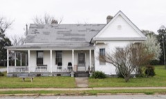 | M. L. B. Sturkey House | 4.7 miles | 1985 |
 | McCormick County Courthouse | 4.8 miles | 1985 |
 | McCormick Train Station | 4.8 miles | 1985 |
| McCormick County Office Building | 4.8 miles | 2024 | |
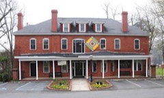 | Hotel Keturah | 4.8 miles | 1985 |
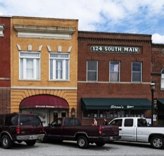 | Farmer's Bank | 4.8 miles | 1985 |
| National Archives record | The nomination case file for reference 100012507 in Record Group 79. |
| McCormick County | All 22 listed properties in this county. |