Block
From the record
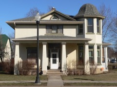
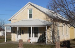
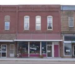
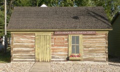
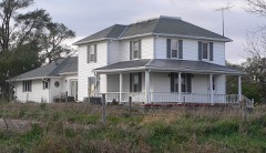
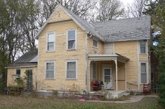
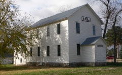
40 National Register listings published here.
Sources: the National Register database, National Park Service
47 topographic sheets cover 10 settlements here, and 40 properties are on the National Register of Historic Places.
40 National Register listings published here.
Sources: the National Register database, National Park Service
Every property in this county listed on the National Register of Historic Places, with the year it was listed and the federal nomination document.
Every wildfire the federal occurrence database records inside this county: 151 of them, burning about 5,289 acres. 4 started naturally and none was recorded as arson. Each settlement page carries the fires within five miles of it.
| Reported cause | Fires |
|---|---|
| Missing data/not specified/undetermined | 95 |
| Debris and open burning | 42 |
| Equipment and vehicle use | 6 |
| Natural | 4 |
| Misuse of fire by a minor | 3 |
| Fireworks | 1 |
The five largest, by the area the report gives. None of them was recorded as arson.
| Date | Cause | Size | Reported by | Name on the report |
|---|---|---|---|---|
| 22 October 2014 | Missing data/not specified/undetermined | 1,200 acres | South Dakota Wildland Fire Suppression | FISCHER |
| 11 April 2014 | Debris and open burning | 1,125 acres | South Dakota Wildland Fire Suppression | COLONY |
| 21 October 2014 | Missing data/not specified/undetermined | 640 acres | South Dakota Wildland Fire Suppression | WALLY SORENSON |
| 14 March 2016 | Missing data/not specified/undetermined | 350 acres | South Dakota Wildland Fire Suppression | TABOR REC AREA |
| 8 March 2004 | Missing data/not specified/undetermined | 300 acres | South Dakota Wildland Fire Suppression | not named |
| 4 April 1999 | Debris and open burning | 160 acres | Ree Heights Volunteer Fire Department | WARING |
| 16 October 2014 | Missing data/not specified/undetermined | 120 acres | South Dakota Wildland Fire Suppression | TRASH FIRE |
| 12 March 2004 | Debris and open burning | 100 acres | South Dakota Wildland Fire Suppression | BALFANY |
Every settlement page carries the fires within five miles of it - see the settlement index below.
The NOAA Storm Events Database holds 479 reports for this county, causing no deaths, 3 injuries and about $6,226,300 in recorded property damage. Each settlement page carries the reports that name it.
| Kind of event | Reports |
|---|---|
| Hail | 226 |
| Thunderstorm Wind | 118 |
| Flood | 91 |
| Tornado | 26 |
| Flash Flood | 13 |
| Lightning | 3 |
| Heavy Rain | 1 |
| Funnel Cloud | 1 |
The most serious of them, by death, then injury, then recorded damage. The accounts are quoted exactly as the forecast office filed them.
| When | Event | Place named | Harm | What the report says |
|---|---|---|---|---|
| May 1956 | Tornado (F2) | not stated | 2 hurt, $250 | no account filed |
| April 1985 | Thunderstorm Wind | not stated | 1 hurt | no account filed |
| March 2019 | Flood | Perkins | $1,490,000 | Flooding resulted in extensive damage to public infrastructure including numerous county and township roads, culverts, and some bridges. |
| June 2024 | Flood | Perkins | $1,170,000 | Rainfall amounts across Bon Homme County from June 20-22 ranged from 2 to 3 inches with an estimated 5 to 6 inches across the far northern portion of the county. Overland flooding ensued with additional major flooding along the James River.||One home experienced a partial basement collapse and 3 businesses received flood damage. ||During peak flooding on June 21, water was overflowing at least 60 roads county-wide with the worst impacts north of South Dakota Highway 46, including South Dakota Highway 25 and the intersection of South Dakota Highways 46 and 37. Water also overran South Dakota Highway 50 near the Bon Homme Golf Course. Preliminary damage assessments estimate loss to public infrastructure across the county to be nearly 1.17 million dollars.||The majority of overland flooding subsided by June 22, but river flooding continued through the end of the month. For additional information on river flooding, please see other flood entries for Bon Homme County. |
| September 2016 | Thunderstorm Wind | Springfield | $1,000,000 | Thunderstorm winds destroyed about 6 houses, severely damaged several other houses and shops, destroyed or damaged several unattached garages, destroyed farm outbuildings and other farm structures, caused widespread tree damage, including numerous trees blown down, moved a large boat 25 yards from a parked position, damaging the boat, and damaged or destroyed outdoor furniture. |
| April 1985 | Tornado (F2) | not stated | $250,000 | no account filed |
| June 1965 | Tornado (F3) | not stated | $250,000 | no account filed |
| June 1962 | Tornado (F3) | not stated | $250,000 | no account filed |
| April 2005 | Thunderstorm Wind | Scotland | $150,000 | Thunderstorm winds blew over and heavily damaged a concession stand at a ball park, damaged front of two businesses on Main Street, blew down several trees, damaged several small buildings at nearby farms, and injured several calves. |
| August 2009 | Hail | Tyndall | $100,000 | Large hail smashed windows on vehicles and buildings, dented vehicles, damaged roofs, and damaged crops. The amount of crop damage was not known. |
| May 2007 | Tornado (EF2) | Tyndall | $100,000 | A tornado damaged two farms, including a house shifted off its foundation, and several outbuildings destroyed. The tornado also caused widespread tree damage, including some trees debarked and uprooted. The tornado also blew off the tops of grain bins and blew down power lines. |
| May 2007 | Flood | Scotland | $100,000 | Heavy rainfall caused flooding of low areas including fields, homes, businesses, schools, roads, streams, and bridges. The flooding was a longer term event than flash flooding, which also had resulted. Long term major flooding of the James River also resulted, with the river peaking at 6.2 feet above flood stage near Scotland on May 11th. Some parks and other recreation areas were affected. The flooding delayed planting of crops in some areas. |
| June 2006 | Thunderstorm Wind | Springfield | $100,000 | Thunderstorm winds caused widespread tree damage. Several trees and large branches were blown down. Some of the falling trees and branches damages homes and vehicles, including the roof of one house and one pickup truck which were heavily damaged. The wind blew down numerous power poles and power lines, causing a power outage in most of Springfield which lasted several hours. |
| June 2003 | Thunderstorm Wind | Tyndall | $100,000 | Thunderstorm winds caused tree damage, including several trees and large limbs blown down. A few houses sustained roof and siding damage. |
| June 2003 | Thunderstorm Wind | Springfield | $100,000 | Thunderstorm winds caused tree damage, including numerous trees and large limbs down. Several houses and vehicles were damaged by falling trees or tree debris. |
| July 2001 | Thunderstorm Wind | Springfield | $100,000 | Thunderstorm winds caused widespread tree damage. including some large trees blown down. Some falling trees damaged houses, especially roofs, with at least one chimney broken off. Several vehicles were also damaged. |
| July 1997 | Thunderstorm Wind | Scotland | $100,000 | Thunderstorm winds caused tree and power line damage, and blew out a large window. Minor damage occurred to homes, mainly from wind blown tree debris. |
| April 2005 | Thunderstorm Wind | Tyndall | $70,000 | Bleachers and track equipment at a high school football field and track were blown over and heavily damaged. A few tree branches were blown down in town, but most of the damage was confined to the school area. |
| August 2019 | Flood | Perkins | $50,000 | Flooding continued from July, with the entire month remaining in major flood stage. The Missouri River at Niobrara (gage site MRNN1) crested 4.30 feet above flood stage on August 31. High water closed numerous recreational boat ramps. The river remained at major flood stage at the end of the month. |
| May 2007 | Tornado (EF2) | Tyndall | $50,000 | A tornado blew over a shed, damaged several outbuildings, and flipped over a hog shed. A house was damaged when hit by debris from the hog shed. The tornado also shifted a two car garage off its foundation, damaged the adjoining house, blew a chimney off the roof, twisted a windmill, and caused tree damage. |
| June 2005 | Flash Flood | Springfield | $50,000 | Heavy rainfall of 4 to 6 inches caused flooding of numerous city streets, other roads, and basements. Several roads were partially washed out. |
| June 2003 | Hail | Springfield | $50,000 | Large hail damaged vehicles and cracked windows. Crop damage was suspected in the area but no damage estimates were available. |
| August 2000 | Hail | Avon | $50,000 | Large hail broke windows and damaged the finish of a few vehicles. The hail also caused crop damage. The amount of crop damage was not known. |
| September 1993 | Thunderstorm Wind | Near Tyndall | $50,000 | High winds blew down trees and branches into at least five buildings. Mostly minor damage was reported except a garage sustained severe damage. Extensive crop damage from hail was reported in central Bon-Homme County just north of Tyndall. |
| August 1996 | Thunderstorm Wind | Springfield | $50,000 | no account filed |
| August 2010 | Thunderstorm Wind | Avon | $40,000 | Thunderstorm winds caused widespread damage to trees and power lines. The tree damage included large trees uprooted or blown down, and at least two houses were damaged by falling trees. The damage to power lines caused a power outage over the town which lasted about 5 hours. The winds also destroyed a large shed and damaged a camper parked in the shed. |
| August 2010 | Thunderstorm Wind | Tyndall | $30,000 | Thunderstorm winds caused tree damage, including large trees blown down. The winds also blew down power lines, damaged several small sheds, and tore shingles off roofs. |
| March 2009 | Tornado (EF1) | Running Water | $30,000 | A tornado destroyed a garage and machine shed. A vehicle in the garage was damaged. Debris and equipment from the machine shed was scattered about the farm. |
| August 2000 | Thunderstorm Wind | Avon | $30,000 | A microburst caused tree damage, including the tops of trees and numerous 6 to 12 inch diameter limbs snapped off and blown away. The winds also blew a large metal grain bin across a road and into an abandoned farmstead. |
| August 2019 | Flood | Perkins | $25,000 | As flooding continued from July, the Missouri River near Verdel (gage site MRVN1) crested 0.82 feet above flood stage on August 31. High water closed numerous recreational boat ramps. The river remained at minor flood stage at the end of the month. |
| September 2019 | Flood | Scotland | $25,000 | A continuation of flooding from August; after falling briefly below flood stage on September 10, the James River near Scotland (gage site SCOS2) responded to excessive rainfall of 4 to 8 inches upstream September 10-12 (7.54 inches at Mitchell and 7.21 inches 7 miles south of Parkston) to crest at a record 9.24 feet above flood stage on September 13. Innumerable roads were inundated and closed for several days, including South Dakota Highway 44 near Milltown, Parkston and Freeman, Highway 18 near Olivet, Highway 81 north of Yankton, Highway 46 west of Irene and 431st Avenue in northern Yankton county - all major area roadways. Extensive amounts of agricultural land were inundated. Moderate flooding continued at the end of the month. |
| April 1985 | Tornado (F1) | not stated | $25,000 | no account filed |
| June 1965 | Tornado | not stated | $25,000 | no account filed |
| June 1954 | Tornado (F3) | not stated | $25,000 | no account filed |
| June 1998 | Lightning | Running Water | $20,000 | no account filed |
| August 2019 | Flood | Scotland | $10,000 | A continuation of flooding from July, the James River near Scotland (gage site SCOS2) crested at 3.33 feet above flood stage on August 13. Many rural roads near the river were inundated, with flooding of significant amounts of agricultural land. Moderate flooding continued at the end of the month. |
| August 2019 | Flood | Running Water | $10,000 | A continuation of flooding from July, the Missouri River at Springfield (gage site SPGS2) crested twice during the month at moderate flood stage. The first was 2.08 feet above flood stage on August 10, with the second at 2.10 feet above flood stage on August 31. High water closed numerous recreational boat ramps, and some camping areas at Springfield Recreational Area. The river remained at moderate flood stage at the end of the month. |
| September 2019 | Flood | Perkins | $10,000 | Flooding continued from August, with the entire month remaining in major flood stage. The Missouri River at Niobrara (gage site MRNN1) crested 5.34 feet above flood stage on September 22, which was the second highest crest on record. High water closed numerous recreational boat ramps. The river remained at major flood stage at the end of the month. |
| September 2019 | Flood | Running Water | $10,000 | A continuation of flooding from August, the Missouri River at Springfield (gage site SPGS2) crested at 2.41 feet above flood stage on September 21. High water closed numerous recreational boat ramps, and some camping areas at Springfield Recreational Area. The river remained at moderate flood stage at the end of the month. |
| August 2011 | Hail | Scotland | $10,000 | Large hail caused damage to bean and corn crops. The amount of crop damage was not known. The hail also dented a few vehicles. |
| July 2009 | Thunderstorm Wind | Scotland | $10,000 | Thunderstorm winds destroyed a 40 foot long storage building, and stripped leaves from trees. |
| May 2007 | Thunderstorm Wind | Springfield | $10,000 | Thunderstorm winds uprooted trees, caused additional tree damage, tipped over small sheds, and caused minor roof damage. |
| July 2002 | Thunderstorm Wind | Avon | $10,000 | Thunderstorm winds blew down power poles and lines. |
| August 2000 | Hail | Scotland | $10,000 | Large hail caused slight damage to vehicles in Scotland, but devastated corn crops along a two mile strip just north of Scotland. |
| August 1996 | Lightning | Springfield | $10,000 | no account filed |
| September 2019 | Tornado (EF0) | Avon | $6,000 | A trained spotter observed the rapid spin up of a tornado to the west of his location 5 miles south of Avon, just north of 307th Street and west of 405th Avenue. The tornado tracked northeast, and moved into a farmstead as it crossed 306th Street. Roof panels were blown off a farm outbuilding, with doors on the building bowed inward. Several trees on the farmstead suffered damage to large branches. The tornado continued to track northeast for around another half mile before lifting. Average path width was 20 yards. |
| October 2019 | Flood | Running Water | $5,000 | A continuation of flooding from September, the Missouri River at Springfield (gage site SPGS2) started the month at a peak of 2.32 feet above flood stage on October 1. High water closed numerous recreational boat ramps, and some camping areas at Springfield Recreational Area. The river remained at minor flood stage at the end of the month. Property damage costs are rough estimates. |
| October 2019 | Flood | Perkins | $5,000 | Flooding continued from September, with the entire month remaining in major flood stage. The Missouri River at Niobrara (gage site MRNN1) started the month at a crest 5.35 feet above flood stage on October 1, which was the second highest crest on record. High water closed numerous recreational boat ramps. The river remained at major flood stage at the end of the month. Property damage costs are rough estimates. |
| October 2019 | Flood | Perkins | $5,000 | A continuation of flooding from September, the Missouri River near Verdel (gage site MRVN1) remained in flood throughout the month. The river crested 1.12 feet above flood stage on October 1, and again 1.08 feet above flood stage on October 18. High water levels led to the closing of many recreational boat ramps. The river remained in minor flood at the end of the month. Property damage costs are rough estimates. |
| October 2019 | Flood | Scotland | $5,000 | A continuation of flooding from September, the James River near Scotland (gage site SCOS2) began the month on October 1 in moderate flood at 1.85 feet above flood stage. Significant flooding of agricultural lands continued. Property damage costs are rough estimates. |
| September 2019 | Flood | Perkins | $5,000 | As releases from Fort Randall Dam increased following the mid-month rainfall, the Missouri River near Verdel (gage site MRVN1) rose sharply into moderate flood stage and crested 1.17 feet above flood stage on September 21. High water levels led to the closing of many recreational boat ramps. The river remained in moderate flood at the end of the month. |
| July 2001 | Lightning | Avon | $5,000 | Lightning struck a large tree, splitting the tree, part of which fell onto power lines, causing a power outage. |
| July 1994 | Thunderstorm Wind | Springfield | $5,000 | Strong winds blew down or damaged several large trees and also blew down booths that were used for a July 4th celebration. |
| September 1993 | Hail | Near Avon | $5,000 | Hail broke windows and damaged corn and soybeans and thunderstorm winds downed trees and branches in the Avon area. |
| August 1993 | Thunderstorm Wind | Springfield | $5,000 | Strong thunderstorm winds resulted in some blown-out windows, downed antennas, and broken trees and branches on the north side of Springfield. |
| June 2006 | Hail | Tabor | $5,000 | no account filed |
| April 2004 | Thunderstorm Wind | Avon | $5,000 | no account filed |
| June 2021 | Thunderstorm Wind | Tyndall | $3,000 | Numerous small branches and limbs along with a large amount of fruit were downed by thunderstorm winds. Peak gust during the period of stronger winds was around 2000CST. Property damage costs are a rough estimate. |
| May 1961 | Tornado (F1) | not stated | $2,500 | no account filed |
| August 1994 | Thunderstorm Wind | Springfield SD | $2,000 | ,,,,,,,,(G58) Thunderstorm winds uprooted trees and blew down some power lines. |
The Survey's mineral resources record lists 62 workings inside this county. 1 still produces and 61 are closed or unrecorded. Each settlement page carries the workings within five miles of it.
| Commodity | Workings |
|---|---|
| Sand and Gravel, Construction | 62 |
The least common of them first, because a county's hundredth gravel pit says nothing its first ten did not.
| Where | Site | Commodity | Status | Recorded |
|---|---|---|---|---|
| Adolph Sestak Gravel Pit | Sand and Gravel, Construction | Past Producer | ||
| August Berka Gravel Pit | Sand and Gravel, Construction | Past Producer | ||
| August Wiederich Gravel Pit | Sand and Gravel, Construction | Past Producer | ||
| Clarence Bower Gravel Pit | Sand and Gravel, Construction | Past Producer | ||
| Corbin Cooley Gravel Pit | Sand and Gravel, Construction | Past Producer | ||
| D.C. Schweitzer Gravel Pit | Sand and Gravel, Construction | Past Producer | ||
| Dewey Thompson Gravel Pit | Sand and Gravel, Construction | Past Producer | ||
| Donald E.Hebbert Gravel Pit | Sand and Gravel, Construction | Past Producer | ||
| E.E.Grimme Gravel Pit | Sand and Gravel, Construction | Past Producer | ||
| E.Pechous Gravel Pit | Sand and Gravel, Construction | Past Producer | ||
| E.Schneider Sand & Gravel Pit | Sand and Gravel, Construction | Past Producer | ||
| Ed Bednar Gravel Pit | Sand and Gravel, Construction | Past Producer | ||
| Elmer Schneider Gravel Pit | Sand and Gravel, Construction | Past Producer | ||
| Emil Plihal Gravel Pit | Sand and Gravel, Construction | Past Producer | ||
| George Vyborny Gravel Pit | Sand and Gravel, Construction | Past Producer | ||
| Gravel Pit | Sand and Gravel, Construction | Past Producer | ||
| Gravel Pit | Sand and Gravel, Construction | Past Producer | ||
| Gravel Pit | Sand and Gravel, Construction | Past Producer | ||
| Gravel Pit | Sand and Gravel, Construction | Past Producer | ||
| Gravel Pit | Sand and Gravel, Construction | Past Producer | ||
| Gravel Pit | Sand and Gravel, Construction | Past Producer | ||
| Gravel Pit | Sand and Gravel, Construction | Past Producer | ||
| Gravel Pit | Sand and Gravel, Construction | Past Producer | ||
| Gravel Pit | Sand and Gravel, Construction | Past Producer | ||
| Gravel Pit | Sand and Gravel, Construction | Past Producer | ||
| Gravel Pit | Sand and Gravel, Construction | Past Producer | ||
| Gustav Boese Gravel Pit | Sand and Gravel, Construction | Past Producer | ||
| Harold Grimme Sand Pit | Sand and Gravel, Construction | Past Producer | ||
| Henry Frick Gravel Pit | Sand and Gravel, Construction | Past Producer | ||
| J. Kocer Gravel Pit | Sand and Gravel, Construction | Past Producer | ||
| J.J.Hale Sand Pit | Sand and Gravel, Construction | Past Producer | ||
| J.Kocer Gravel Pit | Sand and Gravel, Construction | Past Producer | ||
| J.V. Plihal Sand Pit--Area B | Sand and Gravel, Construction | Past Producer | ||
| J.V.Plihal Sand Pit--Area A | Sand and Gravel, Construction | Past Producer | ||
| Jake Nehousky Gravel Pit | Sand and Gravel, Construction | Past Producer | ||
| James Kocer Gravel Pit | Sand and Gravel, Construction | Past Producer | ||
| Jim Mullers Pit | Sand and Gravel, Construction | Producer | ||
| John Grajek Gravel Pit | Sand and Gravel, Construction | Past Producer | ||
| John Nagel Gravel Pit | Sand and Gravel, Construction | Past Producer | ||
| John Putwill Sand Pit | Sand and Gravel, Construction | Past Producer | ||
| John Winckler Gravel Pit | Sand and Gravel, Construction | Past Producer | ||
| Kenneth M Crouse Gravel Pit | Sand and Gravel, Construction | Past Producer | ||
| Kenneth M. Crouse Gravel Pit | Sand and Gravel, Construction | Unknown | ||
| L.F.Chladek Gravel Pit | Sand and Gravel, Construction | Past Producer | ||
| L.G.Hopkins Gravel Pit | Sand and Gravel, Construction | Past Producer | ||
| Leonard Gravel Pit | Sand and Gravel, Construction | Unknown | ||
| Leonard Stole Sand Pit | Sand and Gravel, Construction | Past Producer | ||
| Lou Chladek Sand & Gravel Pit | Sand and Gravel, Construction | Past Producer | ||
| Martin Johnson Gravel Pit | Sand and Gravel, Construction | Past Producer | ||
| Mrs. Kenneth Hauge Gravel Pit | Sand and Gravel, Construction | Past Producer | ||
| Mrs.Ervin Grimme Gravel Pit | Sand and Gravel, Construction | Past Producer | ||
| Nick Jelsma Gravel Pit | Sand and Gravel, Construction | Past Producer | ||
| Otto Wormsbecker Gravel Pit | Sand and Gravel, Construction | Past Producer | ||
| Paul C.Raysby Gravel Pit | Sand and Gravel, Construction | Past Producer | ||
| Percy Coleman Gravel Pit | Sand and Gravel, Construction | Past Producer | ||
| Teofiel Koletzky Sand & Gravel Pit | Sand and Gravel, Construction | Past Producer | ||
| Thom & Ladimir Ptak Gravel Pit | Sand and Gravel, Construction | Past Producer | ||
| Tillie Novak Gravel Pit | Sand and Gravel, Construction | Past Producer | ||
| V.J. Novotny Gravel Pit Area B | Sand and Gravel, Construction | Past Producer | ||
| V.J.Novotny Gravel Pit Area A | Sand and Gravel, Construction | Past Producer | ||
| Virgil Peterson Gravel Pit | Sand and Gravel, Construction | Unknown | ||
| Virginia Van Asperen Gravel Pit | Sand and Gravel, Construction | Unknown |
Named settlements recorded in the Geographic Names Information System, each with the topographic sheets covering it. Villages, hamlets and abandoned places alike. Each is shown with the nearest named watercourse or landform and the survey quadrangle it falls on.
Southeast Bon Homme unorganized territory · 57063 · On Charley Creek · Bon Homme Colony quadrangle
9 sheets, 1955 to 1985
Southwest Bon Homme unorganized territory · 57066 · Kingsburg quadrangle
9 sheets, 1955 to 1985
Southwest Bon Homme unorganized territory · 57062 · Niobrara quadrangle
11 sheets, 1950 to 1989
Southwest Bon Homme unorganized territory · 57062 · Springfield quadrangle
10 sheets, 1955 to 1985
Northeast Bon Homme unorganized territory · 57059 · Scotland quadrangle
12 sheets, 1898 to 1985
Southwest Bon Homme unorganized territory · 57062 · On Emanuel Creek · Springfield quadrangle
10 sheets, 1955 to 1985
Northwest Bon Homme unorganized territory · 57059 · Tripp quadrangle
11 sheets, 1898 to 1985
No longer a settlement
The vanished settlements of Bon Homme County: the places named above that are no longer on the map.