 Block
From the record
7 National Register listings published here.
Sources: the National Register database, National Park Service
16 topographic sheets cover 10 settlements here, and 7 properties are on the National Register of Historic Places.
7 National Register listings published here.
Sources: the National Register database, National Park Service
Every property in this county listed on the National Register of Historic Places, with the year it was listed and the federal nomination document.
| Photograph | Property | Type | Listed | Reference |
|---|---|---|---|---|
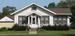 | Armour Historic District | district | 1978 | 78002548 |
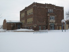 | Delmont Public School | building | 1994 | 94000560 |
 | Delmont Pumphouse | building | 1998 | 98000446 |
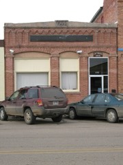 | Delmont State Bank | building | 2008 | 08000044 |
 | Douglas County Courthouse and Auditor's Office | building | 1978 | 78002549 |
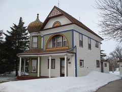 | Thomas Lenehan House | building | 1988 | 88000003 |
 | Stevens Opera Block | building | 1988 | 88002838 |
Every wildfire the federal occurrence database records inside this county: 112 of them, burning about 2,154 acres. 3 started naturally and none was recorded as arson. Each settlement page carries the fires within five miles of it.
| Reported cause | Fires |
|---|---|
| Debris and open burning | 51 |
| Missing data/not specified/undetermined | 27 |
| Equipment and vehicle use | 25 |
| Recreation and ceremony | 3 |
| Natural | 3 |
| Smoking | 2 |
| Fireworks | 1 |
The five largest, by the area the report gives. None of them was recorded as arson.
| Date | Cause | Size | Reported by | Name on the report |
|---|---|---|---|---|
| 15 April 2002 | Debris and open burning | 200 acres | Armour Volunteer Fire Department | HOOGERS #1 |
| 12 April 2006 | Debris and open burning | 191 acres | Lake Andes National Wildlife Refuge | NEW HOLLAND |
| 8 February 2000 | Debris and open burning | 160 acres | Armour Volunteer Fire Department | WATERFOWL |
| 7 April 2004 | Debris and open burning | 160 acres | South Dakota Wildland Fire Suppression | not named |
| 7 February 2000 | Debris and open burning | 140 acres | Lake Andes National Wildlife Refuge | DENNING |
| 30 March 2012 | Missing data/not specified/undetermined | 96 acres | South Dakota Wildland Fire Suppression | REZEK 2012-02 |
| 10 April 2012 | Debris and open burning | 60 acres | South Dakota Wildland Fire Suppression | LEONARD 2012 - 1 |
| 12 October 2014 | Missing data/not specified/undetermined | 60 acres | South Dakota Wildland Fire Suppression | MARRINGTON |
Every settlement page carries the fires within five miles of it - see the settlement index below.
The NOAA Storm Events Database holds 229 reports for this county, causing 1 death, 13 injuries and about $5,094,000 in recorded property damage. Each settlement page carries the reports that name it.
| Kind of event | Reports |
|---|---|
| Hail | 97 |
| Thunderstorm Wind | 83 |
| Tornado | 25 |
| Flash Flood | 13 |
| Flood | 5 |
| Funnel Cloud | 3 |
| Lightning | 1 |
| Wildfire | 1 |
| Heavy Rain | 1 |
The most serious of them, by death, then injury, then recorded damage. The accounts are quoted exactly as the forecast office filed them.
| When | Event | Place named | Harm | What the report says |
|---|---|---|---|---|
| March 2000 | Wildfire | Delmont | 1 killed, 1 hurt, $5,000 | no account filed |
| May 2015 | Tornado (EF2) | Delmont | 9 hurt, $1,500,000 | A tornado, crossing into Douglas County from Charles Mix County, destroyed or damaged 84 structures in and near Delmont, and injured 9 people in Delmont. About 50 of the homes and other structures were destroyed or severely damaged. The damage included numerous small farm buildings totally destroyed, most at four farms south of Delmont, several houses severely damaged, a large and 100 year old church severely damaged, and a newly constructed fire hall destroyed. Power lines and poles were down and the town was without power and water for two days. 100 residents were displaced. |
| June 1969 | Tornado (F2) | not stated | 2 hurt, $25,000 | no account filed |
| May 2017 | Thunderstorm Wind | Armour | 1 hurt, $10,000 | Semi truck and trailer blown off the road. |
| June 1997 | Thunderstorm Wind | Armour | $1,000,000 | no account filed |
| March 2019 | Flood | Joubert | $670,000 | Flooding resulted in extensive damage to public infrastructure including numerous county and township roads, culverts, and some bridges. The property damage costs include estimates for public property losses. |
| June 2024 | Flood | Joubert | $582,000 | Rainfall amounts across Douglas County from June 20-22 ranged from 3 to 5 inches. Some overland flooding ensued with several township roads damaged by flood waters. In addition, three homes reported water damage. Preliminary damage assessments estimate loss to public infrastructure across the county to be 582 thousand dollars. |
| July 1986 | Tornado (F2) | not stated | $250,000 | no account filed |
| June 1975 | Tornado (F0) | not stated | $250,000 | no account filed |
| July 1998 | Hail | Joubert | $200,000 | Large hail devastated crops, broke windows, and caused other damage to buildings and vehicles. |
| September 2019 | Flash Flood | Armour | $100,000 | All roads leading into Delmont became impassable, with 6 inches or more flowing water over the roads. Numerous township roads in southeast Douglas County were also under water with several washed out culverts. |
| June 2020 | Thunderstorm Wind | Harrison | $50,000 | A farmstead suffered damage to several trees and two grain bins. A concrete silo was toppled. Property damage costs are rough estimates. |
| May 2017 | Thunderstorm Wind | Armour | $50,000 | Buildings damaged in Armour. |
| June 2003 | Thunderstorm Wind | Armour | $50,000 | Thunderstorm winds destroyed a large machine shed, ripping its roof off. Two tractors, a van, two loaders and one sprayer inside the shed were damaged. |
| August 2020 | Thunderstorm Wind | Armour | $40,000 | Thunderstorm winds damaged several farm outbuildings. Property damage costs are rough estimates. |
| July 2014 | Thunderstorm Wind | Corsica | $40,000 | Thunderstorm winds blew the roof off a church, damaged structures and seating as a baseball park, and caused widespread tree damage, with one tree falling on a car. The winds were accompanied by large hail. |
| June 2020 | Thunderstorm Wind | Harrison | $35,000 | On a farmstead, a concrete silo was toppled, trees uprooted, and windows broken on the house. Property damage costs are rough estimates. |
| June 2020 | Thunderstorm Wind | Harrison | $30,000 | A concrete silo was toppled and a door to a metal shed bent inward. Property damage costs are rough estimates. |
| July 1986 | Tornado (F1) | not stated | $25,000 | no account filed |
| September 2019 | Flood | Joubert | $21,000 | Water was ponding over Highway 44 one-half mile west of the intersection with U.S. Highway 281. In addition, numerous county and township roads were inundated with water for several days and some loss of crops occurred. |
| June 1997 | Flash Flood | Armour | $20,000 | no account filed |
| September 2019 | Thunderstorm Wind | Joubert | $15,000 | A barn was blown apart by thunderstorm winds north of Joubert. |
| July 2010 | Hail | Corsica | $15,000 | Large hail broke several windows on the north and west side of buildings, damaged vehicles, stripped corn crops in the area and caused other crop damage. The amount of crop damage was not known. |
| July 2007 | Thunderstorm Wind | Harrison | $15,000 | Thunderstorm winds blew down power poles and flattened corn. The amount of crop damage was not known. |
| July 2020 | Flash Flood | Corsica | $10,000 | Roads were flooded over the curb in Armour, with water encroaching on several buildings. Numerous intersections along SD Highway 44 had standing water. Rainfall totaled 3.88 inches 3 miles south southwest of Corsica and 3.16 inches 5 miles west of Armour. Property damage costs are rough estimates. |
| July 2019 | Thunderstorm Wind | Corsica | $10,000 | A farm outbuilding was destroyed by strong thunderstorm winds. |
| July 2010 | Thunderstorm Wind | Corsica | $10,000 | Thunderstorm winds blew down and flattened one grain bin and damaged several others. The winds also caused tree damage, including several trees blown down. |
| July 2010 | Hail | Joubert | $10,000 | Baseball size hail caused an unknown amount of damage to corn and other crops in the area. The hail also damaged vehicles. |
| June 2003 | Thunderstorm Wind | Armour | $10,000 | Thunderstorm winds ripped a porch off a motel. |
| July 1996 | Lightning | Armour | $10,000 | no account filed |
| July 2020 | Thunderstorm Wind | New Holland | $5,000 | Part of a roof was blown off a hoop barn, with numerous tree branches blown off toward the northeast. Photographs provided by the county Emergency Manager. Property damage amounts are rough estimates. |
| July 2020 | Thunderstorm Wind | New Holland | $5,000 | A machine shed walk-in door was ripped from its hinges and thrown 40 to 50 feet. The door was latched at the time of the storm with all other doors closed. Several tree branches from 3 to 4 inches in diameter also downed by the strong winds. Property damage amounts are rough estimates. |
| June 2020 | Flash Flood | Hillside | $5,000 | County roads were flooded from rainfall averaging from 3 to 4 inches across the area. 3.94 inches of rainfall occurred during the overnight and morning hours at Corsica, with 3.33 inches 10 miles west of Dimock. Property damage costs are rough estimates. |
| June 2020 | Thunderstorm Wind | Harrison | $5,000 | Damage was done to several trees, and the covering was ripped off a hoop barn. Property damage costs are rough estimates. |
| July 2014 | Thunderstorm Wind | Delmont | $5,000 | Thunderstorm winds destroyed a machine shed, and caused tree damage. |
| July 1999 | Thunderstorm Wind | Corsica | $5,000 | no account filed |
| September 1985 | Tornado (F0) | not stated | $2,500 | no account filed |
| June 1960 | Tornado (F1) | not stated | $2,500 | no account filed |
| September 2012 | Thunderstorm Wind | Delmont | $1,000 | Thunderstorm winds damaged a metal barn. |
| July 2025 | Thunderstorm Wind | Corsica | - | An extended period of thunderstorm wind gusts was measured by a Road Weather Information System sensor near Corsica. |
| July 2025 | Thunderstorm Wind | Corsica | - | Thunderstorm wind gusts were measured by a Road Weather Information System sensor near Corsica. |
| July 2025 | Thunderstorm Wind | Corsica | - | Thunderstorm wind gusts were measured by a Road Weather Information System sensor near Corsica. |
| July 2025 | Thunderstorm Wind | Armour | - | Thunderstorm wind gusts were measured by a personal weather station. |
| July 2025 | Thunderstorm Wind | Armour | - | Thunderstorm wind gusts were measured by a personal weather station. |
| July 2025 | Thunderstorm Wind | Armour | - | Thunderstorm wind gusts were measured by a personal weather station. |
| July 2025 | Thunderstorm Wind | New Holland | - | Damage throughout town included uprooted trees, roof and siding damage from flying debris, damage to a metal barn, and a bent street sign. |
| June 2025 | Thunderstorm Wind | Corsica | - | An extended period of severe wind gusts was measured by South Dakota RWIS site near Corsica, with the peak wind gust at 2044 CST. |
| June 2025 | Thunderstorm Wind | Corsica | - | Winds were measured by mobile wind equipment. |
| June 2025 | Thunderstorm Wind | Hillside | - | Winds were measured by a personal weather station. |
| July 2024 | Thunderstorm Wind | Corsica | - | A thunderstorm wind gust of 59 mph was measured by the South Dakota Road Weather Information System site near Corsica. |
| July 2024 | Thunderstorm Wind | New Holland | - | Roof decking was removed by thunderstorm winds on the southwest corner of a shouse and tossed for one-quarter mile to the southeast. |
| July 2024 | Thunderstorm Wind | Armour | - | Numerous trees were downed by thunderstorm winds on the north side of Armour. |
| July 2024 | Thunderstorm Wind | Harrison | - | Thunderstorm wind gusts measured on a personal weather station. |
| July 2024 | Thunderstorm Wind | Corsica | - | A long duration of severe wind gusts was measured by the South Dakota Road Weather Information System site near Corsica, with a peak wind gust of 87 mph at 802 pm CST. |
| July 2024 | Thunderstorm Wind | Armour | - | Thunderstorm wind gusts were measured by a personal weather station, with a peak of 68 mph at 801 pm CST. |
| July 2024 | Thunderstorm Wind | Armour | - | Thunderstorm wind gust was measured by personal weather station DVI09260 near Armour. |
| July 2024 | Thunderstorm Wind | Corsica | - | A large cottonwood tree was uprooted by thunderstorm wind gusts. |
| August 2024 | Thunderstorm Wind | New Holland | - | Several smaller tree limbs were downed near New Holland. |
| July 2023 | Hail | Delmont | - | Golf ball to tennis ball sized hail fell straight down, which cracked the windshield on a parked pickup truck. |
| August 2022 | Thunderstorm Wind | Corsica | - | A thunderstorm wind gust of 65 mph was measured by South Dakota Road Weather Information System site SD601 3 miles south of Corsica. Crop damage is an estimate from insured losses. Information provided by the United States Department of Agriculture. |
The Survey's mineral resources record lists 3 workings inside this county. 1 still produces and 2 are closed or unrecorded. Each settlement page carries the workings within five miles of it.
| Commodity | Workings |
|---|---|
| Sand and Gravel, Construction | 3 |
The least common of them first, because a county's hundredth gravel pit says nothing its first ten did not.
| Where | Site | Commodity | Status | Recorded |
|---|---|---|---|---|
| Delmont Hieb Sand Pit | Sand and Gravel, Construction | Past Producer | ||
| Grosz Pit | Sand and Gravel, Construction | Producer | ||
| James Goetz Pit | Sand and Gravel, Construction | Past Producer |
Named settlements recorded in the Geographic Names Information System, each with the topographic sheets covering it. Villages, hamlets and abandoned places alike. Each is shown with the nearest named watercourse or landform and the survey quadrangle it falls on.
Valley township · 57313 · Corsica Lake quadrangle
9 sheets, 1955 to 1990
No longer a settlement
Grandview township · 57328 · Corsica Lake quadrangle
9 sheets, 1955 to 1990
No longer a settlement
The vanished settlements of Douglas County: the places named above that are no longer on the map.