BlockBefore
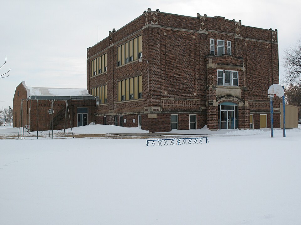
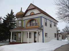
Photograph of Delmont Public School
Photograph by Sdgjake, CC BY-SA 3.0. Via Wikimedia Commons.

Delmont Public School

Listed on the National Register of Historic Places in 1994.

From the record

“The Delmont Public School is a historic former school building at 205 West Third Street in Delmont, South Dakota. It is a three-story brick building, designed by the Nebraska firm of Grabe and Hellberg and built in 1923.”

Wikipedia article Delmont Public School, CC BY-SA 4.0.

One of 7 National Register listings published here for Douglas County · listed in 1994 · category: Building.

Sources: the Wikipedia article · the case file at the National Archives · the National Register database, National Park Service
The listing

  • What is counted as historic. The nomination lists 1 building as contributing to the listing.
  • Address. 205 W. Third, Delmont, 57330
  • When was it listed? June 1994
  • Category. building
  • Township. Belmont township
  • National Register reference number. 94000560 - the number the National Park Service assigned this property when it was listed, and the key its nomination file is catalogued under at the National Archives.

Fires near this property

8 since 2008

Regional context, not property-specific evidence. The federal wildfire occurrence database lists 8 fires within 5 miles of Delmont Public School between 2008 and 2020, burning about 39 acres in total. None started naturally. 1 was recorded as arson. Distance is straight-line from the map coordinates, so a fire counted here may appear on a neighbouring settlement's page as well.

Reported cause Fires
Debris and open burning4
Missing data/not specified/undetermined2
Arson/incendiarism1
Smoking1

The most recent of them, most recent first, with the day each was reported and the service that recorded it.

DateCause SizeReported by Name on the report
5 April 2011Debris and open burningunder an acreSouth Dakota Wildland Fire SuppressionGREEN WOOD COLONY IRON PILE
19 April 2008Debris and open burning5.0 acresSouth Dakota Wildland Fire Suppressionnot named
9 March 2015Smoking3.0 acresSouth Dakota Wildland Fire SuppressionNEW 18 WEST
7 March 2015Missing data/not specified/undeterminedunder an acreSouth Dakota Wildland Fire Suppression1/2 MILE WEST OF DELMONT
21 March 2012Debris and open burning20 acresSouth Dakota Wildland Fire SuppressionMARUIN LAU 2012-01
5 December 2020Debris and open burning10 acresSouth Dakota Wildland Fire SuppressionLEDEBOER202001
18 December 2010Arson/incendiarismunder an acreYankton AgencySANTA CLAUS
14 November 2017Missing data/not specified/undeterminedunder an acreSouth Dakota Wildland Fire SuppressionGOEHRING STALKS

Every fire recorded in Douglas County

Mines and quarries near this property

3 within 5 miles

Regional context, not property-specific evidence. The federal mineral resources record lists 3 workings within 5 miles of Delmont Public School: 2 past producers, 1 producer. 1 still produces. What was taken out: Sand and Gravel, Construction. Distance is straight-line from the map coordinates, so a quarry counted here may appear on a neighbouring settlement's page as well.

Where SiteCommodity StatusRecorded
Delmont Hieb Sand PitSand and Gravel, ConstructionPast Producer
Grosz PitSand and Gravel, ConstructionProducer
James Goetz PitSand and Gravel, ConstructionPast Producer

Every working recorded in Douglas County

Storms near this property

39 since 1999

Regional context, not property-specific evidence. The National Weather Service names Delmont, the town this property stands in, in 39 storm reports between 1999 and 2025: 28 hail, 8 thunderstorm wind, 2 tornado, 1 wildfire. The reports record 1 death and 10 injuries. Each account below is quoted exactly as the forecast office filed it, from the NOAA Storm Events Database, and each date opens the federal record of that event.

WhenEvent Place namedHarm What the report says
March 2000WildfireDelmont1 killed, 1 hurt, $5,000no account filed
May 2015Tornado (EF2)Delmont9 hurt, $1,500,000A tornado, crossing into Douglas County from Charles Mix County, destroyed or damaged 84 structures in and near Delmont, and injured 9 people in Delmont. About 50 of the homes and other structures were destroyed or severely damaged. The damage included numerous small farm buildings totally destroyed, most at four farms south of Delmont, several houses severely damaged, a large and 100 year old church severely damaged, and a newly constructed fire hall destroyed. Power lines and poles were down and the town was without power and water for two days. 100 residents were displaced.
July 2014Thunderstorm WindDelmont$5,000Thunderstorm winds destroyed a machine shed, and caused tree damage.
September 2012Thunderstorm WindDelmont$1,000Thunderstorm winds damaged a metal barn.
July 2023HailDelmont-Golf ball to tennis ball sized hail fell straight down, which cracked the windshield on a parked pickup truck.
June 2022Thunderstorm WindDelmont-The temporary roof was blown off a school.
June 2020HailDelmont-Crop damage is an estimate from insured losses. Information provided by the United States Department of Agriculture.
July 2019Thunderstorm WindDelmont-Significant tree damage and some damage to buildings in town. Power was knocked out to most of the town through the morning hours.
April 2018HailDelmont-First of two quarter size hail events for the day.
April 2018HailDelmont-The ground was covered with three to four inches of hail. Hail was accompanied by 25 to 30 mph winds, which pounded some paint off an outbuilding.
July 2014HailDelmont-Large hail, driven by strong winds, broke windows and dented vehicles.
September 2012HailDelmont-Large hail was accompanied by damaging wind gusts.
September 2006HailDelmont-Large hail damaged siding, windows, and cars. The damage was significant but confined to a small area according to local law enforcement. The amount of damage was not known.
September 2006Tornado (F0)Delmont-A brief tornado caused no reported damage.
August 2004Thunderstorm WindDelmont-Thunderstorm winds damaged power lines, causing a power outage.
August 2025HailDelmont-no account filed
July 2023HailDelmont-no account filed
April 2022HailDelmont-no account filed
April 2018HailDelmont-no account filed
August 2017HailDelmont-no account filed
June 2017HailDelmont-no account filed
May 2011HailDelmont-no account filed
June 2010HailDelmont-no account filed
June 2009HailDelmont-no account filed
June 2008Thunderstorm WindDelmont-no account filed
June 2008HailDelmont-no account filed
May 2008HailDelmont-no account filed
August 2007HailDelmont-no account filed
July 2004HailDelmont-no account filed
August 2002HailDelmont-no account filed
August 2002Thunderstorm WindDelmont-no account filed
August 2002HailDelmont-no account filed
May 2000Thunderstorm WindDelmont-no account filed
May 1999HailDelmont-no account filed

Every storm recorded in Douglas County

Map coverage status

No historic map-sheet match is published for this property yet. That does not mean no map exists. This record needs a coordinate-quality review before it can be joined to a sheet boundary. Browse the county's mapped places while that work is pending.

Listed places nearby

4 within 8 miles

Other National Register properties close enough to walk or drive between, ordered by distance from this one. Both positions come from the same geocoding pass that matched these properties to their map sheets.

Photograph PropertyDistance Listed
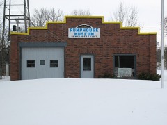
Delmont Pumphouse0.2 miles1998
Thomas Lenehan House0.2 miles1988
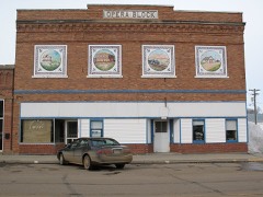
Stevens Opera Block0.2 miles1988
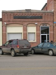
Delmont State Bank0.3 miles2008

Sources for this property

National Archives recordThe nomination case file for reference 94000560 in Record Group 79.
Wikipedia articleCommunity-written account of this property, licensed CC BY-SA.
Douglas CountyAll 7 listed properties in this county.

Provenance

  • Listing record. National Park Service National Register of Historic Places, listed-properties dataset, current to 2026-05-22.
  • Map join. Address geocoded through the United States Census geocoder, then tested against the published boundary of every sheet in the USGS Historical Topographic Map Collection.
  • How this page is made. Listing fields come from federal records; map-sheet coverage is a labelled coordinate-to-boundary calculation, not a source-field claim.
  • Wildfire. Short, Karen C. 2022. Spatial wildfire occurrence data for the United States, 1992-2020 [FPA_FOD_20221014]. 6th Edition. Fort Collins, CO: Forest Service Research Data Archive. https://doi.org/10.2737/RDS-2013-0009.6 Collected with United States Government funding and usable without additional permissions or fees.
  • Mines and quarries. USGS Mineral Resources Data System (MRDS) https://mrdata.usgs.gov/mrds/ A work of the United States government, no copyright under 17 U.S.C. 105.
  • Storms. NOAA National Centers for Environmental Information, Storm Events Database https://www.ncei.noaa.gov/stormevents/ A work of the United States government, no copyright under 17 U.S.C. 105. Narratives are quoted verbatim from the National Weather Service report and are not edited or summarised.