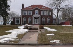
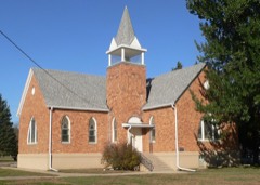
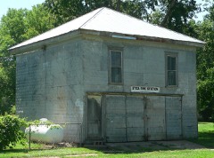
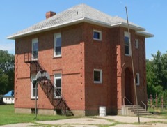
Block
From the record
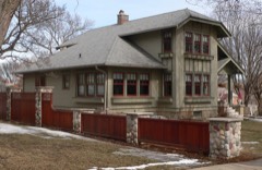
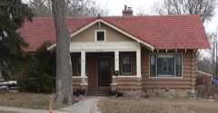
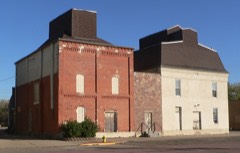
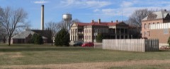
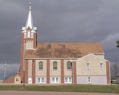
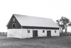
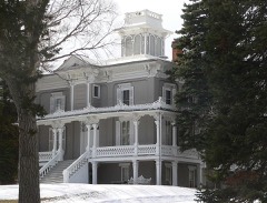
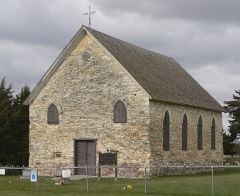
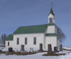
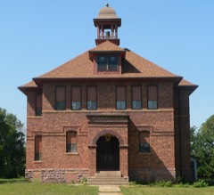
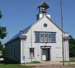
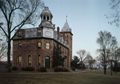
78 National Register listings published here.
Sources: the National Register database, National Park Service
38 topographic sheets cover 18 settlements here, and 78 properties are on the National Register of Historic Places.
78 National Register listings published here.
Sources: the National Register database, National Park Service
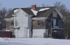
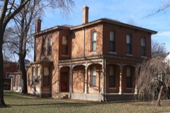
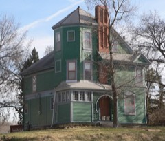
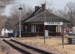
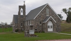
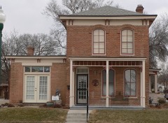
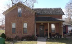
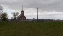
Every property in this county listed on the National Register of Historic Places, with the year it was listed and the federal nomination document.
Every wildfire the federal occurrence database records inside this county: 232 of them, burning about 6,036 acres. 2 started naturally and 1 was recorded as arson. Each settlement page carries the fires within five miles of it.
| Reported cause | Fires |
|---|---|
| Missing data/not specified/undetermined | 130 |
| Debris and open burning | 65 |
| Equipment and vehicle use | 13 |
| Smoking | 8 |
| Fireworks | 4 |
| Power generation/transmission/distribution | 4 |
| Natural | 2 |
| Misuse of fire by a minor | 2 |
| Recreation and ceremony | 2 |
| Arson/incendiarism | 1 |
| Railroad operations and maintenance | 1 |
The five largest, by the area the report gives. None of them was recorded as arson.
| Date | Cause | Size | Reported by | Name on the report |
|---|---|---|---|---|
| 15 October 2020 | Equipment and vehicle use | 800 acres | South Dakota Wildland Fire Suppression | MARQUARDT FIRE |
| 17 March 2009 | Power generation/transmission/distribution | 600 acres | South Dakota Wildland Fire Suppression | NE JIM RIVER ROAD |
| 16 March 2009 | Power generation/transmission/distribution | 550 acres | South Dakota Wildland Fire Suppression | not named |
| 1 November 1999 | Debris and open burning | 500 acres | Yankton Volunteer Fire Department | CEDER HILLS REKINDLE |
| 27 October 1999 | Missing data/not specified/undetermined | 400 acres | Yankton Volunteer Fire Department | SCHWIETZER |
| 21 October 2014 | Missing data/not specified/undetermined | 235 acres | South Dakota Wildland Fire Suppression | BUSHNELL LAKEBED |
| 1 November 1999 | Missing data/not specified/undetermined | 200 acres | Yankton Volunteer Fire Department | NELSON |
| 25 April 2011 | Missing data/not specified/undetermined | 120 acres | South Dakota Wildland Fire Suppression | SCHARUMM COMPLEX |
Every settlement page carries the fires within five miles of it - see the settlement index below.
The NOAA Storm Events Database holds 531 reports for this county, causing 1 death, 3 injuries and about $50,805,600 in recorded property damage. Each settlement page carries the reports that name it.
| Kind of event | Reports |
|---|---|
| Hail | 252 |
| Thunderstorm Wind | 161 |
| Flood | 69 |
| Tornado | 29 |
| Flash Flood | 14 |
| Lightning | 5 |
| Heavy Rain | 1 |
The most serious of them, by death, then injury, then recorded damage. The accounts are quoted exactly as the forecast office filed them.
| When | Event | Place named | Harm | What the report says |
|---|---|---|---|---|
| July 2003 | Lightning | Midway | 1 killed, 1 hurt | Two brothers, age 19 and 17, were struck by lightning while swimming in Lewis and Clark Lake. The 19 year old died later the same day, while the 17 year old survived his injuries. |
| May 2007 | Tornado (EF1) | Yankton | 1 hurt, $100,000 | A tornado damaged two homes, including one roof taken off, destroyed a garage, and caused tree damage. One camper at Lewis and Clark Recreation Area was injured when thrown into trees. |
| June 2021 | Thunderstorm Wind | Yankton | 1 hurt, $1,000 | Thunderstorm winds toppled a large tree at the Marne Creek Apartments on the west edge of Yankton. An elderly man was (directly) injured when the tree fell near the building entrance. The man was taken to a local hospital to recover from injuries. Property damage costs are a rough estimate. |
| April 2019 | Flood | Jamesville | $20,000,000 | Continued precipitation with high water levels damaged county and township roadways during April. 260 miles of gravel roads were reported completely unusable at times during the month. |
| March 2019 | Flood | Utica | $9,800,000 | Street flooding in numerous intersections within the city of Yankton. A high number of flooded basements also reported, especially along Marne Creek. Other flooding resulted in extensive damage to public infrastructure including numerous county and township roads, culverts, and some bridges. |
| July 2009 | Hail | Lesterville | $5,000,000 | Large hail, accompanied in places by damaging winds, destroyed or severely damaged crops in an area up to 10 miles wide from northwestern to southeastern Yankton County. Estimates from the Farm Service Agency were at least 48 thousand acres of corn, soybean, and alfalfa crops that were affected, some of which were totally destroyed. The hail also broke windows in buildings and vehicles, severely dented and even punched holes in numerous vehicles, and damaged siding and roofs of buildings. Property damage was especially great in and near the cities of Yankton and Gayville. Most of about 200 skylights in a Wal-Mart store in Yankton were broken beyond repair. Some of the windows in vehicles were completely broken and removed by the hail. |
| July 2009 | Hail | Yankton | $3,000,000 | Large hail broke windows, damaged vehicles, and damaged trees. |
| June 1979 | Tornado (F1) | not stated | $2,500,000 | no account filed |
| June 1965 | Tornado (F4) | not stated | $2,500,000 | no account filed |
| August 2011 | Hail | (Ykn)Chan Gurney Arp | $2,000,000 | Large hail up to golf ball size, driven by strong to damaging winds, caused widespread property and crop damage in and near Yankton. Numerous windows were broken, both in structures and in vehicles, roofs and siding were damaged in several homes and businesses, and trees were stripped. Corn and other crops in the area were heavily damaged, with crops totally stripped in some areas. The amount of crop damage could not yet be determined. |
| September 2019 | Flood | Jamesville | $1,500,000 | Flooding continued from August, but the James River near Yankton (YNNS2) soon fell below flood stage on September 4. However, excessive rainfall of 4 to 8 inches upstream September 10-12 (7.54 inches at Mitchell and 7.21 inches 7 miles south of Parkston) led to a rapid rise and a record crest 15.1 feet above flood stage on September 14. Five of the six bridges crossing the James River in Yankton county were closed. Innumerable roads were inundated and closed for several days, including major roadways of Highway 81 north of Yankton and Highway 46 west of Irene. Extensive amounts of agricultural land were inundated. Fifty-five homes were impacted by flood waters in Yankton county, with residents forced to take temporary shelter until floodwaters receded. Minor flooding continued at the end of the month. |
| April 2011 | Flood | Jamesville | $1,000,000 | Major flooding of the James River, as well as flooding of small streams and lakes in the county, continued through April. Much farmland remained flooded, both near to and away from the James River. The James River was 9.2 feet above flood stage near Yankton April 1st, and fell very slowly during the month. A large area of land and numerous roads were flooded at the start of the month. Water was running over other roads, from flooded streams, creeks, and fields as well as from the James River. Many roads were heavily damaged. Some homes and businesses were also flooded, with the flooding of these places slowly alleviating through the month. High water and groundwater levels from record precipitation in the year 2010, a main reason the flooding onset was so fast in March, was also a main reason that the flooding subsided so slowly during April. |
| August 2011 | Thunderstorm Wind | Yankton | $500,000 | Thunderstorm winds caused widespread tree damage, including numerous trees blown down. Some homes were damaged by falling trees or tree debris. The winds drove hail that was up to golf ball size, and with the hail contributed to crop damage in the area. |
| July 2009 | Hail | Utica | $500,000 | Large hail damaged vehicles and broke windows. The hail was accompanied by wind gusts up to 50 mph. |
| September 1972 | Tornado (F2) | not stated | $250,000 | no account filed |
| June 2024 | Flood | Utica | $227,000 | Rainfall amounts across Yankton County from June 20-22 ranged from 1 to 3 inches. Farther north and upstream, 5 to 10 inches of rain fell across portions of southeast South Dakota. This rainfall resulted in major flooding along the James River and extensive overland flooding along the adjoining flood plain. Some overland flooding also occurred along Clay Creek and the Marindahl Lake area. ||Multiple county roads succumbed to flood waters and were closed with some damages reported. Preliminary damage assessments estimate loss to public infrastructure to be nearly 227 thousand dollars. ||For additional information on river flooding, please see other flood entries for Yankton County. |
| July 2004 | Thunderstorm Wind | Yankton | $200,000 | Thunderstorm winds blew down power poles and lines and significantly damaged at least 6 houses. Some of the houses had holes blown in the walls from the flying debris. Significant tree damage also occurred with 10 to 20 trees uprooted. |
| July 1997 | Thunderstorm Wind | Lesterville | $200,000 | no account filed |
| August 1996 | Thunderstorm Wind | Yankton | $200,000 | no account filed |
| September 2019 | Flood | Utica | $165,000 | Flooding resulted in crop losses and damage to public infrastructure including county and township roads and culverts. Crop loss estimates provided by the United States Department of Agriculture. |
| June 2010 | Thunderstorm Wind | Mission Hill | $100,000 | Thunderstorm winds destroyed several large grain bins, blew down power lines and poles, and caused widespread tree damage, including several large trees blown down. |
| May 2007 | Tornado (EF2) | Lesterville | $100,000 | A tornado destroyed 3 concrete silos, destroyed numerous outbuildings, heavily damaged a large shed, damaged a barn, caused tree damage, and caused other damage on a farm. |
| May 2007 | Flood | Jamesville | $100,000 | Heavy rainfall caused flooding of low areas including fields, homes, businesses, schools, roads, streams, and bridges. The flooding was a longer term event than flash flooding, which also had resulted. Long term major flooding of the James River also resulted. Some parks and other recreation areas were affected. The flooding delayed planting of crops in some areas. |
| August 2000 | Thunderstorm Wind | Mission Hill | $70,000 | Thunderstorm winds damaged three mobile homes, and also damaged trees and power lines. |
| June 2014 | Flood | Jamesville | $50,000 | Persistent moderate to heavy rain caused flooding of fields and other lowlands, including several roads, homes, and businesses. This flooding lasted for almost two days, and was aggravated locally by additional storms during that time. Some roads were damaged or washed out. |
| August 2010 | Thunderstorm Wind | Napa | $50,000 | Thunderstorm winds overturned several campers and caused widespread tree damage, including large trees blown down at a Lewis and Clark Lake campground. A fee collector was injured by tree debris.. |
| August 2000 | Thunderstorm Wind | Yankton | $50,000 | Thunderstorm winds caused tree and power line damage. There was also some damage to vehicles from tree debris. |
| September 1993 | Thunderstorm Wind | Yankton | $50,000 | Strong thunderstorm winds damaged a grain elevator in Irene and also caused some roof and tree damage. |
| August 1993 | Thunderstorm Wind | Yankton | $50,000 | Thunderstorm winds blew over some trees and branches causing damage to several vehicles. There was also 1.30 to 2.30 inches of rain in the area. |
| July 1998 | Flash Flood | Lesterville | $50,000 | no account filed |
| July 1997 | Thunderstorm Wind | Yankton | $50,000 | no account filed |
| July 2020 | Thunderstorm Wind | Mission Hill | $30,000 | While dime size hail and winds to around 60 mph occurred in Mission Hill, it was part of a 3 mile wide swath of more significant wind-driven hail from around 4 miles north northwest of Mission Hill to a mile south of Mission Hill. Corn and soybean fields were pulverized to stubble, with most trees stripped of leaves. At a farm 3 miles northwest of Mission Hill, a grain bin, machine shed and trailer home each lost part of the roof. Along the path, three center irrigation pivots were overturned. Property damage costs are rough estimates. Crop damage is an estimate from insured losses. Information provided by the United States Department of Agriculture. |
| July 2000 | Thunderstorm Wind | Yankton | $30,000 | Thunderstorm winds caused tree damage, including small trees blown down. The winds also blew down power lines, causing power outages in several parts of Yankton. |
| September 2019 | Flood | Jamesville | $25,000 | A continuation of flooding from August; after falling briefly below flood stage on September 10, the James River near Scotland (gage site SCOS2) responded to excessive rainfall of 4 to 8 inches upstream September 10-12 (7.54 inches at Mitchell and 7.21 inches 7 miles south of Parkston) to crest at a record 9.24 feet above flood stage on September 13. Innumerable roads were inundated and closed for several days, including South Dakota Highway 44 near Milltown, Parkston and Freeman, Highway 18 near Olivet, Highway 81 north of Yankton, Highway 46 west of Irene and 431st Avenue in northern Yankton county - all major area roadways. Extensive amounts of agricultural land were inundated. Moderate flooding continued at the end of the month. |
| June 2010 | Thunderstorm Wind | Lesterville | $25,000 | Thunderstorm winds damaged grain bins, caused damage to several roofs, and caused tree damage, including several trees uprooted. |
| April 1985 | Tornado (F2) | not stated | $25,000 | no account filed |
| June 1975 | Tornado (F0) | not stated | $25,000 | no account filed |
| May 1965 | Tornado (F2) | not stated | $25,000 | no account filed |
| May 1962 | Tornado (F1) | not stated | $25,000 | no account filed |
| May 1959 | Tornado (F3) | not stated | $25,000 | no account filed |
| June 1954 | Tornado (F3) | not stated | $25,000 | no account filed |
| June 1954 | Tornado (F3) | not stated | $25,000 | no account filed |
| September 1997 | Thunderstorm Wind | Utica | $20,000 | Thunderstorm winds destroyed a pole barn, at least two utility poles, and caused tree damage. |
| August 2019 | Flood | Jamesville | $10,000 | A continuation of flooding from July, the James River near Scotland (gage site SCOS2) crested at 3.33 feet above flood stage on August 13. Many rural roads near the river were inundated, with flooding of significant amounts of agricultural land. Moderate flooding continued at the end of the month. |
| August 2019 | Flood | Jamesville | $10,000 | The James River near Yankton (gage site YNNS2) crested 2.38 feet above flood stage on August 5, and again at 2.51 feet above flood stage on August 20. Significant amounts of agricultural land were once again flooded. The river remained in minor flood stage at the end of the month. |
| June 2014 | Thunderstorm Wind | Midway | $10,000 | Thunderstorm winds blew a sheet metal building onto the intersection of South Dakota Highway 46 and U. S. Highway 81. |
| May 2014 | Thunderstorm Wind | Napa | $10,000 | Thunderstorm winds blew down at least 3 power poles, causing power outages. |
| June 2011 | Thunderstorm Wind | Yankton | $10,000 | Thunderstorm winds blew down large limbs and power lines. |
| August 2011 | Hail | Gayville | $10,000 | Large hail dented vehicles and caused crop damage. The amount of crop damage was not known from this hail or from earlier hail in the same afternoon. |
| May 2008 | Thunderstorm Wind | Volin | $10,000 | Thunderstorm winds blew down power lines. |
| June 2006 | Hail | Lesterville | $10,000 | Large hail broke windows and severely damaged siding on at least two homes. The hail also severely damaged corn and soybean crops. The amount of crop damage could not be determined because the extent of crop recovery could not be known for a long time. However, some crops were severely enough damaged to require replanting. |
| July 2001 | Lightning | Yankton | $10,000 | Lightning struck the tower of a radio station, damaging transmitting equipment and knocking the station off the air temporarily. |
| June 2000 | Thunderstorm Wind | Gayville | $10,000 | Thunderstorm winds caused tree damage, including several trees blown down. |
| October 2019 | Flood | Jamesville | $5,000 | A continuation of flooding from September, the James River near Scotland (gage site SCOS2) began the month on October 1 in moderate flood at 1.85 feet above flood stage. Significant flooding of agricultural lands continued. Property damage costs are rough estimates. |
| October 2019 | Flood | Jamesville | $5,000 | Flooding from September continued, but water levels on the James River near Yankton (YNNS2) fell below flood stage by October 4. Significant amounts of agricultural land remained flooded at the start of the month. Property damage costs are rough estimates. |
| July 2010 | Lightning | Yankton | $5,000 | Lightning struck a meter on a business, causing a fire which caused relatively minor damage to the building. |
| May 2008 | Thunderstorm Wind | Mission Hill | $5,000 | Thunderstorm winds damaged a garage. |
| July 1998 | Thunderstorm Wind | Yankton | $5,000 | Thunderstorm winds caused minor tree damage. |
| August 1972 | Tornado (F2) | not stated | $2,500 | no account filed |
| May 1965 | Tornado (F1) | not stated | $2,500 | no account filed |
The Survey's mineral resources record lists 43 workings inside this county. 8 still produce and 35 are closed or unrecorded. Each settlement page carries the workings within five miles of it.
| Commodity | Workings |
|---|---|
| Sand and Gravel, Construction | 41 |
| Stone, Crushed/Broken | 2 |
The least common of them first, because a county's hundredth gravel pit says nothing its first ten did not.
| Where | Site | Commodity | Status | Recorded |
|---|---|---|---|---|
| Knutsen Quarry | Stone, Crushed/Broken | Producer | ||
| Western Portland Cement Co Quarry | Stone, Crushed/Broken | Past Producer | ||
| Bohlmann Gravel Pit | Sand and Gravel, Construction | Producer | ||
| Chris Dolrup Gravel Pit | Sand and Gravel, Construction | Past Producer | ||
| Erickson Gravel Pit | Sand and Gravel, Construction | Past Producer | ||
| Gorset Pit | Sand and Gravel, Construction | Past Producer | ||
| Gravel Pit | Sand and Gravel, Construction | Past Producer | ||
| Gravel Pit | Sand and Gravel, Construction | Past Producer | ||
| Gravel Pit | Sand and Gravel, Construction | Past Producer | ||
| Gravel Pit | Sand and Gravel, Construction | Past Producer | ||
| Gravel Pit | Sand and Gravel, Construction | Past Producer | ||
| Gravel Pit | Sand and Gravel, Construction | Past Producer | ||
| Gravel Pit | Sand and Gravel, Construction | Past Producer | ||
| Gravel Pit | Sand and Gravel, Construction | Past Producer | ||
| Gravel Pit | Sand and Gravel, Construction | Past Producer | ||
| Gravel Pit | Sand and Gravel, Construction | Past Producer | ||
| Gravel Pit | Sand and Gravel, Construction | Past Producer | ||
| Gravel Pit | Sand and Gravel, Construction | Past Producer | ||
| Gravel Pit | Sand and Gravel, Construction | Past Producer | ||
| Gravel Pit | Sand and Gravel, Construction | Past Producer | ||
| Gravel Pit | Sand and Gravel, Construction | Past Producer | ||
| Gravel Pit | Sand and Gravel, Construction | Past Producer | ||
| Gravel Pit | Sand and Gravel, Construction | Past Producer | ||
| Gravel Pit | Sand and Gravel, Construction | Past Producer | ||
| Hauck Gravel Pit | Sand and Gravel, Construction | Past Producer | ||
| Henry Dutton Gravel Pit | Sand and Gravel, Construction | Past Producer | ||
| Knutsen Sand & Gravel Pit | Sand and Gravel, Construction | Past Producer | ||
| M T Johnson Pit | Sand and Gravel, Construction | Past Producer | ||
| Nels Nelson Gravel Pit | Sand and Gravel, Construction | Past Producer | ||
| Old Allen Pit | Sand and Gravel, Construction | Past Producer | ||
| Olson Gravel Pit | Sand and Gravel, Construction | Past Producer | ||
| Oursland Pit | Sand and Gravel, Construction | Producer | ||
| Peter Jonason Gravel Pit | Sand and Gravel, Construction | Past Producer | ||
| Peterson Gravel Pit | Sand and Gravel, Construction | Past Producer | ||
| Sandburg Gravel Pit | Sand and Gravel, Construction | Past Producer | ||
| Schram Gravel Pit | Sand and Gravel, Construction | Past Producer | ||
| Sigel Gravel Pit | Sand and Gravel, Construction | Past Producer | ||
| Sparks Pit | Sand and Gravel, Construction | Producer | ||
| Velleck Sand & Gravel Pit | Sand and Gravel, Construction | Producer | ||
| Volin Gravel Pit | Sand and Gravel, Construction | Producer | ||
| Will Jonason Gravel Pit | Sand and Gravel, Construction | Past Producer | ||
| Yankton Sand and Gravel | Sand and Gravel, Construction | Producer | ||
| Yankton Sand and Gravel Pit | Sand and Gravel, Construction | Producer |
Named settlements recorded in the Geographic Names Information System, each with the topographic sheets covering it. Villages, hamlets and abandoned places alike. Each is shown with the nearest named watercourse or landform and the survey quadrangle it falls on.
West Yankton unorganized territory · 57078 · Near Sego Island (historical) · Tabor SE quadrangle
10 sheets, 1955 to 1985
West Yankton unorganized territory · 57040 · Lesterville quadrangle
11 sheets, 1898 to 1985
West Yankton unorganized territory · 57078 · Near Sego Island (historical) · Tabor SE quadrangle
10 sheets, 1955 to 1985
West Yankton unorganized territory · 57078 · Near Sego Island (historical) · Tabor SE quadrangle
10 sheets, 1955 to 1985
West Yankton unorganized territory · 57037 · Jamesville quadrangle
11 sheets, 1898 to 1985
Yankton city · 57078 · Near Green Island (historical) · Gavins Point Dam quadrangle
10 sheets, 1955 to 1985