 Block
From the record
One of 107 National Register listings published here for Minnehaha County · listed in 2021 · category: Building · built in 1902, Folk Victorian.
Sources: the National Register database, National Park Service
Built in 1902 (Folk Victorian). Listed on the National Register of Historic Places in 2021.
One of 107 National Register listings published here for Minnehaha County · listed in 2021 · category: Building · built in 1902, Folk Victorian.
Sources: the National Register database, National Park Service
Regional context, not property-specific evidence. The federal wildfire occurrence database lists 47 fires within 5 miles of Ole E. Fauske House between 1999 and 2020, burning about 1,927 acres in total. None started naturally. 1 was recorded as arson. Distance is straight-line from the map coordinates, so a fire counted here may appear on a neighbouring settlement's page as well.
| Reported cause | Fires |
|---|---|
| Missing data/not specified/undetermined | 25 |
| Equipment and vehicle use | 6 |
| Debris and open burning | 5 |
| Smoking | 4 |
| Fireworks | 2 |
| Recreation and ceremony | 2 |
| Arson/incendiarism | 1 |
| Power generation/transmission/distribution | 1 |
| Railroad operations and maintenance | 1 |
The most recent of them, most recent first, with the day each was reported and the service that recorded it.
| Date | Cause | Size | Reported by | Name on the report |
|---|---|---|---|---|
| 29 September 2020 | Equipment and vehicle use | 40 acres | South Dakota Wildland Fire Suppression | INC # 106 9/29/2020 |
| 27 September 2020 | Equipment and vehicle use | 5.0 acres | South Dakota Wildland Fire Suppression | INC NO 104 9/27.2020 |
| 25 September 2014 | Missing data/not specified/undetermined | 36 acres | South Dakota Wildland Fire Suppression | FULTON TREE LINE FIRE |
| 14 September 2020 | Railroad operations and maintenance | under an acre | South Dakota Wildland Fire Suppression | I90 FIRE |
| 13 September 2012 | Debris and open burning | 5.0 acres | South Dakota Wildland Fire Suppression | 2012-491 |
| 9 August 2012 | Missing data/not specified/undetermined | 1.0 acres | South Dakota Wildland Fire Suppression | 2012-429 |
| 7 July 2012 | Smoking | 1.0 acres | South Dakota Wildland Fire Suppression | 2012-392 |
| 5 July 1999 | Fireworks | 22 acres | McLaughlin Volunteer Fire Department | DUMPSTER / GRASS |
Regional context, not property-specific evidence. The federal mineral resources record lists 9 workings within 5 miles of Ole E. Fauske House: 5 past producers, 3 unknowns, 1 producer. 1 still produces. What was taken out: Sand and Gravel, Construction. Distance is straight-line from the map coordinates, so a quarry counted here may appear on a neighbouring settlement's page as well.
| Where | Site | Commodity | Status | Recorded |
|---|---|---|---|---|
| Albert Anderson Sand Pit | Sand and Gravel, Construction | Past Producer | ||
| Brandon City Pit | Sand and Gravel, Construction | Past Producer | ||
| Brandon Materials | Sand and Gravel, Construction | Producer | ||
| Highway Pit | Sand and Gravel, Construction | Past Producer | ||
| Railroad Pit | Sand and Gravel, Construction | Past Producer | ||
| Rovac Gravel Pit | Sand and Gravel, Construction | Unknown | ||
| Sand & Gravel Pit | Sand and Gravel, Construction | Past Producer | ||
| Scholten Pit | Sand and Gravel, Construction | Unknown | ||
| Swanson Gravel Pit | Sand and Gravel, Construction | Unknown |
Regional context, not property-specific evidence. The National Weather Service names Corson, the town this property stands in, in 12 storm reports between 2010 and 2025: 4 hail, 3 flood, 2 thunderstorm wind, 1 heavy rain. No death or injury is recorded in these reports. Each account below is quoted exactly as the forecast office filed it, from the NOAA Storm Events Database, and each date opens the federal record of that event.
| When | Event | Place named | Harm | What the report says |
|---|---|---|---|---|
| May 2022 | Tornado (EF1) | Corson | - | A tornado developed approximately two miles east of Brandon, just south of State Highway 138 west of 484th Avenue. The tornado moved eastward and toppled several large trees shortly after touchdown, then turned to more of a east-southeast direction. After tracking about one-quarter mile, the tornado did the greatest damage along its track at the Beaver Valley Lutheran Church, where a large portion of the roof was removed. The tornado continued another couple tenths of a mile across open fields before it dissipated. The estimated maximum wind speed was 105 mph and the average path width was 50 yards. |
| June 2022 | Thunderstorm Wind | Corson | - | A large tree limb was blown down by thunderstorm winds. |
| June 2020 | Funnel Cloud | Corson | - | Multiple reports were received from spotters and law enforcement of non-thunderstorm funnel clouds. |
| June 2014 | Heavy Rain | Corson | - | Rainfall of 3.71 inches was recorded. |
| May 2012 | Flood | Corson | - | Heavy rain caused minor lowland flooding of Split Rock Creek. The creek crested at 1.98 feet above flood stage on May 7th. |
| September 2012 | Thunderstorm Wind | Corson | - | Thunderstorm winds caused tree damage. |
| September 2010 | Flood | Corson | - | Heavy rain caused record flooding of Split Rock Creek. Numerous roads and yards were flooded in and near Corson and Brandon, with the water reaching some homes and businesses, including two local golf courses. Further threatened flooding was partially prevented by sandbagging. The creek crested at 6.84 feet above flood stage at Corson on September 24th. |
| March 2010 | Flood | Corson | - | Rapid melting of a heavy winter snowpack caused flooding of Split Rock creek in the Corson area, with a crest of 2.5 feet above flood stage reported. The flooding affected farmland near the creek. |
| June 2025 | Hail | Corson | - | no account filed |
| July 2019 | Hail | Corson | - | no account filed |
| June 2014 | Hail | Corson | - | no account filed |
| May 2011 | Hail | Corson | - | no account filed |
No historic map-sheet match is published for this property yet. That does not mean no map exists. This record needs a coordinate-quality review before it can be joined to a sheet boundary. Browse the county's mapped places while that work is pending.
Other National Register properties close enough to walk or drive between, ordered by distance from this one. Both positions come from the same geocoding pass that matched these properties to their map sheets.
| Photograph | Property | Distance | Listed |
|---|---|---|---|
| Valley Springs Rest Stop Tipi | 5.6 miles | 2015 | |
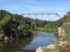 | Palisades Bridge | 5.7 miles | 1999 |
 | Bridge at Iverson Crossing | 6.2 miles | 1996 |
 | Shafer Round Barn | 6.4 miles | 1995 |
| Renner Lutheran Sanctuary | 7.5 miles | 1980 | |
| Slip Up Creek Homestead | 7.7 miles | 2003 |
| National Archives record | The nomination case file for reference 100007110 in Record Group 79. |
| Minnehaha County | All 107 listed properties in this county. |