 Block
From the record
One of 107 National Register listings published here for Minnehaha County · listed in 1996 · category: Structure.
Sources: the case file at the National Archives · the National Register database, National Park Service
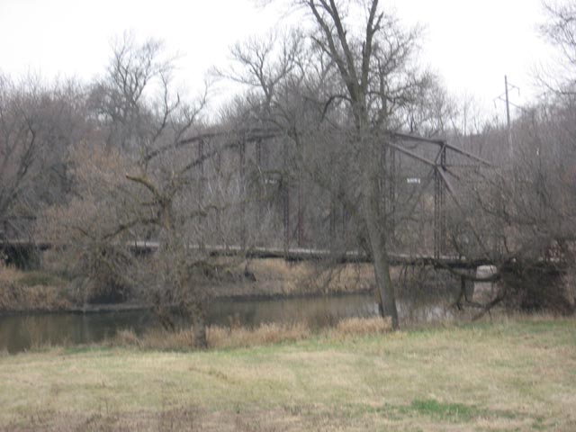
Listed on the National Register of Historic Places in 1996.
One of 107 National Register listings published here for Minnehaha County · listed in 1996 · category: Structure.
Sources: the case file at the National Archives · the National Register database, National Park Service
The chapter on Sioux Falls City in History of Minnehaha County, South Dakota. Containing an Account of Its Settlements, Growth, Development and Resources ... Synopsis of Public Records, Biographical Sketches .., published 1899 names Brandon. This is what it says, exactly as the scans read.
Telephone. - In March, 1882, the Northwestern Telephone Exchange Company was org-anized with a capital of ten thousand dollars, with a view of establishing a telephone system in Sioux Palls. The instruments arrived the September following, and soon after a telephone system in the city was an accomplished fact. In July, 1883, this company transferred its property to the Erie Telegraph and Telephone Co., a New York corporation. There was quite a war between this company and the city authorities during that year, an account of which will be found in the chapter devoted to the incorporation of the city of Sioux Palls.' It was only a short time before the property was transferred to the Northwestern Telephone Exchange Co., and under its managment the system in Sioux Palls has been greatly improved. During the spring of 1895 this company extended its line to Dell Rapids, and on the 21st day of June of that year the first message was transmitted from Dell Rapids to Sioux Palls by George D. Sherman, then manag-er of the company at this point. In 18%, lines were extended by the same compan}^ from Sioux Palls to Valley Springs, Hartford, Humboldt, Montrose, Salem, Canton, Worthing, Lennox and Parker. The system was completed to Brandon and Valley Springs during the first week in October, 1896, and to the other towns above named, on the 12th day of the same month. On the 3d day of March, 1897, the long distance telephone service of this company was completed, and Sioux Palls for the first time was placed in telephone connection with St. Paul, Minneapolis, Winona, La Crosse, Pargo and Grand Porks. The event was made memorable by an entertainment given by the company to the people of Sioux Palls, at which time they enjoyed the novelty of listening to music furnished by orchestras in Minneapolis, Winona and Pargo. In the fall of 1897, this company, having purchased the Iowa Telephone Company's line connecting Elk Point and Vermillion with Sioux City, extended its line from Canton to Sioux City, and from Vermillion to Yankton, and in September, 1898, extended the line from Yankton to Parker.
Passage source: History of Minnehaha County, South Dakota. Containing an Account of Its Settlements, Growth, Development and Resources ... Synopsis of Public Records, Biographical Sketches .., published 1899.
Hospitals. - A hospital was established in the city of Sioux Falls during- the fall of 1888. It was located on the east side of the river, and was principally the work of the Rev. Frederick Gardiner, then rector of the Episcopal church in Sioux Falls. But there was not at that time sufficient interest taken in such an enterprise to make it a success, and after a few months the project was abandoned until the summer of 1894, when a few g-entlemen of Sioux Falls and vicinity conceived the idea of establishing- a hospital in the city. It was incorporated June 14, 1894, and was called the Sioux Falls Hospital. The first directors of the corporation were B. H. Lien, A. Christopherson, J. W. Jensen, A. Mikkelsen, Rev. N. Boe, A. Hovde, M. D., G. Bie Ravndal, C. G. Leyse and G. H. Kiland of Sioux Falls, J. A. Blilie of Flandreau, E. Dale of Spink county, John T. Lee of Brandon, and R. Malmin of Yankton. The capital stock is S10,00(), divided into shares of SIO each. The Seney residence property in the northwestern part of the city was leased and comfortably and appropriately fitted up for hospital purposes, and opened to the public the first week of September following-. At the expiration of the lease in the fall of 1896, the Cameron residence on Dakota avenue was procured, and the hospital removed to that place. Dr. Zetlitz has had g-eneral charg-e of the patients from the first, but the hosj)!- tal is open to all physicians of the city. It has been well conducted, and is now recog-nized as one of the established institutions of the city of Sioux Falls.
Passage source: History of Minnehaha County, South Dakota. Containing an Account of Its Settlements, Growth, Development and Resources ... Synopsis of Public Records, Biographical Sketches .., published 1899.
Machine-read from a century-old scan, so expect the errors a machine makes: misspelled names, dropped words, stray characters.
Read the whole chapter on Sioux Falls City - 79,863 words on its settlement, mills, schools and churches.
Regional context, not property-specific evidence. The federal wildfire occurrence database lists 54 fires within 5 miles of Bridge at Iverson Crossing between 1998 and 2020, burning about 1,440 acres in total. None started naturally. 3 were recorded as arson. Distance is straight-line from the map coordinates, so a fire counted here may appear on a neighbouring settlement's page as well.
| Reported cause | Fires |
|---|---|
| Missing data/not specified/undetermined | 25 |
| Debris and open burning | 13 |
| Equipment and vehicle use | 4 |
| Arson/incendiarism | 3 |
| Smoking | 3 |
| Fireworks | 2 |
| Misuse of fire by a minor | 1 |
| Railroad operations and maintenance | 1 |
| Recreation and ceremony | 1 |
| Power generation/transmission/distribution | 1 |
The most recent of them, most recent first, with the day each was reported and the service that recorded it.
| Date | Cause | Size | Reported by | Name on the report |
|---|---|---|---|---|
| 11 September 2012 | Missing data/not specified/undetermined | 10 acres | South Dakota Wildland Fire Suppression | ALBERS |
| 9 August 2012 | Missing data/not specified/undetermined | 1.0 acres | South Dakota Wildland Fire Suppression | 2012-429 |
| 9 July 2015 | Missing data/not specified/undetermined | under an acre | South Dakota Wildland Fire Suppression | HCFD10136 |
| 7 July 2012 | Smoking | 1.0 acres | South Dakota Wildland Fire Suppression | 2012-392 |
| 5 July 2007 | Fireworks | under an acre | South Dakota Wildland Fire Suppression | not named |
| 30 July 2014 | Missing data/not specified/undetermined | 10 acres | South Dakota Wildland Fire Suppression | BIRD |
| 18 July 2007 | Recreation and ceremony | under an acre | South Dakota Wildland Fire Suppression | not named |
| 30 June 2013 | Debris and open burning | 1.0 acres | Minnehaha County | 2013-384 |
Regional context, not property-specific evidence. The federal mineral resources record lists 20 workings within 5 miles of Bridge at Iverson Crossing: 13 past producers, 5 producers, 2 unknowns. 5 still produce. What was taken out: Sand and Gravel, Construction, Stone, Crushed/Broken. Distance is straight-line from the map coordinates, so a quarry counted here may appear on a neighbouring settlement's page as well.
| Where | Site | Commodity | Status | Recorded |
|---|---|---|---|---|
| Quartzite Quarry | Stone, Crushed/Broken | Past Producer | ||
| Quartzite Quarry | Stone, Crushed/Broken | Past Producer | ||
| Quartzite Quarry | Stone, Crushed/Broken | Past Producer | ||
| Quartzite Quarry | Stone, Crushed/Broken | Past Producer | ||
| Albert Anderson Sand Pit | Sand and Gravel, Construction | Past Producer | ||
| Brandon City Pit | Sand and Gravel, Construction | Past Producer | ||
| Brandon Materials | Sand and Gravel, Construction | Producer | ||
| City of Sioux Falls Gravel Pit | Sand and Gravel, Construction | Producer | ||
| Eagle Materials Co Cactus Hills | Sand and Gravel, Construction | Producer | ||
| Hayes Standard Gravel Co. | Sand and Gravel, Construction | Unknown |
Regional context, not property-specific evidence. The National Weather Service names Brandon, the town this property stands in, in 48 storm reports between 1993 and 2024: 21 flood, 15 hail, 8 thunderstorm wind, 2 flash flood. No death or injury is recorded in these reports. Each account below is quoted exactly as the forecast office filed it, from the NOAA Storm Events Database, and each date opens the federal record of that event.
| When | Event | Place named | Harm | What the report says |
|---|---|---|---|---|
| September 2019 | Flood | Brandon | $50,000 | After excessive two-day rainfall during September 10-12 (8.74 inches at Flandreau, 7.81 inches at Dell Rapids and generally 3 to 4 inches around Sioux Falls), the Big Sioux River near Brandon (gage site BBSS2) reached the highest stage on record of 9.53 feet above flood stage on September 14. Significant amounts of rural flooding occurred, with inundation of much of the Big Sioux Recreation Area. Minor flooding continued at the end of the month. |
| March 2000 | Wildfire | Brandon | $50,000 | no account filed |
| August 2004 | Thunderstorm Wind | Brandon | $30,000 | Thunderstorm winds blew out the wall of an antique barn at a garden center after blowing out the hayloft doors of the barn and pulling steel anchors from the concrete foundation. The winds also destroyed two greenhouses at the center, with numerous plants inside the greenhouses destroyed or damaged. |
| September 1997 | Lightning | Brandon | $20,000 | no account filed |
| June 2005 | Thunderstorm Wind | Brandon | $10,000 | Thunderstorm winds caused widespread tree damage, including several large trees blown down. At least two falling trees caused minor damage to houses. Minor vehicle damage also occurred from tree debris. |
| June 1999 | Thunderstorm Wind | Brandon | $10,000 | Thunderstorm winds blew down power lines and caused tree damage. |
| October 2019 | Flood | Brandon | $5,000 | A continuation of flooding from September, heavy rainfall which averaged 1.00 to 1.50 inches in areas from Dell Rapids to around Sioux Falls maintained early month minor flooding, with a crest of the Big Sioux River near Brandon (gage site BBSS2) at 0.69 feet above flood stage on October 5. There was continued inundation of agricultural lands along the river. Property damage costs are rough estimates. |
| September 1993 | Hail | Brandon | $500 | no account filed |
| July 2024 | Flood | Brandon | - | Flooding continued from June on the Big Sioux River near Brandon, with declining river levels. The river fell below flood stage on the morning of July 4th. |
| June 2024 | Flood | Brandon | - | The Big Sioux River near Brandon rose above flood stage the morning of June 21st, cresting around 8.32 feet above flood stage (1312.32 feet) on June 22nd. This crest is in the Major Stage. The river stayed above flood stage into July. For a more comprehensive description of flood damage, please see other entries for Minnehaha County. |
| June 2024 | Flash Flood | Brandon | - | After 3 to 4 inches of rainfall between 11 pm and 2 am, the river levels at Split Rock Creek near Corson gage site COSS2 reached flood stage at 2 am CDT. For a more comprehensive description of flood damage, please see other entries for areal and river flooding for Minnehaha County. |
| April 2023 | Flood | Brandon | - | The Big Sioux River near Brandon, SD rose above flood stage during the early morning of April 11th before cresting around 1.51 feet above flood stage (1305.51 feet) on April 11th. The river then fell below flood stage on the afternoon of April 18th. |
| May 2022 | Thunderstorm Wind | Brandon | - | The roof of the grandstand at a local speedway was severely damaged by thunderstorm winds. |
| May 2022 | Thunderstorm Wind | Brandon | - | A thunderstorm wind gust of 70 mph was measured by a hand-held anemometer near Brandon. |
| July 2022 | Thunderstorm Wind | Brandon | - | Several large tree branches were downed by thunderstorm winds in Brandon. |
| March 2020 | Flood | Brandon | - | The Big Sioux River at Brandon (gage site BBSS2) crested 1.23 feet above flood stage on March 15. Significant flooding of agricultural lands occurred upstream and downstream of Brandon. |
| March 2020 | Flood | Brandon | - | With rainfall which averaged 1.00 to 1.50 inches around the Sioux Falls area, the Big Sioux River at Brandon (gage site BBSS2) returned to flood late month. The river crested at 0.66 feet above flood stage on March 29, resulting in extensive flooding of agricultural land near the river and flooding the north access road to the Big Sioux Recreation Area. The river remained at minor flood stage at the end of the month. |
| April 2020 | Flood | Brandon | - | A continuation of flooding from March, the Big Sioux River at Brandon (gage site BBSS2) began the month 0.30 feet above flood stage, before falling back below flood stage on April 4. Extensive flooding of agricultural land occurred near the river, and the north access road to the Big Sioux Recreation Area was flooded. |
| June 2019 | Flood | Brandon | - | The Big Sioux River near Brandon (gage site BBSS2) crested 0.47 feet above flood stage on June 28, causing significant flooding of crop and pasture land. |
| March 2019 | Flood | Brandon | - | Snow melt and heavy rainfall (measured 2.74 inches at Hartford, 2.44 inches near Renner, 2.25 inches at Colton, and 2.49 inches at Sioux Falls) resulted in extensive flooding of agricultural land and recreational areas near Brandon. The Big Sioux River near Brandon (gage site BBSS2) reached the highest crest on record at 6.85 feet above flood stage on March 15. The river fell back to minor flood stage on March 15, but would rise back to major flood stage and crest 6.58 feet above flood stage on March 26 due to water routed from upstream melting. The river remained in major flood stage at the end of the month. |
| June 2019 | Flood | Brandon | - | A continuation of flooding from May, the Big Sioux River near Brandon (gage site BBSS2) began the month at 4.15 feet above flood stage. Significant amounts of agricultural land remained flooded, and further impeded spring planting. |
| July 2019 | Flood | Brandon | - | The Big Sioux River near Brandon (gage site BBSS2) crested 3.18 feet above flood stage on July 17. Signficant amounts of crop and pasture land were flooded. |
| May 2019 | Flood | Brandon | - | This is a continuation of flooding from April. The Big Sioux River near Brandon (gage site BBSS2) remained in flood through the month. After an early month crest at 3.43 feet above flood stage on May 1, the river fell back to minor flood stage before late month rains pushed the river to a crest into moderate flood stage at 4.90 feet above flood stage on May 31. Significant agricultural flooding persisted, with no opportunity for spring planting throughout the flood plain. The river remained at moderate flood stage at the end of the month. |
| April 2019 | Flood | Brandon | - | Runoff from occasional precipitation in late March and April maintained significant flooding of agricultural and pasture lands near the Big Sioux River. The Big Sioux River near Brandon (gage site BBSS2) crested at 5.18 feet above flood stage on April 1. Moderate flooding continued at the end of the month. |
| April 2018 | Flood | Brandon | - | Snow melt and runoff from periods of heavier rainfall produced moderate flooding which produced significant impact to lowland agricultural areas. River levels reached 3.4 feet above flood stage near Brandon (gage site BBSS2) on April 28. The river remained at minor flood stage at the end of the month. |
| June 2018 | Flood | Brandon | - | A week of periodic heavy rainfall ending June 26 resulted in a widespread 3 to 7 inches of rainfall, much of which occurred on June 20 and 25. Specific weekly totals included 3.44 inches at Flandreau, 4.08 inches 6 miles north of Dell Rapids, 4.62 inches at Colton, 8.14 inches near Garretson, 5.67 inches near Hartford, and a variety of reports from 5 to 7 inches around the Sioux Falls metro area. Minor flooding occurred with significant amounts of crop and pasture land inundated as the river crested near Brandon (gage site BBBS2) 2.8 feet above flood stage on June 22. The river dropped below flood stage on June 24, but returned above flood stage with minor flooding (0.5 feet above flood stage) again on June 28 before falling back below flood stage on June 29. |
| July 2018 | Flood | Brandon | - | Crop and pasture land near the Big Sioux River was impacted as river levels climbed to 0.6 feet above flood stage near Brandon (gage site BBSS2) on July 3. |
| March 2018 | Flood | Brandon | - | Runoff from heavy rain and snow melt, along with ice pooling near bridges caused inundation of low-lying stretches of township roads near 264th Street and 483rd Avenue. Several areas of roadways were washed out. |
| September 2018 | Flood | Brandon | - | Rainfall across the Sioux Falls metro area from September 18-20 totaled generally 5 to 7 inches. Moderate flooding resulted with significant flooding of crop and pasture land as the Big Sioux River at Brandon (gage site BBSS2) crested 3.3 feet above flood stage on September 21. |
| May 2018 | Flood | Brandon | - | A slow fall through minor flood stages persisted along much of the Big Sioux River during much of the first week of May, with impacts generally limited to flooding of agricultural areas near the river. Flooding ended near Brandon (gage site BBSS2) on May 6. |
| October 2018 | Flood | Brandon | - | A steady moderate rainfall during October 9-10 - resulting in 1.50 to 2.00 inches of rainfall - produced yet another period of minor flooding of crop and pasture land as the Big Sioux River at Brandon (gage site BBSS2) crested 0.3 feet above flood stage on October 12. |
| May 2011 | Hail | Brandon | - | Hail was accompanied by heavy rain and wind gusts to 45 mph. |
| August 2010 | Flash Flood | Brandon | - | Heavy rain caused flooding of several streets in Sioux Falls, including Bahnson Avenue near 12th Street. |
| June 2003 | Thunderstorm Wind | Brandon | - | Thunderstorm winds blew down a frame for a business building under construction, and damaged a fence. |
| May 2022 | Hail | Brandon | - | no account filed |
| May 2022 | Hail | Brandon | - | no account filed |
| August 2021 | Hail | Brandon | - | no account filed |
| June 2014 | Hail | Brandon | - | no account filed |
| May 2011 | Hail | Brandon | - | no account filed |
| May 2004 | Hail | Brandon | - | no account filed |
| May 2004 | Hail | Brandon | - | no account filed |
| September 2004 | Hail | Brandon | - | no account filed |
| April 2002 | Hail | Brandon | - | no account filed |
| June 2001 | Hail | Brandon | - | no account filed |
| June 2001 | Hail | Brandon | - | no account filed |
| March 1998 | Hail | Brandon | - | no account filed |
| July 1997 | Thunderstorm Wind | Brandon | - | no account filed |
| June 1996 | Hail | Brandon | - | no account filed |
No historic map-sheet match is published for this property yet. That does not mean no map exists. This record needs a coordinate-quality review before it can be joined to a sheet boundary. Browse the county's mapped places while that work is pending.
Other National Register properties close enough to walk or drive between, ordered by distance from this one. Both positions come from the same geocoding pass that matched these properties to their map sheets.
| Photograph | Property | Distance | Listed |
|---|---|---|---|
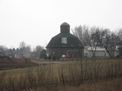 | Shafer Round Barn | 2.6 miles | 1995 |
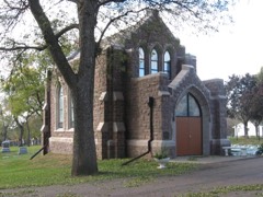 | Josephine Martin Glidden Memorial Chapel | 5.1 miles | 1987 |
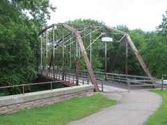 | Cherry Rock Park Bridge | 5.3 miles | 2003 |
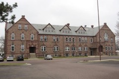 | South Dakota School for the Deaf | 5.3 miles | 1981 |
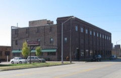 | Farley-Loetscher Company Building | 6.0 miles | 2001 |
| McKennan Park Historic Increase (Boundary Increase) | 6.0 miles | 2003 |
| National Archives record | The nomination case file for reference 96000746 in Record Group 79. |
| Minnehaha County | All 107 listed properties in this county. |