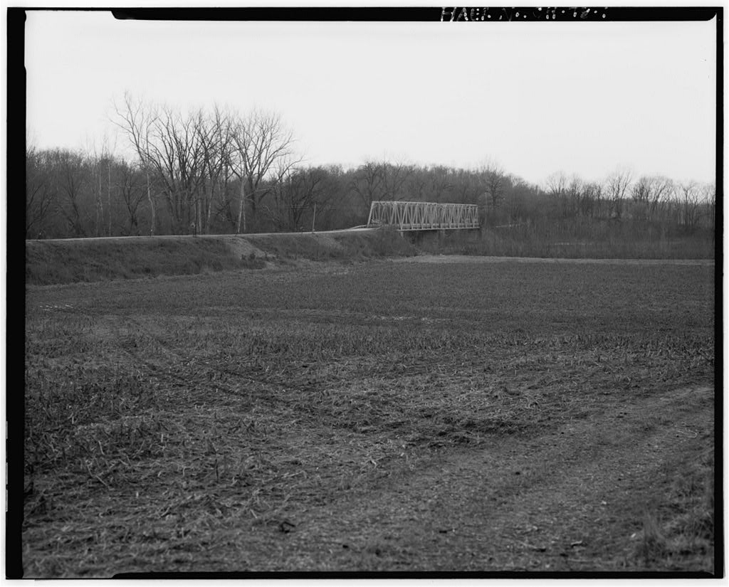
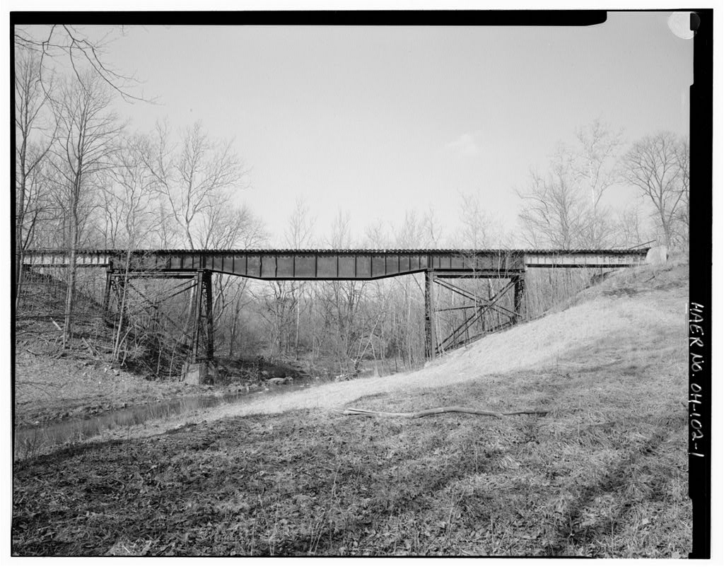
This documentation was undertaken in February, in accordance with the Memorandum of Agreement by the Montgomery County Engineer, Ohio Historic Preserva- tion Officer and the Advisory Council on Historic Preservation as a mitigation measure prior to the removal of the bridge. Fred Mitchell Historic Preservation Associates P. O. Box Cincinnati, Ohio BOOMERSHINE BRIDGE (Manning Road Bridge) HEAR No. OH-78 {Page 2) The location of the Boomershine Bridge has historically been used as a river crossing over Twin Creek in southwestern Montgomery County. The area served by the bridge is primarily rural and agricultural in character exhibiting this land use from its early settlement up to the present.
This bridge was used to facilitate the movement of local traffic from points on the west to the small communities of Germantown and Farmersville located on the east side of the crossing. Trips across the bridge reached an average of 280 vehicles in and were com- posed mainly of automobile and farming equiptment traffic. The immediate area around the bridge exhibits a broad, low flood plain extending to the north and northwest and a moderate undu- lated landscape to the south. Initial settlement of the area was taking place as early as the however, it was not until that pioneer fam- ilies began to develop farms. One man, Henry Boomershine, for whose family the bridge was named, had purchased several large tracts of land in that were in the vicinity of the future bridge location.
As rural agricultural development in- creased, several nearby communities were established as small market centers. Germantown, located approximately three and a half miles to the southeast, was platted in and grew in size to become the primary local market for the region. Another community, Farmersville, platted in is located a little over one mile to the north. Additionally, the local road system developed to meet the growing agricultural needs. Of particular importance to the immediate area was the fact that the Boomershine Grist and Saw Mill had been construct- ed just south of the bridge location and along the east bank of Twin Creek. Built in c. local farmers would transport their grain to be processed into flour and their logs to be cut.
Those farmers on the west side of Twin Creek traversed the creek at this point. Little has been documented concerning the development of modes of crossing the creek at this location. Historically, early river crossing was accomplished either on foot or animal when low water levels would allow. This was undoubtedly the situation here since it was an expensive undertaking to build a bridge. It is known that beginning in the many of the roads within the county were being taken over by Montgomery County for maintenance. A review of the Everts Combined Atlas Map of Montgomery County shows that a bridge was in place at this location in By the area had experienced several changes that were important to the local transportation system and economy.
The Farmersville Turnpike had been constructed between Farmersville BOOMESHINE BRIDGE (Manning Road Bridge) HAER No. OH-78 (Page 3) and Germantown which provided not only a direct link between these two communities but easier access to them from the sur- rounding area. Also, a small railroad had been constructed ad- jacent to the turnpike that extended down to Cincinnati and to various points in nearby eastern Indiana. The railroad was a major link for moving farm products to larger urban markets. As a result, farmers located west of the bridge utilized it to move their products to the rail link. No significant documentation has been discovered that provides an understanding as to the design of the bridge that was in exis- tence immediately prior to the flood.
It is known that it was a two span metal truss bridge with each span extending ap- proximately in length for a total length of Its height above the creek was much lower than the existing bridge. In a disastrous flood caused by an unusual amount of rainfall swelled the banks of many rivers, streams and creeks in southern and central Ohio. This resulted in the loss of numerous farms, villages and life. Almost all bridges, metal and wooden, were destroyed. The old Boomershine Bridge was included within the destruction having been destroyed on March 25, As the result of the loss of this bridge and other bridges within Montgomery County, the County Commission established an Emergency Flood Commission to deal with the various problems associated with the flooding including bridge reconstruction.
On September 11, plans and specifications for the new Boomer- shine Bridge were approved and notification to solicit bids from contractors was undertaken. The notification read: Sealed proposals will be receieved at the office of the County Commission of Montgomery County, Ohio at Dayton, Ohio until AM, Saturday, October 4, for the following County Work: All materials and labor necessary to build and complete a two span steel bridge superstructure and a steel concrete substructure over Twin Creek to replace Bridge No. 40, Jackson Township, known as the Boomershine Bridge de- stroyed by the flood of March 25, including the remov- al of the old superstructure and substructure.
The new bridge shall have two riveted truss spans of 160 feet and 10 inches each, center to center of bearing surfaces, and an 18 foot clear roadway with re-inforced concrete floor; and shall have a live load H capacity conforming to Cooper's Specifications, Class C" loading for steel highway bridges. The work to be done according to the plans on file in the Office of the County Surveyor and be accompanied by a certified check on a Montgomery County, Ohio bank payable to the Auditor of Montgomery County, Ohio, of cash, to the amount of that the bidder will enter into a con- BOOMERSHINE BRIDGE (Manning Road Bridge) HAER NO. OH-78 (Page 4) tract to perform the work in case the same is awarded to him.
Bids must state a lump sum for the superstructure, and state the amount per cubic yard of concrete and per pound of steel for the sub-structure, and must be separately set forth in the proposal. The Board of County Commissioner's reserves the right to reject any and all bids. BY ORDER OF THE COUNTY COMMISSIONER'S AND EMERGENCY COMMISSIONER'S. Walter H. Aslling, Sec'y (Montgomery County Commissioner's Record, September 11, p. On October 4, the bids were opened revealing the fol- lowing: Bids received (Superstructure) Amount The Brackett Construction Co. The Rochester Bridge Co. Central States Bridge Co. The Brookville Bridge Co. Geo. J. Bock and Son Edward J. Landor The Illinois Bridge Co.
Based upon the bids received and a comparison to the County Engineer's estimate of the superstructure contract was awarded to the Central States Bridge Company because it was the lowest bidder. Bids for the sub-structure were all rejected as being above the estimate of the County Engineer. The proposed work was re- advertised and on October 30, the contract was awarded to Geo. j. Bock and Son for their bid of per cubic yard of concrete and $65 per ton of steel. This bid was above the esti- mate of per cubic yard of concrete and $60 per ton of steel made by the County Engineer. The Central States Bridge Company was a firm that was lo- cated in Indiana.
Starting business as the New Castle Steel Sewer Pipe Company in the company soon expanded into the construction of small metal truss bridges. Achieving some suc- cess, the name was changed to the New Castle Bridge company in Starting out on a small scale, this company grew and de- veloped to meet the obligations required of numerous contracts extending beyond its home state into Virginia, Iowa and Michigan, BOOMERSHINE BRIDGE (Manning Road Bridge) HAER No.
OH-78 (Page 5) The company moved from New Castle, Indiana into new facilities in nearby Indianapolis in As business continued to increase and the firm prospered, the name was changed to the Central States Bridge Company in By now the company specialized in the fabrication of riveted beam bridges selling them throughout the central part of Indiana and to other builders and contrac- tors. The company's out of state contracts were a substantial part of its overall business during the period before World War One. The Boomershine Bridge contract contributed to this growth. Its out of state contracts extended into ten states reaching as far west as Oklahoma, the upper midwest and into various midwest- ern states.
Bridge construction was either of their own design or, as in the situation of the Boomershine Bridge, to already drafted engineering drawings and specifications. Bridge fabrica- tion declined in the and the company went into receiver- ship. It was reorganized as the Central States Bridge and Structural Company in It continued operation with bridge and structural steel contracts until ceasing operation in the early This bridge consists of two spans incorporating the Warren through truss design and steel riveted construction.
The overall length is and the width, out to out of trusses, is with a roadbed clearance width of 9' in each lane for a total of Overall height, from bottom chord to top chord is 24' with a maximum clearance at the center between the top of the roadway to the bottom of the portal strut is Each span is in length incorporating 10 panels with each panel being 16' in length and exhibiting a configuration composed of two inclined end and eight interior panels. Inclined end posts and top chords are composed of 12" channels with 16" riveted cover plates and lattice work on the underside. Bottom chord is composed of two 12" high by 2" wide channel beams separ- ated by a 5" space.
The details of the web are accentuated by vertical and diagonal lattice that are connected to the top and bottom chords with rivets and steel gussets where these mem- bers meet. Where verticals do not join with diagonals they are only riveted. The large struts connecting the top chords between each vertical are supported by simple curved spandrels exhibiting a steel open circle within the spandrel. Top chords are further connected with small steel top lateral bracing. The decorative deta.il of the superstructure is enhanced by the use of a steel rail extending the length of the both spans. This is composed of open rectangular steel strip lattice work terminating at the outside end of each main portal with a decor- ative newel post.
The deck is composed of six steel stringers extending the length of each span and are supported with nine large floor "I" beams riveted at their connection with the bottom BOOMERSHINE BRIDGE (Manning Road Bridge) HAER No. OH-78 (Page 6) chord. The superstructure is anchored to each end abutment and middle pier by means of a bearing plate. Each abutment is made of concrete with wing walls projecting off at a 45 degree angle for 40* from the abutment face. The center pier is rectangular in plan and also constructed of concrete. The roadbed is made of wood timber covered asphalt. Expansion joints have been in- corporated between the superstructure and each abutment as well as between each span at the center pier.
A name plate, origin- ally incorporated on the superstructure, has been removed and saved by the Montgomery County Engineer's Department. This was to protect it from vandalism. Over the years, the bridge has experienced various levels of maintenance and rehabilitation. Maintenance has been limited to periodic painting of the superstructure and rehabilitation confined mainly to the replacement of the roadbed deck. The last deck replacement was in and consisted of the install- ation of new wood timber and a 2" asphalt road surface. In addition, portions of several stringers were replaced because of severe metal deterioration. The design of the bridge does not comply with modern safety standards.
The roadbed width of 18* is 4' shorter that the rec- ommended 22' width for minimum safety of a two lane bridge. Legal load limits and axle configurations have been reduced at various times for safety reasons. Water and salt have accentuated the deterioration of various metal members. Corrosion to bottom chord and floor beam connections, floor beam and stringer con- nections and vertical and diagonal connections are examples of serious structural decay. in the bridge was closed to all traffic because of severe structural deficiencies. Because this is an important river crossing in the western part of county and utilized for both vehicular and agricultural needs, its closing has created hardships.
In order to once again facilitate travel across the river, a new bridge shall be con- structed and the Boomershine Bridge shall be removed. BOOMERSHINE BRIDGE (Manning Road Bridge) HAER No. OH-78 (Page 7) SOURCES OF INFORMATION Balke Engineering, Bridge Survey and Inventory Form, Manning Road Bridge, Cincinnati, 0., Beers, W. H., History of Montgomery County, Ohio, Chicago, Cooper, J. L., Iron Monuments to Distant Posterity, Indiana's Metal Bridges, Indiana Department of Natural Resources, Drury, Rev. A. W., History of the City of Dayton and Montgomery County, Ohio, Vol. 1, S. J. Clark Publishing Co., Chicago, Eriksson Engineering, Field Inspection Report and Struc- tural Analysis Bridge No. Ger-64-076 Manning Roadv Columbus, Ohio, No Date. Everts, C.
H., Combination Atlas Map of Montgomery County, Ohio, Fox, H. G. , New Atlas Map of Montgomery County, Ohio, 189 5. Montgomery County Commissioner's Minutes, Montgomery County Administration Building, Dayton, Ohio. September 11, p. October 4, p. October 30, no page number. Montgomery County Engineer's Department, Manning Road Bridge Structural File, Dayton Ohio, Ohio Department of Transportation, The Ohio Historic Bridge Inventory, Evaluation, and Preservation Plan, Columbus, Ohio, Note: Source of drawings located on pages 8 thru >2 is from original engineering drawings for Boomershine Bridge on file with the Ohio Historical Society, Ohio Historical Center, Velma Avenue, Columbus, Ohio BOOMERSHINE BRIDGE (Manning Road Bridge) HAER No.
OH-78 (Page 8) BOOMERSHINE BRIDGE (Manning Road Bridge) HAER No. OH-78 (Page 9) Interior Truss Portal HALF ELEVATION VIEW BOOMERSHINE BRIDGE (Manning Road Bridge) HAER No. OH-78 (Page 10) JD . _- Z O M U w o t-t EH o U H Z Q Z K o O u 33 U o ft O O tc E u TJ s C o o < EH CO a o ft ft < u EH ft >< BOOMERSHINE BRIDGE (Manning Road Bridge) HAER No. OH-78 (Page 11) O'jbide Angle of /- fV ' Z ll~ &otr of SearJ a" j~^ Gearing P/ofr (CasfSffef) DETAIL of NEWEL POST, RAIL and BEARING PLATE * 1 PuAts OF MEWEL POST AND RAIUMG BOOMERSHINE BRIDGE (Manning Road Bridge) HAER NO. OH-78 (Page 12) 'II GXJ nfo-aun/r frrrfi. 3 ato?]M { ^7&o ofSridpaVoor m SK F- 'ok-ZsX "u: at Abutment at Pier Expansion Joint ^h p: Z Z*^ ' - J --- - - i^-.--=-: ff^ r? to.
I T -;o-T-*A ^-8~*$'FiIkr\ -fci-^- ^* _i L **-iy p^tri Connection of Floor Beam Bearing Plate VARIOUS DETAILS BOOMERSHINE BRIDGE (Manning Road Bridge) HAER No. OH-78 (Page 13) w E-i < (^ W E < Z y-t O j < W Q BOOMERSHINE BRIDGE (Manning Road Bridge) HAER No. OH-78 (Page 15) ffi O (O-O fofOJ-l B <V U W > -^ H H d) a, CO < o H E-i H CO en C i-t r-i c (0 c U CO O O 2 o w *o ADDENDUM TO: HAER OH-78 BOOMERSHINE BRIDGE HAER OHIO,57-FARMV.V,1- (Manning Road Bridge) Spanning Twin Creek Farmersville vicinity Montgomery County Ohio FIELD RECORDS HISTORIC AMERICAN ENGINEERING RECORD National Park Service U.S. Department of the Interior C Street NW Washington, DC
 Block
Block