 Block
Bemis, Tennessee
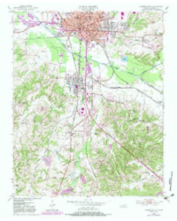
10 topographic sheets cover this place, the earliest surveyed in 1950 and the latest in 1986. It stands in District 6. It lies in ZIP code area 38301. It stands on Dry Branch. The Survey maps it on the Jackson South quadrangle.
On record in Bemis
Buildings and businesses the archive holds for this place. Each opens its own page, with the source record it came from.
On the National Register 1 record
- Bemis Auditoriumlisted 1991
Topographic sheets covering this place
4 surveys from 10 printed sheetsMatched by testing this settlement's coordinate against the published boundary of every sheet in the United States Geological Survey's historical collection. Each opens the scanned sheet at the Survey.
- 1950 USGS Jackson South quadrangle1:24000, 5 printings
- 1956 USGS Blytheville quadrangle1:250000, 2 printings
- 1959 USGS Blytheville quadrangle1:250000
- 1986 USGS Milan quadrangle1:100000, 2 printings
Fires near this place
4 since 1997Regional context, not property-specific evidence. The federal wildfire occurrence database lists 4 fires within 5 miles of Bemis between 1997 and 2007, burning about 49 acres in total. None started naturally. 1 was recorded as arson. Distance is straight-line from the map coordinates, so a fire counted here may appear on a neighbouring settlement's page as well.
| Reported cause | Fires |
|---|---|
| Debris and open burning | 3 |
| Arson/incendiarism | 1 |
The most recent of them, most recent first, with the day each was reported and the service that recorded it.
| Date | Cause | Size | Reported by | Name on the report |
|---|---|---|---|---|
| 14 September 1999 | Debris and open burning | 3.0 acres | Tennessee Division of Forestry | not named |
| 14 June 2007 | Debris and open burning | 22 acres | Tennessee Division of Forestry | 2 |
| 18 February 1997 | Debris and open burning | 5.0 acres | Tennessee Division of Forestry | not named |
| 20 November 1997 | Arson/incendiarism | 19 acres | Tennessee Division of Forestry | not named |
Settlements close enough to share some of these fires:
Mines and quarries near this place
6 within 5 milesRegional context, not property-specific evidence. The federal mineral resources record lists 6 workings within 5 miles of Bemis: 3 occurrences, 2 past producers, 1 producer. 1 still produces. What was taken out: Sand and Gravel, Construction, Clay, Ball Clay. Distance is straight-line from the map coordinates, so a quarry counted here may appear on a neighbouring settlement's page as well.
| Where | Site | Commodity | Status | Recorded |
|---|---|---|---|---|
| Dr. A.B. Dancy Prospect | Ball Clay | Occurrence | ||
| Jackson City Prospects | Clay | Occurrence | ||
| Northwest Pinson Prospect | Clay | Occurrence | ||
| Davidson Dredge | Sand and Gravel, Construction | Producer | ||
| Nicks Sand Plant | Sand and Gravel, Construction | Past Producer | ||
| Number 13 Micheal Pit | Sand and Gravel, Construction | Past Producer | Sedimentary |
Storms near this place
31 since 1996Regional context, not property-specific evidence. The National Weather Service names Bemis in 31 storm reports between 1996 and 2025: 10 hail, 10 thunderstorm wind, 8 flash flood, 1 tornado. The reports record 6 deaths and 106 injuries. Each account below is quoted exactly as the forecast office filed it, from the NOAA Storm Events Database, and each date opens the federal record of that event.
| When | Event | Place named | Harm | What the report says |
|---|---|---|---|---|
| January 1999 | Tornado (F4) | Bemis | 6 killed, 106 hurt, $10,000,000 | The tornado developed just east of Bemis and tracked northeast across the southern part of the city of Jackson. A shopping center suffered severe damage while a nearby funeral home was demolished except for the interior rooms. More than 200 homes were obliterated or heavily damaged while 300 other homes sustained lesser damage. The building housing the school buses for the county was destroyed and 55 school buses were damaged. A high-school baseball stadium was destroyed and the football stadium was damaged. |
| April 1999 | Thunderstorm Wind | Bemis | $750,000 | A Walmart lost part of its roof. One trailer was overturned. At least 50 other homes and buildings were damaged. |
| July 2009 | Lightning | Bemis | $150,000 | Lightning struck a two story house causing a fire. The house was totally destroyed by the fire. |
| February 1999 | Thunderstorm Wind | Bemis | $30,000 | A chicken house and a barn were destroyed near Jackson. One shed was destroyed and another lost its roof. A tractor trailer was knocked down. Several trees and power lines were blown down. |
| April 2005 | Thunderstorm Wind | Bemis | $25,000 | The First Baptist Church of Bemis was damaged. |
| April 2005 | Thunderstorm Wind | Bemis | $15,000 | Four power poles were blown down onto a gas station. Several telephone lines were also blown down. |
| November 1996 | Thunderstorm Wind | Bemis | $10,000 | no account filed |
| April 2006 | Hail | Bemis | $5,000 | no account filed |
| April 2006 | Hail | Bemis | $5,000 | no account filed |
| September 2009 | Flash Flood | Bemis | $1,000 | Several roads were flooded in the Bemis area after nearly 2.5 inches of rain fell in about 90 minutes. At least one car stalled out because of the excessive water on the roads. |
| April 2006 | Flash Flood | Bemis | $1,000 | A few streets were flooded. |
| March 1998 | Thunderstorm Wind | Bemis | $1,000 | The windows of a furniture store were blown out. |
| July 1997 | Thunderstorm Wind | Bemis | $1,000 | Several trees were knocked down. |
| May 1996 | Hail | Bemis | $200 | no account filed |
| June 1996 | Hail | Bemis | $100 | no account filed |
| July 1997 | Hail | Bemis | $50 | no account filed |
| June 1996 | Hail | Bemis | $10 | no account filed |
| April 2025 | Flash Flood | Bemis | - | Flash flooding caused a sink hole on Cerro Gordo Rd. |
| April 2025 | Thunderstorm Wind | Bemis | - | Large trees downed on Riverside Dr. |
| May 2024 | Flash Flood | Bemis | - | North Kentucky Street was closed between C and D streets due to high water. |
| August 2016 | Thunderstorm Wind | Bemis | - | Straight line winds knocked down many power lines and a few trees west of Bemis. A billboard was also damaged. |
| August 2016 | Flash Flood | Bemis | - | Significant street flooding in Bemis. Many roadways covered with water. |
| June 2014 | Flash Flood | Bemis | - | A coop observer reported 2.22 inches of rain in less than an hour in Bemis. As a result, several streets were flooded including Kentucky Street, D Street and North Missouri Street. |
| July 2014 | Hail | Bemis | - | Quarter size hail fell in Bemis. |
| April 2013 | Flash Flood | Bemis | - | Heavy rain produced flash flooding in Jackson making A Street and North Kentucky Street impassable. |
| April 2012 | Hail | Bemis | - | A severe thunderstorm intensified between Bemis and Pinson. Initially the storm began producing quarter size hail. By the time it reached near Pinson, the storm was producing baseball size hail. |
| February 2011 | Thunderstorm Wind | Bemis | - | Straight line winds knocked down trees and power lines at South Highland and Perry Switch Road and at South Highland and Highway 18. |
| August 2011 | Hail | Bemis | - | Penny to quarter size hail fell in Bemis. |
| July 2010 | Heavy Rain | Bemis | - | Between 3 and 3.24 inches fell over a two hour span south of Bemis. |
| August 2008 | Flash Flood | Bemis | - | Heavy rain produced flash flooding south of Jackson. Highland Avenue was flooded as a result. |
| June 2011 | Hail | Bemis | - | no account filed |
Nearest settlements
The eight closest, with where each one stands in the county. Distances are straight-line, computed from the Geographic Names Information System coordinates.
| Map | Place | Distance | Sheets |
|---|---|---|---|
| Malesus | 2.3 miles | 10 | |
| Jackson | 2.7 miles | 10 | |
| Madison Hall | 2.7 miles | 10 | |
| Allenton Heights | 3.3 miles | 10 | |
| East Union | 3.5 miles | 10 | |
| Westwood Gardens | 3.7 miles | 12 | |
| Westover | 3.8 miles | 8 | |
| Hicksville | 4.2 miles | 12 |
Provenance
This settlement is recorded in the Geographic Names Information System as feature 1276986. The sheet list is computed by point-in-boundary test against the United States Geological Survey's historical topographic inventory. Both are works of the United States government and carry no copyright under 17 U.S.C. 105.
Wildfire. Short, Karen C. 2022. Spatial wildfire occurrence data for the United States, 1992-2020 [FPA_FOD_20221014]. 6th Edition. Fort Collins, CO: Forest Service Research Data Archive. https://doi.org/10.2737/RDS-2013-0009.6 Collected with United States Government funding and usable without additional permissions or fees.
Mines and quarries. USGS Mineral Resources Data System (MRDS) https://mrdata.usgs.gov/mrds/ A work of the United States government, no copyright under 17 U.S.C. 105.
Storms. NOAA National Centers for Environmental Information, Storm Events Database https://www.ncei.noaa.gov/stormevents/ A work of the United States government, no copyright under 17 U.S.C. 105. Narratives are quoted verbatim from the National Weather Service report and are not edited or summarised.