Block
From the record
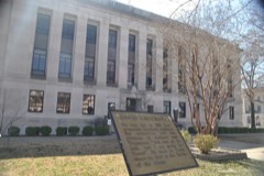
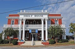
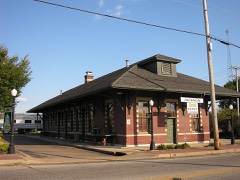
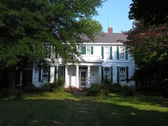
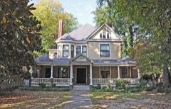
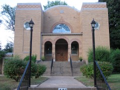
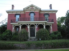
29 National Register listings published here.
Sources: the National Register database, National Park Service
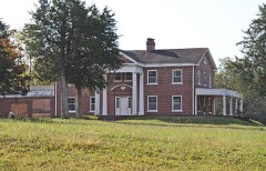
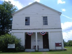
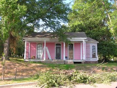
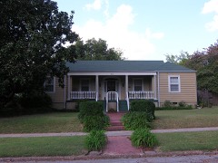
64 topographic sheets cover 40 settlements here, and 29 properties are on the National Register of Historic Places.
29 National Register listings published here.
Sources: the National Register database, National Park Service
Every property in this county listed on the National Register of Historic Places, with the year it was listed and the federal nomination document.
Every wildfire the federal occurrence database records inside this county: 49 of them, burning about 543 acres. 1 started naturally and 15 were recorded as arson. Each settlement page carries the fires within five miles of it.
| Reported cause | Fires |
|---|---|
| Debris and open burning | 17 |
| Arson/incendiarism | 15 |
| Equipment and vehicle use | 8 |
| Smoking | 4 |
| Missing data/not specified/undetermined | 2 |
| Power generation/transmission/distribution | 1 |
| Natural | 1 |
| Misuse of fire by a minor | 1 |
The five largest, by the area the report gives. Five of them were set deliberately.
| Date | Cause | Size | Reported by | Name on the report |
|---|---|---|---|---|
| 8 January 2006 | Arson/incendiarism | 101 acres | Tennessee Division of Forestry | not named |
| 16 September 1999 | Arson/incendiarism | 90 acres | Tennessee Division of Forestry | not named |
| 8 January 2006 | Arson/incendiarism | 52 acres | Tennessee Division of Forestry | not named |
| 3 April 2011 | Arson/incendiarism | 47 acres | Tennessee Division of Forestry | FIRE #01 |
| 4 November 2005 | Power generation/transmission/distribution | 45 acres | Tennessee Division of Forestry | not named |
| 3 November 2005 | Equipment and vehicle use | 32 acres | Tennessee Division of Forestry | not named |
| 1 April 1997 | Arson/incendiarism | 23 acres | Tennessee Division of Forestry | not named |
| 3 November 2005 | Equipment and vehicle use | 23 acres | Tennessee Division of Forestry | not named |
Every settlement page carries the fires within five miles of it - see the settlement index below.
The NOAA Storm Events Database holds 494 reports for this county, causing 21 deaths, 281 injuries and about $199,994,840 in recorded property damage. Each settlement page carries the reports that name it.
| Kind of event | Reports |
|---|---|
| Thunderstorm Wind | 212 |
| Hail | 156 |
| Flash Flood | 67 |
| Tornado | 35 |
| Flood | 13 |
| Lightning | 9 |
| Heavy Rain | 2 |
The most serious of them, by death, then injury, then recorded damage. The accounts are quoted exactly as the forecast office filed them.
| When | Event | Place named | Harm | What the report says |
|---|---|---|---|---|
| May 2003 | Tornado (F4) | Denmark | 11 killed, 66 hurt, $30,000,000 | The tornado touched down in the southwest part of Madison county near Denmark and tracked east through the downtown section of Jackson. The tornado continued to move east and eventually crossed into Henderson county. Nine people were killed in mobile homes between Denmark and Jackson and two other persons were killed in an apartment complex in Jackson. Numerous buildings were destroyed, particularly in downtown Jackson. St. Luke Episcopal Church, one of the oldest churches in Tennessee built in 1844, was destroyed. The Carl Perkins Civic Center, Tennessee Supreme Court Building, the downtown Jackson Post Office and National Guard Armory were damaged. Also damaged was the Proctor and Gamble factory where Pringles Potato Chips are made and a Coca-Cola bottling plant was also damaged. Denmark Elementary School and Jackson Middle School were destroyed and 24 other schools in the county were damaged. The tornado caused severe damage to the local power and water utilities across the county. One of eight stone balls that were set up to commemorate the eight fatalities from the Jackson tornado of January 17, 1999 was blown across a street. |
| January 1999 | Tornado (F4) | Bemis | 6 killed, 106 hurt, $10,000,000 | The tornado developed just east of Bemis and tracked northeast across the southern part of the city of Jackson. A shopping center suffered severe damage while a nearby funeral home was demolished except for the interior rooms. More than 200 homes were obliterated or heavily damaged while 300 other homes sustained lesser damage. The building housing the school buses for the county was destroyed and 55 school buses were damaged. A high-school baseball stadium was destroyed and the football stadium was damaged. |
| February 2008 | Tornado (EF3) | Leighton | 2 killed, 14 hurt, $10,000,000 | A tornado crossed into Madison County from Haywood County, Tennessee. The tornado struck the town of Huntersville and produced EF-3 damage. One home was totally destroyed on Huntersville-Denmark Road. One person was killed inside the home. Another home was destroyed in Huntersville. One person was killed in this home as well. Numerous homes were destroyed or damaged along the path in Huntersville area. The St. John No. 2 Baptist Church was severely damaged and the church bus was flipped upside down and tossed several hundred feet. The tornado lifted northeast of Huntersville near Interstate 40. A rest area along Interstate 40 was severely damaged. Thirteen tractor-trailers and several cars were also blown off of the Interstate due to the tornado. One car was tossed 75 yards from Interstate 40 into a farm field. Along the track of this tornado over 50 structures were destroyed and over 80 more were damaged. |
| April 1975 | Tornado (F1) | not stated | 1 killed, 6 hurt, $2,500,000 | no account filed |
| July 2006 | Lightning | Jackson | 1 killed, $75,000 | Lightning from a thunderstorm struck a house on 109 Wallace Road in Jackson. The strike started a fire in the home. The home burned to the ground and a 87 year old man was killed inside. |
| February 2008 | Tornado (EF4) | Gilmore | 51 hurt, $100,000,000 | The tornado touched down at the Union University Campus near the U.S. Highway 45 Bypass in Jackson producing tremendous damage. Fifty one people were injured at Union University as two dormitories collapsed during the passage of the violent tornado. Eighty percent of the dorms were severely damaged or destroyed. Three academic buildings received major damage and 14 other campus buildings were damaged. Several hundred vehicles in the campus parking lots were also damaged or destroyed. The damage in the University area was rated EF-4 with maximum winds of 170 mph. The track was 125 yards wide. The damage at the university alone was estimated at $40,000,000. The tornado then tracked across the U.S. Highway 45 Bypass damaging several banks and businesses before hitting the Regional Hospital and adjacent doctors' offices. The tornado then moved across North Jackson inflicting significant damage to many subdivisions and businesses. The Chapel Creek, Indian Hills and Wyndhurst subdivisions were all struck by the tornado. The tornado also damaged the Jackson Oaks Senior Living Complex. The tornado continued to track northeast striking the Northside High School in the Oak Hill area. The tornado then moved through the Walnut Trace subdivision before crossing Old Medina Road and damaging more houses. The tornado then continued northeast causing EF-3 damage near the intersection of Christmasville Road and Ashport Road in Northeast Madison County before lifting. The Madison County Fire Station No. 11 was destroyed. The station's fire engine and pumper, water and brush trucks were all damaged. Several homes in the area were also damaged. The maximum winds were 145 mph in this area and the track was 100 yards wide. Along the track of this tornado over 70 structures were destroyed with over 500 more damaged. |
| March 1975 | Tornado (F1) | not stated | 18 hurt, $250,000 | no account filed |
| May 1971 | Tornado (F1) | not stated | 8 hurt, $25,000 | no account filed |
| March 1953 | Tornado (F3) | not stated | 3 hurt, $25,000 | no account filed |
| April 1953 | Tornado (F1) | not stated | 2 hurt, $250,000 | no account filed |
| May 1984 | Tornado (F1) | not stated | 2 hurt, $25,000 | no account filed |
| August 2000 | Lightning | Jackson | 2 hurt | Two persons were injured when lightning struck a construction site just north of Jackson. |
| November 1988 | Tornado (F2) | not stated | 1 hurt, $250,000 | no account filed |
| April 1989 | Thunderstorm Wind | not stated | 1 hurt | no account filed |
| May 1984 | Thunderstorm Wind | not stated | 1 hurt | no account filed |
| January 1999 | Tornado (F3) | Mercer | $25,000,000 | The tornado started southeast of Eurekaton in Haywood County and travelled northeast crossing into Madison County eventually reaching the north part of the city of Jackson. In Haywood county, seven houses, five mobile homes, five barns and seven sheds were destroyed. In Madison county, the tornado damaged or destroyed several homes in Mercer and Denmark. While moving toward Jackson, the tornado struck the south side of McKellar-Sipes Regional Airport damaging the ASOS equipment located at the airport. The new Tennessee National Guard armory and a hangar were flattened. Two UH-60 helicopters and two other helicopters were destroyed with four additional helicopters damaged. In Jackson, a total of 38 apartments were destroyed. |
| May 2010 | Flash Flood | Fairview | $11,300,000 | Very heavy rain fell during the day across Madison County. As much as 11 to 16 inches fell across the county. Forty roads and bridges were closed due to the flooding. Vehicles had water up to the steering wheels in some locations. Power outages occurred as a result of the flooding. Houses were inundated with water(as much as 5 feet) especially in South Jackson, the Herron Grove area of Jackson, McGee Loop area of Northeast Jackson, and Bemis. In total, 120 to 140 homes across Madison County sustained damage from the flooding. As many as 85 businesses in Jackson received damage. The flash flooding event transitioned into a flood event as rivers rose quickly from the rainfall and overflowed their banks. Some roads remained closed for days making travel difficult. Shelters were opened in Jackson due to the flooding. |
| November 2002 | Tornado (F1) | Jackson | $3,000,000 | The tornado touched down northwest of Jackson and moved northeast. The tornado hit a subdivision and also hit parts of Union University where several buildings on campus was badly damaged. Around 500 cars at the school were damaged. Overall, one home was destroyed and over 150 homes and businesses were damaged. |
| April 1999 | Thunderstorm Wind | Bemis | $750,000 | A Walmart lost part of its roof. One trailer was overturned. At least 50 other homes and buildings were damaged. |
| April 2011 | Thunderstorm Wind | Huntersville | $643,900 | Straight line winds destroyed three homes in Madison County and caused minor or major damage to six others. |
| December 2021 | Tornado (EF1) | Beech Bluff | $550,000 | The tornado began on Beech Bluff Road near Ranger Road where a tree was uprooted and a metal outbuilding was damaged. The tornado then moved east-northeast where a home sustained significant roof damage near the intersection of Beech Bluff Road and Willoughby Road. It then moved northeast where a couple of homes sustained roof and siding damage near the intersection of Fowler and Old Jackson-Lexington Road. The tornado then moved northeast where an outbuilding and small building were destroyed. In total, 15 to 20 homes suffered at least some damage in Madison County. The tornado then moved into Henderson County. Peak winds were estimated to be 100 mph in Madison County. |
| March 2022 | Tornado (EF1) | Neely | $500,000 | The tornado developed just south of Womack Lane to the west of Denmark-Jackson Road. Damage was observed to two homes on Womack Lane, one with significant roof damage. Numerous trees were uprooted or snapped as this tornado moved northeast across rural, wooded land. Additional damage was observed at the Pacific Manufacturing facility on Smith Lane where the east-facing wall of a large metal building was peeled off of the frame. Several large rolling doors were blown in at this facility. There were also several metal power poles that were severely bent along Smith Lane. The tornado continued northeast to the south of the McKellar-Sipes Airport. Trees were uprooted along Old Denmark Road and a house suffered roof damage. Several businesses were damaged along Airways Boulevard just to the west of the South Fork of the Forked Deer River. The tornado moved into the southwest portion of Jackson uprooting trees, knocking down powerlines, and damaging the Jackson-Madison County General Hospital. A light pole was damaged at a baseball field. The roof came off at the Forrest Cove Nursing Home near the hospital before the tornado lifted. Peak winds were estimated at 100 mph. |
| May 2010 | Flood | Spring Creek | $500,000 | As much as 11 to 16 inches of rain fell near Spring Creek. The heavy rains caused Spring Creek to rise rapidly. This caused lake levels in the Springbrook Lake to also rise. A levee failed as a result of the high water spilling water into Springbrook Lake Estates. Many homes and roads were flooded as a result. |
| May 2010 | Flood | Jackson | $500,000 | Very heavy rains produced a flash flooding event in Madison County. As much as 11 to 16 inches of rain fell across Madison County. The flash flooding event transitioned to a flood event by late afternoon of May 1st. The South Fork Forked Deer River in Jackson rose quickly above flood stage. Many homes and roads were affected by the high water. |
| March 2022 | Tornado (EF1) | Oakfield | $250,000 | The tornado caused intermittent damage along a seven mile path that continued into southeast Gibson County. The tornado formed just west of the intersection of Barnes Road and Old Medina Road near the railroad tracks. The most significant damage occurred in this area where two homes sustained considerable damage. One home lost most of its roof and the east-facing garage door was blown in. A nearby metal building suffered significant damage. The second home sustained roof damage and many windows were blown out on the north- and south-facing walls. Debris was lofted and deposited in the forest downstream. A couple of barns were damaged farther east-northeast along Barnes Road with intermittent tree damage as the tornado traveled northeast. The next area of damage was at the intersection of Friendship Road and Barnes Road. A church and nearby home suffered minor roof damage and numerous trees were downed. Additional damage was noted on Christmasville Road in Madison County and then the tornado moved into Gibson County. Peak winds were estimated at 110 mph in Madison County. |
| July 2019 | Flash Flood | Lawrence | $250,000 | Cars in parking lot submerged by flood waters. |
| October 1990 | Tornado (F1) | not stated | $250,000 | no account filed |
| June 1981 | Tornado (F0) | not stated | $250,000 | no account filed |
| February 2008 | Tornado (EF2) | Spring Creek | $200,000 | A brief EF-2 tornado touchdown occurred in Spring Creek along Highway 152 about one quarter mile west of Highway 70. One home suffered total roof loss and a partial failure of the front exterior wall. Three additional homes received extensive roof damage. Large trees were snapped and uprooted. Maximum winds were estimated at 125 mph with a maximum width of 150 yards. |
| May 2024 | Tornado (EF1) | Uptonville | $150,000 | This tornado began in far southern Madison County along Sanderson Road where several trees were uprooted. The tornado continued eastward along Hailey Road where numerous trees were uprooted or snapped. The first sign of structural damage occurred to the carport of a home on Bowman Road just west of Kelly Road with more widespread and significant tree damage in the field just behind the house. Several trees were uprooted along Swink Road but almost none of the adjacent structures had any damage. Fairly widespread tree damage continued in a rural area on Lowery and Cain Roads as it moved into Chester County. The most significant damage occurred to two houses just off Highway 18, close to the Hardeman County Line. Peak winds were estimated at 95 mph. One house had partial uplift of the roof and notable loss of paneling from the second story. A second house had a tree collapse onto a garage, major uplift of a patio roof, and its chimney collapsed on the side of the house. In many places, the tree damage was sporadic |and consistent with a broad circulation. The tornado dissipated as it moved across the very northeast corner of Hardeman County and into Chester County. The tornado eventually lifted in a heavily forested area. |
| July 2009 | Lightning | Bemis | $150,000 | Lightning struck a two story house causing a fire. The house was totally destroyed by the fire. |
| June 2012 | Lightning | Jackson | $100,000 | Lightning struck a tree that fell on a house in the Wrights Mill subdivision in Jackson. A small fire also occurred at the house. Several other structures were also struck around the Jackson area causing three other fires. |
| May 2003 | Tornado (F3) | Denmark | $100,000 | The tornado touched down south of where the tornado which struck the city of Jackson started. This tornado also moved east and eventually moved into Henderson county. Numerous homes were damaged or destroyed. |
| December 1999 | Thunderstorm Wind | Adair | $100,000 | One building was destroyed. Up to fifteen homes were damaged. An industrial facility was also damaged. Some trees and power lines were knocked down. |
| March 2021 | Flash Flood | Medon | $75,000 | Two occupied vehicles were swept away by floodwaters. One vehicle was swept away on Bowman Collins Road and the other on Mandy Road. They required swift-water rescues. These roads suffered culvert washouts. There were multiple road closures across the county due to flooding including Chester Street which was flooded with 2 to 3 feet of water near the uptown area of Jackson. Culverts were also washed out on White Fern Road and Meadon Malesus Road. |
| December 2016 | Hail | Jackson | $60,000 | Golf-ball sized hail reported in downtown and the east side of Jackson. Approximately 20 to 30 patrol cars received hail damage in a parking lot. Damage consisted of mostly dings and dents. No broken windows were reported. Report also received by Broadcast Media and County Official. |
| December 2016 | Hail | Lawrence | $60,000 | Several automobiles sustained hail damage on Pinnacle drive near Highway 70. |
| April 2025 | Tornado (EF0) | Neely | $50,000 | A short-lived tornado touched down just south of Denmark Jackson Road, leading to some minor roof damage to multiple homes along Denmark Jackson Road and Vine Hill Road. Some trees in the area were either uprooted or had large tree limbs broken as well. As the tornado moved up Vine Hill Road, a tree was uprooted, falling on a mobile home. Additional tree damage was noted in the area before the tornado lifted just south of Womack Lane. Peak winds were estimated at 80 mph. |
| March 2022 | Thunderstorm Wind | Oakfield | $50,000 | Major structural damage to houses and buildings on Barnes Road. |
| March 2022 | Thunderstorm Wind | Neely | $50,000 | Straight-line winds damaged an outbuilding on Neely Station Road and knocked trees down. A school and the Madison County Sheriff's office suffered roof damage. |
| March 2021 | Flood | Five Pts | $50,000 | Flooding washed out several culverts across Madison County. Culverts were washed out on Hopper Road, Bowman Collins Road, and Wilde Road. |
| February 2021 | Flash Flood | Oakfield | $50,000 | The Highway 45 Bypass and other roads around the county were flooded. |
| November 2016 | Thunderstorm Wind | Leighton | $50,000 | Trees fell on houses along Highway 138 in Madison County. |
| August 2014 | Flash Flood | Oakfield | $50,000 | Slow moving thunderstorms produced flash flooding around Jackson. Numerous roads had at least six inches of water covering them. In addition, Clement Road had pavement washed away due to the flooding. |
| May 2008 | Thunderstorm Wind | Jackson | $50,000 | Straight line winds blew several large trees down in Jackson. Several mobile homes sustained damage from the fallen trees. |
| September 2006 | Tornado (F1) | Jackson | $50,000 | A tornado touched down in North Jackson in the Ramblewood Subdivision off of North Highland Avenue. This is near the Oil Well Road and U.S. Highway 45 Bypass Area. The tornado tracked northeast and lifted near the intersection of Old Medina Road and Ashport Road. One house had its front porch torn off. Several other homes and barns suffered roof damage. Several trees were knocked down, some of which fell on homes. |
| November 2002 | Tornado (F0) | Medon | $50,000 | The tornado briefly touched down in the town of Medon. A barn was demolished. A mobile home and tavern were damaged. Some trees were blown down. |
| November 2001 | Thunderstorm Wind | Countywide | $50,000 | Numerous trees and power lines were knocked down across the county. |
| August 2014 | Flash Flood | Fairview | $30,000 | Slow moving thunderstorms produced flash flooding across North Jackson. As a result, the intersection of Ridgecrest Road and Henderson Road was closed due to flooding. In addition, a portion of East University Parkway was washed out. |
| July 2000 | Thunderstorm Wind | Jackson | $30,000 | Three houses suffered roof damage. Six cars were damaged. Numerous trees and power lines were blown down. |
| February 1999 | Thunderstorm Wind | Bemis | $30,000 | A chicken house and a barn were destroyed near Jackson. One shed was destroyed and another lost its roof. A tractor trailer was knocked down. Several trees and power lines were blown down. |
| April 2024 | Thunderstorm Wind | Malesus | $25,000 | The roof of a business was damaged near the intersection of Highway 45 and Highway 18 south of Jackson. |
| March 2022 | Thunderstorm Wind | Oakfield | $25,000 | Straight-line winds caused roof damage to a couple of houses, uprooted trees and knocked down large branches near Christmasville Road. |
| March 2022 | Thunderstorm Wind | Oakfield | $25,000 | Straight-line winds uprooted trees along Barnes Road. An outbuilding and metal building suffered damage on Friendship Road. |
| July 2020 | Flash Flood | Oakfield | $25,000 | Christmasville Road was completely washed out between Oakfield and Watson Roads. Up to one foot of water covered Christmasville Road near Bermuda Road and Northeast Middle School. |
| December 2015 | Tornado (EF1) | Leighton | $25,000 | This tornado occurred in Western Madison County. The tornado damaged several storage sheds and caused roof damage to a home. |
| February 2011 | Thunderstorm Wind | Jackson | $25,000 | Straight line winds knocked a large oak tree on to a carport and a portion of a house on Westmoreland Place. The carport and the car inside were destroyed. The house suffered slight roof and siding damage. A wooden fence was also damaged. A business had a sign destroyed. |
| February 2008 | Hail | Huntersville | $25,000 | Golf ball to grapefruit size hail fell along Interstate 40 to the west of Jackson. |
| April 2005 | Thunderstorm Wind | Bemis | $25,000 | The First Baptist Church of Bemis was damaged. |
| August 2005 | Lightning | Jackson | $25,000 | A suite of medical offices were damaged by a fire started by lightning. |
The Survey's mineral resources record lists 38 workings inside this county. 7 still produce and 31 are closed or unrecorded. Each settlement page carries the workings within five miles of it.
| Commodity | Workings |
|---|---|
| Clay | 20 |
| Sand and Gravel, Construction | 12 |
| Ball Clay | 4 |
| Fire Clay (Refractory) | 2 |
The least common of them first, because a county's hundredth gravel pit says nothing its first ten did not.
| Where | Site | Commodity | Status | Recorded |
|---|---|---|---|---|
| Highway 70 Prospect | Fire Clay (Refractory) | Prospect | ||
| Jackson Pit | Fire Clay (Refractory) | Past Producer | ||
| Browns Church Road Prospect | Ball Clay | Prospect | ||
| Browns Hill Prospect | Ball Clay | Prospect | ||
| Corinth Brick Co. Pit | Ball Clay | Past Producer | ||
| Dr. A.B. Dancy Prospect | Ball Clay | Occurrence | ||
| #1 Bowden Pit | Sand and Gravel, Construction | Producer | Unconsolidated Sediments | |
| #13 Michael Pit | Sand and Gravel, Construction | Producer | Unconsolidated Sediments | |
| Davidson Dredge | Sand and Gravel, Construction | Producer | ||
| Jackson Sand Plant | Sand and Gravel, Construction | Producer | ||
| Nicks Sand Plant | Sand and Gravel, Construction | Past Producer | ||
| Number 1 Bowden Pit | Sand and Gravel, Construction | Past Producer | Sedimentary | |
| Number 1 Bowden Pit | Sand and Gravel, Construction | Producer | ||
| Number 13 Micheal Pit | Sand and Gravel, Construction | Past Producer | Sedimentary | |
| Road Builders Inc. of Tennessee Pit #1 | Sand and Gravel, Construction | Producer | Unconsolidated Sediments | |
| Road Builders Inc. of Tn. Pit No. 1 | Sand and Gravel, Construction | Past Producer | Sedimentary | |
| Sand Pit | Sand and Gravel, Construction | Past Producer | ||
| Sanders Bluff Road Pit | Sand and Gravel, Construction | Producer | ||
| B.A. Bailey Farm Prospect | Clay | Occurrence | ||
| Beech Bluff Prospect | Clay | Prospect | ||
| Clay Pit | Clay | Past Producer | ||
| Davis Pit | Clay | Past Producer | ||
| Deep Gap Road Prospect | Clay | Occurrence | ||
| Five Points Prospect | Clay | Prospect | ||
| Gilmore Road Prospect | Clay | Prospect | ||
| Homer Hinkle Property Prospect | Clay | Prospect | ||
| Jackson City Prospects | Clay | Occurrence | ||
| Jere Chausse Place Prospect | Clay | Occurrence | ||
| North Beech Bluff Prospect | Clay | Prospect | ||
| Northwest Pinson Prospect | Clay | Occurrence | ||
| Old J.L. Allen Prospect | Clay | Past Producer | ||
| Old Monroe Pit | Clay | Past Producer | ||
| Pinson Hill Prospect | Clay | Prospect | ||
| Pinson Pit | Clay | Past Producer | ||
| S.C. Whitfield Prospect | Clay | Occurrence | ||
| Southwest Beech Bluff Prospect | Clay | Occurrence | ||
| Vol Vantrease Prospect | Clay | Occurrence | ||
| William Ball Pit | Clay | Past Producer |
Named settlements recorded in the Geographic Names Information System, each with the topographic sheets covering it. Villages, hamlets and abandoned places alike. Each is shown with the nearest named watercourse or landform and the survey quadrangle it falls on.
District 8 · 38366 · On Hudson Branch · Henderson quadrangle
9 sheets, 1956 to 1986
No longer a settlement
District 2 · 38301 · On Sandy Creek · Jackson North quadrangle
12 sheets, 1950 to 1997
District 9 · 38305 · On Turkey Creek · Jackson North quadrangle
12 sheets, 1950 to 1997
The vanished settlements of Madison County: the places named above that are no longer on the map.