 Block
Jackson, Tennessee
10 topographic sheets cover this place, the earliest surveyed in 1950 and the latest in 1986. It stands in District 1. It lies in ZIP code area 38301. It stands on Anderson Branch. The Survey maps it on the Jackson South quadrangle. 68,205 people lived here at the 2020 count. It stands 410 feet above sea level.
Research this city
On record in Jackson
Buildings and businesses the archive holds for this place. Each opens its own page, with the source record it came from.
On the National Register 12 of 26 shown
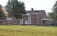 Cedars, Thelisted 1999
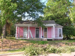 Capt. H. P. Farrar Houselisted 1982
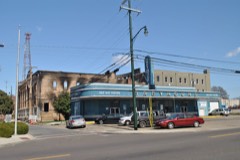 Greyhound Bus Stationlisted 1993
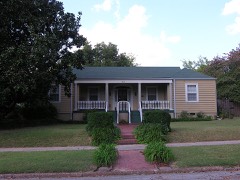 William Holland Jr. Houselisted 2005
 Illinois Central Railroad Division Officelisted 1993
 Jackson Free Librarylisted 1975
 Lane College Historic Districtlisted 1987
 Lane College Historic District (Boundary Increase)listed 1991
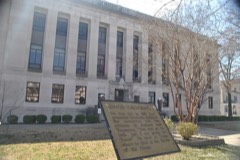 Madison County Courthouselisted 1995
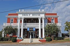 Murphy Hotellisted 1993
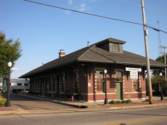 Nashville, Chattanooga & St. Louis Passenger Depot-Jacksonlisted 1993
 New Southern Hotellisted 2002
Population over time
2 figuresJackson grew from 65,211 to 68,205 between 2010 and 2020. These are the recorded population figures Wikidata holds for this place, reached through the Geographic Names Information System number this page is keyed on rather than by name, so they belong to this place and not to another of the same name. Most are census counts, but not all are: an early figure may be a founding or settlement estimate, and an estimate published within five years of a census is left out. The change column is computed, and is left blank where more than 20 years separate a figure from the one before it, because a gap that long is not a change between two counts.
| Year | People | Change |
|---|---|---|
| 2010 | 65,211 | |
| 2020 | 68,205 | +2,994 (+5%) |
Topographic sheets covering this place
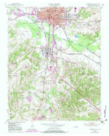
4 surveys from 10 printed sheetsMatched by testing this settlement's coordinate against the published boundary of every sheet in the United States Geological Survey's historical collection. Each opens the scanned sheet at the Survey.
- 1950 USGS Jackson South quadrangle1:24000, 5 printings
- 1956 USGS Blytheville quadrangle1:250000, 2 printings
- 1959 USGS Blytheville quadrangle1:250000
- 1986 USGS Milan quadrangle1:100000, 2 printings
Fires near this place
3 since 1997Regional context, not property-specific evidence. The federal wildfire occurrence database lists 3 fires within 5 miles of Jackson between 1997 and 2007, burning about 30 acres in total. None started naturally. None was recorded as arson. Distance is straight-line from the map coordinates, so a fire counted here may appear on a neighbouring settlement's page as well.
| Reported cause | Fires |
|---|---|
| Debris and open burning | 3 |
The most recent of them, most recent first, with the day each was reported and the service that recorded it.
| Date | Cause | Size | Reported by | Name on the report |
|---|---|---|---|---|
| 14 September 1999 | Debris and open burning | 3.0 acres | Tennessee Division of Forestry | not named |
| 14 June 2007 | Debris and open burning | 22 acres | Tennessee Division of Forestry | 2 |
| 18 February 1997 | Debris and open burning | 5.0 acres | Tennessee Division of Forestry | not named |
Settlements close enough to share some of these fires:
Mines and quarries near this place
8 within 5 milesRegional context, not property-specific evidence. The federal mineral resources record lists 8 workings within 5 miles of Jackson: 3 past producers, 3 occurrences, 1 producer, 1 prospect. 1 still produces. What was taken out: Sand and Gravel, Construction, Clay, Fire Clay (Refractory), Ball Clay. Distance is straight-line from the map coordinates, so a quarry counted here may appear on a neighbouring settlement's page as well.
| Where | Site | Commodity | Status | Recorded |
|---|---|---|---|---|
| Dr. A.B. Dancy Prospect | Ball Clay | Occurrence | ||
| Jackson Pit | Fire Clay (Refractory) | Past Producer | ||
| B.A. Bailey Farm Prospect | Clay | Occurrence | ||
| Davidson Dredge | Sand and Gravel, Construction | Producer | ||
| Gilmore Road Prospect | Clay | Prospect | ||
| Jackson City Prospects | Clay | Occurrence | ||
| Nicks Sand Plant | Sand and Gravel, Construction | Past Producer | ||
| Number 13 Micheal Pit | Sand and Gravel, Construction | Past Producer | Sedimentary |
Storms near this place
60 of 141 shownRegional context, not property-specific evidence. The National Weather Service names Jackson in 141 storm reports between 1993 and 2025: 54 hail, 46 thunderstorm wind, 23 flash flood, 7 flood. The reports record 1 death and 2 injuries. Each account below is quoted exactly as the forecast office filed it, from the NOAA Storm Events Database, and each date opens the federal record of that event.
| When | Event | Place named | Harm | What the report says |
|---|---|---|---|---|
| July 2006 | Lightning | Jackson | 1 killed, $75,000 | Lightning from a thunderstorm struck a house on 109 Wallace Road in Jackson. The strike started a fire in the home. The home burned to the ground and a 87 year old man was killed inside. |
| August 2000 | Lightning | Jackson | 2 hurt | Two persons were injured when lightning struck a construction site just north of Jackson. |
| November 2002 | Tornado (F1) | Jackson | $3,000,000 | The tornado touched down northwest of Jackson and moved northeast. The tornado hit a subdivision and also hit parts of Union University where several buildings on campus was badly damaged. Around 500 cars at the school were damaged. Overall, one home was destroyed and over 150 homes and businesses were damaged. |
| May 2010 | Flood | Jackson | $500,000 | Very heavy rains produced a flash flooding event in Madison County. As much as 11 to 16 inches of rain fell across Madison County. The flash flooding event transitioned to a flood event by late afternoon of May 1st. The South Fork Forked Deer River in Jackson rose quickly above flood stage. Many homes and roads were affected by the high water. |
| June 2012 | Lightning | Jackson | $100,000 | Lightning struck a tree that fell on a house in the Wrights Mill subdivision in Jackson. A small fire also occurred at the house. Several other structures were also struck around the Jackson area causing three other fires. |
| December 2016 | Hail | Jackson | $60,000 | Golf-ball sized hail reported in downtown and the east side of Jackson. Approximately 20 to 30 patrol cars received hail damage in a parking lot. Damage consisted of mostly dings and dents. No broken windows were reported. Report also received by Broadcast Media and County Official. |
| May 2008 | Thunderstorm Wind | Jackson | $50,000 | Straight line winds blew several large trees down in Jackson. Several mobile homes sustained damage from the fallen trees. |
| September 2006 | Tornado (F1) | Jackson | $50,000 | A tornado touched down in North Jackson in the Ramblewood Subdivision off of North Highland Avenue. This is near the Oil Well Road and U.S. Highway 45 Bypass Area. The tornado tracked northeast and lifted near the intersection of Old Medina Road and Ashport Road. One house had its front porch torn off. Several other homes and barns suffered roof damage. Several trees were knocked down, some of which fell on homes. |
| July 2000 | Thunderstorm Wind | Jackson | $30,000 | Three houses suffered roof damage. Six cars were damaged. Numerous trees and power lines were blown down. |
| February 2011 | Thunderstorm Wind | Jackson | $25,000 | Straight line winds knocked a large oak tree on to a carport and a portion of a house on Westmoreland Place. The carport and the car inside were destroyed. The house suffered slight roof and siding damage. A wooden fence was also damaged. A business had a sign destroyed. |
| August 2005 | Lightning | Jackson | $25,000 | A suite of medical offices were damaged by a fire started by lightning. |
| January 1999 | Thunderstorm Wind | Jackson | $25,000 | One mobile home was destroyed. |
| November 2016 | Thunderstorm Wind | Jackson | $20,000 | Fallen trees and limbs caused power lines to be down around Russell and Forest Avenues in Jackson. |
| June 2006 | Flash Flood | Jackson | $20,000 | Heavy rain caused flooding on the Hwy 45 Bypass in Jackson at several intersections. The intersection at Old Hickory Boulevard had 1 foot of water over it for 500 yards. Two cars were flooded out at the Best Western parking lot where water was 3.5 feet deep. |
| August 2002 | Thunderstorm Wind | Jackson | $20,000 | A building under construction was damaged. Some trees and power lines were blown down. |
| November 2001 | Thunderstorm Wind | Jackson | $20,000 | Some trees and power lines were knocked down in the southwest part of Jackson. |
| May 2000 | Thunderstorm Wind | Jackson | $20,000 | A gas station in Jackson had 3 of its gas pumps damaged along with a sign which was also damaged. Several roofs were damaged in Fairview. Some trees were also blown down. |
| April 2025 | Thunderstorm Wind | Jackson | $15,000 | Downed powerlines from N Highland Ave to Hollywood Drive in Jackson. |
| July 2005 | Thunderstorm Wind | Jackson | $15,000 | An old church was damaged. A shed was blown off its foundation. Several trees were blown down. |
| May 2003 | Thunderstorm Wind | Jackson | $15,000 | Several homes were damaged. |
| July 1999 | Flood | Jackson | $15,000 | Heavy rain caused several poorly drained roads in Jackson to flood. Over two feet of water covered a few of these roads and several businesses in the area were flooded. |
| July 2023 | Flash Flood | Jackson | $10,000 | A vehicle was stranded in floodwater at Lambuth Boulevard and Princeton Street. |
| January 2012 | Thunderstorm Wind | Jackson | $10,000 | Many trees were knocked down across the county. |
| May 2008 | Thunderstorm Wind | Jackson | $10,000 | Straight line winds uprooted large trees 7 miles east-northeast of Jackson. Minor damage occurred to a home as well. |
| May 2006 | Thunderstorm Wind | Jackson | $10,000 | Straight line winds blew a 53 foot tractor trailer on its side. |
| May 2003 | Tornado (F0) | Jackson | $10,000 | The tornado touched down west of Jackson along Highway 74 and moved northeast. Several trees and power lines were knocked down. |
| March 2002 | Flash Flood | Jackson | $10,000 | Several homes were flooded. Part of one road was washed away. Numerous roads were under water. |
| June 2002 | Thunderstorm Wind | Jackson | $10,000 | Several trees and power lines were blown down. |
| August 2002 | Lightning | Jackson | $10,000 | A house was damaged by a fire started by lightning. |
| May 2001 | Flood | Jackson | $10,000 | Several homes and businesses were damaged after nearly 2.5 inches of rain fell. As much as 2 feet of water covered U.S. Highway 70. |
| May 1998 | Thunderstorm Wind | Jackson | $10,000 | Several homes were damaged. Some trees and power lines were knocked down. |
| June 1998 | Lightning | Jackson | $10,000 | Three high-voltage lightning arresters were damaged by lightning strikes. A few trees were also knocked down by lightning as well. |
| November 1995 | Thunderstorm Wind | Jackson | $10,000 | A large tree was blown on top of a house. Numerous tree limbs were knocked down. |
| June 1995 | Thunderstorm Wind | Jackson | $10,000 | One house suffered moderate damage and two large trees were blown down. |
| July 1996 | Thunderstorm Wind | Jackson | $10,000 | no account filed |
| April 2006 | Hail | Jackson | $6,000 | Quarter size hail was covering the ground at mile marker 74 on Interstate 40. |
| April 2006 | Hail | Jackson | $5,000 | The hail was reported at the Madison County Sheriff's office. |
| May 2003 | Thunderstorm Wind | Jackson | $5,000 | Several trees were blown down. |
| July 2002 | Thunderstorm Wind | Jackson | $5,000 | A few trees were blown down. One tree fell on a house. |
| October 2002 | Flash Flood | Jackson | $5,000 | Numerous roads were flooded. |
| June 2001 | Thunderstorm Wind | Jackson | $5,000 | A few trees were knocked down. |
| October 2001 | Thunderstorm Wind | Jackson | $5,000 | Several trees fell on a house. |
| November 1998 | Thunderstorm Wind | Jackson | $5,000 | Some trees were blown down. |
| July 1998 | Thunderstorm Wind | Jackson | $5,000 | Several outbuildings were destroyed and a few trees were knocked down. |
| May 1998 | Flash Flood | Jackson | $5,000 | Nearly 4 inches of rain fell in the Jackson area causing the Anderson Branch Creek to flood. Several homes and businesses were flooded. Several roads were also flooded. |
| March 1998 | Thunderstorm Wind | Jackson | $5,000 | Several trees and signs were blown down. |
| May 1998 | Thunderstorm Wind | Jackson | $5,000 | Several trees were knocked down. |
| May 1996 | Thunderstorm Wind | Jackson | $5,000 | no account filed |
| May 1996 | Thunderstorm Wind | Jackson | $5,000 | no account filed |
| July 1996 | Thunderstorm Wind | Jackson | $5,000 | no account filed |
| March 2007 | Hail | Jackson | $3,000 | no account filed |
| March 2007 | Hail | Jackson | $3,000 | no account filed |
| December 2008 | Thunderstorm Wind | Jackson | $2,000 | Straight line winds knocked down power lines in Jackson. |
| August 1995 | Thunderstorm Wind | Jackson | $2,000 | Several power lines were knocked down. |
| February 2008 | Hail | Jackson | $2,000 | no account filed |
| June 1996 | Thunderstorm Wind | Jackson | $2,000 | no account filed |
| May 1996 | Thunderstorm Wind | Jackson | $2,000 | no account filed |
| November 2005 | Hail | Jackson | $1,010 | no account filed |
| December 2017 | Flash Flood | Jackson | $1,000 | Flash flooding has completely flooded Highland Avenue between Roland and Westwood in Midtown. Water was 1 to 2 feet deep at that junction. |
| June 2009 | Lightning | Jackson | $1,000 | Lightning struck police headquarters in Jackson damaging equipment inside the Jackson-Madison County Emergency Management Operations Center. |
Nearest settlements
The eight closest, with where each one stands in the county. Distances are straight-line, computed from the Geographic Names Information System coordinates.
| Map | Place | Distance | Sheets |
|---|---|---|---|
| Allenton Heights | 0.7 miles | 10 | |
| Westwood Gardens | 1.4 miles | 12 | |
| Hicksville | 1.6 miles | 12 | |
| East Union | 2.6 miles | 10 | |
| Lawrence | 2.7 miles | 12 | |
| Bemis | 2.7 miles | 10 | |
| Westover | 3.3 miles | 8 | |
| Oak Grove | 4.4 miles | 8 |
Elsewhere
Matched on this settlement's Geographic Names Information System number rather than its name, so it cannot be a different place of the same name in another state.
| Wikipedia article on Jackson | An encyclopaedic summary. Its text is share-alike, so it is linked here rather than copied. |
| Wikidata item Q985409 | The structured record the population and elevation above come from. Public domain (CC0). |
Provenance
This settlement is recorded in the Geographic Names Information System as feature 1289178. The sheet list is computed by point-in-boundary test against the United States Geological Survey's historical topographic inventory. Both are works of the United States government and carry no copyright under 17 U.S.C. 105.
Wildfire. Short, Karen C. 2022. Spatial wildfire occurrence data for the United States, 1992-2020 [FPA_FOD_20221014]. 6th Edition. Fort Collins, CO: Forest Service Research Data Archive. https://doi.org/10.2737/RDS-2013-0009.6 Collected with United States Government funding and usable without additional permissions or fees.
Mines and quarries. USGS Mineral Resources Data System (MRDS) https://mrdata.usgs.gov/mrds/ A work of the United States government, no copyright under 17 U.S.C. 105.
Storms. NOAA National Centers for Environmental Information, Storm Events Database https://www.ncei.noaa.gov/stormevents/ A work of the United States government, no copyright under 17 U.S.C. 105. Narratives are quoted verbatim from the National Weather Service report and are not edited or summarised.