 Block
Germantown, Tennessee
12 topographic sheets cover this place, the earliest surveyed in 1956 and the latest in 1997. It stands in District 4. It lies in ZIP code area 38138. The Survey maps it on the Germantown quadrangle. 41,333 people lived here at the 2020 count. It stands 377 feet above sea level.
On record in Germantown
Buildings and businesses the archive holds for this place. Each opens its own page, with the source record it came from.
On the National Register 5 records
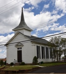 Germantown Baptist Churchlisted 1975
- Germantown Redoubtlisted 1991
- Nelson-Kirby Houselisted 1986
- Oaklawn Gardenlisted 2018
- Wildwood Farms (Additional Documentation)listed 2017
Population over time
2 figuresGermantown grew from 38,844 to 41,333 between 2010 and 2020. These are the recorded population figures Wikidata holds for this place, reached through the Geographic Names Information System number this page is keyed on rather than by name, so they belong to this place and not to another of the same name. Most are census counts, but not all are: an early figure may be a founding or settlement estimate, and an estimate published within five years of a census is left out. The change column is computed, and is left blank where more than 20 years separate a figure from the one before it, because a gap that long is not a change between two counts.
| Year | People | Change |
|---|---|---|
| 2010 | 38,844 | |
| 2020 | 41,333 | +2,489 (+6%) |
Topographic sheets covering this place
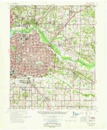
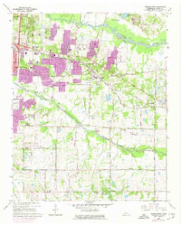
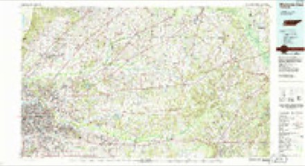
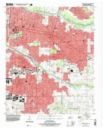
7 surveys from 12 printed sheetsMatched by testing this settlement's coordinate against the published boundary of every sheet in the United States Geological Survey's historical collection. Each opens the scanned sheet at the Survey.
- 1956 USGS Blytheville quadrangle1:250000, 2 printings
- 1959 USGS Blytheville quadrangle1:250000
- 1960 USGS Bartlett quadrangle1:62500
- 1961 USGS Bartlett quadrangle1:62500
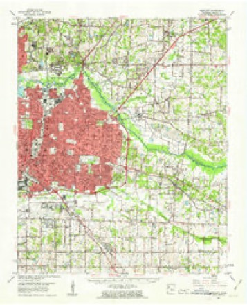
- 1965 USGS Germantown quadrangle1:24000, 4 printings
- 1986 USGS Memphis East quadrangle1:100000, 2 printings
- 1997 USGS Germantown quadrangle1:24000
Mines and quarries near this place
10 within 5 milesRegional context, not property-specific evidence. The federal mineral resources record lists 10 workings within 5 miles of Germantown: 7 past producers, 3 producers. 3 still produce. What was taken out: Sand and Gravel, Construction. Distance is straight-line from the map coordinates, so a quarry counted here may appear on a neighbouring settlement's page as well.
| Where | Site | Commodity | Status | Recorded |
|---|---|---|---|---|
| #1 Ballard Pit | Sand and Gravel, Construction | Producer | Unconsolidated Sediments | |
| #4 Moore Pit | Sand and Gravel, Construction | Producer | Unconsolidated Sediments | |
| Gallina Pit | Sand and Gravel, Construction | Producer | 1971 | |
| Gallina Pit | Sand and Gravel, Construction | Past Producer | Sedimentary | |
| Number 1 Ballard Pit | Sand and Gravel, Construction | Past Producer | Sedimentary | |
| Number 1 Ballard Pit | Sand and Gravel, Construction | Past Producer | ||
| Number 4 Moore Pit | Sand and Gravel, Construction | Past Producer | Sedimentary | |
| Number 4 Moore Pit | Sand and Gravel, Construction | Past Producer | ||
| Pierce Pit | Sand and Gravel, Construction | Past Producer | Unconsolidated Sediments | |
| Pierce Pit | Sand and Gravel, Construction | Past Producer |
Storms near this place
60 of 62 shownRegional context, not property-specific evidence. The National Weather Service names Germantown in 62 storm reports between 1996 and 2025: 23 thunderstorm wind, 18 hail, 17 flash flood, 2 flood. No death or injury is recorded in these reports. Each account below is quoted exactly as the forecast office filed it, from the NOAA Storm Events Database, and each date opens the federal record of that event.
| When | Event | Place named | Harm | What the report says |
|---|---|---|---|---|
| April 2006 | Hail | Germantown | $75,000 | Several cars were damaged by the large hail. |
| July 2023 | Thunderstorm Wind | Germantown | $50,000 | A tree was knocked onto a house in Germantown. |
| July 2023 | Thunderstorm Wind | Germantown | $50,000 | Eleven power poles and associated power lines were downed along Winchester Boulevard. |
| October 2019 | Thunderstorm Wind | Germantown | $50,000 | The tornado that struck portions of Memphis from the airport to Balmoral produced a swath of wind damage as it collapsed. The swath stretched from near Balmoral through parts of Germantown and consisted mostly of tree damage. |
| July 2009 | Lightning | Germantown | $50,000 | A lightning strike caught a house on fire south of Germantown. The house sustained damage from the fire. |
| June 2024 | Flash Flood | Germantown | $25,000 | The Poplar Avenue and International Drive intersection was flooded. Three cars were stranded. |
| April 2005 | Thunderstorm Wind | Germantown | $15,000 | One house was damaged. A few trees were blown down. |
| April 2006 | Hail | Germantown | $11,000 | no account filed |
| April 2023 | Thunderstorm Wind | Germantown | $10,000 | Power poles and power lines were knocked down on Riverdale Road and on Houston Levee Road. |
| June 2017 | Thunderstorm Wind | Germantown | $10,000 | Large tree and power lines downed near the intersection of Riverdale Road and Oak Run Drive. |
| September 2023 | Hail | Germantown | $5,000 | Large hail up to ping-pong size lasted for approximately five minutes resulting in small dents to a car. |
| July 2023 | Thunderstorm Wind | Germantown | $5,000 | Multiple trees had large limbs broken off. |
| June 2018 | Thunderstorm Wind | Germantown | $5,000 | Multiple fallen trees reported in Germantown. |
| April 2006 | Thunderstorm Wind | Germantown | $5,000 | A concession stand at the Johnson Road Park suffered structural damage. |
| May 1999 | Thunderstorm Wind | Germantown | $5,000 | A few trees were blown down. |
| July 1999 | Thunderstorm Wind | Germantown | $5,000 | Several trees were knocked down. |
| July 1998 | Thunderstorm Wind | Germantown | $5,000 | Several power lines and a transformer were knocked down. |
| November 1998 | Thunderstorm Wind | Germantown | $5,000 | Several trees were knocked down. |
| June 2007 | Thunderstorm Wind | Germantown | $2,000 | Straight line winds knocked a railroad crossing arm down on a power line at Poplar Avenue and Mendenhall Road. In addition, a power line was knocked down at Walnut Grove Road at Baptist East Hospital. |
| June 2006 | Thunderstorm Wind | Germantown | $2,000 | A few trees were knocked down by straight line winds. |
| May 2008 | Hail | Germantown | $2,000 | no account filed |
| April 2011 | Thunderstorm Wind | Germantown | $1,000 | Straight line winds blew down a fence over at the corner of Raines and Kirby across from Kirby High School in Southeast Memphis. |
| April 2007 | Hail | Germantown | $1,000 | Penny size hail fell at the intersection of Hacks Cross and Shelby Drive and in Collierville. |
| April 2007 | Hail | Germantown | $1,000 | Penny size hail reported at the intersection of Hacks Cross Road and Winchester Road. |
| June 2007 | Flash Flood | Germantown | $1,000 | Heavy rain produced flash flooding at White Station Road between Poplar Avenue and Park Avenue. Cars became stalled in the flood waters as a result. |
| May 2006 | Hail | Germantown | $1,000 | Penny size hail was reported on Kostka Lane in Germantown. |
| May 1999 | Flood | Germantown | $1,000 | Several streets were flooded in Germantown and Bartlett with as much as 12 inches of water on the road. |
| April 2003 | Hail | Germantown | $150 | no account filed |
| July 2005 | Hail | Germantown | $50 | no account filed |
| July 2004 | Hail | Germantown | $10 | no account filed |
| May 1996 | Hail | Germantown | $10 | no account filed |
| February 2025 | Flash Flood | Germantown | - | Water over roadway. |
| July 2025 | Flash Flood | Germantown | - | Mt Moriah Road and Clarke Rd were shut down due to flash flooding and water overtopping roads, leaving them impassable. |
| June 2025 | Flood | Germantown | - | There was some yard flooding from heavy rain. |
| April 2025 | Flash Flood | Germantown | - | Cars stranded due to flooded roadways West of Kimbrough Road. |
| April 2025 | Flash Flood | Germantown | - | Water was four feet deep at the intersection of Humphreys Blvd and Kirby Rd, leaving multiple cars submerged. |
| November 2022 | Hail | Germantown | - | Estimated hail of 0.75 inches fell two miles southeast of Memphis. |
| June 2019 | Heavy Rain | Germantown | - | Rainfall totals of 6.70 inches from southern sections of Shelby County. Three miles south of Germantown received 5.62 inches and 1.4 miles southeast of Collierville received 6.68 inches. |
| August 2019 | Flash Flood | Germantown | - | Wiley Avenue was flooded in Germantown. |
| August 2018 | Flash Flood | Germantown | - | Several feet of flowing water on Riverdale Road north of Highway 385. Debris in water. Traffic detouring around. |
| July 2017 | Flash Flood | Germantown | - | Heavy ponding on roadways and water overflowing gutters on Knight Arnold and Winchester Roads in southeast Memphis. |
| June 2016 | Thunderstorm Wind | Germantown | - | Trees down in Germantown. |
| June 2016 | Flash Flood | Germantown | - | Intersection of Quince and Ridgeway roads flooded in Southeast Memphis. |
| July 2016 | Hail | Germantown | - | Nickel size hail at Apple Tree Center on Mount Moriah Road. |
| July 2015 | Thunderstorm Wind | Germantown | - | Straight line winds knocked some trees down in Germantown and Collierville. A power line was knocked down and a traffic signal was damaged in Collierville. |
| June 2012 | Flash Flood | Germantown | - | Heavy rain caused flashing flooding in parts of Southeast Memphis. Mount Moriah Road was covered with two feet of water. |
| June 2011 | Thunderstorm Wind | Germantown | - | Straight line winds knocked down several trees throughout Germantown and Collierville. |
| February 2011 | Thunderstorm Wind | Germantown | - | Straight line winds knocked over a chimney at a house in Hickory Hill. The stoplight was damaged at Poplar Avenue and Germantown Road in Germantown. |
| April 2011 | Thunderstorm Wind | Germantown | - | Straight line winds knocked trees down in Germantown and Cordova and briefly trapped one person in a house. |
| April 2011 | Thunderstorm Wind | Germantown | - | Straight line winds knocked down numerous trees in Germantown. Homes and automobiles were damaged as a result of the fallen trees. |
| August 2010 | Flash Flood | Germantown | - | Heavy rain produced flash flooding at the intersection of Holmes Road and Autumn Forrest Drive. Water was as high as the fenders of school buses. |
| April 2010 | Hail | Germantown | - | Quarter to half dollar size hail fell in Hickory Hill. |
| April 2010 | Flash Flood | Germantown | - | Heavy rain produced flash flooding near Germantown. Southbound Kimbrough Road between Wolf River Boulevard and Farmington Boulevard was flooded with 1 foot of water. Farmington Boulevard near Germantown Road was flooded with water higher than the curb. |
| April 2010 | Hail | Germantown | - | Nickel to golf ball size hail fell in the Germantown area. |
| August 2009 | Flash Flood | Germantown | - | Heavy rain produced flash flooding at the intersection of Kirby Parkway and Cottingham Place. |
| June 2009 | Thunderstorm Wind | Germantown | - | Straight line winds knocked down numerous trees and power lines in Germantown. A railroad crossing arm was blown away and wrapped around a power pole at Hacks Cross Road and Poplar Pike. |
| May 2008 | Flash Flood | Germantown | - | Heavy rain produced flash flooding in East Memphis. Six to eight inches of water covered Poplar Avenue east of Massey Road. |
| January 2008 | Flash Flood | Germantown | - | Heavy rain produced flash flooding in East Memphis. Many side streets were closed as a result. |
| February 2007 | Flash Flood | Germantown | - | Heavy rain caused flash flooding on roadways near the Agricenter. |
| April 2025 | Hail | Germantown | - | no account filed |
Nearest settlements
The eight closest, with where each one stands in the county. Distances are straight-line, computed from the Geographic Names Information System coordinates.
| Map | Place | Distance | Sheets |
|---|---|---|---|
| Booth (historical) | 0.6 miles | 12 | |
| Greenlawn | 1.4 miles | 12 | |
| Southwind | 2.6 miles | 12 | |
| White Station | 2.8 miles | 12 | |
| Forest Hill | 3.1 miles | 12 | |
| River Oaks | 3.5 miles | 12 | |
| Brookfield | 3.9 miles | 12 | |
| Clay (historical) | 4.2 miles | 12 |
Elsewhere
Matched on this settlement's Geographic Names Information System number rather than its name, so it cannot be a different place of the same name in another state.
| Wikipedia article on Germantown | An encyclopaedic summary. Its text is share-alike, so it is linked here rather than copied. |
| Wikidata item Q588898 | The structured record the population and elevation above come from. Public domain (CC0). |
Provenance
This settlement is recorded in the Geographic Names Information System as feature 1285318. The sheet list is computed by point-in-boundary test against the United States Geological Survey's historical topographic inventory. Both are works of the United States government and carry no copyright under 17 U.S.C. 105.
Mines and quarries. USGS Mineral Resources Data System (MRDS) https://mrdata.usgs.gov/mrds/ A work of the United States government, no copyright under 17 U.S.C. 105.
Storms. NOAA National Centers for Environmental Information, Storm Events Database https://www.ncei.noaa.gov/stormevents/ A work of the United States government, no copyright under 17 U.S.C. 105. Narratives are quoted verbatim from the National Weather Service report and are not edited or summarised.