 Block
Greenlawn, Tennessee
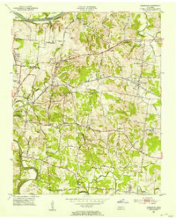
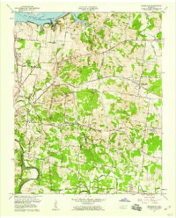
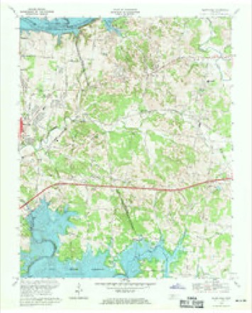
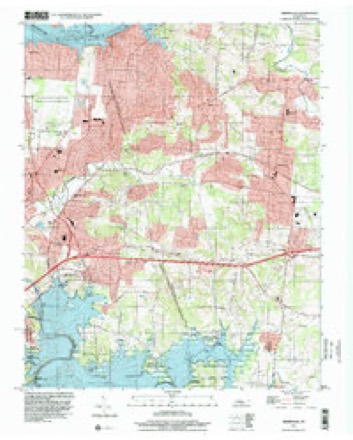
18 topographic sheets cover this place, the earliest surveyed in 1903 and the latest in 1997. It stands in District 8. It lies in ZIP code area 37138. It stands on Schutes Branch. The Survey maps it on the Hermitage quadrangle.
Research this city
On record in Greenlawn
Buildings and businesses the archive holds for this place. Each opens its own page, with the source record it came from.
On the National Register 1 record
- Williamson Chapel CME Church Complexlisted 2006
Topographic sheets covering this place
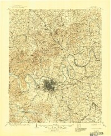
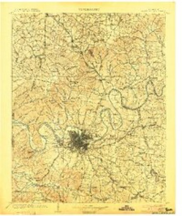
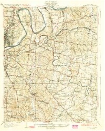
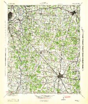
11 surveys from 18 printed sheetsMatched by testing this settlement's coordinate against the published boundary of every sheet in the United States Geological Survey's historical collection. Each opens the scanned sheet at the Survey.
- 1903 USGS Greenbrier quadrangle1:125000, 2 printings
- 1903 USGS Nashville quadrangle1:125000, 2 printings
- 1932 USGS Hermitage quadrangle1:62500, 3 printings
- 1942 USGS Lebanon quadrangle1:100000
- 1952 USGS Hermitage quadrangle1:24000
- 1956 USGS Nashville quadrangle1:250000, 2 printings
- 1957 USGS Hermitage quadrangle1:24000
- 1959 USGS Nashville quadrangle1:250000
- 1968 USGS Hermitage quadrangle1:24000, 3 printings
- 1984 USGS Nashville quadrangle1:100000
- 1997 USGS Hermitage quadrangle1:24000



Fires near this place
2 since 1998Regional context, not property-specific evidence. The federal wildfire occurrence database lists 2 fires within 5 miles of Greenlawn between 1998 and 2000, burning about 16 acres in total. None started naturally. None was recorded as arson. Distance is straight-line from the map coordinates, so a fire counted here may appear on a neighbouring settlement's page as well.
| Reported cause | Fires |
|---|---|
| Debris and open burning | 1 |
| Missing data/not specified/undetermined | 1 |
The most recent of them, most recent first, with the day each was reported and the service that recorded it.
| Date | Cause | Size | Reported by | Name on the report |
|---|---|---|---|---|
| 2 December 1998 | Missing data/not specified/undetermined | 15 acres | Tennessee Division of Forestry | not named |
| 11 December 2000 | Debris and open burning | 1.0 acres | Tennessee Division of Forestry | not named |
Settlements close enough to share some of these fires:
Storms near this place
60 since 2008Regional context, not property-specific evidence. The National Weather Service names Greenlawn in 60 storm reports between 2008 and 2025: 39 thunderstorm wind, 8 heavy rain, 6 flash flood, 3 lightning. No death or injury is recorded in these reports. Each account below is quoted exactly as the forecast office filed it, from the NOAA Storm Events Database, and each date opens the federal record of that event.
| When | Event | Place named | Harm | What the report says |
|---|---|---|---|---|
| July 2016 | Flash Flood | Greenlawn | $100,000 | Significant flash flooding affected much of Wilson County, with several vehicles and roads damaged by flooding and some water rescues conducted. Roads that were flooded and closed in Mount Juliet included John Wright Road, Phillis Road between Chandler Road and Lebanon Road, Old Lebanon Dirt Road north of Weston Drive, Old Lebanon Dirt Road near Page Road, and Belinda Parkway at Southeast Springdale Street where a car stalled in the flood waters. In Lebanon, roadways that were flooded and closed included Callis Lane at Wooddall Road and Bluebird Road near Peyton Road where a man drove into the floodwaters and had to be rescued. Other flooded roads were the 3600 block of Sparta Pike in Watertown, the 12000 block of Stewarts Ferry Pike in Gladeville, and Central Pike at Stewarts Ferry Pike in Gladeville. The Timberline Campground on Murfreesboro Road at Hartmann Drive in Lebanon was also flooded. No injuries or fatalities were reported. |
| January 2008 | Thunderstorm Wind | Greenlawn | $50,000 | There was roof damage and shingles torn off the front and rear of roof of home located at 6040 Saundersville Rd. An eight inch diameter tree was uprooted. There was damage to a covered pontoon boat involving pole and canvas. |
| July 2012 | Lightning | Greenlawn | $35,000 | Lightning struck a home on Woods Run Road where insulation was blown out of its walls. |
| July 2023 | Thunderstorm Wind | Greenlawn | $20,000 | A small but intense microburst struck far north Mount Juliet. Dozens of trees were snapped and uprooted in a southwest to northeast direction on Saundersville Ferry Road, Edgewater Drive, Bellwood Drive, Hillwood Drive, Green Valley Drive, Saundersville Road, and other area side streets. Several homes had minor roof damage or were damaged by falling trees. Nine power poles and several power lines were also blown down resulting in power outages. Damages are a rough estimate. |
| July 2023 | Thunderstorm Wind | Greenlawn | $15,000 | Severe thunderstorm winds downed several trees along Vanderbilt Road in Mount Juliet. Damages are a rough estimate. |
| May 2016 | Flash Flood | Greenlawn | $10,000 | Significant flash flooding affected the Mount Juliet and Belinda City areas of northwest Wilson County. Several homes and businesses were flooded, including homes at 695 John Wright Road and Pascal Drive at Division Street, and businesses including the Country Hams store on Lebanon Road at Nonaville Road and the Clearview Plaza Shopping Center on Mount Juliet Road at Old Lebanon Dirt Road. Numerous roads were also flooded and closed, including 1445 West Division Street near Pascal Drive, Sunnymeade Drive at Stoners Creek, 614 Greenhill Drive, Old Lebanon Dirt Road near Mount Juliet Road, and areas around Charlie Daniels Park. |
| December 2016 | Thunderstorm Wind | Greenlawn | $10,000 | A tree was blown down on a car with occupants inside on Saundersville Road. Power lines were down as well. |
| August 2019 | Lightning | Greenlawn | $5,000 | Lightning struck a house on NW Clearview Drive causing a fire but unknown damage. |
| May 2017 | Thunderstorm Wind | Greenlawn | $5,000 | Several trees were blown down in North Mount Juliet. A tree was blown down with at Davids Corner Road and Benders Ferry Road with the roadway blocked. Trees were also down in the roadway at 6171 Saundersville Road and at Saundersville Road near Deerfield Drive. A tree was also blown down at 171 Saundersville Ferry Road. |
| May 2016 | Thunderstorm Wind | Greenlawn | $5,000 | A Facebook report indicated large tree limbs were blown down and a couple of roofs had minor roof damage in the Hickory Lake Farms subdivision. |
| May 2016 | Thunderstorm Wind | Greenlawn | $5,000 | One tree and 4 to 5 power lines were blown down across Singing Springs Road at Nonaville Road blocking the roadway. |
| August 2016 | Thunderstorm Wind | Greenlawn | $5,000 | NWS employees and social media reports indicated a microburst affected areas near and south of the NWS Nashville office in far northwest Wilson County. One large tree was blown down clipping a house on Needmore Road east of Avalon Bay Drive, and another large tree was blown down at East Shady Trail at Lakeshore Drive. Other large tree limbs were blown down in the side streets around these areas. All damage was in a N to S direction with winds estimated from 50 to 60 mph. |
| July 2016 | Thunderstorm Wind | Greenlawn | $5,000 | Trees, tree limbs, and power lines were blown down on Catskill Drive near Matterhorn Drive, Blue Ridge Drive near Big Horn Drive, and Berkshire Drive in Green Hill. |
| July 2013 | Flash Flood | Greenlawn | $5,000 | The Wilson County Emergency Manager reported several inches to a foot of standing water over Franklin Road near 3781 Franklin Road. A road closure was reported at 10920 Central Pike due to flooding. Road closures were reported at Windy Road, Logue Road, and Tinnel Road due to flooding. Flash Flooding was reported on Callis Road near Highway 109 south of Interstate 40 and RV campers were evacuated from Country Campground located near the intersection of Highway 231S and Maddox-Simpson Parkway due to flooding of Sinking Town Creek. |
| July 2012 | Thunderstorm Wind | Greenlawn | $5,000 | Several trees were blown down on Weeping Elm Road. |
| June 2019 | Thunderstorm Wind | Greenlawn | $3,000 | Public reported several trees were blown down around 5542 Vanderbilt Road. |
| December 2016 | Thunderstorm Wind | Greenlawn | $3,000 | Trees were blocking the roadway at 3960 Saundersville Ferry Rd and 2883 Saundersville Ferry Rd in Mount Juliet. |
| July 2016 | Thunderstorm Wind | Greenlawn | $3,000 | Several trees and power lines were blown down along and across Saundersville Ferry Road with the roadway completely blocked. |
| July 2016 | Thunderstorm Wind | Greenlawn | $3,000 | Three power poles were blown down in the 1300 block of Saundersville Ferry Road. |
| March 2017 | Thunderstorm Wind | Greenlawn | $2,000 | A Facebook report indicated trees were blown down on Vanderbilt Road at Saundersville Road. |
| December 2016 | Thunderstorm Wind | Greenlawn | $2,000 | A tree was blown down on Weather Station Road at the entrance of the NWS office. Another tree was blown down at Needmore Road and Saundersville Road. |
| July 2023 | Thunderstorm Wind | Greenlawn | $1,000 | Severe thunderstorm winds downed a tree at Saundersville Road and North Greenhill Road in Green Hill. Damages are a rough estimate. |
| July 2023 | Thunderstorm Wind | Greenlawn | $1,000 | Severe thunderstorm winds downed a large tree at a home along Vanderbilt Road in Mount Juliet. Damages are a rough estimate. |
| July 2023 | Thunderstorm Wind | Greenlawn | $1,000 | Severe thunderstorm winds downed a large tree along Needmore Road. Damages are estimated. |
| June 2019 | Thunderstorm Wind | Greenlawn | $1,000 | Power lines were blown down near Langford Cove. |
| February 2017 | Thunderstorm Wind | Greenlawn | $1,000 | A tree was snapped in the yard of a home on Saundersville Road just west of Matterhorn Road. |
| November 2017 | Thunderstorm Wind | Greenlawn | $1,000 | A tree was blown down that partially blocked Shutes Branch Road near the entrance to the National Weather Service office. |
| April 2016 | Thunderstorm Wind | Greenlawn | $1,000 | A tree was blown down on Needmore Road near Avalon Bay Drive. |
| May 2016 | Thunderstorm Wind | Greenlawn | $1,000 | A tree was blown down across Saundersville Road near Hermitage Church of Nazarene. |
| December 2016 | Thunderstorm Wind | Greenlawn | $1,000 | Telephone lines down on Idlewood Drive. |
| July 2016 | Thunderstorm Wind | Greenlawn | $1,000 | A tree was blown down at Needmore Road and Avalon Bay Road near the NWS Nashville office. |
| April 2015 | Thunderstorm Wind | Greenlawn | $1,000 | A tree was blown down and blocked Saundersville Ferry Road just north of Saundersville Road. |
| July 2014 | Thunderstorm Wind | Greenlawn | $1,000 | A tree was reported down on Hunters Crossing Road blocking the roadway. |
| July 2014 | Thunderstorm Wind | Greenlawn | $1,000 | A tree was reported down on Saundersville Road near Old Hickory Lake. |
| July 2014 | Lightning | Greenlawn | $1,000 | A house was struck by lightning on Hidden Ridge Circle in Mount Juliet. Only minor damage reported. |
| February 2014 | Thunderstorm Wind | Greenlawn | $1,000 | A tree was blown down across the road at 807 Lori Lane in Mount Juliet. |
| August 2012 | Thunderstorm Wind | Greenlawn | $1,000 | A tree was blown down at Saundersville Ferry Road at Kebu Drive. |
| May 2011 | Thunderstorm Wind | Greenlawn | $1,000 | A tree was downed at the National Weather Service office in Old Hickory. |
| July 2008 | Thunderstorm Wind | Greenlawn | $100 | The 911 dispatch said a tree limb was down on Green Harbor Rd. |
| April 2025 | Flash Flood | Greenlawn | - | Heavy rain in Wilson County resulted in flash flooding, particularly along waterways and across other low-lying areas. Mt. Juliet has several roadways closed for flooding, including Old Lebanon Dirt Road near Page Drive. Extent of damages is unknown. |
| July 2025 | Flash Flood | Greenlawn | - | Heavy rain caused flash flooding in the Green Hill area. Extent of damages is unknown. |
| February 2021 | Hail | Greenlawn | - | A retired NWS employee and several public photos showed long, narrow cylindrical-shaped hail. |
| February 2021 | Hail | Greenlawn | - | Pea to nickel size hail and winds estimated up to 50 mph occurred at the NWS Nashville office. |
| June 2019 | Thunderstorm Wind | Greenlawn | - | A NWS employee in Green Hill estimated a wind gust of 65 mph. |
| February 2019 | Heavy Rain | Greenlawn | - | NWS Nashville office measured a 24 hour rain total of 3.93 inches. |
| February 2019 | Heavy Rain | Greenlawn | - | CoCoRaHS station Green Hill 0.3 N measured a 24 hour rainfall total of 5.33 inches. |
| May 2017 | Heavy Rain | Greenlawn | - | A 24 hour rainfall total was measured at NWS Nashville of 2.29 inches. |
| May 2017 | Heavy Rain | Greenlawn | - | A 24 hour rainfall total was reported by CoCoRaHs Station Green Hill 3.1 NNE of 2.55 inches. |
| May 2016 | Hail | Greenlawn | - | Hail up to nickel size fell at the NWS Nashville office in Old Hickory for 10 minutes. |
| May 2016 | Heavy Rain | Greenlawn | - | Rainfall of 3.00 inches was measured at the NWS Nashville office from 11 PM CDT on May 10 through 6 AM CDT on May 11, with majority of rainfall falling between 11 PM CDT and 2 AM CDT. |
| July 2016 | Thunderstorm Wind | Greenlawn | - | An NWS employee estimated a 60 mph wind gust at his home. |
| July 2016 | Thunderstorm Wind | Greenlawn | - | A NWS employee estimated a peak wind gust of 60 mph at the NWS Nashville office. |
| July 2016 | Heavy Rain | Greenlawn | - | CoCoRaHS station Green Hill 3.1 NNE measured a 24 hour rainfall total of 3.52 inches. |
| April 2015 | Thunderstorm Wind | Greenlawn | - | A wind gust of 68 mph was measured by a broadcast meteorologist on a home weather station at the north end of Saundersville Ferry Road. |
| April 2013 | Flash Flood | Greenlawn | - | Moderate rainfall of 1 to 2 inches during the morning of April 27 was followed by heavy thunderstorms that produced an additional 2 to 4 inches of rainfall during the evening and into the early morning hours on April 28. The result was widespread flash flooding of roadways across Wilson County. Roadways that were flooded and closed in Mount Juliet included Old Lebanon Dirt Road at Kelsey Glen Drive and Nonaville Road, while roadways that were flooded and closed in Lebanon included Lebanon Road at Main Street, Lebanon Road at Maplewood Road, and Coles Ferry Road at Academy Road. Many other roadways throughout the county were also reportedly flooded. |
| August 2013 | Heavy Rain | Greenlawn | - | A two-day rainfall total of 5.81 inches was measured at the NWS Nashville office. |
| August 2013 | Heavy Rain | Greenlawn | - | A two-day rainfall total of 6.49 inches was measured at CoCoRaHS station Green Hill 4.5 NNE. |
| May 2010 | Flood | Greenlawn | - | Cumberland River was cresting at several locations across the county. Some of those locations included the Highway 109 area and North Cairo Bend area. Numerous boat ramps and homes along the Wilson County Water Front of the Cumberland River were being thretened at the time of this report. No additional information concerning final damage on boat ramps and homes was provided. Six inches of water was reported in some places along Central Pike, just east of Mt. Juliet Road. Suggs Creek was reported out of its banks near Underwood Road west of Gladeville. |
| January 2008 | Thunderstorm Wind | Greenlawn | - | Tree was blown down near the NWS office. |
| April 2015 | Thunderstorm Wind | Greenlawn | - | no account filed |
Nearest settlements
The eight closest, with where each one stands in the county. Distances are straight-line, computed from the Geographic Names Information System coordinates.
| Map | Place | Distance | Sheets |
|---|---|---|---|
| Indian Lake Farms | 0.1 miles | 18 | |
| Langford Cove | 0.5 miles | 18 | |
| Lankford Farms | 0.8 miles | 18 | |
| Harbor View | 0.9 miles | 18 | |
| Woodlake | 1.2 miles | 18 | |
| Springmont | 1.4 miles | 18 | |
| Highland Heights | 1.4 miles | 18 | |
| Green Hill | 1.6 miles | 18 |
Provenance
This settlement is recorded in the Geographic Names Information System as feature 1286178. The sheet list is computed by point-in-boundary test against the United States Geological Survey's historical topographic inventory. Both are works of the United States government and carry no copyright under 17 U.S.C. 105.
Wildfire. Short, Karen C. 2022. Spatial wildfire occurrence data for the United States, 1992-2020 [FPA_FOD_20221014]. 6th Edition. Fort Collins, CO: Forest Service Research Data Archive. https://doi.org/10.2737/RDS-2013-0009.6 Collected with United States Government funding and usable without additional permissions or fees.
Storms. NOAA National Centers for Environmental Information, Storm Events Database https://www.ncei.noaa.gov/stormevents/ A work of the United States government, no copyright under 17 U.S.C. 105. Narratives are quoted verbatim from the National Weather Service report and are not edited or summarised.