 Block
La Vergne, Tennessee
18 topographic sheets cover this place, the earliest surveyed in 1903 and the latest in 1997. It stands in District 5. It lies in ZIP code area 37086. It stands on East Branch Hurricane Creek. The Survey maps it on the La Vergne quadrangle. 38,719 people lived here at the 2020 count. It stands 597 feet above sea level.
Population over time
2 figuresLa Vergne grew from 32,588 to 38,719 between 2010 and 2020. These are the recorded population figures Wikidata holds for this place, reached through the Geographic Names Information System number this page is keyed on rather than by name, so they belong to this place and not to another of the same name. Most are census counts, but not all are: an early figure may be a founding or settlement estimate, and an estimate published within five years of a census is left out. The change column is computed, and is left blank where more than 20 years separate a figure from the one before it, because a gap that long is not a change between two counts.
| Year | People | Change |
|---|---|---|
| 2010 | 32,588 | |
| 2020 | 38,719 | +6,131 (+19%) |
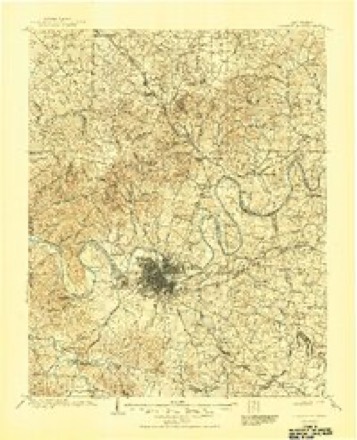
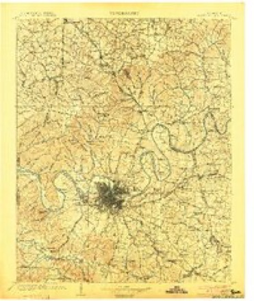
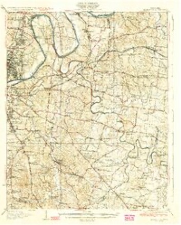
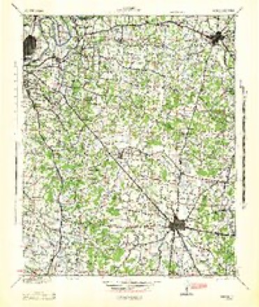
Topographic sheets covering this place
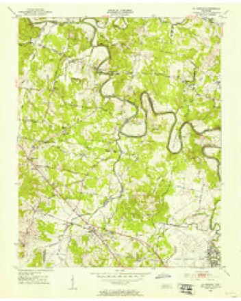
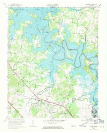
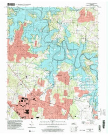
10 surveys from 18 printed sheetsMatched by testing this settlement's coordinate against the published boundary of every sheet in the United States Geological Survey's historical collection. Each opens the scanned sheet at the Survey.
- 1903 USGS Greenbrier quadrangle1:125000, 2 printings
- 1903 USGS Nashville quadrangle1:125000, 2 printings
- 1932 USGS Hermitage quadrangle1:62500, 3 printings
- 1942 USGS Lebanon quadrangle1:100000
- 1952 USGS La Vergne quadrangle1:24000, 2 printings
- 1956 USGS Nashville quadrangle1:250000, 2 printings
- 1959 USGS Nashville quadrangle1:250000
- 1968 USGS La Vergne quadrangle1:24000, 3 printings
- 1984 USGS Nashville quadrangle1:100000
- 1997 USGS La Vergne quadrangle1:24000



Fires near this place
6 since 1997Regional context, not property-specific evidence. The federal wildfire occurrence database lists 6 fires within 5 miles of La Vergne between 1997 and 2001, burning about 19 acres in total. None started naturally. 3 were recorded as arson. Distance is straight-line from the map coordinates, so a fire counted here may appear on a neighbouring settlement's page as well.
| Reported cause | Fires |
|---|---|
| Arson/incendiarism | 3 |
| Debris and open burning | 2 |
| Smoking | 1 |
The most recent of them, most recent first, with the day each was reported and the service that recorded it.
| Date | Cause | Size | Reported by | Name on the report |
|---|---|---|---|---|
| 26 September 1998 | Smoking | 3.0 acres | Tennessee Division of Forestry | not named |
| 3 August 1998 | Debris and open burning | 5.3 acres | Tennessee Division of Forestry | not named |
| 19 February 1997 | Debris and open burning | 2.0 acres | Tennessee Division of Forestry | not named |
| 6 November 2001 | Arson/incendiarism | 8.0 acres | Tennessee Division of Forestry | not named |
| 29 November 2000 | Arson/incendiarism | under an acre | Tennessee Division of Forestry | not named |
| 1 November 2000 | Arson/incendiarism | under an acre | Tennessee Division of Forestry | not named |
Settlements close enough to share some of these fires:
Storms near this place
51 since 1996Regional context, not property-specific evidence. The National Weather Service names La Vergne in 51 storm reports between 1996 and 2025: 26 thunderstorm wind, 11 hail, 8 flash flood, 3 tornado. The reports record 2 injuries. Each account below is quoted exactly as the forecast office filed it, from the NOAA Storm Events Database, and each date opens the federal record of that event.
| When | Event | Place named | Harm | What the report says |
|---|---|---|---|---|
| September 1997 | Dust Devil | La Vergne | 2 hurt, $1,000 | A dust devil struck the city park. Old Timers Day was being celebrated at the park. The winds blew over 3 tents. A rope attached to a tent struck a woman in the face. A woman vendor fell during the hubbub, and she hurt her knees. These 2 people were taken to a hospital, treated and then released. |
| May 2010 | Flood | La Vergne | $3,500,000 | Bridge on One Mile Lane that crosses Stewart Creek was reported to be underwater. Also, numerous homes, numerous businesses, numerous non comercial buildings, along with several county, state, and federal roads across the county received damage due to the flood. |
| April 2011 | Tornado (EF1) | La Vergne | $250,000 | The EF1 tornado began along the Davidson and Williamson County line, along Kidd Road. The damage path extended east across Battle Road, Waldron Road, along Blair Road, and ending near Interstate 24 and Sam Ridley Parkway. The damage path ranged from 50 to 100 yards wide. Damage was very consistent along the path, which was just over 4 miles long. ||The debris pattern showed clear convergent patterns, and eyewitness accounts support the determination that a tornado caused the damage. Numerous power poles were snapped. Hundreds of trees were snapped or uprooted. Some of these had large root systems. Some small storage buildings were destroyed. Numerous homes had roof|and siding damage. Several fences were blown down. Debris was scattered hundreds of yards. A tractor trailer was blown over on Interstate 24. Several cargo trailers were overturned on Interstate 24 also. |
| February 2009 | Thunderstorm Wind | La Vergne | $150,000 | Several commercial buildings had major roof damage. |
| June 2013 | Thunderstorm Wind | La Vergne | $10,000 | A tree was blown down on a Glass Company on Wadron Road. Trees and power lines were also blown down on Buchanan Street and Old Nashville Highway with minor wind damage to homes in the area. |
| April 2013 | Flash Flood | La Vergne | $10,000 | Considerable flooding affected the La Vergne area of northwest Rutherford County on Saturday afternoon April 27 after radar estimates indicated 2 to 3 inches of rain had fallen since midnight. Locations along Mill Creek saw the most substantial flooding, such as Deer Drive where one home was flooded. Other homes on Taylor Drive and Apple Drive had water approach but not flood them. |
| June 2009 | Thunderstorm Wind | La Vergne | $10,000 | Small tree limbs were reported down county wide. |
| April 2018 | Thunderstorm Wind | La Vergne | $8,000 | Trees were blown down onto cars and power lines were also blown down. |
| November 2017 | Thunderstorm Wind | La Vergne | $5,000 | The front porch awning was blown off a home into the backyard and several trees were blown down at a neighboring home on Jefferson Pike at Alsup Lane. No other damage was found in the area. |
| August 2012 | Thunderstorm Wind | La Vergne | $5,000 | A few trees and a power pole were blown down at Waldron Road and Bridgestone Parkway. |
| February 2011 | Thunderstorm Wind | La Vergne | $5,000 | Trees were reported downed across JFK Drive. |
| May 2005 | Thunderstorm Wind | La Vergne | $5,000 | Tree was blown down and another tree fell down on a car. |
| August 1999 | Thunderstorm Wind | La Vergne | $5,000 | EMA reported wind damage in the city of La Vergne. Trees and power lines were down. 3 utility poles were down. There was roof and vinyl siding damage to the Cedar Ridge Apartments. Also, a tree fell onto a house. |
| June 2022 | Thunderstorm Wind | La Vergne | $3,000 | A Twitter tSpotter report and photo showed 3 power poles blown down at Forest Lane at Hampton Drive. |
| November 2017 | Thunderstorm Wind | La Vergne | $3,000 | A tree was blown down near the entrance to Tennessee Fastening Technology on Ingram Blvd just west of Mason Road, and a fence was blown down northeast of the Ingram Blvd and Mason Road intersection. No other damage was found in the area. |
| May 2010 | Thunderstorm Wind | La Vergne | $2,000 | Several trees were blown down in and around LaVergne. |
| July 2023 | Thunderstorm Wind | La Vergne | $1,000 | Severe thunderstorm winds downed trees and powerlines near Brookridge Drive in La Vergne. Damages are a rough estimate. |
| June 2019 | Thunderstorm Wind | La Vergne | $1,000 | A large tree was blown down in the Farmingdale subdivision. |
| August 2019 | Thunderstorm Wind | La Vergne | $1,000 | An outdoor detached carport was blown into the yard of a neighboring home in La Vergne. |
| October 2014 | Thunderstorm Wind | La Vergne | $1,000 | A tree was blown down on Irvin Road with power outages in the area. |
| April 2011 | Thunderstorm Wind | La Vergne | $1,000 | A tree was blown down in La Vergne. |
| April 2011 | Flash Flood | La Vergne | $1,000 | Several roads were flooded across the county due to excessive rainfall. |
| March 2025 | Hail | La Vergne | - | Estimated 2 inch hail was reported between Nolensville and Smyrna. |
| May 2020 | Thunderstorm Wind | La Vergne | - | Large trees were blown down across La Vergne. Public estimated a wind gust of 70 mph. |
| September 2020 | Flash Flood | La Vergne | - | Significant flash flooding caused several shipping containers at the Bridgestone Plant to float to Bridgestone Parkway. |
| April 2017 | Flash Flood | La Vergne | - | Multiple roads were closed in La Vergne due to high water. |
| November 2017 | Flash Flood | La Vergne | - | Numerous roads across Rutherford County were flooded or impassable and closed, including Powells Chapel Road near Walterhill, Nevada Drive in Smyrna, and Cherry Lane in Murfreesboro. Numerous commercial parking lots in La Vergne were also flooded. Rutherford County Schools were closed on Tuesday, November 7, 2017 due to the flooding. |
| March 2006 | Thunderstorm Wind | La Vergne | - | Phone poles were down. Roof was blown off a building at the Tennessee Farmer's Coop and also from the Pea Pod Cafe. |
| March 2005 | Hail | La Vergne | - | Quarter size hail reported by trained spotter. |
| August 2005 | Thunderstorm Wind | La Vergne | - | Trained spotter reported trees were blown down. |
| March 2004 | Thunderstorm Wind | La Vergne | - | Trees were blown down. |
| April 2004 | Thunderstorm Wind | La Vergne | - | A reporter for the "Tennessean" newspaper reported trees were down in the Couchville Pike area on the Rutherford and Wilson County border. |
| April 2003 | Hail | La Vergne | - | Spotter reported quarter size hail. |
| April 2003 | Hail | La Vergne | - | Spotter reported nickel size hail. |
| May 2003 | Tornado (F0) | La Vergne | - | Tornado was observed at the La Vergne Industrial Park, but no significant damage was reported. |
| May 2003 | Flash Flood | La Vergne | - | Several reports of street flooding in La Vergne and Smyrna. |
| September 2003 | Flash Flood | La Vergne | - | Newspaper account of a road closed in La Vergne due to high water, at Old Nashville Highway, under the railroad underpass. |
| April 2002 | Hail | La Vergne | - | Trained spotter reported hail from the size of peas to golf balls from Lavergne to Smyrna. |
| February 2001 | Thunderstorm Wind | La Vergne | - | Sheriff's office reported trees and power lines down. |
| February 2001 | Thunderstorm Wind | La Vergne | - | Spotter reported 60 mph wind gust. |
| February 2001 | Hail | La Vergne | - | Spotter reported dime size hail. |
| April 2001 | Thunderstorm Wind | La Vergne | - | Spotter reported siding blown off houses. |
| October 2001 | Tornado (F0) | La Vergne | - | Spotter reported a tornado, but it did no damage. |
| April 2000 | Hail | La Vergne | - | Dime size hail was observed. |
| August 1999 | Hail | La Vergne | - | WKRN-TV 2 reported golf ball size hail at La Vergne. |
| April 1998 | Hail | La Vergne | - | Public reported quarter size hail. |
| June 1998 | Funnel Cloud | La Vergne | - | SKYWARN Spotter reported a wall cloud and funnel cloud near La Vergne. Funnel cloud retreated back into the clouds. |
| July 1997 | Thunderstorm Wind | La Vergne | - | Numerous trees were blown down. One tree was blown down over I-24 at intersection with Waldron Road. |
| May 2012 | Hail | La Vergne | - | no account filed |
| January 1997 | Hail | La Vergne | - | no account filed |
| December 1996 | Flash Flood | La Vergne | - | no account filed |
Nearest settlements
The eight closest, with where each one stands in the county. Distances are straight-line, computed from the Geographic Names Information System coordinates.
| Map | Place | Distance | Sheets |
|---|---|---|---|
| Eastwood | 1.0 miles | 18 | |
| Morrow | 1.7 miles | 18 | |
| Stone Ridge | 2.1 miles | 13 | |
| Sandhill | 2.2 miles | 18 | |
| Jefferson Pike | 2.5 miles | 18 | |
| Rosswood | 2.7 miles | 13 | |
| Walnut Ridge | 2.7 miles | 13 | |
| Loafers Corner | 2.8 miles | 13 |
Elsewhere
Matched on this settlement's Geographic Names Information System number rather than its name, so it cannot be a different place of the same name in another state.
| Wikipedia article on La Vergne | An encyclopaedic summary. Its text is share-alike, so it is linked here rather than copied. |
| Wikidata item Q1025773 | The structured record the population and elevation above come from. Public domain (CC0). |
Provenance
This settlement is recorded in the Geographic Names Information System as feature 1290433. The sheet list is computed by point-in-boundary test against the United States Geological Survey's historical topographic inventory. Both are works of the United States government and carry no copyright under 17 U.S.C. 105.
Wildfire. Short, Karen C. 2022. Spatial wildfire occurrence data for the United States, 1992-2020 [FPA_FOD_20221014]. 6th Edition. Fort Collins, CO: Forest Service Research Data Archive. https://doi.org/10.2737/RDS-2013-0009.6 Collected with United States Government funding and usable without additional permissions or fees.
Storms. NOAA National Centers for Environmental Information, Storm Events Database https://www.ncei.noaa.gov/stormevents/ A work of the United States government, no copyright under 17 U.S.C. 105. Narratives are quoted verbatim from the National Weather Service report and are not edited or summarised.