 Block
Memphis, Tennessee
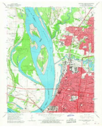
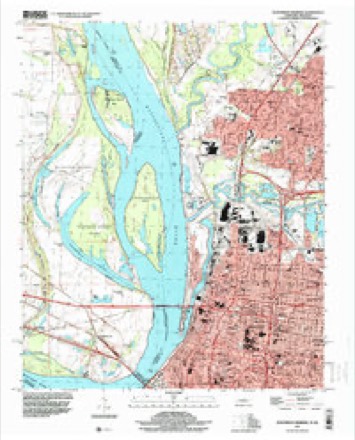
18 topographic sheets cover this place, the earliest surveyed in 1916 and the latest in 1997. It stands in District 8. It lies in ZIP code area 38105. It stands on Tan Yard Bayou. The Survey maps it on the Northwest Memphis quadrangle. 633,104 people lived here at the 2020 count. It stands 338 feet above sea level.
Research this city
On record in Memphis
Buildings and businesses the archive holds for this place. Each opens its own page, with the source record it came from.
On the National Register 12 of 188 shown
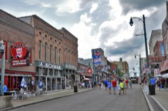 Beale Street Historic DistrictNational Historic Landmark · listed 1966
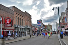 Beale Street Historic District (Boundary Increase)National Historic Landmark · listed 1993
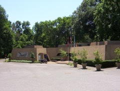 Chucalissa Indian VillageNational Historic Landmark · listed 1973
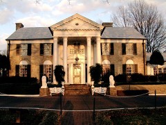 GracelandNational Historic Landmark · listed 1991
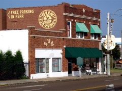 Sun Record Company, Memphis Recording ServiceNational Historic Landmark · listed 2003
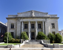 Adams Avenue Historic Districtlisted 1980
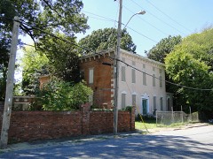 Anderson-Coward Houselisted 1986
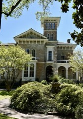 Annesdalelisted 1980
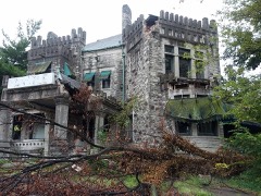 Ashlar Halllisted 1983
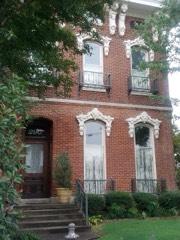 John Alexander Austin Houselisted 1984
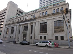 Bank of Commerce and Trust Company Buildinglisted 1980
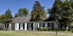 Pauline Cheek Barton Houselisted 1995
Population over time
3 figuresMemphis fell from 650,100 to 633,104 between 2000 and 2020. These are the recorded population figures Wikidata holds for this place, reached through the Geographic Names Information System number this page is keyed on rather than by name, so they belong to this place and not to another of the same name. Most are census counts, but not all are: an early figure may be a founding or settlement estimate, and an estimate published within five years of a census is left out. The change column is computed, and is left blank where more than 20 years separate a figure from the one before it, because a gap that long is not a change between two counts.
| Year | People | Change |
|---|---|---|
| 2000 | 650,100 | |
| 2010 | 646,889 | -3,211 (-0%) |
| 2020 | 633,104 | -13,785 (-2%) |
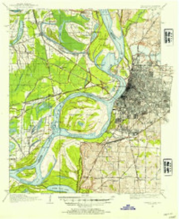
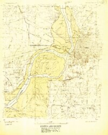
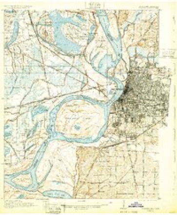
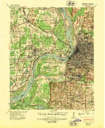
Topographic sheets covering this place
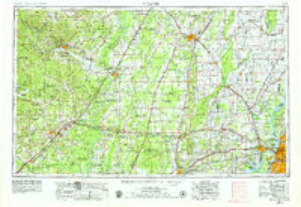
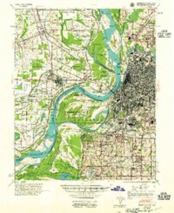
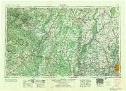
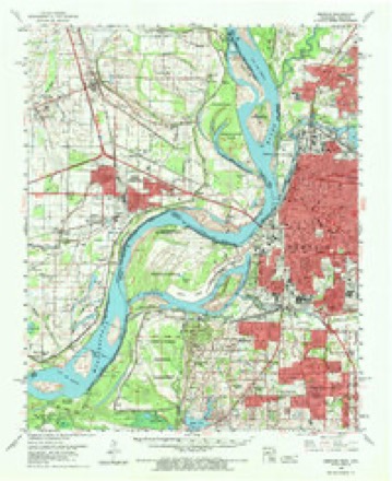
11 surveys from 18 printed sheetsMatched by testing this settlement's coordinate against the published boundary of every sheet in the United States Geological Survey's historical collection. Each opens the scanned sheet at the Survey.
- 1916 USGS Memphis quadrangle1:62500
- 1925 USGS Memphis quadrangle1:48000
- 1927 USGS Memphis quadrangle1:62500, 2 printings
- 1939 USGS Memphis quadrangle1:62500
- 1953 USGS Memphis quadrangle1:250000, 3 printings
- 1955 USGS Memphis quadrangle1:62500
- 1956 USGS Memphis quadrangle1:250000
- 1960 USGS Memphis quadrangle1:62500, 2 printings
- 1965 USGS Northwest Memphis quadrangle1:24000, 3 printings
- 1986 USGS Memphis West quadrangle1:100000, 2 printings
- 1997 USGS Northwest Memphis quadrangle1:24000
What the histories say of this town
455,622 words2 chapters about Memphis from the published histories of the county, public domain and reproduced complete.
| Chapter | From | Length |
|---|---|---|
| History | History of the City of Memphis and Shelby County Tennessee (1888) | 262,589 words in 17 parts |
| Standard History of Memphis, Tennessee, from a Study of the Original S | Standard History of Memphis, Tennessee, from a Study of the Original Sources (1912) | 193,033 words in 13 parts |
Fires near this place
1 since 1999Regional context, not property-specific evidence. The federal wildfire occurrence database lists 1 fire within 5 miles of Memphis in 1999, burning about 10 acres in total. None started naturally. None was recorded as arson. Distance is straight-line from the map coordinates, so a fire counted here may appear on a neighbouring settlement's page as well.
| Reported cause | Fires |
|---|---|
| Debris and open burning | 1 |
The most recent of them, most recent first, with the day each was reported and the service that recorded it.
| Date | Cause | Size | Reported by | Name on the report |
|---|---|---|---|---|
| 16 October 1999 | Debris and open burning | 10 acres | Tennessee Division of Forestry | not named |
Settlements close enough to share some of these fires:
Mines and quarries near this place
10 within 5 milesRegional context, not property-specific evidence. The federal mineral resources record lists 10 workings within 5 miles of Memphis: 5 past producers, 5 producers. 5 still produce. What was taken out: Sand and Gravel, Construction, Clay. Distance is straight-line from the map coordinates, so a quarry counted here may appear on a neighbouring settlement's page as well.
| Where | Site | Commodity | Status | Recorded |
|---|---|---|---|---|
| Memphis Pit | Clay | Past Producer | ||
| #2 Hollywood Plant | Sand and Gravel, Construction | Producer | 1967 | |
| 64 Pit | Sand and Gravel, Construction | Past Producer | ||
| Allen Materials, Inc. Pit | Sand and Gravel, Construction | Past Producer | ||
| Allen Materials, Inc. Plant Dredge Operation | Sand and Gravel, Construction | Producer | Unconsolidated Sediments | |
| Allen Mine | Sand and Gravel, Construction | Producer | ||
| Bragg Pit | Sand and Gravel, Construction | Past Producer | ||
| Bryant Pit | Sand and Gravel, Construction | Past Producer | ||
| Mine No. 3 | Sand and Gravel, Construction | Producer | ||
| Sylvia G. Dredge | Sand and Gravel, Construction | Producer |
Storms near this place
60 of 170 shownRegional context, not property-specific evidence. The National Weather Service names Memphis in 170 storm reports between 1993 and 2025: 77 thunderstorm wind, 45 hail, 40 flash flood, 3 flood. The reports record 13 injuries. Each account below is quoted exactly as the forecast office filed it, from the NOAA Storm Events Database, and each date opens the federal record of that event.
| When | Event | Place named | Harm | What the report says |
|---|---|---|---|---|
| July 2001 | Flash Flood | Memphis | 6 hurt, $25,000 | Heavy rain caused part of the roof at a Sears store to collapse. Six persons suffered minor injuries. Some street flooding also occurred. |
| March 1998 | Lightning | Memphis | 5 hurt | Five Westwood High School students were injured when lightning struck the tree they were under. |
| June 1998 | Thunderstorm Wind | Memphis | 1 hurt, $1,000,000 | A 13-year-old boy was injured when the chimney of his home toppled and crashed through the roof and landed on him. Numerous homes and businesses were damaged. Numerous trees were knocked down. |
| November 2002 | Lightning | Memphis | 1 hurt | A University of Memphis professor was injured by a lightning strike while leaving his car. |
| August 2001 | Flash Flood | Memphis | $1,000,000 | A line of strong thunderstorm produced very heavy rain over Shelby County. Over 4 inches of rain fell over central parts of the county in about 2 hours time. Many structures in low lying areas were flooded and many streets were covered with water which disrupted traffic. Twenty-nine mobile homes were destroyed and another 100 were damaged. |
| April 2005 | Thunderstorm Wind | Memphis | $900,000 | Several mobile homes were blown off of their foundation just east of the Memphis International Airport. Some trees were also knocked down. One tree limb fell on a power line and started a fire to a house in East Memphis. Another large tree fell down and damaged a home in the Midtown section of Memphis. |
| July 2015 | Flash Flood | Memphis | $500,000 | Heavy rain caused flash flooding in Memphis. An underpass was flooded on McLean just south of Central Avenue and a vehicle was stranded. A roof of a vacant building on South Main Street in Downtown Memphis collapsed. Adjacent buildings, including several apartments, were flooded as a result. |
| June 1994 | Tornado (F1) | Memphis | $500,000 | A tornado started near the National Weather Service Forecast Office and continued across the extreme eastern part of Memphis. A nearby apartment complex had considerable roof damage. A two-story house and barn each lost their top floor. A few houses had some minor roof damage. Several large trees were blown down. |
| June 1994 | Thunderstorm Wind | Memphis | $500,000 | Numerous trees were blown down in the Midtown section of Memphis. Several of these trees fell on houses. Several signs were knocked down. |
| February 1993 | Thunderstorm Wind | Memphis | $500,000 | A strong downburst produced significant damage to the Whitehaven section of Memphis. An Econo-Lodge was damaged. Several other businesses in the area were damaged as well. Several mobile homes were knocked over. Numerous trees and power lines were blown down. Several signs and billboards were knocked down as well. The damage extended for about 2 miles. |
| May 1998 | Hail | Memphis | $200,000 | Over 400 homes in the Lakeland area were damaged by the hail. Hail ranged from quarter size in Memphis and Bartlett to baseball size in Arlington. |
| September 2002 | Flash Flood | Memphis | $100,000 | One house was flooded in south Memphis. Forty-four mobile homes were damaged in Frayser. Numerous streets and several underpasses were flooded. |
| June 2017 | Thunderstorm Wind | Memphis | $80,000 | Downed large tree caused damage to two homes in Midtown. |
| April 2003 | Thunderstorm Wind | Memphis | $75,000 | A roof was blown off of a building. Some gas lines were blown off of some overhead heaters. A 100-year-old tree was blown down in Collierville, damaging 10 cars. |
| May 2001 | Thunderstorm Wind | Memphis | $50,000 | A microburst produced significant damage in the midtown area of Memphis. A printing business experienced roof and structural damage. The debris from the printing business was blown next door into a hotel damaging the exterior of the building. Several trees were knocked down or uprooted with one tree falling on a house. |
| May 1995 | Hail | Memphis | $50,000 | A tree and light pole fell on a pickup truck. A few other trees were knocked down. |
| October 1995 | Hail | Memphis | $50,000 | Numerous reports of hail occurred across the city of Memphis. The hail produced holes in several roofs and downed some tree limbs. |
| November 1994 | Thunderstorm Wind | Memphis | $50,000 | A few houses were damaged. A plate glass window was blown out at a department store. One mobile home was blown off its foundation. a structure designed to withstand winds of up to 70 mph was damaged. Numerous trees, tree limbs and power lines were blown down. |
| August 2012 | Thunderstorm Wind | Memphis | $45,000 | Straight line winds knocked down a very large tree on to the Vance Avenue Youth Development Center. It landed on the southeast section of the center. Two connected modular buildings that were recently renovated were damaged. A wooden deck was partially crushed and other roof damage led to some damage of the center's electronics. |
| September 1997 | Flood | Memphis | $40,000 | The University of Memphis suffered flood damage at the law school. About seven inches of water was found in the building after over 4 inches of rain fell in the Memphis area. This was the third flood at the law school in the last 14 months. |
| May 1999 | Thunderstorm Wind | Memphis | $25,000 | A gas station had its awning blown down on top of a car. One house lost part of its siding. Several trees were knocked down. |
| May 1998 | Thunderstorm Wind | Memphis | $25,000 | Numerous trees were blown down in the midtown section of Memphis. Several trees fell on houses and cars. |
| July 2018 | Thunderstorm Wind | Memphis | $20,000 | Several trees down across the county. |
| March 1995 | Thunderstorm Wind | Memphis | $20,000 | Thunderstorm winds produced damage in a four block area in the Raleigh section of the city. A patio roof was destroyed. A few homes also received minor damage. A section of a wooden fence was knocked down. Several trees were blown down as well. |
| May 1995 | Thunderstorm Wind | Memphis | $20,000 | A trampoline was blown about one city block away. Several homes suffered roof damage. Several trees and power poles were blown down. |
| October 1996 | Flash Flood | Memphis | $20,000 | no account filed |
| April 2017 | Thunderstorm Wind | Memphis | $15,000 | Large tree down on a car in parking lot of Owen Brennan's restaurant. |
| April 2004 | Thunderstorm Wind | Memphis | $15,000 | Several large trees were knocked down. One large tree fell on a house. |
| April 2006 | Hail | Memphis | $15,000 | no account filed |
| April 2006 | Hail | Memphis | $12,000 | no account filed |
| January 2008 | Thunderstorm Wind | Memphis | $10,000 | Straight line winds knocked down several traffic signals and wires from Downtown Memphis to East Memphis. |
| November 2005 | Thunderstorm Wind | Memphis | $10,000 | Numerous trees were blown down in downtown Memphis. |
| November 2002 | Thunderstorm Wind | Memphis | $10,000 | Some trees and power lines were blown down. |
| July 2002 | Thunderstorm Wind | Memphis | $10,000 | The metal roof to a storage building was damaged in the southeast part of Memphis. A few trees were also blown down. |
| April 2001 | Thunderstorm Wind | Memphis | $10,000 | Several trees and power lines were blown down. |
| July 2001 | Thunderstorm Wind | Memphis | $10,000 | Several trees were blown down. Some of the trees fell on houses. |
| October 2001 | Thunderstorm Wind | Memphis | $10,000 | Some bricks were blown off of an empty house. A few trees fell on another house. |
| April 1998 | Thunderstorm Wind | Memphis | $10,000 | A large tree was knocked down through the carport and dining room of a house in East Memphis. |
| June 1997 | Thunderstorm Wind | Memphis | $10,000 | Numerous trees, power lines and several street signs were knocked down. |
| May 1996 | Thunderstorm Wind | Memphis | $10,000 | no account filed |
| August 2007 | Thunderstorm Wind | Memphis | $6,000 | Numerous trees were knocked down on Sierra Street and at Kirby and Summer Avenue, power lines were knocked down at Poplar and Holmes, and a billboard was knocked down at Interstate 240 and Covington Pike from straight line winds. |
| August 2025 | Flash Flood | Memphis | $5,000 | Several locations in Midtown Memphis had water over the road, impeding traffic. Lemaster Street and the Crosstown area were flooded. |
| June 2009 | Thunderstorm Wind | Memphis | $5,000 | Straight line winds knocked a tree down on a house on Kendale Avenue in South Memphis. |
| July 2005 | Thunderstorm Wind | Memphis | $5,000 | Several trees were knocked down. |
| March 2004 | Flash Flood | Memphis | $5,000 | One home had 4 inches of water in it. Numerous streets were flooded. |
| July 2004 | Thunderstorm Wind | Memphis | $5,000 | Several trees were knocked down. |
| June 2004 | Flash Flood | Memphis | $5,000 | Many streets in downtown Memphis were flooded. Several cars were stalled. |
| April 2003 | Flash Flood | Memphis | $5,000 | A home and a business were flooded in Memphis. |
| May 2003 | Flash Flood | Memphis | $5,000 | Several streets were flooded. |
| August 2003 | Thunderstorm Wind | Memphis | $5,000 | Some trees were knocked down. |
| December 2002 | Thunderstorm Wind | Memphis | $5,000 | A couple of trees fell on some power lines and a car. |
| December 2002 | Flash Flood | Memphis | $5,000 | Several roads were flooded in the Midtown section of Memphis. |
| September 2002 | Thunderstorm Wind | Memphis | $5,000 | Some trees were blown down. One tree fell on a house. |
| February 2001 | Thunderstorm Wind | Memphis | $5,000 | A couple of large trees were knocked down. |
| February 2001 | Thunderstorm Wind | Memphis | $5,000 | A few power lines were blown down. |
| May 2001 | Thunderstorm Wind | Memphis | $5,000 | Some trees were blown down. |
| November 2001 | Thunderstorm Wind | Memphis | $5,000 | A couple of trees were knocked down. |
| November 2001 | Thunderstorm Wind | Memphis | $5,000 | A few trees were blown down. |
| January 1999 | Thunderstorm Wind | Memphis | $5,000 | A large metal building was destroyed. |
| April 1998 | Thunderstorm Wind | Memphis | $5,000 | Some trees and power lines were knocked down in Memphis. |
Nearest settlements
The eight closest, with where each one stands in the county. Distances are straight-line, computed from the Geographic Names Information System coordinates.
| Map | Place | Distance | Sheets |
|---|---|---|---|
| Lauderdale Courts | 0.2 miles | 18 | |
| Hunt Village | 0.7 miles | 18 | |
| Greenlaw | 0.8 miles | 18 | |
| Dixie Homes | 1.1 miles | 18 | |
| Foote Homes | 1.2 miles | 18 | |
| Stonewall Place | 1.9 miles | 18 | |
| Annesdale Park | 2.0 miles | 18 | |
| Annesdale-Snowden | 2.3 miles | 18 |
Elsewhere
Matched on this settlement's Geographic Names Information System number rather than its name, so it cannot be a different place of the same name in another state.
| Wikipedia article on Memphis | An encyclopaedic summary. Its text is share-alike, so it is linked here rather than copied. |
| Wikidata item Q16563 | The structured record the population and elevation above come from. Public domain (CC0). |
Provenance
This settlement is recorded in the Geographic Names Information System as feature 1326388. The sheet list is computed by point-in-boundary test against the United States Geological Survey's historical topographic inventory. Both are works of the United States government and carry no copyright under 17 U.S.C. 105.
Wildfire. Short, Karen C. 2022. Spatial wildfire occurrence data for the United States, 1992-2020 [FPA_FOD_20221014]. 6th Edition. Fort Collins, CO: Forest Service Research Data Archive. https://doi.org/10.2737/RDS-2013-0009.6 Collected with United States Government funding and usable without additional permissions or fees.
Mines and quarries. USGS Mineral Resources Data System (MRDS) https://mrdata.usgs.gov/mrds/ A work of the United States government, no copyright under 17 U.S.C. 105.
Storms. NOAA National Centers for Environmental Information, Storm Events Database https://www.ncei.noaa.gov/stormevents/ A work of the United States government, no copyright under 17 U.S.C. 105. Narratives are quoted verbatim from the National Weather Service report and are not edited or summarised.