 Block
Oak Hill, Tennessee
18 topographic sheets cover this place, the earliest surveyed in 1903 and the latest in 1997. It stands in District 25. It lies in ZIP code area 37220. It stands on Twelve Stones Creek. The Survey maps it on the Oak Hill quadrangle. 4,891 people lived here at the 2020 count. It stands 676 feet above sea level.
On record in Oak Hill
Buildings and businesses the archive holds for this place. Each opens its own page, with the source record it came from.
On the National Register 2 records
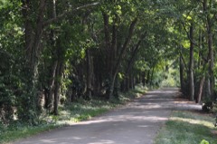 Overton Lanelisted 1980
- Glen Levenlisted 2008
Population over time
2 figuresOak Hill grew from 4,529 to 4,891 between 2010 and 2020. These are the recorded population figures Wikidata holds for this place, reached through the Geographic Names Information System number this page is keyed on rather than by name, so they belong to this place and not to another of the same name. Most are census counts, but not all are: an early figure may be a founding or settlement estimate, and an estimate published within five years of a census is left out. The change column is computed, and is left blank where more than 20 years separate a figure from the one before it, because a gap that long is not a change between two counts.
| Year | People | Change |
|---|---|---|
| 2010 | 4,529 | |
| 2020 | 4,891 | +362 (+8%) |
Topographic sheets covering this place
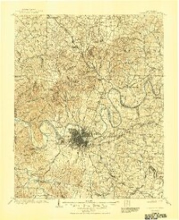
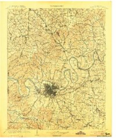
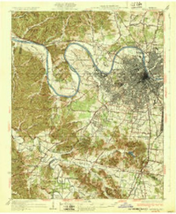
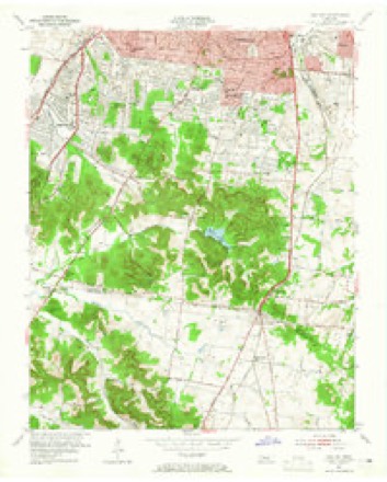
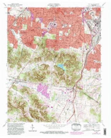
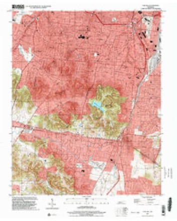
9 surveys from 18 printed sheetsMatched by testing this settlement's coordinate against the published boundary of every sheet in the United States Geological Survey's historical collection. Each opens the scanned sheet at the Survey.
- 1903 USGS Greenbrier quadrangle1:125000, 2 printings
- 1903 USGS Nashville quadrangle1:125000, 2 printings
- 1932 USGS Nashville quadrangle1:62500, 2 printings
- 1953 USGS Oak Hill quadrangle1:24000, 2 printings
- 1956 USGS Nashville quadrangle1:250000, 2 printings
- 1959 USGS Nashville quadrangle1:250000
- 1968 USGS Oak Hill quadrangle1:24000, 5 printings
- 1984 USGS Nashville quadrangle1:100000
- 1997 USGS Oak Hill quadrangle1:24000



Fires near this place
3 since 1999Regional context, not property-specific evidence. The federal wildfire occurrence database lists 3 fires within 5 miles of Oak Hill between 1999 and 2005, burning about 103 acres in total. None started naturally. None was recorded as arson. Distance is straight-line from the map coordinates, so a fire counted here may appear on a neighbouring settlement's page as well.
| Reported cause | Fires |
|---|---|
| Debris and open burning | 2 |
| Smoking | 1 |
The most recent of them, most recent first, with the day each was reported and the service that recorded it.
| Date | Cause | Size | Reported by | Name on the report |
|---|---|---|---|---|
| 9 September 1999 | Smoking | 93 acres | Tennessee Division of Forestry | not named |
| 13 September 2002 | Debris and open burning | 3.0 acres | Tennessee Division of Forestry | not named |
| 25 January 2005 | Debris and open burning | 7.0 acres | Tennessee Division of Forestry | not named |
Settlements close enough to share some of these fires:
Mines and quarries near this place
4 within 5 milesRegional context, not property-specific evidence. The federal mineral resources record lists 4 workings within 5 miles of Oak Hill: 3 past producers, 1 producer. 1 still produces. What was taken out: Limestone, General, Stone, Crushed/Broken. Distance is straight-line from the map coordinates, so a quarry counted here may appear on a neighbouring settlement's page as well.
| Where | Site | Commodity | Status | Recorded |
|---|---|---|---|---|
| Derryberry Construction Bo. Quarry | Limestone, General | Past Producer | Sedimentary | |
| Derryberry Construction Bo. Quarry | Stone, Crushed/Broken | Past Producer | ||
| Glencliff Quarry | Limestone, General | Past Producer | Sedimentary | |
| Glencliff Quarry | Stone, Crushed/Broken | Producer |
Storms near this place
55 since 2004Regional context, not property-specific evidence. The National Weather Service names Oak Hill in 55 storm reports between 2004 and 2025: 42 thunderstorm wind, 8 hail, 3 lightning, 1 heavy rain. The reports record 1 injury. Each account below is quoted exactly as the forecast office filed it, from the NOAA Storm Events Database, and each date opens the federal record of that event.
| When | Event | Place named | Harm | What the report says |
|---|---|---|---|---|
| April 2025 | Lightning | Oak Hill | 1 hurt | Media reports Metro Police dispatch confirms the victim was outside when they were struck at the Hilton on Cleghorn Avenue in Nashville's Green Hills neighborhood. Victim was awake and alert, and did not require medical transport to a hospital. |
| May 2023 | Lightning | Oak Hill | $100,000 | Lightning struck a house along Glen Echo Road in south Nashville, causing a house fire. No injuries are known, and damages are a rough estimate. |
| April 2015 | Thunderstorm Wind | Oak Hill | $100,000 | A tree fell onto and crushed part of a house in Green Hills. |
| September 2024 | Lightning | Oak Hill | $50,000 | Lightning struck a house on Kensington Park, causing a fire. Extent of damages is unknown. |
| May 2018 | Thunderstorm Wind | Oak Hill | $25,000 | A severe 8 mile long by 4 mile wide downburst spread west-southwestward and caused widespread wind damage in and around Belle Meade, West Nashville, and Bellevue. Numerous trees and power lines were blown down with several roadways blocked, including Belmont Boulevard, Page Road, Blackburn Avenue, Wildwood Avenue, Park Avenue, 12th Avenue North, and Belle Meade Boulevard. A tree fell onto a home on Percy Warner Boulevard, and another tree fell onto a house on Cross Timbers Drive. A tree also fell and crushed a car at an apartment complex in the 800 block of Bellevue Road. Part of the awning at a gas station on Highway 70 at Old Hickory Boulevard was blown off. Power was knocked out to roughly 7,000 customers. Winds were estimated up to 65 mph. |
| July 2012 | Thunderstorm Wind | Oak Hill | $20,000 | Several trees along with some power lines and traffic wires were downed in southern Davidson County. |
| July 2021 | Thunderstorm Wind | Oak Hill | $15,000 | Numerous trees and power lines were blown down across southern Davidson County. Trees were reported down on Lone Oak Road at Overhill Drive, Otter Creek Road at Granny White Pike, Bramble Wood Drive at Monterey Drive, 407 Lynnwood Blvd, 1718 25th Avenue N, and 3907 Trimble Road. Power lines were reported down on Highway 70 at I-40, Lynnwood Blvd at Abbott Martin Road, and Plymouth Avenue at Brush Hill Road. |
| September 2024 | Thunderstorm Wind | Oak Hill | $10,000 | Severe thunderstorm winds downed several trees in the Crieve Hall area. Damages are a rough estimate. |
| April 2015 | Thunderstorm Wind | Oak Hill | $10,000 | Twitter reports indicated several trees and power poles were snapped and blocked Granny White Pike at Shackleford Road just south of Lipscomb University. |
| May 2010 | Thunderstorm Wind | Oak Hill | $10,000 | Some small trees were downed and three quarter inch hail was reported in the Crieve Hall Area. |
| April 2025 | Thunderstorm Wind | Oak Hill | $5,000 | Severe thunderstorm winds downed a powerline near Hillsboro High School in Belle Meade. Damages are a rough estimate. |
| July 2023 | Thunderstorm Wind | Oak Hill | $5,000 | Severe thunderstorm winds downed multiple trees onto a power line near Green Hills Village near Belle Meade. Damages are a rough estimate. |
| July 2023 | Thunderstorm Wind | Oak Hill | $5,000 | Severe thunderstorm winds downed tree branches and caused power outages near Battery Lane and Lealand Lane in Oak Hill. Damages are a rough estimate. |
| June 2022 | Thunderstorm Wind | Oak Hill | $5,000 | Numerous tree branches and some trees were blown down in the Belle Meade and Oak Hill areas. |
| June 2019 | Thunderstorm Wind | Oak Hill | $5,000 | Numerous trees were blown down around the Lipscomb University area. |
| March 2017 | Thunderstorm Wind | Oak Hill | $5,000 | A large tree fell on multiple parked cars at Acklen Park Drive and Fairmont Drive. |
| June 2016 | Thunderstorm Wind | Oak Hill | $5,000 | Trees and tree limbs were reported blown down in the Green Hills area. |
| May 2011 | Thunderstorm Wind | Oak Hill | $5,000 | A tree and power lines were reported downed on Richardson Avenue. |
| October 2010 | Thunderstorm Wind | Oak Hill | $5,000 | A tree was downed on a house at Hobbs Road. Type of cost and damage associated with the tree falling on the home were unknown. |
| July 2021 | Thunderstorm Wind | Oak Hill | $4,000 | A Twitter tSpotter report inidicated multiple trees were blown down on Lealand Lane between Battery Lane and Stonewall Drive. |
| July 2015 | Thunderstorm Wind | Oak Hill | $4,000 | Two trees and power lines were blown down on Granny White Pike by JT Moore Middle School. |
| July 2015 | Thunderstorm Wind | Oak Hill | $4,000 | Trees and power lines were blown down at Glendale at Lealand Lane. |
| May 2022 | Thunderstorm Wind | Oak Hill | $3,000 | Twitter tSpotter reports indicated trees were blown down in Nashville at North Wilson Blvd at West End Avenue, on John Robertson Pkwy at Gay St., and in the Charlotte Park area. |
| June 2018 | Thunderstorm Wind | Oak Hill | $3,000 | A Twitter tSpotter report indicated several trees were blown down that blocked Woodmont Boulevard between Estes Road and Hillsboro Pike. |
| March 2017 | Thunderstorm Wind | Oak Hill | $3,000 | A trained spotter reported trees blown down in the Green Hills area of Nashville. |
| March 2017 | Thunderstorm Wind | Oak Hill | $3,000 | A tree fell on a moving vehicle on Hobbs Road in Green Hills. No injuries were reported. |
| March 2021 | Thunderstorm Wind | Oak Hill | $2,000 | TSpotter report of trees and power lines down in Green Hills at Shackleford Road and Granny White Pike. |
| May 2016 | Thunderstorm Wind | Oak Hill | $2,000 | A #tSpotter Twitter report indicated a tree was blown down onto a house in Green Hills. |
| April 2025 | Thunderstorm Wind | Oak Hill | $1,000 | Severe thunderstorm winds snapped a large tree on Kimpalong Drive. Damages are a rough estimate. |
| April 2025 | Thunderstorm Wind | Oak Hill | $1,000 | Severe thunderstorm winds downed a tree onto Woodlawn Drive in Belle Meade. Damages are a rough estimate. |
| July 2023 | Thunderstorm Wind | Oak Hill | $1,000 | Severe thunderstorm winds downed a tree at the intersection of Hillsboro Pike and Woodmont Boulevard near Berry Hill. Damages are a rough estimate. |
| July 2023 | Thunderstorm Wind | Oak Hill | $1,000 | Severe thunderstorm winds downed a tree at Hillsboro Pike and Golf Club Lane in Berry Hill. Damages are a rough estimate. |
| June 2019 | Thunderstorm Wind | Oak Hill | $1,000 | Large tree limbs were blown down in the Oak Hill area. |
| June 2019 | Thunderstorm Wind | Oak Hill | $1,000 | A fireworks tent was blown down near Hillsboro High School. |
| June 2019 | Thunderstorm Wind | Oak Hill | $1,000 | A large tree was uprooted in the Duncanwood subdivision in Green Hills. |
| April 2018 | Thunderstorm Wind | Oak Hill | $1,000 | A tree was blown down onto power lines on Lauderdale Road. |
| April 2018 | Thunderstorm Wind | Oak Hill | $1,000 | A tree was blown down onto power lines on Bear Road. |
| July 2018 | Thunderstorm Wind | Oak Hill | $1,000 | A tSpotter Twitter report and photo showed a tree was blown down in Oak Hill. |
| March 2017 | Thunderstorm Wind | Oak Hill | $1,000 | A tree was blown down on Abbot Martin Road. |
| March 2017 | Thunderstorm Wind | Oak Hill | $1,000 | A tree was blown down at Harding Place and Northumberland. |
| April 2016 | Thunderstorm Wind | Oak Hill | $1,000 | A large tree was blown down in Green Hills. |
| July 2016 | Thunderstorm Wind | Oak Hill | $1,000 | Tree down at Montgomery Bell Academy. |
| November 2016 | Thunderstorm Wind | Oak Hill | $1,000 | A twitter report indicated a tree down on Belmont Blvd between Glen Echo Rd and Woodmont Blvd. |
| March 2021 | Hail | Oak Hill | - | TSpotter report of 1.5 hail near the intersection of Brightwood Avenue and Lombardy Avenue. |
| March 2021 | Hail | Oak Hill | - | Several tSpotter reports of quarter to half dollar size hail in Green Hills. |
| September 2021 | Flash Flood | Oak Hill | - | Tyne Blvd, Granny White Pike, Franklin Pike Circle, Hill Road, and Edmondson Pike north of Old Hickory Blvd were flooded and impassable in places. |
| May 2020 | Thunderstorm Wind | Oak Hill | - | An historic 200 year old oak tree was blown down at JT Moore Middle School. |
| February 2019 | Heavy Rain | Oak Hill | - | CoCoRaHS station Belle Meade 1.2 ESE measured a 24 hour rainfall total of 6.20 inches. |
| June 2018 | Hail | Oak Hill | - | A Facebook photo showed pea to nickel size hail fell in east Belle Meade. |
| September 2017 | Hail | Oak Hill | - | Nickel size hail reported at the Green Hills Library. |
| October 2014 | Hail | Oak Hill | - | Quarter size hail reported in Oak Hill and Crieve Hall. |
| March 2012 | Hail | Oak Hill | - | Golf ball sized hail was reported at Lipscomb University. |
| April 2005 | Hail | Oak Hill | - | Nickel size hail reported. |
| April 2004 | Thunderstorm Wind | Oak Hill | - | Emergency manager reported numerous trees and power lines blown down. |
| June 2018 | Hail | Oak Hill | - | no account filed |
Nearest settlements
The eight closest, with where each one stands in the county. Distances are straight-line, computed from the Geographic Names Information System coordinates.
| Map | Place | Distance | Sheets |
|---|---|---|---|
| Glendale Park | 0.7 miles | 18 | |
| Phillips | 1.6 miles | 18 | |
| Crieve Hall | 1.7 miles | 18 | |
| Green Hills | 2.1 miles | 18 | |
| Berry Hill | 2.2 miles | 18 | |
| Radnor | 2.5 miles | 19 | |
| Oak Hill Estates | 2.8 miles | 18 | |
| Paragon Mills | 2.9 miles | 19 |
Elsewhere
Matched on this settlement's Geographic Names Information System number rather than its name, so it cannot be a different place of the same name in another state.
| Wikipedia article on Oak Hill | An encyclopaedic summary. Its text is share-alike, so it is linked here rather than copied. |
| Wikidata item Q3292521 | The structured record the population and elevation above come from. Public domain (CC0). |
Provenance
This settlement is recorded in the Geographic Names Information System as feature 1296134. The sheet list is computed by point-in-boundary test against the United States Geological Survey's historical topographic inventory. Both are works of the United States government and carry no copyright under 17 U.S.C. 105.
Wildfire. Short, Karen C. 2022. Spatial wildfire occurrence data for the United States, 1992-2020 [FPA_FOD_20221014]. 6th Edition. Fort Collins, CO: Forest Service Research Data Archive. https://doi.org/10.2737/RDS-2013-0009.6 Collected with United States Government funding and usable without additional permissions or fees.
Mines and quarries. USGS Mineral Resources Data System (MRDS) https://mrdata.usgs.gov/mrds/ A work of the United States government, no copyright under 17 U.S.C. 105.
Storms. NOAA National Centers for Environmental Information, Storm Events Database https://www.ncei.noaa.gov/stormevents/ A work of the United States government, no copyright under 17 U.S.C. 105. Narratives are quoted verbatim from the National Weather Service report and are not edited or summarised.