 Block
Oakwood, Tennessee
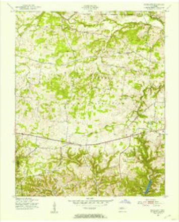
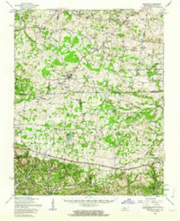
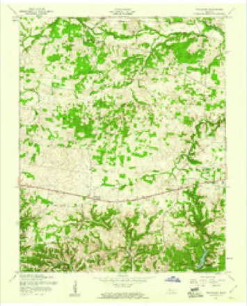
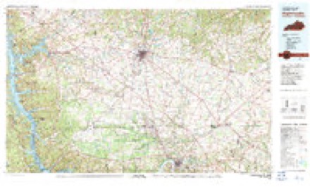
9 topographic sheets cover this place, the earliest surveyed in 1951 and the latest in 1980. It stands in District 7. It lies in ZIP code area 37191. The Survey maps it on the Woodlawn quadrangle.
Topographic sheets covering this place
6 surveys from 9 printed sheetsMatched by testing this settlement's coordinate against the published boundary of every sheet in the United States Geological Survey's historical collection. Each opens the scanned sheet at the Survey.
- 1951 USGS Woodlawn quadrangle1:24000
- 1956 USGS Nashville quadrangle1:250000, 2 printings
- 1957 USGS Herndon quadrangle1:62500
- 1957 USGS Woodlawn quadrangle1:24000, 3 printings
- 1959 USGS Nashville quadrangle1:250000
- 1980 USGS Hopkinsville quadrangle1:100000


Fires near this place
15 since 1997Regional context, not property-specific evidence. The federal wildfire occurrence database lists 15 fires within 5 miles of Oakwood between 1997 and 2020, burning about 50 acres in total. None started naturally. 3 were recorded as arson. Distance is straight-line from the map coordinates, so a fire counted here may appear on a neighbouring settlement's page as well.
| Reported cause | Fires |
|---|---|
| Debris and open burning | 10 |
| Arson/incendiarism | 3 |
| Missing data/not specified/undetermined | 2 |
The most recent of them, most recent first, with the day each was reported and the service that recorded it.
| Date | Cause | Size | Reported by | Name on the report |
|---|---|---|---|---|
| 16 September 1999 | Missing data/not specified/undetermined | under an acre | Tennessee Division of Forestry | not named |
| 9 August 2002 | Debris and open burning | 1.0 acres | Tennessee Division of Forestry | not named |
| 7 April 1999 | Debris and open burning | under an acre | Tennessee Division of Forestry | not named |
| 7 April 1997 | Debris and open burning | 3.5 acres | Tennessee Division of Forestry | not named |
| 6 April 2005 | Debris and open burning | 2.0 acres | Tennessee Division of Forestry | not named |
| 12 April 2015 | Arson/incendiarism | 3.0 acres | Tennessee Division of Forestry | 7 MILE RIDGE FIRE |
| 25 March 1999 | Debris and open burning | under an acre | Tennessee Division of Forestry | not named |
| 24 March 2009 | Debris and open burning | 3.0 acres | Tennessee Division of Forestry | OAK CREST |
Settlements close enough to share some of these fires:
Mines and quarries near this place
3 within 5 milesRegional context, not property-specific evidence. The federal mineral resources record lists 3 workings within 5 miles of Oakwood: 3 past producers. None of them still produces. What was taken out: Iron, Aluminum, Kaolin. Distance is straight-line from the map coordinates, so a quarry counted here may appear on a neighbouring settlement's page as well.
| Where | Site | Commodity | Status | Recorded |
|---|---|---|---|---|
| Dr. Gaither's Property | Aluminum, Kaolin | Past Producer | ||
| Oakwood Prospects | Iron | Past Producer | ||
| Poplar Spring Prospects | Iron | Past Producer |
Storms near this place
13 since 2000Regional context, not property-specific evidence. The National Weather Service names Oakwood in 13 storm reports between 2000 and 2025: 8 flash flood, 3 thunderstorm wind, 1 hail, 1 tornado. No death or injury is recorded in these reports. Each account below is quoted exactly as the forecast office filed it, from the NOAA Storm Events Database, and each date opens the federal record of that event.
| When | Event | Place named | Harm | What the report says |
|---|---|---|---|---|
| July 2016 | Flash Flood | Oakwood | $1,000,000 | Major flash flooding affected much of Montgomery County, with several homes, businesses, vehicles and roads damaged by flooding. Several water rescues were also conducted for people trapped in flooded homes and vehicles in Clarksville. Homes that were flooded included at least one on Central Avenue in Clarksville, where 2 people were rescued from a flooded home, and others on Golf Club Lane. Businesses damaged by flooding in Clarksville included Swan Lake Golf Course on Dunbar Cave Road and the Tabernacle Church on Golf Club Lane. Roads that were flooded and closed in Clarksville included Liberty Parkway, Crossland Avenue, Central Avenue, Golf Club Lane, Madison Street, University Avenue, Riverside Drive, Highway 41A near Eva Lane, and Saratoga Drive, where one person was rescued from a flooded car. The flooding also caused large sinkholes to open on Spencer Lane at Jackson Road, and Mossrose Road between West Happy Hollow Drive and Woody Hills Drive, forcing the closure of both roads. Flooded and closed roads elsewhere in Montgomery County, mainly western portions of the county, included Cooper Creek Road, Lylewood Road, Lake Road, Moore Hollow Road, and Dotsonville Road, which had a bridge damaged by flooding. Numerous parks were flooded and closed in Clarksville as well, which encompassed Billy Dunlop Park, Clarksville Greenway, Heritage Park, Kleeman Recreation Center, McGregor Park, and the New Providence Pool. No injuries or fatalities were reported. |
| April 2013 | Flash Flood | Oakwood | $1,000,000 | Repeated development of thunderstorms across Montgomery County resulted in 5 to 7 inches of rain falling during the evening hours on April 27 into the early morning hours on April 28. Significant flash flooding resulted from the heavy rainfall, with numerous roadways flooded, impassable, and closed across the county. Flooded roadways included Trenton Road, Highway 76 at Port Royal Road, Madison Street in Clarksville, and many other secondary and low-lying roadways. Over the next several days following the flash flood, a few large sinkholes formed on some roadways, such as Fort Campbell Boulevard in Clarksville, which resulted in additional road closures. |
| December 2023 | Tornado (EF0) | Oakwood | $50,000 | The tornado first touched down just east of the Cumberland River near Cross Creeks National Wildlife Refuge off of Commissary Hollow Road. Minor damage was observed to trees with a home sustaining significant roof damage. the tornado continued east-northeast where dozens more trees were snapped and uprooted along Lower Cross Creek Road. Once the tornado entered Indian Mound, more trees were either uprooted or snapped along Highway 46. The tornado then intensified on Red Top Road and Gillum Hollow Road where a church overhang awning and greenhouses were damaged. A few more barns and outbuildings were damaged along Gillum Hollow Road with several instances of uprooted and snapped trees along its path including a tree falling onto a residence. The tornado finally began to weaken as it entered into far western portions of Montgomery County where only a few trees and large branches were broken. The tornado then lifted southeast of the Indian Mound Road and Liverpool Road intersection. |
| January 2008 | Thunderstorm Wind | Oakwood | $20,000 | Trees were blown down. Some trees fell on homes and cars. There was wind damage to a home at 3743 Dover Rd. |
| April 2020 | Thunderstorm Wind | Oakwood | $3,000 | Trees were blown down on Cooper Creek Road. |
| July 2013 | Flash Flood | Oakwood | $2,000 | The Montgomery County Emergency Manager reported water running over Marthas Chapel Road just south of 7 Mile Ferry Road, 6 inches or more of standing water on Rossview Road just south of Interstate 24, 6 or more inches of standing water on Hickory Point Road near the intersection of County Road 12, and 6 or more inches of standing water on Highway 76 at the intersection of Harmony Church Road. |
| September 2016 | Thunderstorm Wind | Oakwood | $1,000 | A tree was blown down on Cooper Creek Road near Woodlawn. |
| February 2025 | Flash Flood | Oakwood | - | Heavy rain across Montgomery County caused flooding and forced the closure of Cooper Creek Road west of Clarksville. Damages are unknown. |
| April 2025 | Flash Flood | Oakwood | - | Heavy rain across Montgomery County resulted in widespread flash flooding, especially along waterways and across other low-lying areas. Extent of damages in unknown. |
| April 2025 | Flash Flood | Oakwood | - | Heavy rain across Montgomery County resulted in widespread flash flooding, especially along waterways and across other low-lying areas. Extent of damages is unknown. |
| April 2025 | Flash Flood | Oakwood | - | Heavy rain across Montgomery County resulted in widespread flash flooding, especially along waterways and across other low-lying areas. In Clarksville, 36 apartments had to be evacuated due to flooding at Dunlop Lane and Dalton Smith Court. By the end of this event, observations and radar estimated showed 8 to 11 inches of rain had fallen across Montgomery County. Extent of damages is unknown. |
| December 2017 | Flash Flood | Oakwood | - | Several roads were flooded and closed across Montgomery County, including International Blvd at Highway 79 in Clarksville which was covered in 3 to 4 feet of water. |
| May 2000 | Hail | Oakwood | - | Public reported walnut size hail. |
Nearest settlements
The eight closest, with where each one stands in the county. Distances are straight-line, computed from the Geographic Names Information System coordinates.
| Map | Place | Distance | Sheets |
|---|---|---|---|
| Bellamy (historical) | 3.3 miles | 8 | |
| Cave Spring | 3.6 miles | 8 | |
| Woodlawn | 3.7 miles | 9 | |
| Stringtown | 4.1 miles | 8 | |
| Jordan Springs (historical) | 4.2 miles | 9 | |
| Needmore | 4.8 miles | 8 | |
| Rose Hill (historical) | 5.4 miles | 9 | |
| New York (historical) | 5.8 miles | 8 |
Provenance
This settlement is recorded in the Geographic Names Information System as feature 1296208. The sheet list is computed by point-in-boundary test against the United States Geological Survey's historical topographic inventory. Both are works of the United States government and carry no copyright under 17 U.S.C. 105.
Wildfire. Short, Karen C. 2022. Spatial wildfire occurrence data for the United States, 1992-2020 [FPA_FOD_20221014]. 6th Edition. Fort Collins, CO: Forest Service Research Data Archive. https://doi.org/10.2737/RDS-2013-0009.6 Collected with United States Government funding and usable without additional permissions or fees.
Mines and quarries. USGS Mineral Resources Data System (MRDS) https://mrdata.usgs.gov/mrds/ A work of the United States government, no copyright under 17 U.S.C. 105.
Storms. NOAA National Centers for Environmental Information, Storm Events Database https://www.ncei.noaa.gov/stormevents/ A work of the United States government, no copyright under 17 U.S.C. 105. Narratives are quoted verbatim from the National Weather Service report and are not edited or summarised.