 Block
Woodlawn, Tennessee
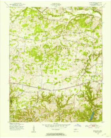
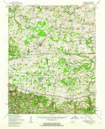
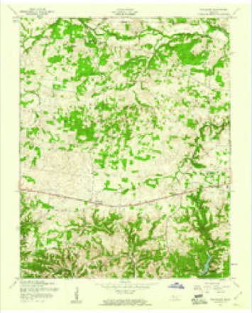
9 topographic sheets cover this place, the earliest surveyed in 1951 and the latest in 1980. It stands in District 7. It lies in ZIP code area 37191. The Survey maps it on the Woodlawn quadrangle. It stands 633 feet above sea level.
Topographic sheets covering this place
6 surveys from 9 printed sheetsMatched by testing this settlement's coordinate against the published boundary of every sheet in the United States Geological Survey's historical collection. Each opens the scanned sheet at the Survey.
- 1951 USGS Woodlawn quadrangle1:24000
- 1956 USGS Nashville quadrangle1:250000, 2 printings
- 1957 USGS Herndon quadrangle1:62500
- 1957 USGS Woodlawn quadrangle1:24000, 3 printings
- 1959 USGS Nashville quadrangle1:250000
- 1980 USGS Hopkinsville quadrangle1:100000


Fires near this place
9 since 1999Regional context, not property-specific evidence. The federal wildfire occurrence database lists 9 fires within 5 miles of Woodlawn between 1999 and 2007, burning about 47 acres in total. None started naturally. 1 was recorded as arson. Distance is straight-line from the map coordinates, so a fire counted here may appear on a neighbouring settlement's page as well.
| Reported cause | Fires |
|---|---|
| Debris and open burning | 3 |
| Missing data/not specified/undetermined | 2 |
| Other causes | 1 |
| Smoking | 1 |
| Misuse of fire by a minor | 1 |
| Arson/incendiarism | 1 |
The most recent of them, most recent first, with the day each was reported and the service that recorded it.
| Date | Cause | Size | Reported by | Name on the report |
|---|---|---|---|---|
| 16 September 1999 | Missing data/not specified/undetermined | under an acre | Tennessee Division of Forestry | not named |
| 31 August 2007 | Missing data/not specified/undetermined | 7.7 acres | Tennessee Division of Forestry | LAKE ROAD |
| 6 April 2005 | Debris and open burning | 2.0 acres | Tennessee Division of Forestry | not named |
| 11 April 1999 | Smoking | 1.5 acres | Tennessee Division of Forestry | not named |
| 25 March 2001 | Debris and open burning | 5.0 acres | Tennessee Division of Forestry | not named |
| 19 March 2006 | Arson/incendiarism | 10 acres | Tennessee Division of Forestry | not named |
| 22 February 2002 | Misuse of fire by a minor | 13 acres | Tennessee Division of Forestry | not named |
| 19 November 2005 | Other causes | 6.0 acres | Tennessee Division of Forestry | not named |
Settlements close enough to share some of these fires:
Mines and quarries near this place
1 within 5 milesRegional context, not property-specific evidence. The federal mineral resources record lists 1 working within 5 miles of Woodlawn: 1 past producer. None of them still produces. What was taken out: Iron. Distance is straight-line from the map coordinates, so a quarry counted here may appear on a neighbouring settlement's page as well.
| Where | Site | Commodity | Status | Recorded |
|---|---|---|---|---|
| Oakwood Prospects | Iron | Past Producer |
Storms near this place
22 since 1996Regional context, not property-specific evidence. The National Weather Service names Woodlawn in 22 storm reports between 1996 and 2026: 15 thunderstorm wind, 3 hail, 3 tornado, 1 flash flood. The reports record 4 deaths and 62 injuries. Each account below is quoted exactly as the forecast office filed it, from the NOAA Storm Events Database, and each date opens the federal record of that event.
| When | Event | Place named | Harm | What the report says |
|---|---|---|---|---|
| December 2023 | Tornado (EF3) | Woodlawn | 4 killed, 62 hurt, $20,000,000 | This EF-3 tornado first touched down on Fort Campbell just north of the Sabre Airfield with mostly minor tree damage. It quickly intensified as it crossed Walnut Grove Road and destroyed a building next to a church. The tornado then continued northeast and damaged dozens of homes in a neighborhood along Garrettsburg Road near Purple Heart Highway. The tornado then went through a heavily wooded neighborhood south of Britton Springs Road where dozens of mobile and manufactured homes were destroyed. The tornado crossed into another neighborhood, causing heavy damage in and near Eva Drive with several houses shifted off their foundations that were only attached with straight nails (EF-2 damage). The tornado intensified to EF-3 with maximum winds of 140 mph as it crossed Highway 41 and struck several commercial businesses, including a vacant fast food restaurant and strip mall where only the interior remained. Just east of Highway 41 north of Ringgold Road, another neighborhood was struck with several homes sustaining significant damage. As the tornado continued northeast, it strengthened further to EF-3 with maximum winds of 150 mph, destroying four two-story brick and vinyl siding homes on Henry Place Boulevard. Debris was blown across the field towards West Creek Elementary School where the school sustained roof damage. As the tornado cross Preachers Mill Road, two dozen brand new two-story brick apartment homes were severely damaged with roofs missing on at least a dozen of these structures. Dozens more houses suffered significant roof damage along and near Needmore Road and Tiny Town Road with EF-2 damage. The tornado then crossed I-24 at Trenton Road where numerous cedar trees were uprooted. Continuing across Tylertown Road, the tornado caused EF-1 to EF-2 roof and siding damage to dozens of homes across three neighborhoods before moving into Kentucky. A total of nearly 1,000 homes were impacted by the tornado, including 114 homes destroyed and 268 homes with major damage. Unfortunately, four people were killed and 62 others were injured. |
| May 2025 | Tornado (EF0) | Woodlawn | $250,000 | An EF-0 tornado touches down along 101st Airborne Division Road, causing minor tree damage. The tornado moved northeast, causing minor tree damage in neighborhoods north of Purple Heart Parkway. Several trees were uprooted and tree tops were snapped near Britton Springs Road and Norris Drive. The tornado continued northeast after crossing Highway 41A continuing to snap large tree branches. The tornado lifted north of West Creek Middle School and south of Tiny Town Road. Damages are a rough estimate. |
| April 2011 | Thunderstorm Wind | Woodlawn | $50,000 | Numerous trees were downed across the northwestern portion of the county. A newspaper also reported that six homes received damage in the county. Specific details concerning the type of damage and associated costs were unknown. |
| January 1999 | Tornado (F1) | Woodlawn | $20,000 | F1 tornado at HWY 79 and N. Liberty Church Rd. A hay barn lost a metal roof. A tobacco barn was destroyed. Utility poles were snapped. Trees were uprooted. |
| April 2026 | Thunderstorm Wind | Woodlawn | $10,000 | Severe thunderstorm winds downed trees in the Woodlawn area with one falling onto a powerline and catching fire. Damages are a rough estimate. |
| June 2023 | Thunderstorm Wind | Woodlawn | $5,000 | A Facebook user reported multiple trees down just west of Woodlawn. Damages are a rough estimate. |
| June 2014 | Thunderstorm Wind | Woodlawn | $5,000 | Several trees and power lines were blown down around Woodlawn. |
| April 2006 | Thunderstorm Wind | Woodlawn | $5,000 | Trees were down on a mobile home. |
| April 2006 | Thunderstorm Wind | Woodlawn | $4,000 | Numerous trees were blown down. A barn was destroyed. |
| January 2020 | Thunderstorm Wind | Woodlawn | $3,000 | Trees were blown down in the Woodlawn area. |
| April 2013 | Thunderstorm Wind | Woodlawn | $3,000 | A few trees were blown down. |
| February 2011 | Flash Flood | Woodlawn | $1,000 | Four to six inches of water depth on the road was reported at the intersection of Jim Taylor Road and Lake Road. |
| June 2007 | Thunderstorm Wind | Woodlawn | $500 | The 911 Dispatch reported a tree was blown down at 3212 Dover Rd. |
| October 2007 | Thunderstorm Wind | Woodlawn | - | The 911 dispatch reported trees were down starting at Woodlawn at 0934 PM CST then through Clarksville and ending at Port Royal by 10 PM CST. |
| September 2006 | Thunderstorm Wind | Woodlawn | - | Trees were down. |
| May 2001 | Thunderstorm Wind | Woodlawn | - | Power company reported large tree limbs down around Woodlawn. |
| June 2001 | Thunderstorm Wind | Woodlawn | - | 911 center reported a tree down in Woodlawn and also just north of Clarksville. |
| May 2000 | Hail | Woodlawn | - | Trained spotter reported half dollar size hail. |
| May 1998 | Thunderstorm Wind | Woodlawn | - | Local law enforcement reported a tree was blown down. |
| April 1997 | Hail | Woodlawn | - | Weather spotter reported nickel size hail. |
| August 2012 | Hail | Woodlawn | - | no account filed |
| April 1996 | Thunderstorm Wind | Woodlawn | - | no account filed |
Nearest settlements
The eight closest, with where each one stands in the county. Distances are straight-line, computed from the Geographic Names Information System coordinates.
| Map | Place | Distance | Sheets |
|---|---|---|---|
| Oakwood | 3.7 miles | 9 | |
| Belle Forest | 4.2 miles | 11 | |
| Countrybrook | 4.2 miles | 11 | |
| Jordan Springs (historical) | 4.4 miles | 9 | |
| Boyd Acres | 4.4 miles | 11 | |
| Dotsonville | 4.4 miles | 8 | |
| Rosehill Estates | 4.7 miles | 11 | |
| Woodlawn Estates | 4.7 miles | 11 |
Elsewhere
Matched on this settlement's Geographic Names Information System number rather than its name, so it cannot be a different place of the same name in another state.
| Wikipedia article on Woodlawn | An encyclopaedic summary. Its text is share-alike, so it is linked here rather than copied. |
| Wikidata item Q8032989 | The structured record the population and elevation above come from. Public domain (CC0). |
Provenance
This settlement is recorded in the Geographic Names Information System as feature 1314536. The sheet list is computed by point-in-boundary test against the United States Geological Survey's historical topographic inventory. Both are works of the United States government and carry no copyright under 17 U.S.C. 105.
Wildfire. Short, Karen C. 2022. Spatial wildfire occurrence data for the United States, 1992-2020 [FPA_FOD_20221014]. 6th Edition. Fort Collins, CO: Forest Service Research Data Archive. https://doi.org/10.2737/RDS-2013-0009.6 Collected with United States Government funding and usable without additional permissions or fees.
Mines and quarries. USGS Mineral Resources Data System (MRDS) https://mrdata.usgs.gov/mrds/ A work of the United States government, no copyright under 17 U.S.C. 105.
Storms. NOAA National Centers for Environmental Information, Storm Events Database https://www.ncei.noaa.gov/stormevents/ A work of the United States government, no copyright under 17 U.S.C. 105. Narratives are quoted verbatim from the National Weather Service report and are not edited or summarised.