 Block
South Carthage, Tennessee
11 topographic sheets cover this place, the earliest surveyed in 1928 and the latest in 1982. It stands in District 7. It lies in ZIP code area 37030. It stands on Caney Fork. The Survey maps it on the Gordonsville quadrangle. 1,490 people lived here at the 2020 count. It stands 509 feet above sea level.
On record in South Carthage
Buildings and businesses the archive holds for this place. Each opens its own page, with the source record it came from.
On the National Register within a mile 5 records
The National Register names another town for these. They stand within one mile of this settlement's coordinate.
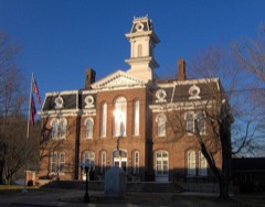 Smith County Courthouselisted 1979 · 0.7 miles away
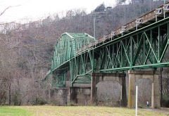 Cordell Hull Bridgelisted 2009 · 0.7 miles away
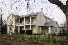 Fite-Williams-Ligon Houselisted 2003 · 0.9 miles away
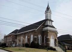 Carthage United Methodist Churchlisted 1985 · 0.9 miles away
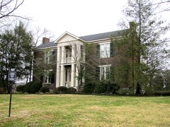 Cullum Mansionlisted 1983 · 1.0 miles away
Population over time
2 figuresSouth Carthage grew from 1,322 to 1,490 between 2010 and 2020. These are the recorded population figures Wikidata holds for this place, reached through the Geographic Names Information System number this page is keyed on rather than by name, so they belong to this place and not to another of the same name. Most are census counts, but not all are: an early figure may be a founding or settlement estimate, and an estimate published within five years of a census is left out. The change column is computed, and is left blank where more than 20 years separate a figure from the one before it, because a gap that long is not a change between two counts.
| Year | People | Change |
|---|---|---|
| 2010 | 1,322 | |
| 2020 | 1,490 | +168 (+13%) |
Topographic sheets covering this place
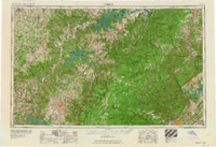
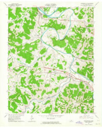
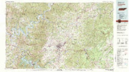
6 surveys from 11 printed sheetsMatched by testing this settlement's coordinate against the published boundary of every sheet in the United States Geological Survey's historical collection. Each opens the scanned sheet at the Survey.
- 1928 USGS Gordonsville quadrangle1:62500, 2 printings
- 1942 USGS Statesville quadrangle1:100000
- 1956 USGS Corbin quadrangle1:250000, 3 printings
- 1958 USGS Corbin quadrangle1:250000
- 1962 USGS Gordonsville quadrangle1:24000, 3 printings
- 1982 USGS Cookeville quadrangle1:100000
Fires near this place
17 since 1998Regional context, not property-specific evidence. The federal wildfire occurrence database lists 17 fires within 5 miles of South Carthage between 1998 and 2016, burning about 161 acres in total. None started naturally. 10 were recorded as arson. Distance is straight-line from the map coordinates, so a fire counted here may appear on a neighbouring settlement's page as well.
| Reported cause | Fires |
|---|---|
| Arson/incendiarism | 10 |
| Debris and open burning | 7 |
The most recent of them, most recent first, with the day each was reported and the service that recorded it.
| Date | Cause | Size | Reported by | Name on the report |
|---|---|---|---|---|
| 23 September 2007 | Debris and open burning | 4.0 acres | Tennessee Division of Forestry | HUTSON |
| 6 July 2012 | Debris and open burning | 21 acres | Tennessee Division of Forestry | WOOD |
| 4 July 2012 | Arson/incendiarism | 5.0 acres | Tennessee Division of Forestry | SULLIVAN BEND |
| 8 April 2002 | Arson/incendiarism | 1.0 acres | Tennessee Division of Forestry | not named |
| 6 April 2005 | Arson/incendiarism | 13 acres | Tennessee Division of Forestry | not named |
| 1 April 2014 | Debris and open burning | 2.9 acres | Tennessee Division of Forestry | LUTHER ALLEN LN |
| 27 March 2014 | Arson/incendiarism | 11 acres | Tennessee Division of Forestry | BEARWALLER GAP |
| 15 March 2000 | Arson/incendiarism | under an acre | Tennessee Division of Forestry | not named |
Settlements close enough to share some of these fires:
Mines and quarries near this place
10 of 24 shownRegional context, not property-specific evidence. The federal mineral resources record lists 24 workings within 5 miles of South Carthage: 11 producers, 10 past producers, 2 plants, 1 prospect. 13 still produce. What was taken out: Zinc, Stone, Crushed/Broken, Lead, Fluorine-Fluorite, Barium-Barite, Fluorine-Fluorite, Lead, Barium-Barite. Distance is straight-line from the map coordinates, so a quarry counted here may appear on a neighbouring settlement's page as well.
| Where | Site | Commodity | Status | Recorded |
|---|---|---|---|---|
| Carthage Mine | Limestone, General | Producer | ||
| Carthage Stone Co. Quarry | Stone, Crushed/Broken, Limestone, General | Producer | Limestone | |
| Central Tennessee Zinc District | Zinc, Cadmium, Germanium, Barium-Barite, Fluorine-Fluorite, Lead | Producer | Sphalerite, Barite, Fluorspar | |
| Cumberland Mine | Zinc, Cadmium, Dolomite | Producer | 1965 | |
| Elmwood Zinc Mine No. 2 Shaft | Zinc, Lead, Barium-Barite, Fluorine-Fluorite | Producer | Stratabound | |
| Gordonsville-Elmwood | Germanium, Zinc, Limestone, General, Stone, Crushed/Broken | Producer | 1967, 1975 | |
| Gordonsville-Elmwood Mine | Zinc, Stone, Fluorine-Fluorite, Lead, Barium-Barite | Producer | Barite, Galena, Sphalerite | |
| Carthage Property | Zinc, Dolomite | Prospect | 1965 | |
| Elmwood Zinc Mine #3 Shaft | Zinc, Lead, Fluorine-Fluorite, Barium-Barite | Producer | Stratabound | |
| Elmwood Zinc Mine #4 Shaft | Zinc, Fluorine-Fluorite, Lead, Barium-Barite | Producer | Stratabound |
Storms near this place
21 since 2000Regional context, not property-specific evidence. The National Weather Service names South Carthage in 21 storm reports between 2000 and 2025: 14 thunderstorm wind, 2 hail, 2 flood, 1 heavy rain. No death or injury is recorded in these reports. Each account below is quoted exactly as the forecast office filed it, from the NOAA Storm Events Database, and each date opens the federal record of that event.
| When | Event | Place named | Harm | What the report says |
|---|---|---|---|---|
| May 2024 | Thunderstorm Wind | South Carthage | $500,000 | A NWS storm survey team found straight line wind damage in and around Carthage with maximum winds estimated up to 75 mph. Several trees were snapped and uprooted along Lebanon Highway west of Carthage. In the town, downed trees were found along Jefferson Avenue, Myers Terrance Road, Carmack Avenue, and Colonial Avenue. Nearby cars were also damaged by falling trees. These straight line winds also blew a steeple off of North Carthage Baptist Church. Damages are a rough estimate. |
| May 2024 | Thunderstorm Wind | South Carthage | $250,000 | A NWS storm survey team found straight line wind damage in and around Carthage with maximum winds estimated up to 75 mph. Several trees were snapped and uprooted along Lebanon Highway west of Carthage. In the town, downed trees were found along Jefferson Avenue, Myers Terrance Road, Carmack Avenue, and Colonial Avenue. Nearby cars were also damaged by falling trees. These straight line winds also blew a steeple off of North Carthage Baptist Church. Damages are a rough estimate. |
| May 2024 | Thunderstorm Wind | South Carthage | $100,000 | Straight-line winds snapped and uprooted numerous trees along Cullum Street. One of these uprooted trees caused structural damage to a house. Damages are a rough estimate. |
| May 2024 | Thunderstorm Wind | South Carthage | $50,000 | A NWS storm survey team found straight line wind damage in and around Carthage with maximum winds estimated up to 75 mph. Several trees were snapped and uprooted along Lebanon Highway west of Carthage. In the town, downed trees were found along Jefferson Avenue, Myers Terrance Road, Carmack Avenue, and Colonial Avenue. Nearby cars were also damaged by falling trees. These straight line winds also blew a steeple off of North Carthage Baptist Church. Damages are a rough estimate. |
| May 2024 | Thunderstorm Wind | South Carthage | $50,000 | A NWS storm survey team found straight line wind damage in and around Carthage with maximum winds estimated up to 75 mph. Several trees were snapped and uprooted along Lebanon Highway west of Carthage. In the town, downed trees were found along Jefferson Avenue, Myers Terrance Road, Carmack Avenue, and Colonial Avenue. Nearby cars were also damaged by falling trees. These straight line winds also blew a steeple off of North Carthage Baptist Church. Damages are a rough estimate. |
| June 2009 | Thunderstorm Wind | South Carthage | $25,000 | Several trees were downed in the Carthage area. |
| December 2021 | Tornado (EF0) | South Carthage | $15,000 | This EF-0 tornado touched down on Bright Avenue in South Carthage and moved northeast along the east side of Carthage uprooting several small trees and snapping large tree limbs on Upper Ferry Road, McGinness Avenue, Hillcrest Drive, Skyline Drive, Ridgeway Drive, and Cumberland Mine Road. The tornado then crossed the Horseshoe Bend of the Cumberland River blowing down several trees, then moved across McClures Bend of the Cumberland River and caused tree damage and moderate roof damage to a structure on McClures Bend Lane. The tornado continued east, crossing Sullivan Bend and the Cumberland River yet again before lifting on Waynick Road in Jackson County where it caused minor tree damage. Total path length of this tornado was 7.35 miles. |
| August 2018 | Thunderstorm Wind | South Carthage | $10,000 | A Twitter tSpotter report and photo showed the steeple was blown off the First Baptist Church in Carthage. |
| April 2011 | Thunderstorm Wind | South Carthage | $10,000 | Several trees were blown down in Carthage on Jefferson Avenue East. |
| April 2014 | Thunderstorm Wind | South Carthage | $5,000 | A tree was blown down onto a van at the Smith County Bus Garage on Upper Ferry Road in Carthage. |
| May 2016 | Thunderstorm Wind | South Carthage | $2,000 | Power lines were blown down along Highway 70 west of Carthage. |
| April 2016 | Thunderstorm Wind | South Carthage | $1,000 | A #tSpotter Twitter report indicated a tree was blown down in Carthage on Jefferson Avenue. |
| May 2016 | Thunderstorm Wind | South Carthage | $1,000 | A tSpotter Twitter report indicated a tree was blown down in the Eastland Heights area of Carthage. |
| September 2001 | Thunderstorm Wind | South Carthage | $500 | A few trees were down along Old Lebanon Rd., McCall St., and Hailey Ave. A sassafras tree fell on a kennel and outdoor furniture near a home. No animals were injured. |
| March 2025 | Hail | South Carthage | - | Estimated 1 inch hail was reported from a severe thunderstorm in South Carthage. |
| February 2021 | Flash Flood | South Carthage | - | Social media reports indicated rushing flood waters covered several roadways in Carthage. |
| February 2020 | Flood | South Carthage | - | Main street was partially blocked due to flooding. |
| June 2016 | Flood | South Carthage | - | Minor flooding was reported on Old State Highway 53 in South Carthage. |
| August 2013 | Heavy Rain | South Carthage | - | A two-day rainfall total of 4.90 inches was measured at CoCoRaHS station Carthage 2.8 WSW. |
| January 2000 | Thunderstorm Wind | South Carthage | - | Several trees were down. |
| March 2012 | Hail | South Carthage | - | no account filed |
Nearest settlements
The eight closest, with where each one stands in the county. Distances are straight-line, computed from the Geographic Names Information System coordinates.
| Map | Place | Distance | Sheets |
|---|---|---|---|
| Carthage | 0.7 miles | 10 | |
| Bluff Creek | 1.7 miles | 11 | |
| Tanglewood | 3.0 miles | 10 | |
| McClures Bend | 3.5 miles | 10 | |
| Elmwood | 3.7 miles | 11 | |
| Stone Bridge (historical) | 4.3 miles | 11 | |
| Stonewall | 4.5 miles | 11 | |
| Monoville | 4.6 miles | 10 |
Elsewhere
Matched on this settlement's Geographic Names Information System number rather than its name, so it cannot be a different place of the same name in another state.
| Wikipedia article on South Carthage | An encyclopaedic summary. Its text is share-alike, so it is linked here rather than copied. |
| Wikidata item Q3292420 | The structured record the population and elevation above come from. Public domain (CC0). |
Provenance
This settlement is recorded in the Geographic Names Information System as feature 1270836. The sheet list is computed by point-in-boundary test against the United States Geological Survey's historical topographic inventory. Both are works of the United States government and carry no copyright under 17 U.S.C. 105.
Wildfire. Short, Karen C. 2022. Spatial wildfire occurrence data for the United States, 1992-2020 [FPA_FOD_20221014]. 6th Edition. Fort Collins, CO: Forest Service Research Data Archive. https://doi.org/10.2737/RDS-2013-0009.6 Collected with United States Government funding and usable without additional permissions or fees.
Mines and quarries. USGS Mineral Resources Data System (MRDS) https://mrdata.usgs.gov/mrds/ A work of the United States government, no copyright under 17 U.S.C. 105.
Storms. NOAA National Centers for Environmental Information, Storm Events Database https://www.ncei.noaa.gov/stormevents/ A work of the United States government, no copyright under 17 U.S.C. 105. Narratives are quoted verbatim from the National Weather Service report and are not edited or summarised.