 Block
From the record
One of 22 National Register listings published here for Franklin County · listed in 2017 · category: Building · built in 1938, Gothic Revival.
Sources: the National Register database, National Park Service
Built in 1938 (Gothic Revival). Listed on the National Register of Historic Places in 2017.
One of 22 National Register listings published here for Franklin County · listed in 2017 · category: Building · built in 1938, Gothic Revival.
Sources: the National Register database, National Park Service
Regional context, not property-specific evidence. The federal wildfire occurrence database lists 38 fires within 5 miles of Saint Margaret Mary Catholic Mission between 1998 and 2017, burning about 183 acres in total. None started naturally. 11 were recorded as arson. Distance is straight-line from the map coordinates, so a fire counted here may appear on a neighbouring settlement's page as well.
| Reported cause | Fires |
|---|---|
| Debris and open burning | 15 |
| Arson/incendiarism | 11 |
| Equipment and vehicle use | 8 |
| Missing data/not specified/undetermined | 1 |
| Recreation and ceremony | 1 |
| Misuse of fire by a minor | 1 |
| Smoking | 1 |
The most recent of them, most recent first, with the day each was reported and the service that recorded it.
| Date | Cause | Size | Reported by | Name on the report |
|---|---|---|---|---|
| 7 September 1999 | Equipment and vehicle use | 65 acres | Tennessee Division of Forestry | not named |
| 6 September 2002 | Equipment and vehicle use | 2.0 acres | Tennessee Division of Forestry | not named |
| 24 September 2010 | Equipment and vehicle use | under an acre | Tennessee Division of Forestry | 125 MILE MARKER |
| 12 September 1998 | Debris and open burning | 1.0 acres | Tennessee Division of Forestry | not named |
| 16 June 2007 | Equipment and vehicle use | 4.0 acres | Tennessee Division of Forestry | C SMITH |
| 5 May 2015 | Debris and open burning | 2.8 acres | Tennessee Division of Forestry | WORMWOOD LANE |
| 9 April 2013 | Debris and open burning | 18 acres | Tennessee Division of Forestry | BRAKEFIELD ROAD |
| 7 April 2000 | Equipment and vehicle use | under an acre | Tennessee Division of Forestry | not named |
Regional context, not property-specific evidence. The federal mineral resources record lists 3 workings within 5 miles of Saint Margaret Mary Catholic Mission: 2 prospects, 1 past producer. None of them still produces. What was taken out: Clay, Manganese, Sand and Gravel, Construction. Distance is straight-line from the map coordinates, so a quarry counted here may appear on a neighbouring settlement's page as well.
| Where | Site | Commodity | Status | Recorded |
|---|---|---|---|---|
| Jump Off Mine No. 1 | Sand and Gravel, Construction | Past Producer | ||
| King Prospect | Clay | Prospect | ||
| King Prospect | Manganese | Prospect |
Regional context, not property-specific evidence. The National Weather Service names Decherd, the town this property stands in, in 32 storm reports between 1996 and 2025: 20 thunderstorm wind, 6 hail, 4 flash flood, 2 tornado. No death or injury is recorded in these reports. Each account below is quoted exactly as the forecast office filed it, from the NOAA Storm Events Database, and each date opens the federal record of that event.
| When | Event | Place named | Harm | What the report says |
|---|---|---|---|---|
| July 1997 | Thunderstorm Wind | Decherd | $10,000 | Strong thunderstorm winds blew the roof off a commercial building that houses Movie World, Donut Palace and Paul's Pizza. |
| May 2025 | Thunderstorm Wind | Decherd | $5,000 | Several trees were reported down in the city of Decherd. |
| April 2013 | Thunderstorm Wind | Decherd | $5,000 | A tree was downed by thunderstorm winds on Fourth Avenue in Decherd, Tennessee. |
| May 2025 | Thunderstorm Wind | Decherd | $3,000 | A tree was knocked down onto a power line. |
| June 2011 | Thunderstorm Wind | Decherd | $2,000 | A tree was knocked down on a home in the 400 block of Bennett Street. |
| May 1997 | Thunderstorm Wind | Decherd | $1,000 | Local law enforcement reported a telephone pole and power lines were down. |
| March 1996 | Thunderstorm Wind | Decherd | $500 | no account filed |
| March 2020 | Thunderstorm Wind | Decherd | $200 | A tree was knocked down on Perkins Street. |
| March 2020 | Thunderstorm Wind | Decherd | $200 | A tree was knocked down across the roadway on Cherry Street. |
| March 2020 | Thunderstorm Wind | Decherd | $200 | A tree was knocked down on Perkins Street. |
| March 2021 | Flash Flood | Decherd | - | Water covering North 2nd street and Mill Street. Roads impassable. |
| March 2020 | Thunderstorm Wind | Decherd | - | A barn was torn down on Knights Church Road north of Decherd. |
| March 2018 | Tornado (EF0) | Decherd | - | Sporadic tree damage adjacent to the Hwy 50/64 connector (northwest of the Nissan Plant) was observed. A few trees near the intersection of Old Alto Hwy and Hwy 50 were slightly uprooted or had large branches knocked down. The assessment determined the damage was indicative of an EF-0 tornado with maximum winds of 75 mph. The tornado tracked east-northeast along/adjacent to Old Alto Hwy. Widely scattered large tree branch damage was observed through the Gum Creek area. |
| May 2017 | Thunderstorm Wind | Decherd | - | Numerous trees and power lines were knocked down. Power outages were reported in Decherd. |
| March 2012 | Hail | Decherd | - | Baseball sized hail was reported. |
| June 2011 | Hail | Decherd | - | Quarter size hail was reported. |
| August 2007 | Thunderstorm Wind | Decherd | - | Thunderstorm wind blew down trees down across Franklin County including Decherd. Street signs were blown down within the city of Decherd. Time estimated. |
| March 2006 | Thunderstorm Wind | Decherd | - | A tree was blown down. |
| February 2004 | Flash Flood | Decherd | - | Flash flooding occurred with a few roads with several inches of water over them near Decherd. |
| November 2004 | Thunderstorm Wind | Decherd | - | A few trees were blown down by thunderstorm winds. |
| February 2001 | Flash Flood | Decherd | - | Newspaper related a story of a home surrounded with water due to poor drainage along the county road. The water entered the home's heating unit. The home was at 812 Payne's Church Road. |
| June 2001 | Hail | Decherd | - | Police department reported dime size hail. |
| May 2000 | Thunderstorm Wind | Decherd | - | Sheriff's office reported a tree was blown down. |
| June 2000 | Thunderstorm Wind | Decherd | - | Top of barn was blown off. Trees and power lines were down. Newspaper article related that many trees were blown down on Blue Springs Road and Carter Road. A kid's swimming pool was carried across the neighborhood and dropped on a road. Patio furniture was swept away off a porch "and we still haven't found it" quoted one of those who were hit by the storm. Winds were estimated to be around 90 mph in the thunderstorm. |
| July 2000 | Thunderstorm Wind | Decherd | - | Decherd fire department reported trees blown down near intersection of U.S. Highway 41A and 127. |
| June 1999 | Flash Flood | Decherd | - | There was standing water on Blue Creek Road and Old Decherd Estill Road. |
| August 1997 | Thunderstorm Wind | Decherd | - | Power company reported trees were blown down. |
| November 1997 | Thunderstorm Wind | Decherd | - | Power lines were blown down. |
| November 1997 | Hail | Decherd | - | Dime size hail was reported by local law enforcement. |
| October 1997 | Hail | Decherd | - | Local law enforcement reported dime size hail. |
| November 1996 | Tornado (F1) | Decherd | - | no account filed |
| March 1996 | Hail | Decherd | - | no account filed |
No historic map-sheet match is published for this property yet. That does not mean no map exists. This record needs a coordinate-quality review before it can be joined to a sheet boundary. Browse the county's mapped places while that work is pending.
Other National Register properties close enough to walk or drive between, ordered by distance from this one. Both positions come from the same geocoding pass that matched these properties to their map sheets.
| Photograph | Property | Distance | Listed |
|---|---|---|---|
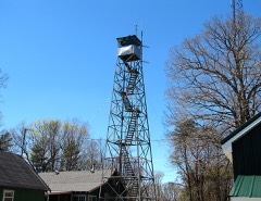 | Sewanee Fire Lookout Tower | 5.2 miles | 2015 |
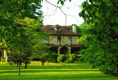 | Haynes House | 7.5 miles | 2005 |
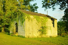 | Asia School | 7.8 miles | 2011 |
 | Cowan Depot | 7.9 miles | 1978 |
| National Archives record | The nomination case file for reference 100001305 in Record Group 79. |
| Franklin County | All 22 listed properties in this county. |