 Block
From the record
One of 216 National Register listings published here for Shelby County · listed in 1994 · category: Building.
Sources: the National Register database, National Park Service · the Wikipedia article
Listed on the National Register of Historic Places in 1994.
One of 216 National Register listings published here for Shelby County · listed in 1994 · category: Building.
Sources: the National Register database, National Park Service · the Wikipedia article
Regional context, not property-specific evidence. The federal mineral resources record lists 7 workings within 5 miles of John H. McFadden House: 4 past producers, 3 producers. 3 still produce. What was taken out: Sand and Gravel, Construction. Distance is straight-line from the map coordinates, so a quarry counted here may appear on a neighbouring settlement's page as well.
| Where | Site | Commodity | Status | Recorded |
|---|---|---|---|---|
| #4 Highway 64 Pit | Sand and Gravel, Construction | Producer | 1971 | |
| Carroll Pit | Sand and Gravel, Construction | Past Producer | Sedimentary | |
| Carroll Pit | Sand and Gravel, Construction | Past Producer | Unconsolidated Sediments | |
| Carroll Pit | Sand and Gravel, Construction | Past Producer | ||
| Duke Pit | Sand and Gravel, Construction | Producer | ||
| Number 4 Highway 64 Pit | Sand and Gravel, Construction | Past Producer | Sedimentary | |
| Number 4 Highway 64 Pit | Sand and Gravel, Construction | Producer |
Regional context, not property-specific evidence. The National Weather Service names Bartlett, the town this property stands in, in 55 storm reports between 1993 and 2025: 24 thunderstorm wind, 19 hail, 7 flash flood, 4 lightning. No death or injury is recorded in these reports. Each account below is quoted exactly as the forecast office filed it, from the NOAA Storm Events Database, and each date opens the federal record of that event.
| When | Event | Place named | Harm | What the report says |
|---|---|---|---|---|
| July 1996 | Lightning | Bartlett | $200,000 | no account filed |
| April 2006 | Lightning | Bartlett | $150,000 | Lightning struck the business of Dixie Floor Coverings on Kate Bond Road in Bartlett. The lightning started a fire and the building burned to the ground. The business lost ninety-five percent of its equipment, all of the inventory, and all of its service trucks. |
| June 2007 | Lightning | Bartlett | $145,000 | Lightning struck a home in the Abbington Wood Subdivision in Bartlett. The lightning strike produced a fire in the home causing severe damage. No injuries occurred. |
| June 2009 | Tornado (EF1) | Bartlett | $25,000 | A brief tornado touched down near the intersection of Bartlett Boulevard and Elmore Road in Bartlett. This tornado snapped numerous hardwood trees and caused minor roof damage to several homes. The estimated maximum winds were 105 mph. |
| January 2005 | Thunderstorm Wind | Bartlett | $10,000 | Three homes were damaged. |
| July 2001 | Thunderstorm Wind | Bartlett | $10,000 | Numerous trees were blown down. |
| April 2006 | Hail | Bartlett | $7,500 | no account filed |
| April 2006 | Hail | Bartlett | $6,000 | no account filed |
| May 2022 | Thunderstorm Wind | Bartlett | $5,000 | Downed powerline and leaning utility pole at Stage Road and Elmore Park Road. |
| January 2008 | Thunderstorm Wind | Bartlett | $5,000 | Straight line winds knocked down traffic light signals and wires at the intersection of Covington Pike and Covington Way. |
| July 2001 | Thunderstorm Wind | Bartlett | $5,000 | A couple of trees were snapped in two. |
| August 1998 | Lightning | Bartlett | $5,000 | Lightning struck and damaged a large tree in Bartlett. |
| June 1997 | Thunderstorm Wind | Bartlett | $5,000 | A gas station had its roof collapse. Several trees fell on some power lines. |
| July 1995 | Thunderstorm Wind | Bartlett | $5,000 | Several trees were blown down. One tree fell on a house. |
| June 1994 | Thunderstorm Wind | Bartlett | $5,000 | A section of a fence was blown down in Bartlett. A tree fell on a house in Memphis. Several other trees were knocked down in Memphis and Collierville. |
| August 1993 | Thunderstorm Wind | Bartlett | $5,000 | Numerous trees were knocked down. |
| June 2006 | Hail | Bartlett | $5,000 | no account filed |
| August 2007 | Thunderstorm Wind | Bartlett | $4,000 | Trees were knocked down at Interstate 40 and Covington Pike and at Summer Ave and Mangum Road by straight line winds. |
| May 2006 | Thunderstorm Wind | Bartlett | $3,000 | Straight line winds knocked down numerous trees north of Highway 70 and along and south of Old Brownsville Road. Downed trees blocked Billy Meyer Road in North Bartlett. Some power lines were also knocked down. |
| April 2006 | Hail | Bartlett | $2,500 | no account filed |
| April 2024 | Thunderstorm Wind | Bartlett | $2,000 | A large tree was knocked down across the road at Sycamore View Road and Main Street in Bartlett. |
| July 2023 | Thunderstorm Wind | Bartlett | $2,000 | A tree was knocked down blocking Kenwood Cove at Ivanhoe Road. |
| June 2017 | Thunderstorm Wind | Bartlett | $2,000 | Large tree down on Sycamore View Road just north of Raleigh La-Grange Road. |
| April 2008 | Thunderstorm Wind | Bartlett | $2,000 | Straight line winds blew trees down on Milnor Drive in Raleigh. |
| April 2007 | Thunderstorm Wind | Bartlett | $2,000 | Straight line winds knocked down a few trees in Bartlett. |
| June 2007 | Thunderstorm Wind | Bartlett | $2,000 | Straight line winds knocked trees down on Davies Plantation Road in Lakeland. |
| June 2007 | Thunderstorm Wind | Bartlett | $2,000 | Straight line winds knocked trees down on Yale Road in Bartlett. |
| August 2007 | Thunderstorm Wind | Bartlett | $2,000 | Trees were knocked down at Summer Avenue and Raleigh-LaGrange Road, 1 mile southeast of Bartlett by straight line winds. |
| January 2008 | Hail | Bartlett | $2,000 | no account filed |
| March 2008 | Hail | Bartlett | $2,000 | no account filed |
| May 2002 | Flash Flood | Bartlett | $1,000 | Several roads were flooded. |
| September 2002 | Flash Flood | Bartlett | $1,000 | Several streets were flooded. |
| June 2007 | Hail | Bartlett | $1,000 | no account filed |
| May 2002 | Hail | Bartlett | $500 | A few tree branches were knocked down by the hail. |
| March 2002 | Hail | Bartlett | $220 | no account filed |
| February 2005 | Hail | Bartlett | $10 | no account filed |
| April 2003 | Hail | Bartlett | $10 | no account filed |
| June 1997 | Hail | Bartlett | $10 | no account filed |
| August 2023 | Flash Flood | Bartlett | - | Harrington Creek was out of its banks and flooding a nearby parking lot near Stage Road. |
| April 2020 | Thunderstorm Wind | Bartlett | - | Power lines down near WJ Freeman Park and Stage Road in Bartlett. |
| May 2018 | Hail | Bartlett | - | Nickel to quarter size. |
| April 2017 | Thunderstorm Wind | Bartlett | - | Multiple large oak trees uprooted. |
| July 2015 | Thunderstorm Wind | Bartlett | - | Straight line winds uprooted a couple of trees and knocked down a couple of tree limbs in the Bartlett area. |
| July 2014 | Thunderstorm Wind | Bartlett | - | Straight line winds knocked down trees and power lines all around the Bartlett area. |
| November 2012 | Hail | Bartlett | - | Quarter to Golfball size hail fell in a corridor from Bartlett to Lakeland. |
| June 2011 | Hail | Bartlett | - | Nickel size hail fell from Bartlett to Arlington. |
| April 2011 | Hail | Bartlett | - | Penny to quarter size hail fell in the Bartlett and Ellendale area. |
| June 2010 | Flash Flood | Bartlett | - | Heavy rain produced flash flooding in Bartlett. Water flooded the intersection of Bartlett Boulevard and Stage Road as a result. |
| June 2009 | Thunderstorm Wind | Bartlett | - | Straight line winds blew numerous trees down in Bartlett. Trees fell on houses in the vicinity of Sycamore View Road and Interstate 240. Power lines were knocked down at Yale Road near Covington Pike. Windows were shattered from a building on Kirby-Whitten Road just south of Summer Avenue. The front of the building was destroyed. A front porch was also damaged in the area. Trees were knocked down on Memphis-Arlington Road and Highway 70. Several dozen trees were knocked down on Sycamore View Road and Bartlett Road. Ellendale was also hit hard as numerous old trees were knocked down in the neighborhood. |
| March 2008 | Flash Flood | Bartlett | - | Heavy rain produced flash flooding at the intersection of Raleigh-LaGrange Road and Sycamore View Road. In addition, 2 to 3 inches of water were over the roadways in the Sycamore View Apartment Complex. |
| November 2007 | Flash Flood | Bartlett | - | Heavy rain produced flash flooding on North Germantown Parkway about a half mile south of Interstate 40. |
| August 2007 | Flash Flood | Bartlett | - | Heavy rain produced flooding on Interstate 40 between the Sycamore View exit and the Interstate 240/40 interchange. |
| May 2025 | Hail | Bartlett | - | no account filed |
| March 2017 | Hail | Bartlett | - | no account filed |
| December 2015 | Hail | Bartlett | - | no account filed |
No historic map-sheet match is published for this property yet. That does not mean no map exists. This record needs a coordinate-quality review before it can be joined to a sheet boundary. Browse the county's mapped places while that work is pending.
Other National Register properties close enough to walk or drive between, ordered by distance from this one. Both positions come from the same geocoding pass that matched these properties to their map sheets.
| Photograph | Property | Distance | Listed |
|---|---|---|---|
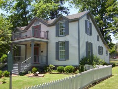 | Nicholas Gotten House | 3.5 miles | 2002 |
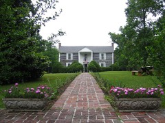 | Davies Manor | 3.8 miles | 1975 |
| Walter Granville Allen House | 5.3 miles | 1990 | |
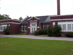 | Cordova School | 5.7 miles | 1995 |
| Ell Persons Lynching Site | 5.9 miles | 2024 | |
| Goodwinslow | 6.2 miles | 1979 |
| National Archives record | The nomination case file for reference 94000577 in Record Group 79. |
| Wikipedia article | Community-written account of this property, licensed CC BY-SA. |
| Shelby County | All 216 listed properties in this county. |