 Block
Block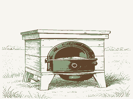
Rush Township
The complete chapter on this township from A History of Scioto County, Ohio,, published 1903; History of Scioto County, Ohio, Together with a Pioneer Record of Southern Ohio, published 1903. 4,640 words, covering 3 settlements. Source changes inside the text are labelled at the exact paragraph where the next book begins.
Contents
3 sectionsThe section headings the book prints inside this chapter. Each one jumps to where it begins.
The modern record here
3 settlementsWhat the federal record holds for each settlement inside this township: wildfires and storm reports since the 1950s, mineral workings, and museum specimens collected nearby. These are counted within a few miles of each settlement, so neighbours share them and the columns are deliberately not added up. Every row links to the settlement's own page, where each figure is broken out.
| Settlement | Fires | Storm reports | Mines and quarries | Specimens |
|---|---|---|---|---|
| McDermott | 50 | - | 9 | 1,552 |
| Owensville | 44 | 3 | 9 | 1,435 |
| Rushtown | 47 | 5 | 7 | 1,322 |
Settlements in this township
3 placesEvery populated place the Geographic Names Information System records inside this township's Census boundary. 2 of the 3 are named in the chapter; the rest were founded later or were never more than a post office.
The chapter
4,640 wordsReproduced complete and unedited from A History of Scioto County, Ohio,, published 1903; History of Scioto County, Ohio, Together with a Pioneer Record of Southern Ohio, published 1903. The text is machine-read from scans, so expect recognition errors: misspelled names, dropped words, and stray characters. Nothing has been corrected, because correcting a proper name invents one. The headings below are the books' own; source changes are labelled in place.
Rush Township
Rush Township is the youngest of all the townships but two, and was organized from a part of the territory of Union, June 3, 1867. A petition was presented by Levi Kirkendall and others to the Commissioners praying for the formation of a new township from the territory of Union. Another petition or remonstrance was presented by Milburn Coe and others against this procedure. The Commissioners after due consideration found that the petition for forming a new township had been signed by a majority of the householders of Union Township; that the territory proposed for a new township contained 22 square miles; that the territory of Union after such division was 22 square miles; and that it was necessary and expedient to form a new township, so it was ''Ordered, That a new Township be, and the same is, hereby laid off designated from the territory of said Union Township as prayed for in said petition; and it is further ordered, that said new township be known by the name of 'Rush.' And it is further ordered, that the County Surveyor, or other competent surveyor proceed immediately to survey and establish the line dividing the said new from the said old township as nearly in accordance with the prayers of the petitioners as practicable, and forthwith report the boundaries of said new township to this board and that the same be recorded in a book kept for that purpose, and it is further ordered, that an election be held at the school house near the mouth of Brush Creek in said new township on the 17th day of June, 1807, for the election of township officers for said new township of 'Rush.' ''The Commissioners appointed James Boldman. Surveyor, in accordance with the foregoing order and further ordered that the Auditor issue an order to James Boldman directing him to make said survey. June 3, 1867.
The township as it now stands, and no changes of any consequence have been made since the organization, is bounded on the north by Morgan, on the east by the Scioto, on the south by Washington and on the west by Union Township.
This township has much valuable farming land most of which lies along the Scioto River. Other farm land, though not so productive, lies along Brush Creek, Pond Creek and Duck Run. Besides this there is some terrace land along the Scioto Valley that produces well for upland. That part of the township south of Brush Creek is very hilly, while there is much rolling land in the northern part, affording excellent upland farms. Though the whole township was formerly well wooded, the timber has practically disappeared. Much of it had been shipped on the Canal previous to the building of the Cincinnati and Eastern Railroad. Since that it has disappeared very rapidly.
Brush Creek crosses the middle of the township from west to east. Pond Creek enters toward the southwest corner and flows across the southern end and empties its waters at the north end of the Big Island into the Scioto River. Duck Run enters the township from Morgan and flows southeasterly and empties into Brush Creek at Rushtown. The Ohio Canal crosses it from north to south following the border of the hills. The Norfolk & Western R. R. crosses the township along the valley of Brush Creek and the Ohio Canal and has three stations within the township, to-wit: McDermott, Rushtown and Wharton.
The township was named for Dr. Benjamin Rush. The first settlement must have been about 1796 or 1797 by Abraham Wykoff, who died in the township "August 11, 1799, aged thirty-eight years." His tombstone with this inscription on it is found on the river bank about three hundred yards north of the Bethany Brick Church. Gen. William Kendall built boats and ran a mill near the mouth of Brush Creek. The first boat ever built inland was constructed here in 1818 by William Lodwic-k. The Utts came in 1797. Later came Samuel G. .Tones, George Heroedh, Thomas Arnold, James Wallace, Thomas Jones, William Russell, John Shultz and Daniel Kirkendall.
Creighton Inn is near the station on the Norfolk and Western at Rushtown and is beautifully located in a quiet, shady and secluded spot overlooking the Scioto Valley.
The assessed value of real estate in 1902 was $142,540; personal property, $59,134; total, $201,674. The rank among the townships outside of Wayne in each respective valuation, is tenth, twelfth and tenth. It contains 14,300 acres and ranks fifteenth outside of Wayne in size.
was platted July 28, 1898, by the McDermott Stone Company, James Barker and Honor Barker. The plat contained 27 acres sub-divided into 113 lots numbered serially from 1 to 113, and is a part of Survey No. 7,630. The chief business enterprise here is the McDermott Stone Company.
The general offices, mills and quarries of this Company are at McDermott, a thriving town on the Cincinnati division of the Norfolk & Western Railway, ten miles northwest of Portsmouth. The properties owned by The McDermott Stone Co. a large acreage underlaid with Ohio's best sandstone deposit, had been operated separately, and on a small scale for more than forty years, until the year 1897 when they were presented to the attention of William and Michael McDermott, two successful and expert quarry operators of National reputation. After a thorough investigation, they decided to purchase the different properties and organize them info one Company, equipped with modern facilities, so that the Stone could be produced promptly and shipped in large quantities. As a basis for carrying out this plan, the lands were purchased, in the year 1897, the mills were erected and the standard gauge railroad tracks were built, connecting the various quarries with the main line of the Norfolk & Western Railway. The property was then taken over by the McDermott Stone Company, which was organized and incorporated under the laws of Ohio, March 23, 1898, with an authorized and paid up capital stock of $100,000.00. The improvements in methods and equipment have continued under the management of R. B. Eglin, President; George A. Dickens, Vice President and John S. Smith, Superintendent, until at the present time this Company and its product ranks among the highest in the building and architectural trade. The mills are equipped with a special idea of quick and accurate work, all material being handled automatically into and out of the mills and loaded on the cars ready for shipment to the most distant points.
The gangs which do the sawing are screw feed and pipe sides of the latest designs. The sand and water for cutting the stone are distributed by a sand pump and conducted to their proper position for doing the work under the steel saws without human assistance. The property is also equipped with an electric light plant so that sawing and shipping are carried on constantly night and day, throughout the entire season. The branch railroad which is owned and equipped by the Company consists of over three miles or standard gauge railroad track built of 56 pound rails, with rock ballasted road bed throughout its entire length. It is a perfect sample of railroad construction. The motive power employed is a standard, ten wheel, Brooks locomotive, and the equipment consists of numerous flat cars and side dump cars. In the quarries, the same complete manner of equipment is followed, all derricks are operated by steam hoisters from a central power station, and all are of thirty ton capacity, very heavily guyed to insure strength and safety. Steam drills and channeling machines are employed in quarrying the rock from its natural formation. A steam shovel is used in removing the top soil which overlays the stone. Owing to the large amount of machinery used by them they have now established a model machine and blacksmith shop at the plant for their own use, which is prepared to do all classes of work in that line. The Company employs a very large force of men, a majority of whom have acquired their own property and built homes at or near the town of McDermott, giving the place a very active and thriving appearance.
Since the quarries have been operated by this Company, the stone is known and sold from Boston to the Missouri River and from Canada to the Gulf of Mexico. The Company has salesmen on the road constantly, visiting new territory and increasing the demand for the McDermott Stone which has secured an enviable reputation and has become recognized as a standard material for building and sidewalk work. It is greatly admired for its durability and attractive appearance. Many buildings both public and private have been built or trimmed from it, a few of which may be mentioned as follows: The Court House at Williamson, West Virginia; The Kentwood Bank, Kentwood, Louisiana: St. Mary's Home, Green Bay, Wisconsin: City Hall, Whitewater, Wisconsin; Baptist Church, Portsmouth, Virginia; Insane Asylum, Topeka, Kansas; and many others of equal importance. The quarries present a remarkably interesting appearance to the visitor, the stone being formed in natural ledges, varying in thickness up to five feet, all of which is overlaid by a covering of earth averaging from ten to twelve feet in depth. The heavier ledges are sawed to size, for steps, caps, sills, etc., or shipped in rough dimension blocks to destination where it is prepared by the stone cutters for its final position in the building. The few thin ledges in the quarry, known to the trade as Flat Rock, are used for footing stone and similar work. The flat rock used for the footings in the Neave Building at Cincinnati, Ohio, upon which the weight of the ten story walls rest, came from these quarries. Over three hundred cars of flat rock used in the stone retaining walls of the Miami Canal when it was rebuilt through the city of Cincinnati in 1901, came from McDermott. The stone is used for bridge abutments and piers at various places along the line of the Norfolk & Western Railway between Cincinnati. Columbus and Norfolk, Virginia. It has also been used extensively by the Cincinnati, Hamilton & Dayton and the Pennsylvania Railroads.
The Methodist Episcopal Church at McDermott was organized in 1899 and a church building was erected. The membership is 25 and the average attendance of the Sunday School is 40. Rev. W. Phillips is the pastor. F. C. Smith is Superintendent of the Sunday School. The trustees are Mrs. C. C. Hulett, Miss Magnolia Smith and Miss Emma Dodds. In this place the women, as elsewhere, have a monopoly of religious affairs.
A suspension foot bridge was constructed across Brush Creek near the Arnold school house for school purposes in 1884 at an expense of $495. James M. Russell was the contractor. The bridge is 312 feet long and 4 feet wide.
The organization of Bethany Baptist Church dates its existence from November 30, 1834. Mr. George Heroedh built the brick church and donated it to the society. It was incorporated this year with 127 members. Mr. Heroedh was the first Clerk. Elder Burnett was the first regular preacher. In 1898 Rev. A. K. Murphy led a movement to build a new church. A beautiful and modern structure was soon completed and dedicated on the second Sunday of May, 1900, costing $3,000. The Rev. Willis is pastor.
The Methodist Episcopal Church at Rushtown was organized in 1868. J. D. Baker was the fisrt pastor. The organization remained intact until 1895 and during that time the following is a list of the pastors: E. V. Bing, Samuel Bateman, C. M. Pryor, C. B. Lewis, Thomas Leslie. W. F. Filler, S. A. Crossley, William Donelson and H. Burkstresser, J. H. Rogers, Thomas Hass, J. W. Blair, Rev. Kling and W. A. Hunter. The charge was discontinued in 1895.
There were originally five school districts in Rush Township when it was created, and there are now seven. The different school houses are located as follows: No. 1 is on Pond Creek; No. 2 is on Duck Run near the old R. M.
Owen place, on the Rickey farm; No. 3 is the Upper Pond Creek school; No. 4 is the Kirkendall place; No. 5 is on Brush Creek on the George Arnold place; No. 6 is on Upper Duck Run close to the Inskeep Stone Mill, called the Hannah School House; No. 7 was originally located on Dever's Run, but now stands on the Doll farm, close to the Lucasville bridge.
The Heroedh burial ground became a township cemetery April 13, 1881. It is near the mouth of Brush Creek on an elevated piece of ground. George Heroedh and William Russell located it and the latter was to be the first interred therein. Russell and his son Robert died September 25, 1845, and were both interred in the same grave. From this time on it became a general burying ground. ^ It contains 1.68 acres and was donated to the township by Levi and Sarah Kirkendall. On July 14, 1899, Mrs. Kirkendall deeded one additional acre to this cemetery for a consideration of $200.
The Hayman or Lucas graveyard is on Pond Creek. Some of the burials are: William Lucas, Jr., died October 23, 1837, aged 31 years, 7 months and 14 days; Gen. William Lucas, died September 10, 1805, in the 32nd year of his age; Joseph Lucas, (Associate Judge), died August 12, 1808, aged 37 years; Hannah Lucas, (his wife,) died April 8. 1857. aged 82 years, 10 months and 18 days; Elizabeth Lucas, consort of William Lucas, died August 16, 1835, aged 37 years; William Lucas, born November 20, 1799, died March 15, 1854; Samuel Lucas, died April 4, 1885, aged 55 years, 7 months and 24 days; Sarah Noel, consort of Andrew Noel, died January 21, 1841, aged 32 years, 2 days. This burial ground is no longer used.
Source changes here: from History of Scioto County, Ohio, Together with a Pioneer Record of Southern Ohio, by Nelson W. Evans A.m, published 1903; 2,320 words in this source stream.
Rush Township
Rush Township is the youngest of all the townships but two, and was organized from a part of the territory of Union, June 3, 1867. A petition was presented by Levi Kirkendall and others to the Commissioners praying for the formation of a new township from the territory of Union. Another petition or remonstrance was presented by Milburn Coe and others against this procedure. The Commissioners after due consideration found that the petition for forming a new township had been signed by a majority of the householders of Union Township; that the territory proposed for a new township contained 22 square miles; that the territory of Union after such division was 22 square miles; and that'it was necessary and expedient to form a new township, so it was "Ordered, That a new Township be, and the same is, hereby laid off designated from the territory of said Union Township as prayed for in said petition; and it is further ordered, that said new township be known by the name of 'Rush.' And it is further ordered, that the County Surveyor, or other competent surveyor proceed immediately to survey and establish the line dividing the said new from the said old township as nearly in accordance with the prayers of the petitioners as practicable, and forthwith report the boundaries of said new township to this board and that the same be recorded in a book kept for that purpose, and it is further ordered, that an election be held at the school house near the mouth of Brush Creek in said new township on the 17th day of June, 1867, for the election of township officers for said new township of 'Rush.' 'The Commissioners appointed James Boldman, Surveyor, in accordance with the foregoing order and further ordered that the Auditor issue an order to James Boldman directing him to make said survey. June 3, 1867.
The township as it now stands, and no changes of any consequence have been made since the organization, is bounded on the north by Morgan, on the east by the Scioto, on the south by Washington and on the west by Union Township.
This township has much valuable farming Jand most of which lies along the Scioto River. Other farm land, though not so productive, lies along Brush Creek, Pond Creek and Duck Run. Besides this there is some terrace land along the Scioto Valley that produces well for upland. That part of the township south of Brush Creek is very hilly, while there is much rolling land in the northern part, affording excellent upland farms. Though the whole township was formerly well wooded. the timber has practically disappeared. Much of it had been shipped on the Canal previous to the building of the Cincinnati and Eastern Railroad. Since that it has disappeared very rapidly.
Brush Creek crosses the middle of the township from west to east. Pond Creek enters toward the southwest corner and flows across the southern end and empties its waters at the north end of the Big Island into the Scioto River. Duck Run enters the township from Morgan and flows southeasterly and empties into Brush Creek at Rushtown. The Ohio Canal crosses it from north to south following the border of the hills. The Norfolk & Western R. R. crosses the township along the valley of Brush Creek and the Ohio Canal and has three stations within the township, to-wit: McDermott, Rushtown and Wharton.
The township was named for Dr. Benjamin Rush. The first settlement must have been about 1796 or 1797 by Abraham Wykoff, who died in the township "August 11, 1799, aged thirty-eight years." His tombstone with this inscription on it is found on the river bank about three hundred yards north of the Bethany Brick Church. Gen. William Kendall built boats and ran a mill near the mouth of Brush Creek. The first boat ever built inland was constructed here in 1818 by William Lodwick. The Utts came in 1797. Later came Samuel G. Jones, George Heroedh, Thomas Arnold, James Wallace, Thomas Jones, William Russell, John Shultz and Daniel Kirkendall.
Creighton Inn is near the station on the Norfolk and Western at Rushtown and is beautifully located in a quiet, shady and secluded spot overlooking the Scioto Valley.
The assessed value of real estate in 1902 was $142,540; personal property, $59,184; total, $201,674. The rank among the townships outside of Wayne in each respective valuation, is tenth, twelfth and tenth. It contains 14,300 acres and ranks fifteenth outside of Wayne in size.
was platted July 28, 1898, by the McDermott Stone Company, James Barker and Honor Barker. The plat contained 27 acres sub-divided into 113 lots numbered serially from 1 to 118, and is a part of Survey No. 7,680. The chief business enterprise here is the McDermott Stone Company.
The general offices, mills and quarries of this Company are at McDermott, a thriving town on the Cincinnati division of the Norfolk & Western Railway, ten miles northwest of Portsmouth. The properties owned by The McDermott Stone Co. a large acreage underlaid with Ohio's best sandstone deposit, had been operated separately, and on a small scale for more than forty years, until the year 1897 when they were presented to the attention of William and Michael McDermott, two successful and expert quarry operators of National reputation. After a thorough investigation, they decided to purchase the different properties and organize them into one Company, equipped with modern facilities, so that the Stone could be produced promptly and shipped in large quantities. As a basis for carrying out this plan, the lands were purchased, in the year 1897, the mills were erected and the standard gauge railroad tracks were built, connecting the various quarries with the main line of the Norfolk & Western Railway. The property was then taken over by the McDermott Stone Company, which was organized and incorporated under the laws of Ohio, March 28, 1898, with an authorized and paid up capital stock of $100,000.00. The improvements in methods and equipment have continued under the management of R. B. Eglin, President; George A. Dickens, Vice President and John S. Smith, Superintendent, until at the present: time this Company and its product ranks among the highest in the building and architectural trade. The mills are equipped with a special idea of quick and accurate work, all material being handled automatically into and out of the mills and loaded on the cars ready for shipment to the most distant points.
The gangs which do the sawing are screw feed and pipe sides of the latest designs. The sand and water for cutting the stone are distributed by a sand pump and conducted to their proper position for doing the work under the steel saws without human assistance. The property is also equipped with an electric light plant so that sawing and shipping are carried on constantly night and day, throughout the entire season. The branch railroad which is owned and equipped by the Company consists of over three miles or standard gauge railroad track built of 56 pound rails, with rock ballasted road bed throughout its entire length. It is a perfect sample of railroad construction. » The motive power employed is a standard, ten wheel, Brooks locomotive, and the equipment consists of numerous flat cars and side dump cars. In the quarries, the same complete manner of equipment is followed, all derricks are operated by steam hoisters from a central power station, and all are of thirty ton capacity, very heavily guyed to insure strength and safety. Steam drills and channeling machines are employed in quarrying the rock from its natural formation. A steam shovel is used in removing the top soil which over- _lays the stone. Owing to the large amount of machinery used by them they have now established a model machine and blacksmith shop at the plant for their own use, which is prepared to do all classes of work in that line. The Company employs a very large force of men, a majority of whom have acquired their own property and built hames at or near the town of McDermott, giving the place a very active and thriving appearance.
Oven
Since the quarries have been operated by this Company, the stone is known and sold from Boston to the Missouri River and from Canada to the Gulf of Mexico. The Company has salesmen on the road constantly, visiting new territory and increasing the demand for the McDermott Stone which has secured an enviable reputation and has become recognized as a standard material for building and sidewalk work. It is greatly admired for its durability and attractive appearance. Many buildings both public and private have been built or trimmed from it, a few of which may be mentioned as follows: The Court House at Williamson, West Virginia; The Kentwood Bank, Kentwood, Louisiana; St. Mary's Home, Green Bay, Wisconsin; City Hall, Whitewater, Wisconsin; Baptist Church, Portsmouth, Virginia; Insane Asytum, Topeka, Kansas; and many others of equal importance. The quarries present a remarkably interesting appearance to the visitor, the stone being formed in natural ledges, varying in thickness up to five feet, all of which is overlaid by a covering of earth averaging from ten to twelve feet in depth. The heavier ledges are sawed to size, for steps, caps, sills, etc., or shipped in rough dimension blocks to destination where it is prepared by the stone cutters for its final position in the building. The few thin ledges in the quarry, known to the trade as Flat Rock, are used for footing stone and similar work. The flat rock used for the footings in the Neave Building at Cincinnati, Ohio, upon which the weight of the ten story walls rest, came from these quarries. Over three hundred cars of flat rock used in the stone retaining walls. of the Miami Canal when it was rebuilt through the city of Cincinnati in 1901, came from McDermott. The stone is used for bridge abutments and piers at various places along the line of the Norfolk & Western Railway between Cincinnati, Columbus and Norfolk, Virginia. It has also been used extensively by the Cincinnati, Hamilton & Dayton and the Pennsylvania Railroads.
The Methodist Episcopal Church at McDermott was organized in 1899 and a church building was erected. The membership is 25 and the average attendance of the Sunday School is 40. Rev. W. Phillips is the pastor. F. C. Smith is Superintendent of the Sunday School. The trustees are Mrs. C. C. Hulett, Miss Magnolia Smith and Miss Emma Dodds. In this place the women, as elsewhere, have a monopoly of religious affairs.
A suspension foot bridge was constructed across Brush Creek near the Arnold school house for school purposes in 1884 at an expense of $495. James M. Russell -was the contractor. The bridge is 312 feet long and 4 feet wide.
The organization of Bethany Baptist Church dates its existence from November 30, 1834. Mr. George Heroedh built the brick church and donated it to the society. It was incorporated this year with 127 members. Mr. Heroedh was the first Clerk. Elder Burnett was the first regular preacher. In 1898 Rev. A. K. Murphy led a movement to build a new church. A beautiful and modern structure was soon completed and dedicated on the second Sunday of May, 1900, costing $3,000. The Rev. Willis is pastor.
The Methodist Episcopal Church at Rushtown was organized in 1868. J. D. Baker was the fisrt pastor. The organization remained intact until 1895 and dvring that time the following is a list of the pastors: E. V. Bing, Samuel Bateman, C. M. Pryor, C. B. Lewis, Thomas Leslie. W. F. Filler, S. A. Crossley, William Donelson and H. Burkstresser, J. H. Rogers, Thomas Hass, J. W. Blair, Rev. Kling and W. A. Hunter. The charge was discontinued in 1895.
There were originally five school districts in Rush Township when it was created, and there are now seven. The different school houses are located as follows:- No. 1 is on Pond Creek; No. 2 is on Duck Run near the old R. M. Owen place, on the Rickey farm; No. 3 is the Upper Pond Creek school; No. 4 is the Kirkendall place; No. 5 is on Brush Creek on the George Arnold place; No. 6 is on Upper Duck Run close to the Inskeep Stone Mill, called the Hannah School House; No. 7 was originally located on Dever's Run, but now stands on the Doll farm, close to the Lucasville bridge.
The Heroedh burial ground became a township cemetery April 13, 1881. It is near the mouth of Brush Creek on an elevated piece of ground. George Heroedh and William Russell located it and the latter was to be the first interred therein. Russell and his son Robert died September 25, 1845, and were both interred in the same grave. From this time on it became a general burying ground. It contains 1.68 acres and was donated to the township by Levi and Sarah Kirkendall. On July 14, 1899, Mrs. Kirkendall deeded one additional acre to this cemetery for a consideration of $200.
'The Hayman or Lucas graveyard is on Pond Creek. Some of the burials are: William Lucas, Jr., died October 23, 1837, aged 31 years, 7 months and 14 days; Gen. William Lucas, died September 10, 1805, in the 32nd year of his age; Joseph Lucas, (Associate Judge), died August 12, 1808, aged 387 years; Hannah Lucas, (his wife,) died April 8, 1857, aged 82 years, 10 months and 18 days; Elizabeth Lucas, consort of William Lucas, died August 16, 1835, aged 37 years; William Lucas, born November 20, 1799, died March 15, 1854; Samuel Lucas, died April 4, 1885, aged 55 years, 7 months and 24 days; Sarah Noel, consort of Andrew Noel, died January 21, 1841, aged 32 years, 2 days. This burial ground is no longer used.
Provenance
Text from A History of Scioto County, Ohio,, published 1903; History of Scioto County, Ohio, Together with a Pioneer Record of Southern Ohio, published 1903, in the public domain in the United States and digitised by the Internet Archive. The settlements listed against this township are matched by point-in-polygon test of each Geographic Names Information System coordinate against the Census Bureau's county subdivision boundary, not by name.