Block
BlockFrom the record
57 National Register listings published here, 1 of them a National Historic Landmark.
Sources: the National Register database, National Park Service
80 topographic sheets cover 21 settlements here, and 57 properties are on the National Register of Historic Places.
57 National Register listings published here, 1 of them a National Historic Landmark.
Sources: the National Register database, National Park Service
Every property in this county listed on the National Register of Historic Places, with the year it was listed and the federal nomination document.
Drawn when these were printed as single large sheets: the town seen from the air, and the county divided into its farms with every owner named. Each opens the original at the Library of Congress.

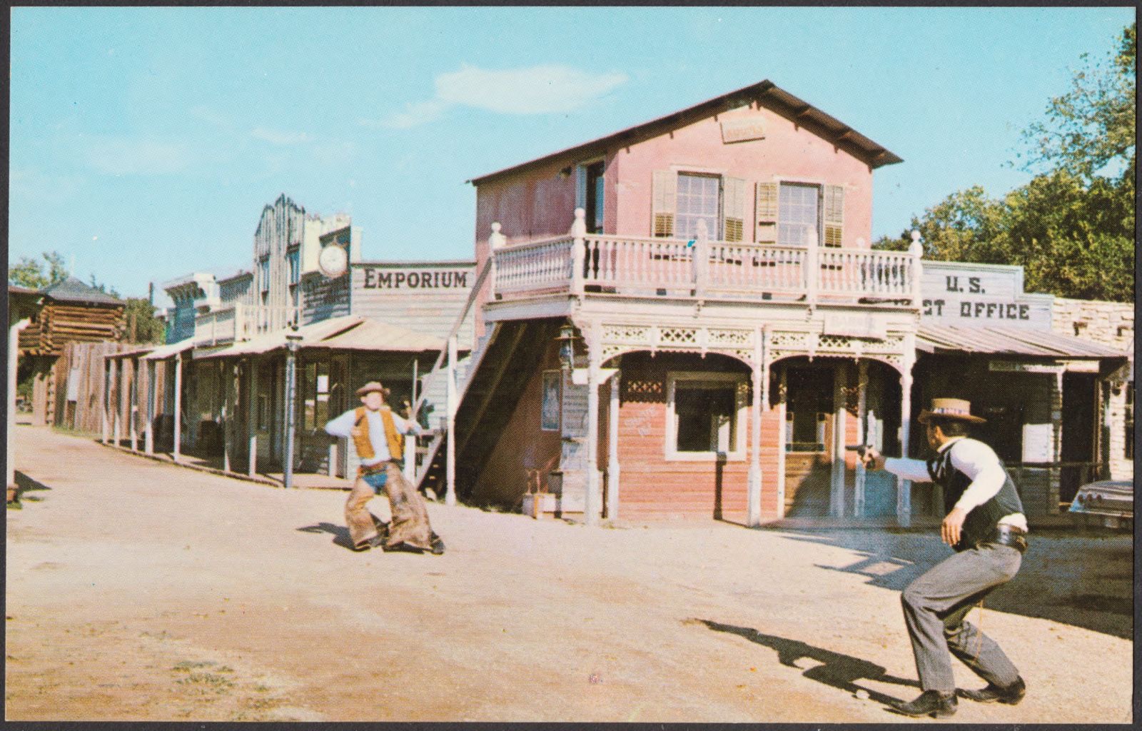
Selected from the Digital Public Library of America's 20 image records catalogued for this county. Every one shown here carries a public-domain status or a licence that permits reuse on a site that carries advertising; non-commercial, share-alike and restricted images are excluded. The selection is spread across the county's towns (at most eight per town), so no single institution's bulk upload crowds out the rest. Each opens the holding library's record, and the complete set at the Digital Public Library of America is one click away.


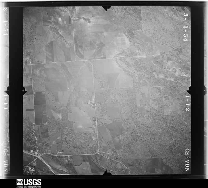
Flown by the U.S. Geological Survey between 1937 and 1989, the Aerial Photo Single Frames collection is the definitive mid-century view of the land: fields, roads and rivers as the camera saw them. The Survey holds 2,715 frames inside the rectangle that bounds this county; the 48 frames below were taken over the county itself, chosen across the decades of flights (at most four a year from that rectangle), so one flight cannot crowd out the rest. The full set is free to browse and download at EarthExplorer under the dataset Aerial Photo Single Frames.















































The thermometers that kept this county's weather, and the gages that measured the flow of its streams, as the federal records hold them. The extremes below are measured values from those records, not estimates.
Who lived here in 1950, one enumeration district at a time, as the Census Bureau described each district. Each row opens its official National Archives result, with Population Schedules and ED Maps available there.
Every wildfire the federal occurrence database records inside this county: 550 of them, burning about 7,997 acres. 4 started naturally and 13 were recorded as arson. Each settlement page carries the fires within five miles of it.
| Reported cause | Fires |
|---|---|
| Debris and open burning | 276 |
| Missing data/not specified/undetermined | 178 |
| Equipment and vehicle use | 40 |
| Arson/incendiarism | 13 |
| Smoking | 12 |
| Misuse of fire by a minor | 12 |
| Power generation/transmission/distribution | 9 |
| Recreation and ceremony | 5 |
| Natural | 4 |
| Other causes | 1 |
The five largest, by the area the report gives. None of them was recorded as arson.
| Date | Cause | Size | Reported by | Name on the report |
|---|---|---|---|---|
| 6 August 2001 | Debris and open burning | 1,175 acres | Texas A & M Forest Service | SOUTH BRANCH - 11 |
| 15 November 2006 | Debris and open burning | 956 acres | Texas A & M Forest Service | RIM ROCK FIRE |
| 14 March 2008 | Equipment and vehicle use | 866 acres | Texas A & M Forest Service | OLD BASTROP HIGHWAY |
| 30 January 2018 | Missing data/not specified/undetermined | 500 acres | Texas A & M Forest Service | LEDGEROCK |
| 13 July 2009 | Misuse of fire by a minor | 500 acres | Texas A & M Forest Service | LOST PLAINS FIRE |
| 21 February 2007 | Missing data/not specified/undetermined | 381 acres | Texas A & M Forest Service | SITES RANCH FIRE |
| 19 July 2017 | Debris and open burning | 250 acres | Texas A & M Forest Service | ONION CREEK |
| 22 December 2007 | Missing data/not specified/undetermined | 241 acres | Texas A & M Forest Service | not named |
Every settlement page carries the fires within five miles of it - see the settlement index below.
The NOAA Storm Events Database holds 453 reports for this county, causing 16 deaths, 141 injuries and about $370,152,610 in recorded property damage. Each settlement page carries the reports that name it.
| Kind of event | Reports |
|---|---|
| Hail | 179 |
| Flash Flood | 126 |
| Thunderstorm Wind | 106 |
| Tornado | 31 |
| Lightning | 5 |
| Funnel Cloud | 3 |
| Flood | 3 |
The most serious of them, by death, then injury, then recorded damage. The accounts are quoted exactly as the forecast office filed them.
| When | Event | Place named | Harm | What the report says |
|---|---|---|---|---|
| May 2015 | Flash Flood | Wimberley | 10 killed, $100,000,000 | Thunderstorms produced heavy rain that caused flash flooding. Rainfall totals of 10 to 13 inches were reported upstream in southern Blanco County and all of this water entered the Blanco River and Little Blanco River. The Fischer Store Rd. bridge over the Blanco River was destroyed by flood waters west of Wimberley. The Blanco River, down stream from the bridge, at Wimberley reached a record crest. The gauge failed at 40 feet and the USGS later estimated the crest at 44.9 feet with 175,000 cfs. This height was more than 10 feet over the previous record height of 33.3 feet from 1929. Homes along the banks of the Blanco River from the City of Blanco, through Wimberley, and down to San Marcos experienced an historic flood. Many homes were totally destroyed and swept down stream. Many homes were struck by large debris, including full size cypress trees which typically lined the banks of the river. A house in the 100 block of Deer Crossing Ln. in Wimberley was washed away in the flood with nine people inside. There was one lone survivor while eight others died. Six bodies were recovered and the two small children remain missing. Several of the bodies were recovered near San Marcos Texas nearly 30 miles downstream. Another fatality occurred when a man was washed away with his vehicle. He was 29 years old and was found on May 26 near FM 2325. A 74 year old male also drown after he was swept off his roof of his house along River Road near Wimberley. The river experienced rises that exceeded 20 feet in one hour. Estimates of insured losses are around 100 million dollars. Overall in Hays County including Wimberley and San Marcos, 321 homes were destroyed, with hundreds more heavily damaged. |
| June 1997 | Flash Flood | Countywide | 2 killed, 7 hurt, $2,500,000 | no account filed |
| April 1953 | Tornado (F3) | not stated | 1 killed, 5 hurt, $250,000 | no account filed |
| May 2019 | Flash Flood | Dripping Spgs | 1 killed | A man's car was swept off the road due to fast moving water at the 3300 block of Bell Springs road. The man's body was recovered the following day after the water had receded. |
| March 2007 | Flash Flood | Wimberley | 1 killed | Between 3 and 5 inches of rain fell across northwest Hays county with the heaviest rainfall observed near Henley. Flash flooding closed FM12, FM165, and FM150. A man was traveling northward in his truck toward Dripping Springs when it was swept into Onion Creek. He was unable to make it to safety and drowned. |
| November 2004 | Flash Flood | San Marcos | 1 killed | The Blanco River rose to above bankfull stage late on the evening of November 14, but remained below flood stage. Two people attempted to drive through a low water crossing on Post Oak Road where the Blanco River crosses just south of Kyle. The car was swept into the river and washed downstream. The man was rescued after catching on to a tree. The woman also caught on to a tree but lost her grip and was swept away and drowned. |
| October 1998 | Flash Flood | Countywide | 100 hurt, $500,000 | no account filed |
| November 2001 | Flash Flood | Countywide | 20 hurt, $200,000 | As rainfall continued into the mid morning period, totals began to approach 3 inches by mid morning. Flash flooding developed across Hays County near 1000 CST. Flash flooding was widespread across the county, with the worst problems in the Wimberley area. Two cars were washed off roads, but all the occupants were rescued. Several schools delayed transporting students home that afternoon due to flood threats. The rising water forced schools to close early the following day. Minor flooding was reported in buildings in San Marcos, and hundreds of people were evacuated away from flood prone areas. |
| November 2001 | Tornado (F1) | Kyle | 3 hurt, $500,000 | This F1 tornado formed immediately after a previous F1 tornado that had been observed by a Department of Public Safety Trooper along I-35 between mile markers 215 and 217 from 2.5 miles north of Kyle to 5 miles northeast of Kyle. The two tornadoes continued together for several minutes, causing extensive tree damage along the frontage road with tops of trees sheared off. Large oak tree branches 5 to 8 inches round were twisted and scattered across the area. Numerous road signs bent over and twisted at the base along with uprooted trees. Some downed trees were pointing south, others were pointing north. The same held true with the bent over highway signs. Power line poles were snapped. They damaged the truck stop at exit #217 sustained extensive damage to the awnings and roof. Several 18-wheelers were knocked over the by tornadoes. A hotel under construction also was damaged along with a restaurant across I-35 from the GAS station. The Hays County Independent School District Headquarters building was also damaged. In all, over 100 homes were damaged by the tornadoes and two were destroyed. Almost 20 businesses suffered damage. Repair costs to area roads and bridges were estimated at near 1/2 million dollars. |
| November 2001 | Tornado (F1) | Kyle | 3 hurt, $500,000 | This first F1 tornado was observed by a Department of Public Safety Trooper as it formed some 2.5 miles north of Kyle. It moved across I-35 between mile markers 215 and 217 to 5 miles northeast of Kyle. The trooper also reported a second tornado that formed in the same vicinity as the first and moved alongside the first for several minutes. The two tornadoes caused extensive tree damage along the frontage road with tops of trees sheared off. Large oak tree branches 5 to 8 inches round were twisted and scattered across the area. Numerous road signs bent over and twisted at the base along with uprooted trees. Some downed trees were pointing south, others were pointing north. The same held true with the bent over highway signs. Power line poles were snapped. They damaged the truck stop at exit #217 sustained extensive damage to the awnings and roof. Several 18-wheelers were knocked over the by tornadoes. A hotel under construction also was damaged along with a restaurant across I-35 from the GAS station. The Hays County Independent School District Headquarters building was also damaged. In all, over 100 homes were damaged by the tornadoes and two were destroyed. Almost 20 businesses suffered damage. Repair costs to area roads and bridges were estimated at near 1/2 million dollars. |
| April 2006 | Hail | San Marcos | 1 hurt, $100,000,000 | The team began the survey along IH-35 near Center Point Road. They noted widespread damage to trees and vegetation beginning near that point and continuing northward to the San Marcos Tanger Outlet Mall and Prime Time Outlet Mall. The damage was caused by a combination of large hail and winds gusting 40 to 50 mph. NWS NEXRAD Radar late Thursday afternoon had indicated severe thunderstorms in that area moving toward the northeast.At the south end of the Malls, the parking lot surface was covered with dents and impressions produced by the wind and hail. Hundreds of vehicles had been damaged in this event but only a few remained in the area. Most of these had all of the window glass broken out with hundreds of hail dents in the car bodies. At this part of the Malls, damage to store signs was seen only on the north and west sides of buildings. There was no damage to signs on the south and east sides. Therefore, the storm winds had propelled the hail toward the southeast. In addition to the sign damage, hundreds of roof tiles had been broken and cracked, and many of these had fallen into the parking lot during the storm.As the team drove northward through the Mall areas, the same type of damage to building signs and roofs as well as parking surfaces was seen. However, at the north end of the Malls, damage to the store signs was confined to the south and west walls of the buildings. In this part of the Malls, the damaging winds had propelled the hail toward the northeast. Thus, the pattern of damage was fan-shaped, with the winds generally blowing the hail toward the west, but with a southeast component of motion on the south end of the Malls and a northeast component of motion on the north end of the Malls. This type of damage is clearly indicative of straight-line winds, also referred to as "downburst winds." One of the NWS staff members was at the Malls during the storm. Dents in his vehicle were 4.25 inches in diameter, indicating that at some of the hail stones were as large as grapefruits. He had estimated windspeeds to be between 60 and 70 mph.The team drove roads in all directions from the Mall areas and concluded that the severe wind and hail had caused the worst damage in an area enclosed by Wonder World Drive, Posey Road, Hunter Road, and FM266 which is also known as Old Bastrop Highway. Other areas of large hail and damaging winds were reported to the NWS, but the level of damage was generally more isolated and less severe.Damages from this storm were estimated at $100M with up to 10,000 vehicles damaged and another 7000 vehicles in homes in the area. Losses to businesses as a result of closing the following day were estimated at $500,000. |
| March 1976 | Tornado (F2) | not stated | 1 hurt, $250,000 | no account filed |
| November 2001 | Tornado (F0) | Henly | 1 hurt, $50,000 | A tornado, rated F0, moved from 8 miles south-southwest of Henley 6 miles south-southwest of Henley. As it crossed FM2325, it knocked down trees, and damaged several roofs of homes, as well as destroying some outbuildings. One injury was reported as the tornado knocked over a trailer-tractor and injured the driver. |
| May 2015 | Flash Flood | Kyle | $100,000,000 | Thunderstorms produced heavy rain that caused flash flooding in Kyle and San Marcos. The majority of the flooding was along the Blanco and San Marcos Rivers. A massive floodwave came down the Blanco River from Wimberley. Huge amounts of debris came with the flood waters. Four people were trapped on a roof awaiting a helicopter rescue in Kyle. I-35 was closed in both directions in San Marcos when the Blanco River flooded and overtopped the interstate. Hwy 80 bridge was also overtopped with flood water just east of I-35. Highway 80 was closed with debris bumping into a bridge structure. Water flooded the Aspen Apartment complex and water was reported to be up to the top of car tires in the parking lot. The Hays County jail in San Marcos was evacuated due to flooding. Many homes along River Road were flooded as well as businesses along the I-35 frontage road as the San Marcos river started to backup into town. All along the Blanco River in Hays County 1515 structures were impacted with 321 houses destroyed and an additional 376 receiving Major damage according to assessments. It is estimated that there were 100 million dollars in insured losses for this flash flood. |
| August 1980 | Tornado (F2) | not stated | $25,000,000 | no account filed |
| May 2024 | Hail | Mt Gaynor | $10,000,000 | A thunderstorm produced three inch diameter hail south of Dripping Springs. As of this writing there is no official estimate of monetary loss due to the hail across Hays County including Dripping Springs and the Wimberley area. Will go with an initial 10 million dollars and this will be updated at a later time if more accurate estimates come in from city or county officials. |
| October 2015 | Flash Flood | Driftwood | $10,000,000 | Massive flooding occurred along and just west of Interstate 35 on the morning of October 30th as a supercell thunderstorm merged with another line of storms. Torrential rains with rain rates of 7+ inches per hour caused massive runoff and quickly flooded the Blanco River, Onion Creek, Plum Creek, the San Marcos River and other smaller creeks and streams. Rainfall totals along I-35 were as high as 16 inches which led to significant flooding in Kyle and Buda as well. Sections of I-35 were shut down as water made the interstate impassable. Areas of San Marcos were inundated with water, trapping people and school kids. Dozens of swift water rescues continued during the morning and afternoon. The extent of the flooding was similar to the historic flood of October 1998. Hundreds of homes were flooded, as many as 100 of them completely destroyed. These estimates are probably low as FEMA assessments are still ongoing as of this writing. Infrastructure losses to roads and bridges are in the millions. There are no monetary loss estimates to uninsured/insured homes at the time of this writing. |
| June 2003 | Thunderstorm Wind | San Marcos | $7,000,000 | A line of thunderstorms formed along a cold front in central Texas and moved quickly southward. As the storms moved through Hays County, they produced a downburst that struck the town of San Marcos and spread southeastward into Caldwell County. An NWS Storm Survey Team reported numerous large tree limbs of diameter from 6 to 12 inches broken or blown over in San Marcos and along the I-35 corridor. Blown over trees and limbs were generally pointed toward a southeast direction. Many business signs and awnings were damaged along with roof damage to several businesses. Metal or tin roof in some businesses was peeled off on the side of the incoming high winds. Based on the damage and its pattern, it appeared that damage was the result of straight line winds indicative of a strong downburst estimated at 60 knots or greater. The strong winds also toppled over a semi truck. At Dudley Johnson Park the winds knocked over portable toilets and blew down numerous trees across the roads. Total damage in the town was estimated at $7 million. |
| April 1994 | Thunderstorm Wind | San Marcos | $5,000,000 | Thunderstorms produced widespread large hail, accompanied by damaging winds that knocked down tree limbs, stripped leaves from trees and knocked out power and telephone communications to San Marcos for several hours. The hailstones broke windows in homes and school as well as Southwest State University. |
| October 2015 | Flash Flood | Wimberley | $1,000,000 | Thunderstorms produced heavy rain that caused flash flooding sending water over the Hwy 12 bridge at Cypress Creek in Wimberley. Rainfall totals from that morning totaled over 10 inches, much of that rain coming in only a few hours time. Several businesses in downtown Wimberley along Cypress Creek were flooded and damaged. The Blanco River was just a few feet short of overtopping the Highway 12 bridge. |
| October 2013 | Flash Flood | Wimberley | $1,000,000 | Thunderstorms produced heavy rain that led to flash flooding in Wimberley, San Marcos, Buda, and Kyle. Public reports of 14 inches of rain fell near Wimberley and this rainfall made its way into the Blanco River Watershed and the Onion Creek Watershed. Rainfall totals near Bude and Kyle were upwards of 8-10 inches. The Blanco River flooded and major flooding occurred downstream to San Marcos. The Blanco River crested at 26.74 feet in Wimberley. The Blanco River USGS gauge at Kyle crested at 35.92 feet. Flooding then occurred in the San Marcos River as the flood wave crossed I-35 and flooded areas near Martindale in Caldwell County. Reports indicate that the Blanco River was near or slightly higher than the 1998 flood of record. Sections of San Marcos flooded near the Blanco River including areas of Texas State University and areas along River Road where several evacuations of residences occurred. The Blanco River was 100 feet out of its banks. In many areas along the Blanco River, debris was found 15 to 20 feet up. Several roads needed repair and several homes were flooded out. Across Hays County, 47 homes sustained minor damage, 24 sustained major damage, and one home was destroyed. Four businesses sustained major damage including the Buda Fire Department station and Buda Elementary. |
| May 2024 | Thunderstorm Wind | San Marcos Lowman Ar | $750,000 | A thunderstorm produced wind gusts measured at 70 mph that knocked over some trees in San Marcos. The City of San Marcos Office of Emergency Management reports near 750 thousand dollars in damages to public facilities, infrastructure, broadband tower repairs, and debris removal. |
| March 2000 | Hail | San Marcos | $600,000 | The extremely large hail caused widespread damage to roofs and windows of homes as well as the glass and bodies of vehicles just to the north of thecity of San Marcos. |
| April 2017 | Flash Flood | San Marcos Lowman Ar | $500,000 | Thunderstorms produced heavy rain (up to 8 inches) that led to flash flooding in San Marcos. The I-35 frontage roads from Hwy 80 to McCarty Ln. and Hwy 123 south of the city were closed due to water over the road. Several people had to be rescued from their cars. Emergency Management reported 60 water rescues. There were 35 residential properties damaged and 7 commercial properties damaged. Monetary damage estimates include infrastructure damage and flooded cars. Crop damage is unknown. Nearly 3000 people were without power. Along with the flash flooding, winds up to 70 mph and dime size hail were reported. |
| April 1994 | Hail | Wimbereley | $500,000 | Thunderstorms produced widespread large hail, accompanied by damaging winds that knocked down tree limbs, stripped leaves from trees and knocked out power and telephone communications to San Marcos for several hours. The hailstones broke windows in homes and school as well as Southwest State University. |
| April 1994 | Hail | San Marcos | $500,000 | Thunderstorms produced widespread large hail, accompanied by damaging winds that knocked down tree limbs, stripped leaves from trees and knocked out power and telephone communications to San Marcos for several hours. The hailstones broke windows in homes and school as well as Southwest State University. |
| May 1994 | Thunderstorm Wind | San Marcos | $500,000 | Extensive reports were received of wind damage that toppled trees and power lines. |
| June 2004 | Flash Flood | Countywide | $350,000 | Most rural roads in Hays County were closed through the afternoon and early evening as 1 to 2 inch rains covered the county, and up to 5 inches fell near Wimberley. |
| April 1985 | Tornado (F2) | not stated | $250,000 | no account filed |
| April 1954 | Tornado (F1) | not stated | $250,000 | no account filed |
| May 2024 | Thunderstorm Wind | San Marcos Lowman Ar | $100,000 | A thunderstorm produced wind gusts estimated at 70 mph that knocked down multiple trees northwest of San Marcos. |
| May 2024 | Thunderstorm Wind | San Marcos Lowman Ar | $100,000 | A thunderstorm produced wind gusts estimated at 60 mph at a hospital in San Marcos. |
| January 2020 | Thunderstorm Wind | Kyle | $100,000 | A thunderstorm produced wind gusts estimated at 75 mph that blew the siding off a house and flipped over a storage pod in Kyle. There were multiple trees and fences blown down near this neighborhood as well as areas just to the west on the west side of Interstate 35. Multiple houses had shingle damage. |
| May 2019 | Flash Flood | Dripping Spgs | $100,000 | Thunderstorms produced heavy rain that flooded the Spring Apartments in Dripping Springs. Over 20 apartments experienced water damage. The building had to be evacuated. Several other businesses including one restaurant were also flooded. The area around Dripping Springs including much of north Hays County experienced over 6 inches of rain, much of which fell in less than 3 hours. Multiple roads were also flooded in the area. |
| August 2017 | Flood | Kyle | $100,000 | Hurricane Harvey moved onshore as a Category 4 hurricane over San Jose Island east of Rockport during the late evening of August 25th. Harvey moved inland entering southern DeWitt County during the morning of August 26th as a Category 1 hurricane. It continued to weaken as it moved farther inland eventually reaching south central Gonzales County as a tropical storm during the late evening of August 26th. The center of the storm made a loop through Gonzales, Karnes, and DeWitt Counties before exiting our County Warning Area during the afternoon of August 27th moving into Victoria County. ||The eastern half of Hays County experienced tropical storm force winds with gusts as high as 50 mph during the storm. This produced some minor tree damage and knocked out power. 100 people were evacuated due to rising water on creeks and the threat of a small dam breach during the height of the event. A sinkhole developed on Highway 21 due to the heavy rain amounts. Across the county, rainfall totals averaged 8 to 12 inches along and east of Interstate 35. Monetary loss are estimates of road repair. |
| May 2010 | Lightning | Kyle | $100,000 | The Austin American Statesman reported that a house caught fire as a result of a lightning strike. The house was destroyed. |
| January 2007 | Thunderstorm Wind | San Marcos | $100,000 | A severe thunderstorm struck just south of the San Marcos Police Headquarters Building near 7:00 am and produced winds estimated at 70 to 80 mph northward along IH-35. At the beginning of the damage path, tin metal roofs were torn off several buildings and tossed several hundred feet. Damage was noted to roofs and eaves as well as walls of some buildings. Typically, all the damage was blown toward the north. These severe winds continued from the initial damage location for approximately one mile to a residential area. All along this path the team saw sections of tin ripped from roofs, with pieces tossed several hundred feet. At one location a large wooden deck was torn from a one-story building. Again, all the debris in this mile-long path was blown in the same direction - toward the north. |
| July 2007 | Flash Flood | Dripping Spgs | $100,000 | From 2 to 3 inches of rain fell in the eastern part of Hays County. Highest totals were 5 inches between Buda and Kyle. Flood waters got into the Wimberley Village Library, causing widespread damage. Most county roads were shut down, including RM12 between San Marcos and Wimberley. A woman was arrested in San Marcos after driving her van with two children around a barricade. |
| March 2002 | Thunderstorm Wind | Countywide | $100,000 | The derecho continued across Hays County where winds estimated at 60 to 70 knots knocked over trees, brought down large limbs and damaged homes and vehicles. The worst damage was in the southeast part of the county, near the town of San Marcos, where several power lines were blown down. |
| April 2002 | Thunderstorm Wind | Buda | $100,000 | Severe thunderstorm winds damaged roofs and windows of homes and knocked over trees in the Buda area. |
| April 2000 | Hail | Dripping Spgs | $100,000 | Large hail damaged several roofs in the Dripping Springs area. |
| October 2002 | Tornado (F0) | Driftwood | $70,000 | A small tornado struck just southwest of Driftwood, knocking 2 trucks off SH12. None of the vehicle occupants were injured. One of the trucks was operable after being righted. |
| June 2013 | Lightning | Buda | $50,000 | A thunderstorm produced lightning that started a house fire. |
| June 2009 | Thunderstorm Wind | San Marcos | $50,000 | The San Marcos police department reported power lines down in the city. |
| April 2007 | Thunderstorm Wind | San Marcos | $50,000 | The bow-shaped line along the Comal-Bexar-Wilson line moved into Hays and Guadalupe Counties near midnight, continuing to produce widespread wind gusts of 40 to 50 knots, with spotty higher gusts near 70 knots. Most of the damage consisted of knocked-over trees in southern Hays County. |
| January 2007 | Tornado (F1) | San Marcos | $50,000 | Much more severe damage was seen near the center of this path at Police Headquarters. Just south of the building, metal roofs had been torn off a structure and tossed toward the north. In the south parking lot adjacent to the building, three telephone poles were blown down...one toward the westone toward the northand one toward the south. An officer was in his vehicle at 7:08 am CST as the storm struckparked next to a large metal building which partly protected it. The officer reported that very high winds and heavy rain began blowing from north to souththen abruptly changed direction and began blowing from south to northaccompanied by penny-sized hail. His carin spite of being somewhat shelteredwas badly damaged by the blowing debris. In allthirty-five vehicles at the Police Building sustained damagewith numerous dents and large gashes in car bodiesas well as windows and windshields fractured. A large area of brick was ejected from an upper portion of the Buildings north wall. The conclusion of the survey team was that this damage at the Police Headquarters was due to a small and short-lived tornado that occurred just behind the 70 to 80 mph thunderstorm winds. Damage was also found about 200 yards north of the Police Building at a business that manufactures lighting fixtures. This was thought to be a second touchdown of the small tornado. Here a large dumpster was spun almost 360 degrees and several trailers were slammed into each other. A single-wide trailer was tipped over on its side. Windows and doors at the building were broken, with some blown inward and some blown outward. Based on the type and level of damage, the tornado was rated an F1 on the Fujita Scale, and an EF1 on the new Enhanced Fujita Scale. The tornado path was estimated to be 100 yards wide and a three-tenths of a mile long. |
| October 2004 | Thunderstorm Wind | Dripping Spgs | $50,000 | The Hays County Sheriff's Department reported that severe thunderstorm winds had knocked down power lines near Dripping Springs. |
| November 2001 | Tornado (F0) | Wimberley | $50,000 | A small tornado touched down near Wimberley, knocking down trees and causing scattered area of minor damage to buildings in Wimberley. Most damage was confined to roofs and fences. The tornado lifted shortly afterward and dissipated. |
| June 1997 | Flash Flood | Countywide | $50,000 | no account filed |
| August 2003 | Thunderstorm Wind | San Marcos | $30,000 | Severe thunderstorm winds blew down power lines around the San Marcos, causing power outages for several hours. |
| March 1998 | Thunderstorm Wind | San Marcos | $30,000 | Numerous trees were blown down by severe thunderstorm winds. |
| March 1998 | Thunderstorm Wind | San Marcos | $30,000 | Widespread damage was reported to trees and signs in and around San Marcos. Winds were estimated in excess of 60 kts by observers. |
| August 2001 | Flash Flood | Countywide | $30,000 | no account filed |
| May 2024 | Thunderstorm Wind | San Marcos Lowman Ar | $25,000 | A thunderstorm produced wind gusts estimated at 70 mph that blew down some trees and damaged the roof a church in San Marcos. |
| May 2024 | Thunderstorm Wind | Wimberley | $25,000 | A thunderstorm produced wind gusts estimated at 70 mph that blew some trees and powerlines between Wimberley and San Marcos. |
| July 2021 | Thunderstorm Wind | San Marcos | $25,000 | A thunderstorm produced wind gusts estimated at 70 mph that snapped 12 inch diameter tree limbs which fell on a house near Texas State University along Hillcrest Dr. in San Marcos. |
| May 2018 | Thunderstorm Wind | Fitzhugh | $25,000 | A thunderstorm produced wind gusts estimated at 80 mph that damaged a rain barn. The structure was essentially a canopy constructed with metal posts and trusses. Part of the metal roof was peeled off the structure and some of the trusses were knocked off the posts. |
| March 1976 | Tornado (F2) | not stated | $25,000 | no account filed |
| May 1975 | Tornado (F1) | not stated | $25,000 | no account filed |
| March 2000 | Thunderstorm Wind | Dripping Spgs | $20,000 | Trees were reported to have been blown down by winds estimated at 70 mph. |
The Survey's mineral resources record lists 9 workings inside this county. 7 still produce and 2 are closed or unrecorded. Each settlement page carries the workings within five miles of it.
| Commodity | Workings |
|---|---|
| Sand and Gravel, Construction | 6 |
| Limestone, General, Stone, Dimension | 1 |
| Limestone, General | 1 |
| Clay, Limestone, General, Stone, Crushed/Broken | 1 |
The least common of them first, because a county's hundredth gravel pit says nothing its first ten did not.
| Where | Site | Commodity | Status | Recorded |
|---|---|---|---|---|
| Buda Quarry | Limestone, General, Stone, Dimension | Producer | Limestone | |
| Texas Cement Quarry & Plant | Clay, Limestone, General, Stone, Crushed/Broken | Producer | ||
| Unnamed Quarry | Limestone, General | Producer | Limestone | |
| Acme | Sand and Gravel, Construction | Unknown | ||
| Cummings | Sand and Gravel, Construction | Unknown | ||
| Howe Pit & Plant | Sand and Gravel, Construction | Producer | ||
| Howe Pits | Sand and Gravel, Construction | Producer | Gravel, Sand | |
| Hughson Pit | Sand and Gravel, Construction | Producer | ||
| Thompson Pit & Plant | Sand and Gravel, Construction | Producer |
Named settlements recorded in the Geographic Names Information System, each with the topographic sheets covering it. Villages, hamlets and abandoned places alike. Each is shown with the nearest named watercourse or landform and the survey quadrangle it falls on.
Dripping Springs-Wimberley census division · 78737 · Near Signal Hill · Signal Hill quadrangle
19 sheets, 1896 to 1986
Dripping Springs-Wimberley census division · 78737 · Near Signal Hill · Signal Hill quadrangle
19 sheets, 1896 to 1986
San Marcos census division · 78666 · On Sink Creek · San Marcos North quadrangle
16 sheets, 1911 to 1995
Dripping Springs-Wimberley census division · 78676 · Near Heaton Hollow · Wimberley quadrangle
12 sheets, 1929 to 1992
Kyle-Buda census division · 78619 · On Gatlin Creek · Driftwood quadrangle
15 sheets, 1887 to 1985
Dripping Springs-Wimberley census division · 78620 · Dripping Springs quadrangle
15 sheets, 1887 to 1986
Dripping Springs-Wimberley census division · 78736 · On Roy Branch · Dripping Springs quadrangle
15 sheets, 1887 to 1986
Kyle-Buda census division · 78610 · Near Barton Hill · Mountain City quadrangle
18 sheets, 1896 to 1985
Kyle-Buda census division · 78619 · On Yorks Creek · Mountain City quadrangle
18 sheets, 1896 to 1985
Dripping Springs-Wimberley census division · 78620 · On Henly Branch · Henly quadrangle
16 sheets, 1887 to 1985
Dripping Springs-Wimberley census division · 78620 · On Cardium Creek · Henly quadrangle
16 sheets, 1887 to 1985
Dripping Springs-Wimberley census division · 78676 · On Wilson Creek · Wimberley quadrangle
12 sheets, 1929 to 1992
Dripping Springs-Wimberley census division · 78676 · On Cedar Fork · Rough Hollow quadrangle
15 sheets, 1887 to 1985
San Marcos census division · 78666 · On Purgatory Creek · San Marcos North quadrangle
16 sheets, 1911 to 1995
Dripping Springs-Wimberley census division · 78676 · On Cypress Creek · Wimberley quadrangle
12 sheets, 1929 to 1992
Dripping Springs-Wimberley census division · 78676 · Near Little Twin Sister Peaks · Driftwood quadrangle
15 sheets, 1887 to 1985