 Block
BlockFrom the record
3 National Register listings published here.
Sources: the National Register database, National Park Service
46 topographic sheets cover 20 settlements here, and 3 properties are on the National Register of Historic Places.
3 National Register listings published here.
Sources: the National Register database, National Park Service
Every property in this county listed on the National Register of Historic Places, with the year it was listed and the federal nomination document.
| Photograph | Property | Type | Listed | Reference |
|---|---|---|---|---|
 | Droemer Brickyard Site | site | 1979 | 79002991 |
 | Lee County Courthouse | building | 1975 | 75001998 |
 | Schubert House | building | 1970 | 70000753 |
Drawn when these were printed as single large sheets: the town seen from the air, and the county divided into its farms with every owner named. Each opens the original at the Library of Congress.


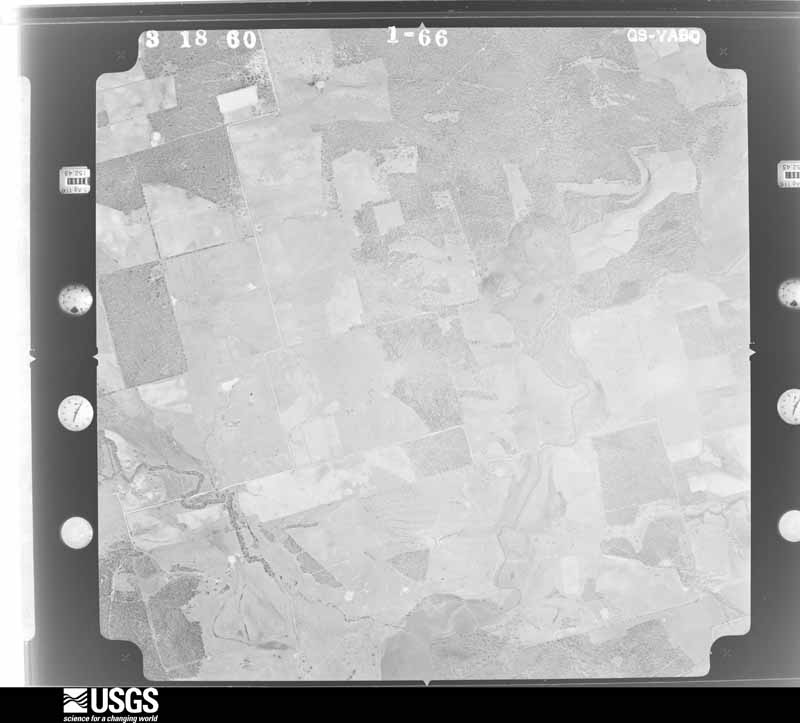
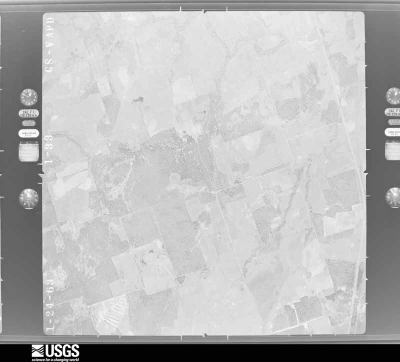
Flown by the U.S. Geological Survey between 1937 and 1989, the Aerial Photo Single Frames collection is the definitive mid-century view of the land: fields, roads and rivers as the camera saw them. The Survey holds 1,447 frames inside the rectangle that bounds this county; the 48 frames below were taken over the county itself, chosen across the decades of flights (at most four a year from that rectangle), so one flight cannot crowd out the rest. The full set is free to browse and download at EarthExplorer under the dataset Aerial Photo Single Frames.














































The thermometers that kept this county's weather, and the gages that measured the flow of its streams, as the federal records hold them. The extremes below are measured values from those records, not estimates.
Who lived here in 1950, one enumeration district at a time, as the Census Bureau described each district. Each row opens its official National Archives result, with Population Schedules and ED Maps available there.
Every wildfire the federal occurrence database records inside this county: 797 of them, burning about 5,622 acres. 14 started naturally and 6 were recorded as arson. Each settlement page carries the fires within five miles of it.
| Reported cause | Fires |
|---|---|
| Debris and open burning | 381 |
| Missing data/not specified/undetermined | 165 |
| Equipment and vehicle use | 145 |
| Power generation/transmission/distribution | 41 |
| Smoking | 16 |
| Natural | 14 |
| Railroad operations and maintenance | 12 |
| Misuse of fire by a minor | 10 |
| Recreation and ceremony | 7 |
| Arson/incendiarism | 6 |
The five largest, by the area the report gives. None of them was recorded as arson.
| Date | Cause | Size | Reported by | Name on the report |
|---|---|---|---|---|
| 17 November 1999 | Smoking | 400 acres | Texas A & M Forest Service | not named |
| 17 October 2007 | Debris and open burning | 240 acres | Texas A & M Forest Service | not named |
| 11 June 2009 | Equipment and vehicle use | 200 acres | Texas A & M Forest Service | GRASS FIRE |
| 27 November 2005 | Equipment and vehicle use | 200 acres | Texas A & M Forest Service | CENTRAL TX - 43 |
| 3 August 2011 | Missing data/not specified/undetermined | 200 acres | Texas A & M Forest Service | TANGLEWOOD (LEE) FIRE |
| 13 March 2006 | Debris and open burning | 150 acres | Texas A & M Forest Service | PETERSON FIRE |
| 15 June 1998 | Natural | 120 acres | Texas A & M Forest Service | not named |
| 24 January 1992 | Missing data/not specified/undetermined | 100 acres | Texas A & M Forest Service | not named |
Every settlement page carries the fires within five miles of it - see the settlement index below.
The NOAA Storm Events Database holds 236 reports for this county, causing 2 deaths, 36 injuries and about $6,563,250 in recorded property damage. Each settlement page carries the reports that name it.
| Kind of event | Reports |
|---|---|
| Hail | 82 |
| Thunderstorm Wind | 70 |
| Flash Flood | 51 |
| Tornado | 30 |
| Funnel Cloud | 2 |
| Flood | 1 |
The most serious of them, by death, then injury, then recorded damage. The accounts are quoted exactly as the forecast office filed them.
| When | Event | Place named | Harm | What the report says |
|---|---|---|---|---|
| May 2016 | Flash Flood | Loebau | 1 killed | A vehicle was swept off the road due to swift water. The driver was found deceased the next day due to apparent drowning. |
| March 2012 | Flash Flood | Fedor | 1 killed | Thunderstorms produced heavy rain that caused flash flooding of FM 1624 at West Yegua Creek near Fedor where a vehicle was swept off the road by flood waters. The driver of the vehicle was found dead. |
| November 2001 | Flash Flood | West Portion | 10 hurt, $50,000 | Heavy rainfall continued to spread eastward during the mid afternoon, and by early evening, accumulations over the northwestern portion of Lee County was approaching 4 inches. Flash flooding formed just before sunset and continued into the early morning hours of the 16th. Maximum totals were 7 inches in the northwest part of the county. The flash flooding closed most rural roads and nearly all low water crossings. Flooding was reported to be the worst since 1956 along Middle Yegua in the northwestern part of the county. Lexington school were forced to cancel their classes. Numerous roads and bridges were washed away. Several rescues were required. |
| November 1987 | Tornado (F2) | not stated | 8 hurt, $2,500,000 | no account filed |
| December 1984 | Thunderstorm Wind | not stated | 6 hurt | no account filed |
| December 1953 | Tornado (F3) | not stated | 4 hurt, $25,000 | no account filed |
| April 1954 | Tornado (F2) | not stated | 2 hurt, $250,000 | no account filed |
| March 1957 | Tornado (F3) | not stated | 2 hurt, $25,000 | no account filed |
| March 1957 | Tornado (F3) | not stated | 2 hurt, $25,000 | no account filed |
| May 1983 | Tornado (F1) | not stated | 1 hurt, $250,000 | no account filed |
| May 2015 | Tornado (EF0) | Giddings | 1 hurt, $10,000 | A high end EF-0 tornado touched down damaging a Ramada Hotel on Highway 290 east of the city of Giddings. Most of the damage consisted of uprooted trees rooted in wet soils while other damage included a destroyed outbuilding, whose debris were lofted into the Ramada Hotel causing window and roof damage to the hotel. |
| March 2000 | Hail | Giddings | $500,000 | The extremely large hail damaged hundreds of cars windows and bodies and dented and damaged the roofs of dozens of homes. Many consider this to be the most devastating hail storm in the city of Giddings in over 50 years. |
| August 2017 | Flood | Fedor | $250,000 | The largest impact across Lee County with Harvey was the rainfall where as much as 20 inches fell near Giddings. The southern half of the county experienced the worst flooding with 25 homes being impacted, many of those having experienced major damage. The tropical storm force winds did bring some trees down across the county. Damage from the flooding is estimated to be near 250K dollars. |
| April 1980 | Tornado (F3) | not stated | $250,000 | no account filed |
| April 2006 | Thunderstorm Wind | Lincoln | $200,000 | Severe thunderstorms moved into Lee County in the late afternoon. They began producing severe winds as they approached US77, knocking down trees and power lines from near Lincoln eastward to near Dime Box. The storm also destroyed outbuildings and damaged several mobile homes along the path. Near Dime Box the storms destroyed several barns, with the damage estimated near $200,000. |
| March 2005 | Thunderstorm Wind | Giddings | $200,000 | Severe thunderstorm winds destroyed severely damaged a large barn northeast of Giddings along FM141. The winds destroyed the roof of the barn. |
| March 2002 | Thunderstorm Wind | Countywide | $200,000 | Widespread wind damage in the derecho was reported across Lee County by wind gusts estimated at 60 to 70 knots. The storms knocked over trees and power lines, damaged roofs and windows, and destroyed barns and outbuildings. |
| December 2002 | Hail | Lexington | $150,000 | Damage was reported to roofs and windows of buildings as well as to vehicles in the Lexington area by the softball-sized hail. |
| May 2006 | Thunderstorm Wind | Lexington | $100,000 | High winds blew an 18-wheel trailer off a bridge and into a creek along US77 2 miles north of Lexington. Other severe thunderstorm winds knocked down trees and power lines in the city of Lexington. Some residents were left without power for few hours. |
| March 2000 | Hail | Giddings | $100,000 | Large, very dense hail, propelled by winds estimated at 30 to 40 mph caused widespread damage to vehicles from northeast of Giddings to near Dime Box. |
| May 2000 | Thunderstorm Wind | Lexington | $100,000 | Severe thunderstorm winds blew down trees in the Lexington area. The winds also severely damaged 2 barns just outside Lexington. |
| May 1999 | Hail | Lincoln | $100,000 | Hail of up to golfball size damaged cars and trucks just west of Lincoln. |
| September 2000 | Thunderstorm Wind | Giddings | $90,000 | Severe thunderstorm winds blew the roofs off several businesses in Giddings. |
| January 1998 | Tornado (F1) | Giddings | $80,000 | The tornado developed just south of Giddings, moving toward the northeast as it destroyed a barn and a mobile home. The tornado crossed SH 290 and damaged a nursery along with several small sheds before dissipating. |
| January 1998 | Tornado (F1) | Dime Box | $80,000 | A third tornado touched down near Dime Box. It was spotted by a constable who reported that it destroyed a barn and several sheds across a city block, taking off tin roofs. tossing lumber about and knocking down fences. |
| December 1997 | Thunderstorm Wind | Giddings | $80,000 | no account filed |
| September 1997 | Thunderstorm Wind | Giddings | $80,000 | no account filed |
| June 2007 | Flash Flood | Fedor | $50,000 | Thunderstorms moved into Lee County shortly after midnight and produced a general 1-2 inch rain over the county. The heaviest amounts were in the Giddings area where 4 inches fell. Flash flooding was widespread across the central part of the county with many rural roads closed. Among those closed due to flash flooding were CR226, CR230, and CR231. |
| July 2003 | Thunderstorm Wind | Lexington | $50,000 | A cold front moved southward into South Central Texas on the morning of July 23. A line of showers and thunderstorms developed along the front and moved quickly southward. Strong downburst winds damaged roofs, and knocked over several dozen trees shortly before noon. |
| December 2002 | Thunderstorm Wind | Giddings | $50,000 | Trees were knocked down and damage was reported to outbuildings between Giddings and Lexington as a result of severe thunderstorm winds. |
| January 1998 | Tornado (F1) | Giddings | $50,000 | A second tornado was spotted just northeast of Giddings by a Deputy Sheriff. It also moved briefly northeastward, destroying a barn and fence. |
| June 1994 | Thunderstorm Wind | Giddings | $50,000 | Severe thunderstorm blew over a metal barn near Loebau. The storm then headed northeastward and destroyed the roof of a farm house. |
| March 1993 | Hail | Giddings | $50,000 | Up to dime-size hail was reported in Giddings by a TV-36 Stormtracker. Two auto dealerships in Giddings reported significant damage to their stock. Several cars in town had windshields broken out and several homes had roof damage. |
| January 2012 | Thunderstorm Wind | Northrup | $40,000 | A mobile home was rolled over and destroyed. |
| November 1998 | Flash Flood | South Portion | $40,000 | no account filed |
| June 2002 | Thunderstorm Wind | Lincoln | $30,000 | Trees were blown over by severe thunderstorm winds along US21 between Lincoln and Manheim. |
| January 1991 | Tornado (F1) | not stated | $25,000 | no account filed |
| August 1972 | Tornado (F1) | not stated | $25,000 | no account filed |
| February 1962 | Tornado (F1) | not stated | $25,000 | no account filed |
| February 1962 | Tornado (F2) | not stated | $25,000 | no account filed |
| April 2009 | Hail | Tanglewood | $20,000 | A resident reported nickel size hail which damaged a pickup truck. |
| August 2003 | Thunderstorm Wind | Lexington | $20,000 | A severe thunderstorm moved southward across northern Lee County and produced severe winds as it approached Lexington. The damaging winds knocked down several trees in the area. |
| December 2002 | Thunderstorm Wind | Giddings | $20,000 | High winds blew down trees in the Giddings area. |
| October 2000 | Thunderstorm Wind | Fedor | $20,000 | Severe thunderstorm winds knocked over trees and small outbuildings. |
| July 1998 | Thunderstorm Wind | Giddings | $20,000 | Severe thunderstorm winds struck the Northrup area near Giddings, knocking down trees and taking the roofs off mobile homes and small sheds. |
| April 1997 | Thunderstorm Wind | Countywide | $20,000 | Trees were blown down across the western part on county. Numerous fences were also reported to have been damaged. |
| October 1998 | Flash Flood | Countywide | $20,000 | no account filed |
| May 1999 | Thunderstorm Wind | Lexington | $15,000 | Severe winds blew down trees just northwest of Lexington. |
| October 1997 | Flash Flood | Countywide | $15,000 | no account filed |
| May 2017 | Thunderstorm Wind | Giddings | $10,000 | A thunderstorm produced wind gusts estimated at 70 mph that snapped large Oak trees on the south side of Giddings. |
| August 2012 | Thunderstorm Wind | Loebau | $10,000 | A thunderstorm produced wind gusts estimated at 58 mph that damaged the underpinning of a mobile home, a porch, a barn, a well house, a fence, and multiple trees. |
| January 2012 | Thunderstorm Wind | Lincoln | $10,000 | Thunderstorms produced wind gusts estimated at 50 mph which blew down several trees and destroyed some buildings. A church gym was heavily damaged. Several trees were blown down along Highway 21 and throughout the county. |
| July 2009 | Thunderstorm Wind | Giddings | $10,000 | A farmer in Ledbetter reported damage to his barn along with trees blown down. |
| February 2003 | Flash Flood | Countywide | $10,000 | General 2 inch rainfall over the county, with isolated totals to 8 inches brought very rapid flash flooding across the county from the late morning into the early evening. Many of the county roads were closed. Schools in the area were dismissed early. |
| June 2003 | Thunderstorm Wind | Giddings | $10,000 | The Lee County Sheriff's Department reported that severe thunderstorm winds blew down trees in the Giddings area. |
| June 2002 | Thunderstorm Wind | Fedor | $10,000 | Severe thunderstorm winds estimated at over 50 knots blew down numerous large branches from trees. |
| November 1994 | Tornado (F2) | Blue | $10,000 | A trailer home was destoyed 1 mile north of the town of Blue. The tornado lifted the mobile home and dropped it 25 feet away. A 13-year old boy was eating supper in the mobile home alone as the tornado struck. He described a sound "like a freight train", with the trailer beginning to rock back and forth. He remembered hitting the floor and ceiling as the mobile home was rolled over and destroyed. He was found uninjured amid the debris. At 1845CST the Sheriff's Department reported trees downed just southeast of Blue. |
| May 1999 | Thunderstorm Wind | Lincoln | $10,000 | no account filed |
| January 1998 | Hail | Lexington | $10,000 | no account filed |
| October 1997 | Thunderstorm Wind | Serbin | $10,000 | no account filed |
The Survey's mineral resources record lists 5 workings inside this county. None of them still produces: all are closed or unrecorded. Each settlement page carries the workings within five miles of it.
| Commodity | Workings |
|---|---|
| Titanium, Metal, Zirconium, Thorium | 2 |
| Titanium | 1 |
| Bentonite | 1 |
| Zirconium | 1 |
The least common of them first, because a county's hundredth gravel pit says nothing its first ten did not.
| Where | Site | Commodity | Status | Recorded |
|---|---|---|---|---|
| Colvin Sandstone Deposit | Titanium | Unknown | ||
| Colvin Sandstone Deposit | Zirconium | Unknown | ||
| Mitschke | Bentonite | Unknown | ||
| Carter-Branch Prospect | Titanium, Metal, Zirconium, Thorium | Occurrence | 1954 | |
| Colvin Prospect | Titanium, Metal, Zirconium, Thorium | Occurrence | 1954 |
Named settlements recorded in the Geographic Names Information System, each with the topographic sheets covering it. Villages, hamlets and abandoned places alike. Each is shown with the nearest named watercourse or landform and the survey quadrangle it falls on.
Lexington census division · 78947 · On Blue Branch · Beaukiss quadrangle
15 sheets, 1885 to 1985
Lexington census division · 78947 · On Burns Branch · Beaukiss quadrangle
15 sheets, 1885 to 1985
Lincoln-Dime Box census division · 78948 · On Blue Buck Creek · Lincoln quadrangle
9 sheets, 1919 to 1993
Lincoln-Dime Box census division · 78948 · On Bluff Creek · Fedor quadrangle
15 sheets, 1885 to 1985
Lexington census division · 78947 · On Spring Branch · Hicks quadrangle
8 sheets, 1954 to 1993
Lexington census division · 78947 · On Doak Spring Branch · Lincoln quadrangle
9 sheets, 1919 to 1993
Lincoln-Dime Box census division · 78948 · On Elm Creek · Lincoln quadrangle
9 sheets, 1919 to 1993
Lexington census division · 78947 · Tanglewood quadrangle
9 sheets, 1919 to 1993
No longer a settlement
Giddings census division · 78942 · On Little Pin Oak Creek · Giddings quadrangle
8 sheets, 1919 to 1993
Lincoln-Dime Box census division · 78942 · On Water Hole Branch · Dime Box quadrangle
10 sheets, 1919 to 1993
The vanished settlements of Lee County: the places named above that are no longer on the map.