 Block
BlockAndrews, Texas
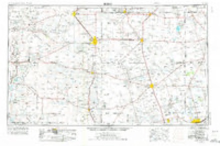
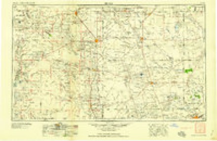
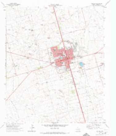
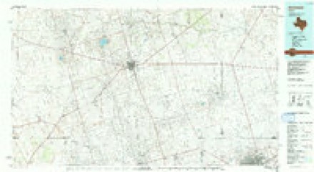
5 topographic sheets cover this place, the earliest surveyed in 1954 and the latest in 1991. It stands in the Andrews North census division. It lies in ZIP code area 79714. The Survey maps it on the Andrews quadrangle. 13,487 people lived here at the 2020 count. It stands 3,176 feet above sea level.
Research this city
Population over time
2 figuresAndrews grew from 11,088 to 13,487 between 2010 and 2020. These are the recorded population figures Wikidata holds for this place, reached through the Geographic Names Information System number this page is keyed on rather than by name, so they belong to this place and not to another of the same name. Most are census counts, but not all are: an early figure may be a founding or settlement estimate, and an estimate published within five years of a census is left out. The change column is computed, and is left blank where more than 20 years separate a figure from the one before it, because a gap that long is not a change between two counts.
| Year | People | Change |
|---|---|---|
| 2010 | 11,088 | |
| 2020 | 13,487 | +2,399 (+22%) |
Topographic sheets covering this place
4 surveys from 5 printed sheetsMatched by testing this settlement's coordinate against the published boundary of every sheet in the United States Geological Survey's historical collection. Each opens the scanned sheet at the Survey.
- 1954 USGS Hobbs quadrangle1:250000, 2 printings
- 1958 USGS Hobbs quadrangle1:250000
- 1963 USGS Andrews quadrangle1:24000
- 1991 USGS Andrews quadrangle1:100000
Photographs
8 of 36 photographs shown, 1942Taken for the Office of War Information and the Farm Security Administration, who photographed the country between 1935 and 1944. Works of United States government photographers, with no known restriction on use. Each opens its catalogue record.

Vachon, John, 1942. Library of Congress

Vachon, John, 1942. Library of Congress

Vachon, John, 1942. Library of Congress

Vachon, John, 1942. Library of Congress

Vachon, John, 1942. Library of Congress

Vachon, John, 1942. Library of Congress

Vachon, John, 1942. Library of Congress
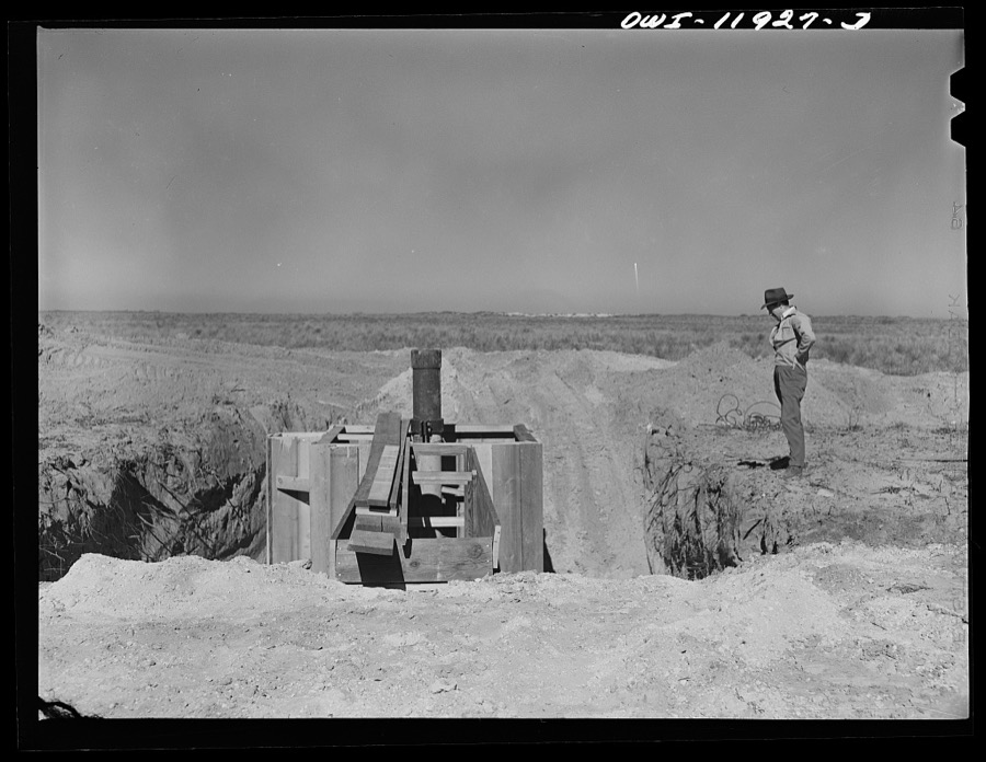
Vachon, John, 1942. Library of Congress
Every photograph of Andrews County
Fires near this place
156 since 2005Regional context, not property-specific evidence. The federal wildfire occurrence database lists 156 fires within 5 miles of Andrews between 2005 and 2017, burning about 30,963 acres in total. 16 started naturally. None was recorded as arson. Distance is straight-line from the map coordinates, so a fire counted here may appear on a neighbouring settlement's page as well.
| Reported cause | Fires |
|---|---|
| Equipment and vehicle use | 70 |
| Missing data/not specified/undetermined | 39 |
| Debris and open burning | 18 |
| Natural | 16 |
| Smoking | 5 |
| Misuse of fire by a minor | 4 |
| Power generation/transmission/distribution | 3 |
| Recreation and ceremony | 1 |
The most recent of them, most recent first, with the day each was reported and the service that recorded it.
| Date | Cause | Size | Reported by | Name on the report |
|---|---|---|---|---|
| 9 September 2011 | Equipment and vehicle use | 5.0 acres | Texas A & M Forest Service | APACHE SHAFTER LAKE FIRE |
| 3 September 2010 | Equipment and vehicle use | 2.0 acres | Texas A & M Forest Service | 2010265 |
| 22 September 2011 | Natural | under an acre | Texas A & M Forest Service | 2011533 |
| 20 September 2008 | Equipment and vehicle use | under an acre | Texas A & M Forest Service | not named |
| 2 September 2007 | Missing data/not specified/undetermined | 1.0 acres | Texas A & M Forest Service | not named |
| 17 September 2006 | Equipment and vehicle use | 1.0 acres | Texas A & M Forest Service | not named |
| 14 September 2011 | Equipment and vehicle use | 9.0 acres | Texas A & M Forest Service | NW MUSTANG FIRE |
| 11 September 2010 | Equipment and vehicle use | 1.0 acres | Texas A & M Forest Service | 2010282 |
Settlements close enough to share some of these fires:
Mines and quarries near this place
2 within 5 milesRegional context, not property-specific evidence. The federal mineral resources record lists 2 workings within 5 miles of Andrews: 2 producers. All of them still produce. What was taken out: Limestone, General, Stone, Crushed/Broken. Distance is straight-line from the map coordinates, so a quarry counted here may appear on a neighbouring settlement's page as well.
| Where | Site | Commodity | Status | Recorded |
|---|---|---|---|---|
| Grimmett Pit | Limestone, General | Producer | Caliche | |
| Joe Stewart Pit | Stone, Crushed/Broken | Producer |
Storms near this place
60 of 198 shownRegional context, not property-specific evidence. The National Weather Service names Andrews in 198 storm reports between 1993 and 2025: 108 hail, 47 thunderstorm wind, 39 flash flood, 3 tornado. The reports record 1 injury. Each account below is quoted exactly as the forecast office filed it, from the NOAA Storm Events Database, and each date opens the federal record of that event.
| When | Event | Place named | Harm | What the report says |
|---|---|---|---|---|
| September 2006 | Thunderstorm Wind | Andrews | 1 hurt, $6,000 | The Andrews County Sheriff's Office reported damage and one injury due to severe thunderstorm winds just southeast of Andrews. Observations from the West Texas Mesonet station in Andrews reported a maximum wind gust of 55 mph. The injured person had been hit in the face and chest by a corrugated metal fence panel and suffered blunt force trauma to the face and chest as well as a laceration that needed stitching. A damage assessment was performed by the Andrews County emergency manager and sheriff's department personnel the following day. They discovered that all debris was oriented from southwest to northeast and made the determination that all damage was caused by straight-line winds. Damage consisted mostly of broken tree limbs, uprooted trees, damaged small metal storage buildings, displaced barn roofs, and fallen utility poles. One semi-trailer was blown over, but did not appear to be damaged otherwise. An abandoned house trailer had a portion of the roof blown off exposing framing and insulation. A wood framed covered porch on an occupied house trailer was blown up and over the trailer, across the front yard, onto the other side of the street. |
| June 1995 | Hail | Andrews | $6,000,000 | An LP Supercell produced very large hail across much of the city of Andrews causing damage to cars and roofs totalling around $6 million. Over 700 roofs had shingles replaced. Reports received from SKYWARN spotters, sheriff's office, and off-duty National Weather Service personnel. |
| April 1999 | Hail | Andrews | $5,000,000 | A multicell cluster of thunderstorms moved into Andrews County from Winkler County. A new cell developed on the south end of the cluster and dropped the large hail on parts of Andrews. Numerous cars were damaged along with some roofs. This was the worst hail storm in Andrews since June 4, 1995. |
| June 1995 | Hail | Andrews | $500,000 | Another hail storm passed over much of the same area as the June 4th storm. Additional damage occurred south of the June 4th path, however. SKYWARN spotter and insurance agent provided reports. |
| June 2008 | Thunderstorm Wind | Andrews | $200,000 | Widespread wind damage occurred throughout Andrews. The West Texas Mesonet site measured a peak gust of 55 knots. Numerous powerline poles were downed by these winds. Two hanger doors wers blown inward at the Andrews Airport. Two commercial roofs were torn off and a convenience store awning collapsed. |
| August 2004 | Flash Flood | Andrews | $150,000 | Storm spotters and local officials reported flash flooding in Andrews. Several city streets were inundated by flowing water. High water entered houses in parts of the city and caused structural damage. In addition, fire department officials conducted several high water rescues when motorists were stranded by flood waters. |
| July 2016 | Thunderstorm Wind | Andrews | $100,000 | A thunderstorm moved across Andrews County and produced straight line wind damage in the northeastern part of the county. A farmer reported damage to his barns and equipment. One shed was ripped completely up and strung out for a quarter mile or so to the northeast. This shed had no side walls, just a roof. Tractors and sprayers were damaged. A metal building 25 yards east of this shed had part of the roof blown off as well as a metal overhang. One of the metal I beam posts that were cemented into the ground was ripped out and blown into the side of this same building. A much larger metal building located 50 yards south of these buildings was also damaged. A section of south facing wall was blown in and portions of the roof and cross members were blown off. The time of damage is an estimate and the cost of damage is a very rough estimate. |
| September 2003 | Thunderstorm Wind | Andrews | $75,000 | Severe thunderstorm winds blew down at least 15 power poles along Highway 176 east of Andrews to near the Martin County line as the supercell storm moved across eastern Andrews County. |
| June 2023 | Flash Flood | Andrews | $50,000 | Street flooding with cars stranded was reported in Andrews. Property damage cost is an estimation. |
| September 2019 | Flash Flood | Andrews | $50,000 | Heavy rain moved across Andrews County and produced flash flooding in the town of Andrews. There were multiple accidents with injuries in Andrews. The number of injuries is unknown. Streets were closed and there were stalled cars. The cost of damage is a very rough estimate. |
| August 2002 | Thunderstorm Wind | Andrews | $50,000 | Winds up to 70 MPH from severe thunderstorms resulted in damage throughout parts of the city of Andrews. The most significant damage occured at the First Baptist Church...where a portion of the roof was blown off. The same church lost its roof during severe thunderstorms in July. In addition...several large trees were blown down throughout the city. |
| April 1993 | Thunderstorm Wind | Andrews | $50,000 | An amateur radio operator reported wind damage to his roof and radio antenna in Andrews. East of Andrews, several homes in a subdivision suffered roof damage. |
| July 1994 | Thunderstorm Wind | Andrews | $50,000 | no account filed |
| June 2007 | Thunderstorm Wind | Andrews | $30,000 | Powerlines and trees were downed by strong winds. A roof was also blown off a building and onto powerlines. |
| June 2003 | Thunderstorm Wind | Andrews | $30,000 | A very intense storm developed rapidly at the intersection of two outflow boundaries over Andrews County. The storm produced golfball size hail and an intense downburst which destroyed a barn just west of town, blew down power poles, and blew a large tree across a city street in town. |
| September 2004 | Flash Flood | Andrews | $25,000 | Thunderstorms and heavy rain again erupted over west Texas during the afternoon of the 27th. Saturated ground conditions were first aggravated by downpours over Andrews. Urban flash flooding quickly ensued and several vehicles stalled in flooded city streets. The Andrews Fire Department conducted at least one high water rescue. No injuries were reported. |
| August 2007 | Thunderstorm Wind | Andrews | $20,000 | Several powerlines were downed by strong winds in the city of Andrews. |
| September 2003 | Thunderstorm Wind | Andrews | $20,000 | At least five power poles were blown down by severe thunderstorm winds along State Route 176 near the intersection of Farm to Market Road 1788.The first of four supercell thunderstorms to affect the northern Permian Basin during the evening of the 7th and the early morning hours of the 8th developed over Andrews County. This storm resulted in large hail and damaging thunderstorm winds. The storm then propagated southeast across unpopulated areas of southwest Martin County, and eventually across Midland (including the city of Midland proper) and northern Upton Counties. |
| May 2022 | Hail | Andrews | $10,000 | A thunderstorm produced 2.50 inch hail five miles west southwest of Andrews, TX. There was damage to car windshields. The cost of damage is a very rough estimate. |
| June 2013 | Thunderstorm Wind | Andrews | $10,000 | A thunderstorm moved across Andrews County and produced an estimated 45 mph wind gust. This wind had blown off the roof of a structure. The cost of damage is a rough estimate. |
| March 2000 | Thunderstorm Wind | Andrews | $10,000 | Thunderstorm outflow winds blew over a trailer. |
| May 1998 | Thunderstorm Wind | Andrews | $10,000 | The storm that first dropped golfball size hail two hours earlier had slowly sagged southward as it became better organized into an impressive HP Supercell. A mid-level circulation developed and a rain-filled rear-flank downdraft (RFD) surged southward across County Road 7000. Twelve utility poles were downed in this area in two groups: a group of 3 and a group of 9 separated by one mile.A survey of the area determined that the damage occurred about 2-3 miles west of where the circulation passed over the road (as determined through radar and GPS comparisons). No damage was seen in the area of the circulation, therefore it was determined that this circulation never reached the ground. The damage path was slightly divergent with winds from a 340 to 325 degree direction. |
| June 1997 | Thunderstorm Wind | Andrews | $10,000 | no account filed |
| September 2017 | Thunderstorm Wind | Andrews | $6,000 | A thunderstorm moved across Andrews County and produced wind damage eight miles south of the City of Andrews. A few telephone poles were blown down. The cost of damage is a very rough estimate. |
| July 2009 | Flash Flood | Andrews | $5,000 | A vehicle was reported submerged within the city limits in Andrews. Roads on the northwest and northeast side of the city also had 1 foot of flowing water over them. |
| June 2008 | Hail | Andrews | $5,000 | Silver dollar sized hail damaged home windows near the intersection of County Road 2001 and Texas State Highway 176. |
| June 2007 | Hail | Andrews | $5,000 | Tennis ball sized hail fell on the west side of Andrews. |
| April 1993 | Thunderstorm Wind | Andrews | $5,000 | An amateur radio operator reported wind damage to his roof and radio antenna in Andrews. East of Andrews, several homes in a subdivision suffered roof damage. |
| May 1993 | Thunderstorm Wind | Andrews | $5,000 | Downburst wind gusts reached speeds of 76 miles an hour north of Andrews, according to the public and equipment at the Andrews County Airport. Damage to roofs and trees was reported. |
| September 1995 | Thunderstorm Wind | Andrews | $5,000 | no account filed |
| October 2012 | Thunderstorm Wind | Andrews | $4,000 | A thunderstorm moved across Andrews County and produced a strong wind gust which resulted in several trees and power lines being blown down. This wind gust is estimated to have been around 70 mph, and the cost of damage from the wind is a rough estimate. |
| June 2019 | Hail | Andrews | $3,000 | A thunderstorm moved across Andrews County and produced tennis ball sized hail six miles east of Andrews. Windows in vehicles were broken from the hail. The cost of damage is a very rough estimate. |
| October 2015 | Flash Flood | Andrews | $2,000 | Andrews County Sheriffs Office reported water flooding residents' yards and 1 to 2 feet of water covering some roadways. A vehicle was submerged under water and southbound lanes of N Main and NW Mustang Streets were being barricaded. Damage costs are a very rough estimate. |
| June 2010 | Thunderstorm Wind | Andrews | $2,000 | Law enforcement reported powerlines were downed by strong winds in Andrews, TX. |
| June 1998 | Thunderstorm Wind | Andrews | $1,500 | A couple of utility poles were knocked down by strong winds from this storm. |
| August 2016 | Flash Flood | Andrews | $1,000 | Heavy rain fell across Andrews County and produced flash flooding northeast of the City of Andrews. The Andrews County Sheriff's Office reported two feet of water running over the intersection of Ranch Road 1788 and 7100, about ten to eleven miles northeast of the City of Andrews. The cost of damage is a very rough estimate. |
| August 2016 | Flash Flood | Andrews | $1,000 | Heavy rain fell across Andrews County and produced flash flooding near the City of Andrews. The Andrews Police Department reported Road SE 3000 on the southeast side of Andrews to be closed due to high water. Parts of US 385 and 115 also were closed. The cost of damage is a very rough estimate. |
| September 2014 | Flash Flood | Andrews | $1,000 | Heavy rain moved across Andrews County and produced flash flooding in the city of Andrews. No damage was reported so the cost of damage is a rough estimate. |
| September 2014 | Flash Flood | Andrews | $1,000 | Heavy rain moved across Andrews County and produced flash flooding near Andrews. The Texas Department of Transportation reported that an eight mile stretch of State Highway 176 from County Road SW 2001 to State Highway 181 was closed due to flooding. Traffic was being detoured around the flooded stretch of road. The cost of damage is a very rough estimate. |
| September 2014 | Flash Flood | Andrews | $1,000 | Heavy rain moved across Andrews County and produced flash flooding in Andrews. The county judge reported numerous flooded roads in the city of Andrews. No damage was reported so the cost of damage is a very rough estimate. |
| July 1998 | Thunderstorm Wind | Andrews | $1,000 | The storm that dropped the hail in Andrews also caused scattered light wind damage across town. |
| October 2015 | Flash Flood | Andrews | $500 | Several roads and intersections in Andrews were covered with one to two feet of water. The cost of damage is a very rough estimate. |
| August 1993 | Thunderstorm Wind | Andrews | $500 | A rancher reported dime-size hail and broken tree limbs north of Andrews. |
| September 2014 | Flash Flood | Andrews | $300 | Heavy rain fell across Andrews County and produced flash flooding. There was flooding reported at the intersection of SE Road 8000 and U.S. Highway 385. The cost of damage is a very rough estimate. |
| November 2025 | Hail | Andrews | - | A video was shared by the public on social media of nickel to quarter-size hail covering the side of the road and in grassy areas along FM 2371 west of Andrews. The time of occurrence is estimated from radar. |
| September 2024 | Flash Flood | Andrews | - | Andrews County Emergency Management reported multiple road closures in the city of Andrews. |
| June 2023 | Flash Flood | Andrews | - | Flash flooding report relayed from mPing. |
| June 2023 | Hail | Andrews | - | Hail was observed on US 385. |
| June 2023 | Flash Flood | Andrews | - | Widespread street and yard flooding was reported in Andrews via mPing. |
| June 2023 | Hail | Andrews | - | Hail report via mPing. |
| June 2023 | Hail | Andrews | - | Quarter-size hail was reported via mPing. |
| May 2023 | Flash Flood | Andrews | - | Broadcast media relayed a report of street flooding in Andrews. The video showed water up to the top of wheel wells on vehicles. |
| February 2022 | Thunderstorm Wind | Andrews | - | A thunderstorm moved across Andrews County and produced a 67 mph wind gust near the town of Andrews. |
| September 2021 | Thunderstorm Wind | Andrews | - | A thunderstorm moved across Andrews County and produced a 62 mph wind gust near the town of Andrews. |
| March 2018 | Hail | Andrews | - | A storm moved over Andrews County and produced quarter sized hail which covered the road at the intersection of US 385 and County Road SE 6000. |
| March 2018 | Funnel Cloud | Andrews | - | A storm moved across the Andrews/Ector county line and briefly produced a funnel cloud. |
| June 2017 | Thunderstorm Wind | Andrews | - | A thunderstorm moved across Andrews County and produced a 62 mph wind gust two miles east of Andrews. |
| September 2016 | Thunderstorm Wind | Andrews | - | A thunderstorm moved across Andrews County and produced a 62 mph wind gust at the City of Andrews AWOS site. |
| July 2016 | Thunderstorm Wind | Andrews | - | A thunderstorm moved across Andrews County and produced a 58 mph wind gust near the City of Andrews. |
| August 2014 | Thunderstorm Wind | Andrews | - | A thunderstorm moved across Andrews County and produced a 58 mph wind gust near the town of Andrews. No damage was reported. |
Nearest settlements
The eight closest, with where each one stands in the county. Distances are straight-line, computed from the Geographic Names Information System coordinates.
| Map | Place | Distance | Sheets |
|---|---|---|---|
| McKinney Acres | 1.5 miles | 5 | |
| Waldon Place Windmill | 4.9 miles | 5 | |
| Shafter Lake (historical) | 8.7 miles | 5 | |
| Florey | 9.5 miles | 5 | |
| Old Place Windmills | 10.0 miles | 5 | |
| Frankel City | 13.3 miles | 5 | |
| Sixteen Corner Windmill | 16.1 miles | 5 | |
| Coyote Corner | 17.4 miles | 5 |
Elsewhere
Matched on this settlement's Geographic Names Information System number rather than its name, so it cannot be a different place of the same name in another state.
| Wikipedia article on Andrews | An encyclopaedic summary. Its text is share-alike, so it is linked here rather than copied. |
| Wikidata item Q509541 | The structured record the population and elevation above come from. Public domain (CC0). |
Provenance
This settlement is recorded in the Geographic Names Information System as feature 1329539. The sheet list is computed by point-in-boundary test against the United States Geological Survey's historical topographic inventory. Both are works of the United States government and carry no copyright under 17 U.S.C. 105.
Wildfire. Short, Karen C. 2022. Spatial wildfire occurrence data for the United States, 1992-2020 [FPA_FOD_20221014]. 6th Edition. Fort Collins, CO: Forest Service Research Data Archive. https://doi.org/10.2737/RDS-2013-0009.6 Collected with United States Government funding and usable without additional permissions or fees.
Mines and quarries. USGS Mineral Resources Data System (MRDS) https://mrdata.usgs.gov/mrds/ A work of the United States government, no copyright under 17 U.S.C. 105.
Storms. NOAA National Centers for Environmental Information, Storm Events Database https://www.ncei.noaa.gov/stormevents/ A work of the United States government, no copyright under 17 U.S.C. 105. Narratives are quoted verbatim from the National Weather Service report and are not edited or summarised.