 Block
BlockBakersfield, Texas
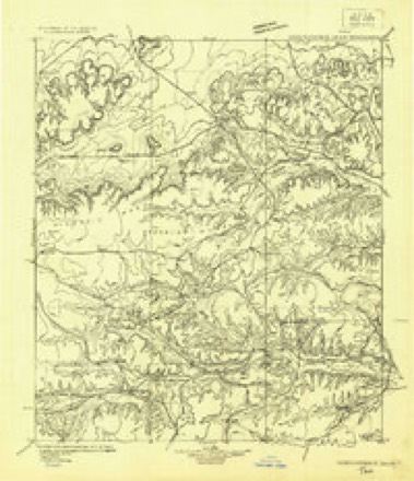
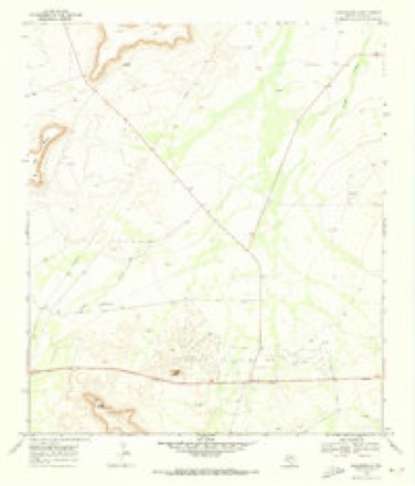
9 topographic sheets cover this place, the earliest surveyed in 1929 and the latest in 1985. It stands in the Iraan census division. It lies in ZIP code area 79752. It lies near Tunas Peak. The Survey maps it on the Bakersfield quadrangle.
Research this city
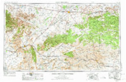
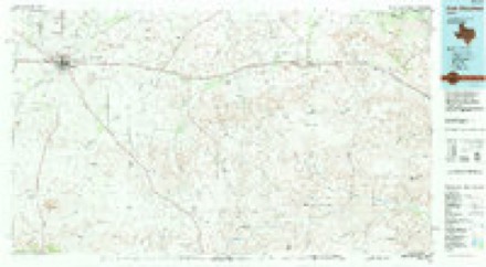
Topographic sheets covering this place
6 surveys from 9 printed sheetsMatched by testing this settlement's coordinate against the published boundary of every sheet in the United States Geological Survey's historical collection. Each opens the scanned sheet at the Survey.
- 1929 USGS Independence Draw Quadrangle quadrangle1:125000
- 1954 USGS Fort Stockton quadrangle1:250000, 3 printings
- 1958 USGS Fort Stockton quadrangle1:250000
- 1969 USGS Bakersfield quadrangle1:24000
- 1973 USGS Fort Stockton quadrangle1:250000
- 1985 USGS Fort Stockton quadrangle1:100000, 2 printings
Fires near this place
2 since 2008Regional context, not property-specific evidence. The federal wildfire occurrence database lists 2 fires within 5 miles of Bakersfield between 2008 and 2011, burning about 31 acres in total. 1 started naturally. None was recorded as arson. Distance is straight-line from the map coordinates, so a fire counted here may appear on a neighbouring settlement's page as well.
| Reported cause | Fires |
|---|---|
| Natural | 1 |
| Missing data/not specified/undetermined | 1 |
The most recent of them, most recent first, with the day each was reported and the service that recorded it.
| Date | Cause | Size | Reported by | Name on the report |
|---|---|---|---|---|
| 23 July 2011 | Natural | 30 acres | Texas A & M Forest Service | LIGON FIRE |
| 14 March 2008 | Missing data/not specified/undetermined | 1.0 acres | Texas A & M Forest Service | PECOS RIVER |
Mines and quarries near this place
1 within 5 milesRegional context, not property-specific evidence. The federal mineral resources record lists 1 working within 5 miles of Bakersfield: 1 producer. All of them still produce. What was taken out: Limestone, General, Stone, Crushed/Broken. Distance is straight-line from the map coordinates, so a quarry counted here may appear on a neighbouring settlement's page as well.
| Where | Site | Commodity | Status | Recorded |
|---|---|---|---|---|
| Unnamed Quarry | Limestone, General, Stone, Crushed/Broken | Producer | Limestone |
Storms near this place
60 of 109 shownRegional context, not property-specific evidence. The National Weather Service names Bakersfield in 109 storm reports between 1994 and 2025: 77 hail, 15 thunderstorm wind, 10 tornado, 4 flash flood. The reports record 1 injury. Each account below is quoted exactly as the forecast office filed it, from the NOAA Storm Events Database, and each date opens the federal record of that event.
| When | Event | Place named | Harm | What the report says |
|---|---|---|---|---|
| May 1999 | Hail | Bakersfield | 1 hurt | Reported by people that saw the tornado. One person was operating a hail cannon (used to break up large hail stones). This person was pounded by the tennis ball size hail and received minor injuries. |
| June 2009 | Hail | Bakersfield | $1,500,000 | Mesa Vineyard lost eighty percent of their grapes due to hail damage. |
| May 1994 | Hail | Bakersfield | $50,000 | no account filed |
| August 2005 | Thunderstorm Wind | Bakersfield | $15,000 | A National Weather Service cooperative observer reported that several buildings on his property near Farm to Market Road 1901 were affected by damaging winds. Part of the metal roof on his house was blown off and two portable buildings were blown down. The winds were accompanied by large hail. |
| June 1998 | Thunderstorm Wind | Bakersfield | $10,000 | The Fort Stockton cluster continued to move to the east and took the roof off one mobile home, damaged the walls of another mobile home, and damaged a barn in the Bakersfield Valley community. |
| April 2024 | Hail | Bakersfield | $5,000 | Emergency management reports broken windshields and hail covering the ground. |
| January 2017 | Thunderstorm Wind | Bakersfield | $5,000 | Thunderstorms moved across Pecos County and produced wind damage eight miles northeast of Bakersfield. Multiple small RV trailers were overturned and a metal roof was blown off of a building. Winds were estimated near 80 mph. The cost of damage is a very rough estimate. |
| May 1999 | Thunderstorm Wind | Bakersfield | $3,000 | Thunderstorm outflow winds took the roof off a porch. |
| October 2006 | Hail | Bakersfield | $1,000 | A NWS cooperative observer reported quarter size hail to a depth of six inches along her fence. She also lost windows on the back of her house and all of her trees lost most of their leaves. A farmer down the road from her lost most of his cotton crop and another neighbor lost windows in her home as well. |
| April 2015 | Hail | Bakersfield | $570 | Golf ball to tennis ball size hail shattered a skylight on residents home and cracked another. A recreational vehicle was also damaged. |
| May 2019 | Hail | Bakersfield | $500 | A thunderstorm moved across Pecos County and produced large hail that cracked a windshield as seen from a video on snapchat. The exact size of the largest hail is unknown. The cost of damage is a rough estimate. |
| May 1994 | Hail | Bakersfield | $500 | An eastward moving supercell thunderstorm produced grapefruit-size hail that was reported by a SKYWARN spotter. The public later reported a brief tornado on Highway 349. |
| July 1994 | Hail | Bakersfield | $500 | The public reported quarter-size hail and 70 MPH winds in Bakersfield. Walnut-size hail was also reported by the public south of Bakersfield. |
| July 1994 | Thunderstorm Wind | Bakersfield | $500 | The public reported quarter-size hail and 70 MPH winds in Bakersfield. Walnut-size hail was also reported by the public south of Bakersfield. |
| May 2014 | Flash Flood | Bakersfield | $400 | Heavy rain fell across Pecos County and produced flash flooding near Bakersfield. Several spots on Farm to Market Road 1901 between Bakersfield and McCamey were reported to be flooded with over six inches of water. Since no damage was reported, the cost of damage is a rough estimate. |
| April 2025 | Tornado (EFU) | Bakersfield | - | A storm chaser shared video evidence of a brief tornado over rural fields in Pecos County. No damage was reported by landowners, and no damage was able to be found. The tornado was therefore rated EF-Unknown. The approximate tornado track and width were estimated. |
| May 2024 | Hail | Bakersfield | - | This report was from mPING. |
| June 2023 | Hail | Bakersfield | - | Emergency Manager reports Tennis ball-sized hail 10 miles south of I-10 on FM2023. |
| June 2023 | Hail | Bakersfield | - | Emergency Manager reports golf ball size hail on FM 2023 south of I-10. |
| June 2023 | Hail | Bakersfield | - | Baseball size hail was reported along Harral Rd just west of South State Highway 2886. |
| June 2023 | Tornado (EFU) | Bakersfield | - | One eyewitness captured a tornado likely in the dissipating stage roughly 10 miles southwest of Sheffield. It is possible the tornado lasted shorter or longer than the estimated time and may have lifted and touched down at multiple points along the path. The survey team was unable to reach the path of the tornado and no damage indicators were found, thus this tornado is classified as an EF-Unknown. Path width is also estimated. |
| April 2019 | Tornado (EF0) | Bakersfield | - | A weak tornado developed about 13 miles southeast of Bakersfield and was briefly witnessed by a trained spotter. The tornado occurred over open country and produced no visible damage. |
| May 2019 | Tornado (EF0) | Bakersfield | - | A thunderstorm produced a tornado about three and a half miles northwest of Bakersfield. The tornado became rain-wrapped and remained over open country. The tornado ended about three miles north northwest of Bakersfield. No damage was reported with this tornado. The estimated peak wind of the tornado was 80 mph. |
| October 2018 | Hail | Bakersfield | - | The local sheriff's department reported golf ball sized hail between mile markers 280-286 along Interstate 10. |
| May 2016 | Funnel Cloud | Bakersfield | - | A thunderstorm moved across Pecos County and produced a funnel cloud north northwest of Bakersfield. |
| May 2015 | Tornado (EF0) | Bakersfield | - | A thunderstorm moved across Pecos County and produced a brief tornado about ten miles southwest of Bakersfield. No damage was reported so the tornado was rated as an EF-0. |
| May 2015 | Tornado (EF0) | Bakersfield | - | A thunderstorm moved across Pecos County and produced a tornado five miles southwest of Bakersfield. The amount of time the tornado was on the ground is unknown. Since there was no damage reported with this tornado, the tornado is being rated as an EF-0. |
| May 2015 | Tornado (EF0) | Bakersfield | - | A thunderstorm moved across Pecos County and produced a tornado near FM 2886 and Harral Road. No damage was reported so the tornado was rated as an EF-0. |
| May 2015 | Tornado (EF0) | Bakersfield | - | A thunderstorm moved across Pecos County and produced a tornado about 30 miles southeast of Fort Stockton. The tornado was reported by an NWS employee to be on the ground for one minute. No damage was reported, so the tornado was rated as an EF-0. |
| May 2015 | Hail | Bakersfield | - | A thunderstorm moved across Pecos County and produced baseball sized hail south southwest of Bakersfield that had recently fallen when local law enforcement spotted it. No reports of damage were received. |
| June 2010 | Thunderstorm Wind | Bakersfield | - | The public reported an estimated gust near 60 mph. No damage was reported with this gust. |
| April 2009 | Hail | Bakersfield | - | The hail nearly covered the ground. |
| April 2009 | Funnel Cloud | Bakersfield | - | The duration of the funnel cloud was estimated. |
| April 2009 | Hail | Bakersfield | - | The duration and time of this report was estimated from radar. The report was called in after the storm had passed at 2130 CST. |
| April 2008 | Hail | Bakersfield | - | Law enforcement reported quarter sized hail on I-10 near mile marker 300. |
| March 2007 | Thunderstorm Wind | Bakersfield | - | No damage was reported. |
| April 2007 | Flash Flood | Bakersfield | - | Farm to Market Road 11 was impassable due to flooding. In addition, the Exxon Station in Bakersfield was flooded. |
| March 2007 | Hail | Bakersfield | - | Golfball to baseball size hail was reported in and around Bakersfield. |
| March 2006 | Hail | Bakersfield | - | A trained NWS storm spotter came across penny size hail covering the ground southwest of Bakersfield an hour after the last storm went through the area. Hail size estimated given potential melting over that period. |
| May 2006 | Thunderstorm Wind | Bakersfield | - | A NWS trained spotter reported gusts to 60 mph associated with a downburst from a thunderstorm. |
| June 2005 | Hail | Bakersfield | - | Storm spotters reported penny size hail along Interstate 10 east of Bakersfield. |
| August 2005 | Hail | Bakersfield | - | An isolated severe thunderstorm traveled across Pecos county, producing hen egg size hail southeast of Bakersfield. |
| August 2005 | Hail | Bakersfield | - | A National Weather Service cooperative observer reported that penny to nickel size hail accompanied severe winds. |
| May 2004 | Hail | Bakersfield | - | An isolated supercell thunderstorm produced dime to quarter size hail along the Pecos/Terrell County line. |
| July 2004 | Hail | Bakersfield | - | A left moving anticyclonic supercell thunderstorm moved north across eastern Pecos County on the afternoon of the 1st. This storm produced large hail as it crossed Interstate 10. A motorist reported nickel size hail west of the Bakersfield. |
| August 2004 | Hail | Bakersfield | - | The first of two supercell thunderstorms developed over Pecos County and produced nickel size hail as it passed over Bakersfield. This storm moved sharply to the right of the mean flow, and propagated due south over the eastern parts of the county. |
| September 2003 | Thunderstorm Wind | Bakersfield | - | Large limbs measuring "several inches" in diameter were broken off of trees at a rural residence in far southeast Pecos County by severe thunderstorm winds. |
| June 2003 | Hail | Bakersfield | - | Reported on Interstate 10. |
| June 2003 | Hail | Bakersfield | - | The public reported nickel to quarter size hail. |
| July 2003 | Thunderstorm Wind | Bakersfield | - | Damaging thunderstorm winds broke large tree limbs greater than two inches in diameter. |
| May 2002 | Hail | Bakersfield | - | Law enforcement officials reported hail to the size of golfballs along Interstate 10 between mile marker 284 and 288. |
| April 2002 | Thunderstorm Wind | Bakersfield | - | Large tree limbs were downed by thunderstorm winds. |
| April 2002 | Hail | Bakersfield | - | Hail covered the ground with drifts up to 8 inches deep. |
| October 2002 | Hail | Bakersfield | - | Dime size hail was reported at two seperate rural residences in southeast Pecos County. |
| April 2001 | Hail | Bakersfield | - | Hail was reported by a DPS trooper on Interstate 10 between mile marker 300 and 305. |
| April 2000 | Hail | Bakersfield | - | Storm moving slowly through northeastern Pecos County turned to southeast passing over FM 11 where this event occurred. |
| June 2000 | Flash Flood | Bakersfield | - | Water was reported over Texas Highway 11 between Girvin and Bakersfield. |
| May 1999 | Hail | Bakersfield | - | The storm accelerated eastward occasionally showing signs of weak rotation, but moving through a very sparsely populated area with only one report received. |
| May 1999 | Tornado (F0) | Bakersfield | - | Spotted by a trucker near I-10. Radar confirmed circulation in this vicinity. |
| May 1999 | Tornado (F0) | Bakersfield | - | Tornado seen by people at a vineyard in eastern Pecos County near I-10. condensation funnel was 2/3 of the way to the ground. All information on tornado was gathered from eyewitness accounts. |
Nearest settlements
The eight closest, with where each one stands in the county. Distances are straight-line, computed from the Geographic Names Information System coordinates.
| Map | Place | Distance | Sheets |
|---|---|---|---|
| Adobe Crossing | 11.2 miles | 9 | |
| Girvin | 12.8 miles | 9 | |
| Baldridge | 19.5 miles | 8 | |
| Iraan | 21.3 miles | 7 | |
| Horsehead Crossing | 25.7 miles | 9 | |
| Buena Vista | 28.6 miles | 8 | |
| Sheffield | 28.7 miles | 7 | |
| Bodieville Colonia | 30.4 miles | 11 |
Elsewhere
Matched on this settlement's Geographic Names Information System number rather than its name, so it cannot be a different place of the same name in another state.
| Wikipedia article on Bakersfield | An encyclopaedic summary. Its text is share-alike, so it is linked here rather than copied. |
| Wikidata item Q4849278 | The structured record the population and elevation above come from. Public domain (CC0). |
Provenance
This settlement is recorded in the Geographic Names Information System as feature 1379383. The sheet list is computed by point-in-boundary test against the United States Geological Survey's historical topographic inventory. Both are works of the United States government and carry no copyright under 17 U.S.C. 105.
Wildfire. Short, Karen C. 2022. Spatial wildfire occurrence data for the United States, 1992-2020 [FPA_FOD_20221014]. 6th Edition. Fort Collins, CO: Forest Service Research Data Archive. https://doi.org/10.2737/RDS-2013-0009.6 Collected with United States Government funding and usable without additional permissions or fees.
Mines and quarries. USGS Mineral Resources Data System (MRDS) https://mrdata.usgs.gov/mrds/ A work of the United States government, no copyright under 17 U.S.C. 105.
Storms. NOAA National Centers for Environmental Information, Storm Events Database https://www.ncei.noaa.gov/stormevents/ A work of the United States government, no copyright under 17 U.S.C. 105. Narratives are quoted verbatim from the National Weather Service report and are not edited or summarised.